
Location: Oaza Kiriyama, Koda-cho, Nukata-gun, Aichi, Japan
Date of interview: Saturday, February 26, 2011
Kotozawa Adjustment Pond

The Kotosawa Regulating Pond is located in Koda-cho, Nukata-gun, south of Okazaki City, and is a central impervious zone type rockfill dam under the jurisdiction of the Ministry of Agriculture, Forestry and Fisheries, and is dedicated to irrigation. The area is dotted with such reservoirs because there are no major rivers in the area. The signboard is quite impressive.
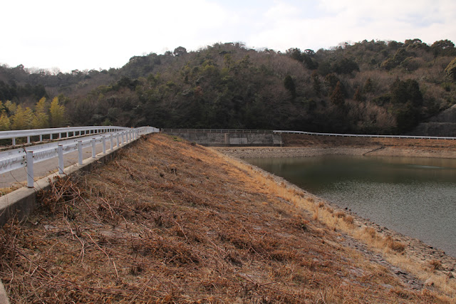
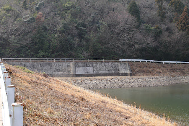
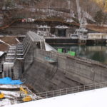
View of the embankment on the lake side from the left bank
As mentioned above, there were no major rivers or water sources in the vicinity, but water is taken from the Yahagigawa River under the state-run Yahagigawa River Comprehensive Project and sent to the southern part of the Nishimikawa River via a shared waterway and the 40 km-long Nanbu-Kira trunk canal, and this Kotosawa regulating pond is located at the center of the trunk canal. The Kotozawa Regulating Pond is located in the center of the trunk canal and serves as an important source of irrigation water for Koda Town, Kira Town, and Hazu Town.
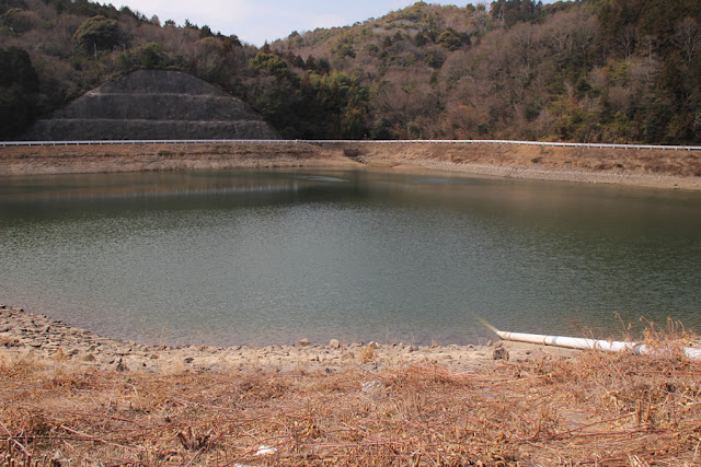
View of the dam lake from the left bank
The water intake is a bottom-hole type. It appears to be a so-called dam hole, but since it is submerged at the bottom of the water, it is probably regulated by a valve or gate.
View of the water injection works from the left bank
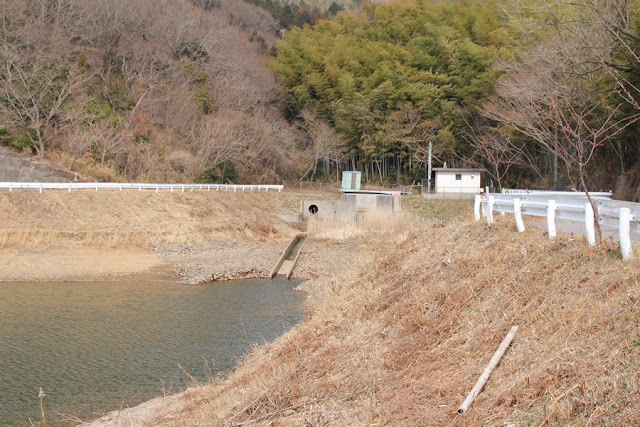
Water brought in from the main canal is poured into the dam lake here.
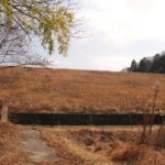
View of the top edge from the left bank
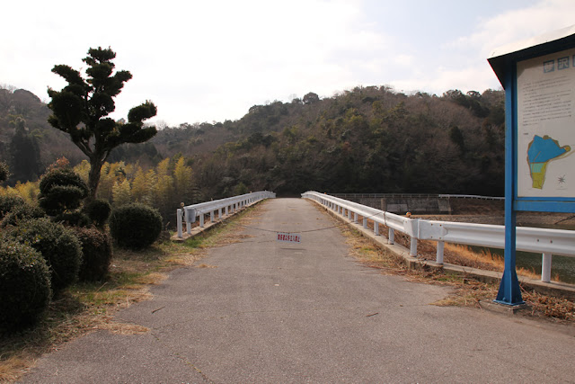
Unfortunately, the skyline was off-limits to all but authorized personnel. If possible, I would have liked to see the flood discharge up close.
stone monument
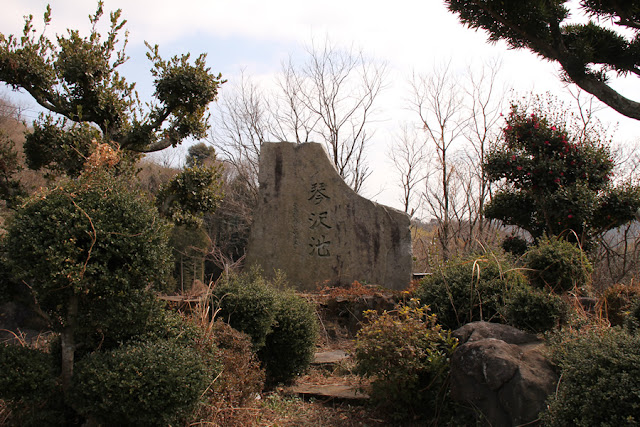
It is a magnificent stone monument. The dam must have been a long-cherished wish of the local farmers.
View of flood discharge
Free overflow flood discharge of certain types of irrigation dams, especially rockfill dams and earth dams.
Back side of the monument
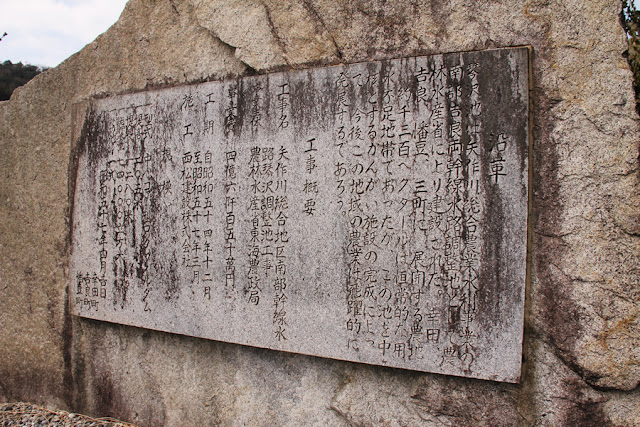
On the reverse side of the monument, it is written, "The area has always been short of water, but with the completion of the irrigation facilities centering on this pond, agriculture in this area will make great strides in the future.
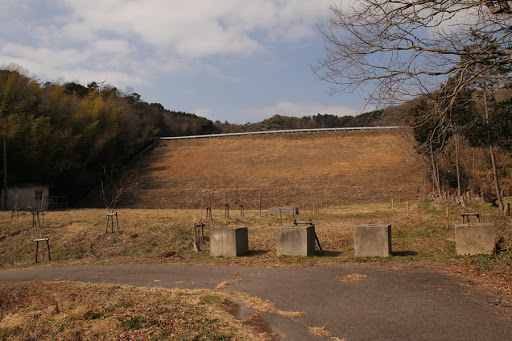
View of the embankment from the downstream dam site
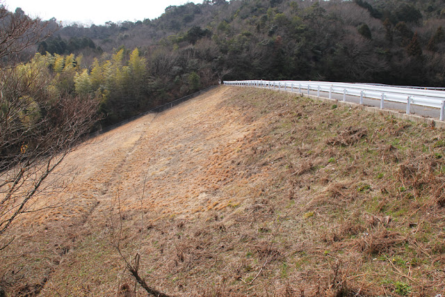
It is a rockfill dam, although it appears to be an earth dam as no rock material or riprap is visible. Grass seems to cover the embankment quite often, but the embankment was neatly mowed at this time.
View of the levee from downstream

When people say it's an earth dam, it looks like an earth dam...it's like a phantom thief who lives hiding his true identity lol.
View of the conduit
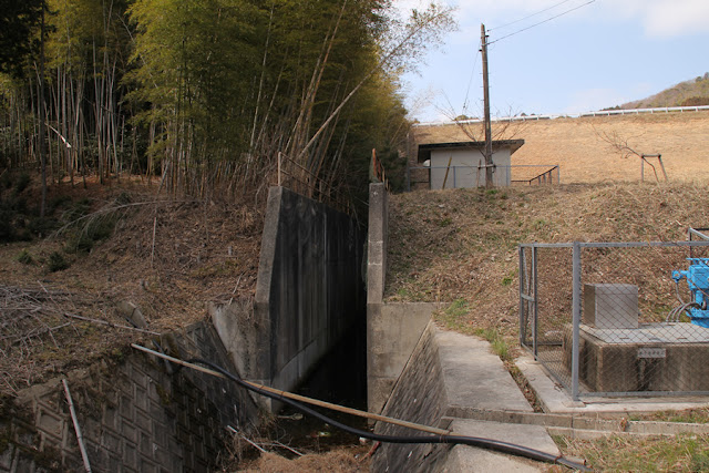
The conduit is very narrow. The actual water supply runs underground, but it is probably sufficient to just pass it that way.
Kotozawa Regulating Pond Specifications
| River Name | Kotozawa River |
|---|---|
| Objective | outside the control or jurisdiction (of) |
| Model | rockfill dam |
| Bank height | 20.5m |
| Bank length | 128m |
| Dam volume | 67,000m3 |
| Watershed Area | 0.2km2 |
| Reservoir area | 1 ha |
| Total storage capacity | 74,000m3 |
| Effective water storage capacity | 70,000m3 |
| Dam operator | Tokai Agricultural Administration Bureau |
| Main body constructor | Nishimatsu Construction |
| Year of launch | 1969. |
| Year Completed | 1981 |
Other facilities/observations
| Parking lot | △ | I think the dam site on the left bank can just barely be parked. There is no space on the downstream side that can be called a parking lot. |
|---|---|---|
| Toilet | × | |
| Park | × | |
| PR Exhibition Hall | × | |
| Fishing | ×x? |
Comment