

Location: 4-2, Mizusawa, Nayoro, Shinshiro City, Aichi Prefecture
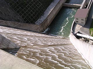
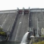
View of the flood discharge from the levee
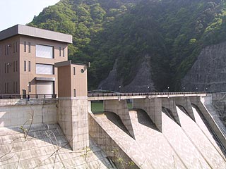
Take Route 151 (Bessho Kaido) and go south at the Naego intersection. I believe there is a signboard, so you should be fine. If you drive along the road as it is, you will naturally arrive at the site. The dam was built recently and is very well maintained. As you can see from the photo, the dam is a natural overflow dam, and the water flowing out of the dam lake is very beautiful like scales.
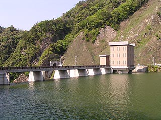
View of the embankment from the left bank (dam lake side)
As I parked on the right bank and crossed the embankment to find a photo point on the left bank, an elderly man got out of a light car parked on the left bank and came up to me! In this day and age.... I was a little wary of him and was about to take a picture when he said to me, "What are you taking a picture of?
Remains of the foundation of a construction crane
I was very embarrassed to have a doubt in my mind.... This elderly man seems to live in the neighborhood and has been visiting the dam frequently since it was built. He has been taking pictures of the dam since it was built.
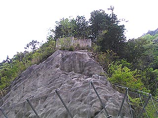
I was able to hear many stories. The photo on the left shows the remains of the foundation of a construction crane, and the Uren Dam also had a cableway from Mikawa Kawai Station on the Iida Line during its construction.
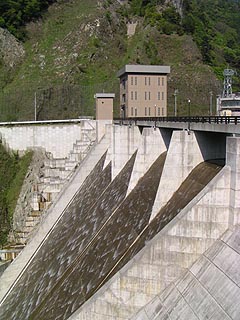
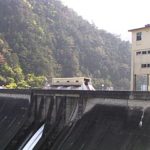
View of the levee (downstream side) from the left bank
I would have liked to talk with him about many other things and to show him some of the photos I had taken, but unfortunately, I had to move on to Uren, Sakuma, and Mizukubo, and I was running out of time, so I had to part ways with him. I had to leave him, but unfortunately, I had to go to Uren, Sakuma, and Mizukubo in the near future.
I think this was the first time I had this kind of interaction with a local person at the dam. Was this old man really against or for the dam construction?
View of the levee (downstream side) from the right bank
dam characteristics
| form (something takes) | straight linegravity-fed concrete dam |
| Objective | Water for irrigation and water supply |
| Bank height | 69.4m |
| Bank length | 160.0m |
| levee length and width | 4.0m |
| Dam volume | 183,000m3 |
| Watershed Area | 18.4km2 |
| Reservoir area | 50 ha |
| Total storage capacity | 12,300,000m3 |
| Effective water storage capacity | 11,300,000m3 |
| Name of Dam Lake | lake in early morning mist |
| Flood discharge | Non-regulated type (natural overflow type) Q=550m3/s |
| water intake | Maximum water withdrawal 19m3/s |
| discharge facility | Jet Flow Gate phi1400mmphi250mm, 1 each |
| River Name | Oshima River, Toyokawa River system |
| Year of launch | 1989 |
| Year Completed | 2001 |
Other facilities/observations
I should say that the interaction with the local people was a more valuable experience than the dam itself. When I was covering a dam and taking pictures, people usually looked at me suspiciously because I was not taking pictures in a commemorative way, but I had never been talked to before, so it was a good experience. I had never had anyone talk to me before, so it was a good experience for me.
2003/10/15: "PR Exhibition Hall" was changed from "X" to "○" (Abesh! Thanx!)
| Parking lot | ○ |
| Toilet | ○ |
| Park | ○ |
| PR Exhibition Hall | ○ |
Comment