

Location: Gifu Prefecture, Gero City, Kanayama Town
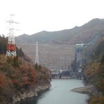
View of the embankment from the right bank
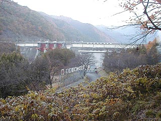
The Mazegawa No. 2 Dam is located just off Route 41 from the Nagoya area, turn onto Route 256 at the Shimo-Myoki-cho intersection, and then onto Prefectural Route 86.
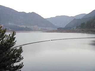
It was taken in the early morning haze, so it is a little hard to see, but please bear with me....
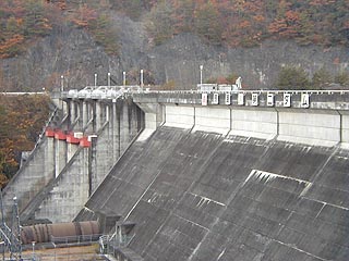
get even closer
Since it is a dam for power generation, it gives a mechanical impression. It is also a pumped-storage type power generation dam, with the Iwaya Dam (Maze River No. 1 Power Station) being the upper part and the Maze River No. 2 Dam being the lower part.
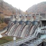
View downstream from the levee
The discharge section is quite simple.
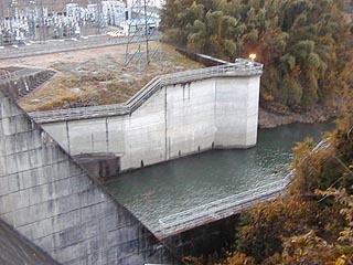
View of the embankment (lake side) from the left bank
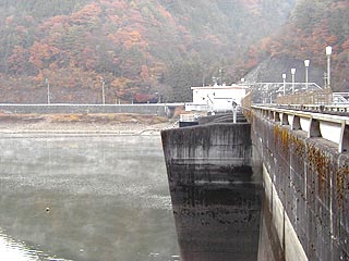
Can you see the morning mist? It was very cold and frosty as it was the end of autumn.
View of the dam lake from the left bank
dam characteristics
| da mu | form (something takes) | gravity-fed concrete dam |
|---|---|---|
| Objective | generation (e.g. power) | |
| Bank height | 44.5m | |
| Bank length | 263m | |
| Dam volume | 101,000m3 | |
| savings water (esp. cool, fresh water, e.g. drinking water) pond | Watershed Area | 1049 km2 |
| Reservoir area | 72ha | |
| Total storage capacity | 9,736,000m3 | |
| Effective water storage capacity | 6,100,000m3 | |
| River Name | Kiso River System Maze River | |
| Year of launch | 1966 | |
| Year Completed | 1976 | |
Other facilities/observations
| Parking lot | ○ | Iwaya Dam is the main one, so it is a secondary one. It's kind of a shadow of its former self. |
|---|---|---|
| Toilet | × | |
| Park | ○ | |
| PR Exhibition Hall | × |
Comment