

Location: Oaza Chuhara, Inabe-cho, Inabe City, Mie Prefecture
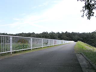
View of the top edge from the right bank
People who do not know this area often call "Inabe" "Inaben," but make no mistake, it is "Inabe"! It is a place name that is easily mistaken for "Inabe," so much so that a navigator for a certain FM station (lol) read a postcard sent by an Inabe resident as "Inben" with all his might.
This dam is located in such a town of Inabe. Although it is a small dam, the surrounding area is a park and seems to be a popular spot for locals.
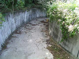
Incline (?) from the top edge View of the Incline (?) from the top
It is a small dam, so the incline (?) is also very small. The incline (?) is also very small because it is a small dam. This incline is marked "No Trespassing", but the gate was open. I wondered if a child had opened the gate because fishing is allowed in this pond. I wondered if a child had opened the gate.
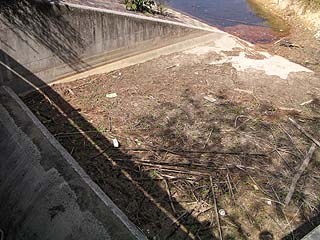
View of the flood discharge (spillway) from the left bank
It seems to be a flood discharge that has hardly ever been used. I wondered if this is what all flood discharges of small-scale dams for irrigation are called, since it is also expressed as a "residual water discharge. It seems that this flood discharge is not used at all.
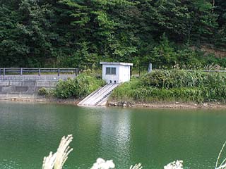
View of the water intake from the left bank View from the left bank
It is a natural overflow type. There are no steel gates of any kind. It is very simple.
View of the dam lake from the left bank
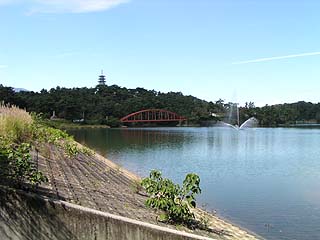
It is more of a "pond" than a dam lake. The embankment is filled with concrete blocks. Incidentally, the top edge is open to automobile traffic.
information sign
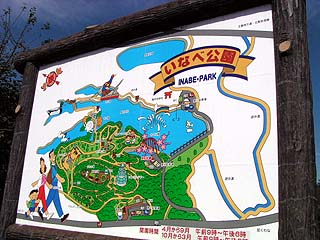
It is a beautiful sign. This information sign indicates that the surrounding area is well maintained.
dam characteristics
| da mu | form (something takes) | earth dam |
|---|---|---|
| Objective | irrigation water | |
| Bank height | 15m | |
| Bank length | 165m | |
| Dam volume | 82,000m3 | |
| savings water (esp. cool, fresh water, e.g. drinking water) pond | Total storage capacity | 650,000m3 |
| Effective water storage capacity | 650,000m3 | |
| Name of Dam Lake | Inabe Oike | |
| Year Completed | 1940. | |
| Access to D@M | Get off at Kuwana IC on Higashi-Meihan Expressway and turn left Go west on Prefectural Road 63. Turn right at the end of the road and follow Route 421 until you enter Inabe Town. Turn right at the east intersection of the town hall→go straight the rest of the way | |
Other facilities/observations
| Parking lot | ○ | The height of the embankment is 15 meters, which is just about the standard for a dam. It exists as a place of relaxation for Inabe citizens. Therefore, the number of visitors was very large, and there were many anglers. I am very envious that there is a park like this in the town. |
|---|---|---|
| Toilet | ○ | |
| Park | ○ | |
| PR Exhibition Hall | × |
Comment