
Date of interview: 5/1/2005
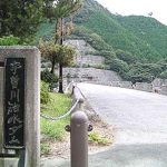
Location: Odaicho, Taki County, Mie Prefecture
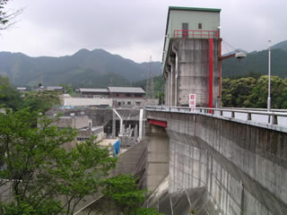
View of the top edge from the left bank

We had heard that the dam was devastated by Typhoon No. 21 that struck in 2004. We conducted our interview under cloudy skies that seemed to evoke such a past.
From the left bank, there is no change at all....
View of the dam lake from the top
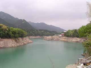
The dammed lake is also quite normal.
Downstream view of the levee from the left bank
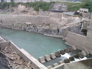
However, the downstream side looks terribly rough.
Incidentally, they were also just releasing the fish.
View of the conduit from the top edge
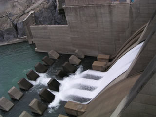
The water is being discharged in a smooth manner.
View of the gate from the top

The red gate is impressive, but to even see the discharge....
View of the conduit from the top edge
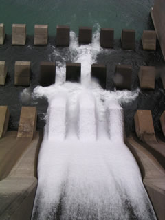
The amount of discharge may be quite large.
View of the right bank downstream from the top
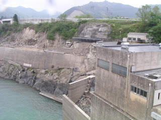
You can see that this side of the building was quite damaged. In the center of the photo you can see what looks like a shelter, but it was probably a bicycle parking lot or something. This means that it was probably a passageway, but it is gouged out and empty.
View from the top of the building View from the top
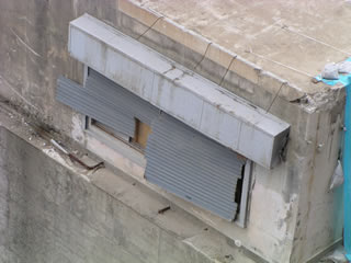
The building, which is believed to have been the administration office, is completely dilapidated.
View from the top of the building View from the top
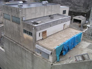
I would have liked to see more, but the rain was getting heavier, so I left and retreated!
dam characteristics
| River Name | Miya River System Miya River |
|---|---|
| form (something takes) | Gravity Concrete |
| Objective | Industrial water, power generation |
| Bank height | 39m |
| Bank length | 160m |
| Dam volume | 65,000m3 |
| Watershed Area | 190km2 |
| Reservoir area | 86 ha |
| Total storage capacity | 13,100,000m3 |
| Effective water storage capacity | 4,000,000m3 |
| Dam operator | Mie prefecture (Kinki area) |
| Main body constructor | Nishimatsu Construction |
| Name of Dam Lake | Lake Ise |
| Year of launch | 1963. |
| Year Completed | 1966 |
| Access to D@M | Turn left at the traffic light after getting off at the Seiwa-Taki IC of the Ise Expressway. The rest of the way is National Highway 42 toward Owase. After passing through the roadside station "Okuise Oodai", At the "Odai Police Station" traffic light intersection, turn onto Prefectural Route 31. Turn left at the first traffic light. |
Other facilities/observations
| Parking lot | × | The park is like a rough and tumble open space. There is no parking lot, but the area near the left bank is a bit wide, so you can park here. |
|---|---|---|
| Toilet | × | |
| Park | ○ | |
| PR Exhibition Hall | × | |
| Fishing | ? |
Comment