

Location: Oaza Ding, Fujiwara-cho, Inabe City, Mie Prefecture
Official Web site:.http://www.water.go.jp/chubu/mieyosui/index.html
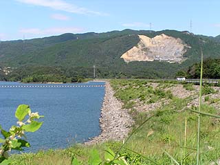
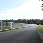
View of the levee from downstream
Nakasato Dam is located near the source of water for the Mie Water Supply under the control of the Japan Water Agency (former Japan Water Development Corporation), and serves to guide water when the water in the Miyagawa, Komono, and Kasato dams' regulating reservoirs is insufficient. In other words, it is the parent of these dams. However, if even this is not enough, the water is led from the Uchikami Dam to the town of Kamiishizu in Gifu Prefecture, which is further upstream.
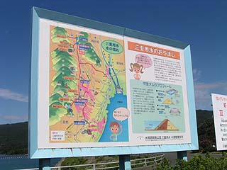
Signboard "Mie Irrigation Water Overview"
It is also one of the leading earth dams in Japan, ranking fifth among earth dams in terms of height and water area, and first in terms of volume.
On the left is a very large sign that describes the Mie Irrigation.
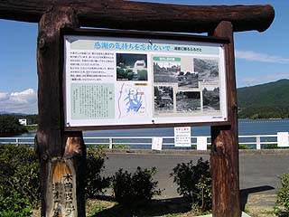
On 2003/10/1, the "Japan Water Resources Development Corporation" changed its name to the "Japan Water Agency," but the sign for this dam still bore the old name.
Sign: "Remember to be thankful."
The dam lake was home to 58 people in 28 households in the former Fukao district, but they decided to move out of the area because of their abstinence, and that area was submerged. A splendid signboard has been installed for this purpose. A monument called "Monument of Hometown" has also been erected on the north side of the dam lake.
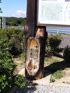
The base of the pillar of the sign "Gratitude".
Incidentally, this signboard was made from driftwood from the Makio Dam, perhaps because of the Water Resources Agency. It is interesting to think that a tree from a dam in Nagano, far away, is here.
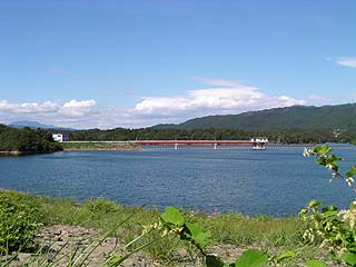
View of the embankment from the lake side of the right bank
From here it looks like rock fill, but it is an earth dam.Surely it is an earth dam when viewed from downstream, so is the riprap laid down as a barrier?(PS: This is for slope protection, not a barrier)
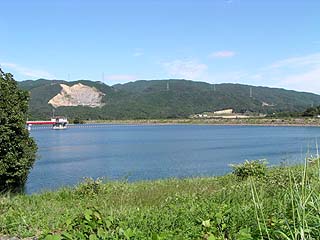
View of the dam lake from the right bank
It is a very large dammed lake.
You can see the water intake in such a distance.
View of the dam lake from the right bank
To the left is the water intake, and much further back is the dike. The top of the dike is so long that the entire dike could not be captured in the photo.
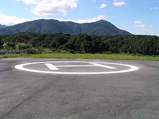
heliport
There is even a heliport on the right bank of the dam site. Does this mean that it is such a large dam?
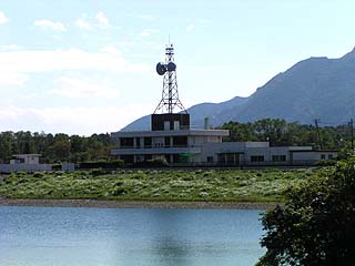
View of the dam management office from the right bank
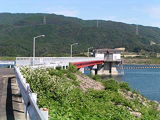
View of the water intake from the right bank
The bridge to the intake is also very long.
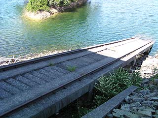
incline
An incline has been installed on the right bank.
Nakasato Dam Specifications
| Model | Inclined core zone typeearth dam |
| Objective | Irrigation water, water supply water, industrial water |
| Bank height | 46m |
| Bank length | 985m |
| Dam volume | 2,970,000m3 |
| Watershed Area | 57.9 km2 |
| Reservoir area | 128ha |
| Total storage capacity | 16,400,000m3 |
| Effective water storage capacity | 16,000,000m3 |
| Name of Dam Lake | Nakasato Reservoir |
| River Name | Kisogawa River System Mie Irrigation |
| Year of launch | 1964 |
| Year Completed | 1976 |
| Access | Get off at Kuwana IC on Higashi-Meihan Expressway, turn left, go west on Prefectural Road 63→turn right at the end of the road, follow National Road 421, enter Inabe Town, go straight at the intersection of Inabe Police Station East to Prefectural Road 5, enter Hokusei Town, go straight further, turn right at Kamada intersection, go north on National Road 306, turn right at Shireishi Shinden intersection, go north on Prefectural Road 107 Turn right at the second prefectural road and drive for a while and you will see a sign. The way to get there is a little complicated.... |
Other facilities/observations
I remember visiting Fujiwara-cho for camping when I was in elementary school. I believe we also visited the Nakasato Dam at that time,
I can't remember any of the details of my visit to the dam, and I tried to compare the differences at that time... hmmm...
Speaking of which, I had forgotten to look at the flood discharge, which was so huge that I had completely forgotten about it. I did not see it on the right bank, but looking at the map, it seems that the flood discharge is on the left bank. Still, 985m is too far away!
| Parking lot | ○ |
| Toilet | ○ |
| Park | × |
| PR Exhibition Hall | × |
Accommodations that may be close to Nakasato Dam

Comment