
A dam located in an inn town. Kiso Dam.
Location: Aza-arano, Kisofukushima-cho, Kiso-gun, Nagano Prefecture
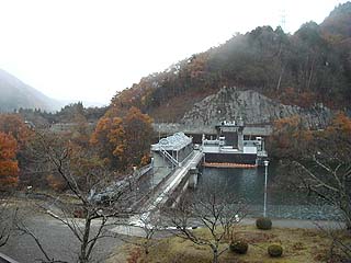
View of the levee from the high ground on the left bank
We covered this dam on the same day as the Makio Dam, but it had not yet snowed because we had covered the Kiso Dam first. The photo was supposed to be published, but it was inadvertently forgotten. I guess I thought I had published it. I'm sure there are more such photos at ・・・・.

To approach Makio Dam, take Prefectural Road No. 20 from the Motobashi intersection on National Road No. 19. Turn left just before the first tunnel and follow the road the rest of the way.
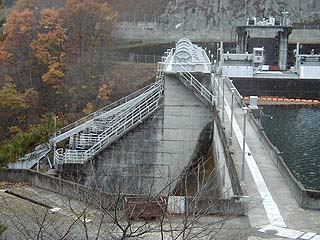
Zoom in further on the levee
I hesitated and could only take pictures from here because the levee looked like it was off limits. It would have been nice if someone concerned had been there....
So there are three radial gates, although they are not visible from this angle. The one on the right side of the dike is probably an intake.
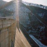
dam characteristics
| Model | gravity-fed concrete dam |
| Objective | generation (e.g. power) |
| Bank height | 35.2m |
| Bank length | 132.5m |
| Dam volume | 45,000m3 |
| Watershed Area | 578.9 km2 |
| Reservoir area | 42ha |
| Total storage capacity | 4,367,000m3 |
| Effective water storage capacity | 1,844,000m3 |
| River Name | Kiso River System Ohtaki River |
| Year of launch | 1963. |
| Year Completed | 1968. |
Other facilities/observations
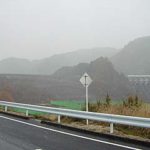
The road from County Road 20 is so narrow that I really don't know if this is the right place! Is it okay to go through! Are you sure you want to go through here? It makes you feel uneasy in many ways.
| Parking lot | × |
| Toilet | × |
| Park | × |
| PR Exhibition Hall | × |
Comment