

Location: Tatsuyama-cho, Hamamatsu City, Shizuoka Prefecture
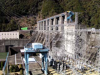
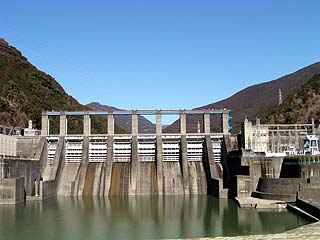
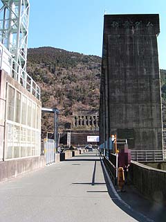
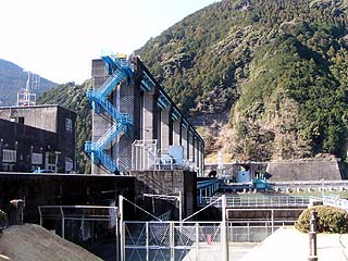
View of the power plant and embankment from the left bank
Off-line meeting at Sakuma Dam (January 25, 2004)This is the second dam that I visited during the "Mutsukuro Dam" in the "Mutsukuro Dam" in the previous year. This is the second time I personally visited the dam, but that time I only photographed it from the national highway.
...but the data from my previous visit is in a MO that is no longer readable.... Can anyone save this MO at a reasonable price~ (tears & quite earnestly)
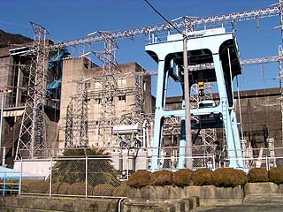
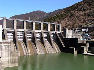
View of the power plant from the left bank
As for the reading of this dam, some people involved in power supply development read it as "Akiha", while others pronounce it muddled as "Akiba", which is true.... In the Japan Dam Association's dam handbook, it is "Akiha. Well, let's leave it as "Akiha.(but the HTML file name is "akiba"...)The following is a list of the most common problems with the
View of the levee from the downstream side of the left bank
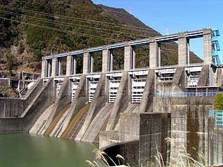
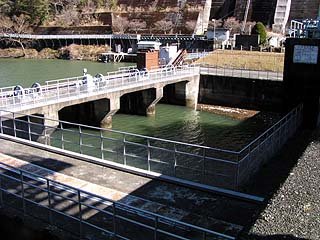
It is equipped with six roller gates. The design is somewhat reminiscent of the Funaki Dam. However, the height between the gates and the riverbed downstream is higher than that of the Funaming Dam.
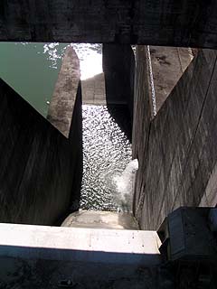
View of the drain
Drain for power generation (?) It is quite large. It is quite large. Akiba Dam is equipped with three power plants.
Drainage channel? (Drainage channel?)

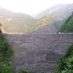
This dam also seems to be struggling with sedimentation.
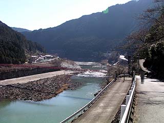
View of the embankment from the downstream suspension bridge
Hmmm. The fact that it is a little tilted is just for fun....
It was a bit difficult to take pictures on the swaying suspension bridge (sweat).
View of the suspension bridge from the right bank

This is the suspension bridge. It is not very high, so unless you are extremely afraid of heights, you should be able to cross it without much problem. You can't see much in this picture, but there are people from MBS near the center of the bridge. They were leaning over the parapet to take pictures.
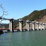
View of the levee from the downstream side of the right bank
Looking downstream from the right bank
View of the levee from the downstream side of the right bank
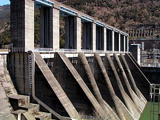
It looks quite large in this view. From the national highway, it looks small, but please approach the levee and take a look. You can feel how big it is.
View of the top edge from the right bank
The top edge is open to automobile traffic.
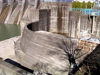
View of water intake
There are two conduit tunnels, one in the front and one in the back, each connected to the other, and the back seems to lead to the Mikatahara irrigation canal.
The gate located on the right bank most
The water coming out of the wall on the right appears to be a water diversion discharge from the Akiba No. 3 Power Plant.
View of the dam lake from the top
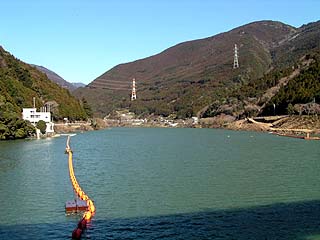
Like Funaki Dam, the lake surface here was calm, but it was a very cold day.
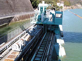
View of the water intake for the second power plant
Another feature of Akiba Dam is that water intakes are located here and there.
View of the levee from the parking lot on the left bank
dam characteristics
| da mu | Model | gravity-fed concrete dam | Access to D@M | Turn left at the Hamamatsu IC of Tomei Expressway and go north on Prefectural Route 65. Turn right at the intersection with Prefectural Road 45 Continue north and you will hit Route 152, turn right at the intersection. The rest of the way is just north on Route 152. After passing by the Funaming Dam, the mountains finally deepen and we enter Longshan Village. Just after passing the Yongsan Village Hall on your right, you will see a tunnel and turn right at the T-intersection (!) in the tunnel. Turn right at | |
|---|---|---|---|---|---|
| Objective | Irrigation water, industrial water, and generation (e.g. power) | ||||
| Bank height | 89m | ||||
| Bank length | 273.4m | ||||
| Dam volume | 515,000m3 | ||||
| savings water (esp. cool, fresh water, e.g. drinking water) pond | Watershed Area | 4,490 km2 | |||
| Reservoir area | 190ha | ||||
| Total storage capacity | 34,703,000m3 | ||||
| Effective water storage capacity | 7,750,000m3 | ||||
| Name of Dam Lake | Lake Akiba | ||||
| River Name | Tenryu River System Tenryu River | ||||
| Year of launch | 1954 | ||||
| Year Completed | 1958 | ||||
Other facilities/observations
| Parking lot | ○ | When I typed "gravity type," I accidentally typed "curse type," which reminded me of a father and son who died in a car accident a few years ago when they fell into Lake Akiba.... Please be safe on the road, everyone! |
|---|---|---|
| Toilet | ○ | |
| Park | × | |
| PR Exhibition Hall | × |
Comment
[...] 3/30: Funaki Dam, Akiba Dam, Sakuma Dam. Weather cloudy. This was a photo shoot for a wedding reception. [...].