

Location: 1106-3, Aza Shimokusari, Oaza Tashiro, Aoi-ku, Shizuoka City, Shizuoka Prefecture
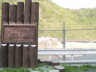
View of the levee and the sign indicating the power station from the right bank
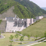
Like the nearby Igawa Dam and Hatanagi No. 1 Dam, Hatanagi No. 2 Dam is a hollow gravity dam. Like the Hatanagi No. 1 Dam, it is a pumped storage dam. Incidentally, I have a selfish belief that "dams owned by Chuden and named No. 2 are closed", and as expected, the Hatanagi No. 2 Dam is also surrounded by a fence, so we can hardly see it. As expected, the Hatanagi No. 2 Dam is also surrounded by a fence, so you can hardly see it.
View of the embankment (lake side) from the right bank
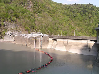
I was barely able to get close enough to the embankment to take this shot. It was taken through a wire net. It is said to be a hollow gravity dam, but as with the Igawa Dam, I could not capture its features from the outside.
dam characteristics
| da mu | Model | Hollow Gravity Type concrete dam | Access to D@M | Get off at Sagara Makinohara IC of Tomei Expressway The rest of the way is National Route 473 heading north toward Kawane Town. After entering Kawane Town and eating taiyaki at Ieyama, head north again on Route 473. After driving for a while, you will hit a T intersection with Route 362. Turn right at the intersection and go north on Route 362. There is a road that enters Prefectural Route 77 near Chigashira, so turn onto that road and continue north. When you pass the Okuizumi station in the Igawa line in the railroad, you will see the fork of the Sunmatakyo and the Precipice. Turn right onto Prefectural Route 388 toward the precipice. From here on, we will rely on our intuition (not much) and head for the Igawa Dam. After passing the Ousumi Dam and driving for a while, you will come to an intersection with Prefectural Road No. 60. Turn left on it (turn right is the Igawa Dam) The rest of the way is winding Prefectural Route 60. If you look at Akaishi Onsen on your right hand side and go through a tunnel, you will find Hatanagi second dam behind you on your right. (If you're not careful, you'll probably go too far.) Please note that there are many risks of slope collapses on the surrounding roads. | |
|---|---|---|---|---|---|
| Objective | generation (e.g. power) | ||||
| Bank height | 69m | ||||
| Bank length | 171m | ||||
| Dam volume | 155,000m3 | ||||
| savings water (esp. cool, fresh water, e.g. drinking water) pond | Watershed Area | 329.2 km2 | |||
| Reservoir area | 45 ha | ||||
| Total storage capacity | 11,400,000m3 | ||||
| Effective water storage capacity | 3,600,000m3 | ||||
| River Name | Oigawa River System (river with a) gaping hole in the middle of a river | ||||
| Year of launch | 1957 | ||||
| Year Completed | 1961 | ||||
Other facilities/observations
| Parking lot | × | It is endlessly far. And the roads are endlessly bad. So, when you get to this point, your driving fatigue will be at its peak. Always take a break if you feel the least bit tired! Since the road is not connected, you will have to make a U-turn at the Hatanagi First Dam ahead. Since we are going back on the rough road we just came from, we need to be prepared for that when we get to this point. Whatever happens, you are on your own.... |
|---|---|---|
| Toilet | × | |
| Park | × | |
| PR Exhibition Hall | × |
Comment