
Location: Yokobori, Kamata, Ito City, Shizuoka Prefecture
Date of interview: Friday, July 09, 2010
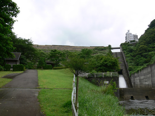
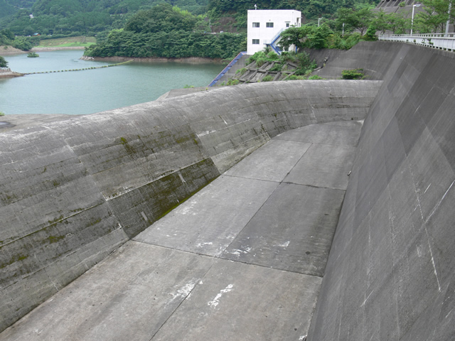
View of the levee from the downstream side of the right bank
There are only two dams on the Izu Peninsula. One is the Aono Daishi Dam in Minami-Izu Town, where Ishigorozaki is located at the tip of the Izu Peninsula, and the other is the Okuno Dam. We stopped by these dams on our way to Izu, but unfortunately, the weather was not ideal. We decided to visit them before it started to rain. The Okuno Dam is a rock-fill dam, a multi-purpose dam used for flood control, river maintenance, and water supply.
View of the conduit
A permanent flood discharge is provided in the middle of the conduit.

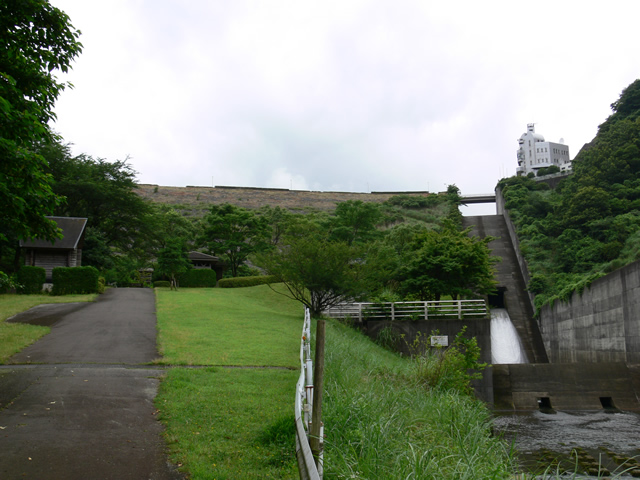
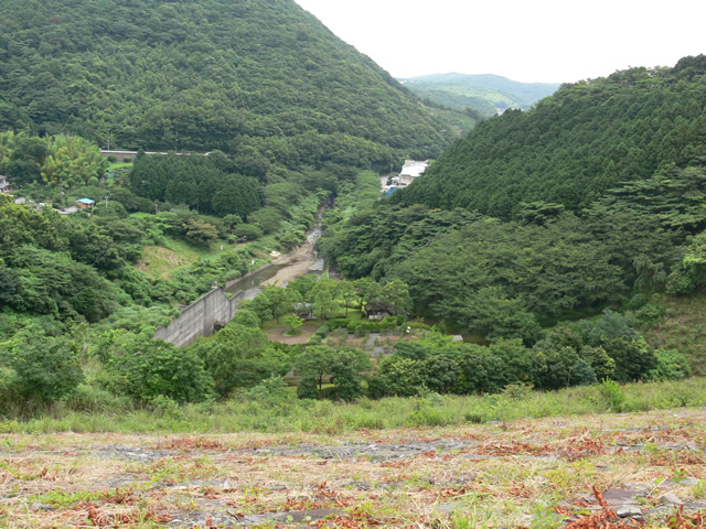
View of the river from the downstream side of the right bank
It flows through the center of Ito City and pours into the Sagaminada Sea. Immediately ahead is a culvert for some reason.

Okuno Dam approach
Then move on to the top end level. But why is the dam lake more appealing than the dam name?
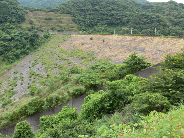
View of the levee downstream from the left bank
It is the dampness characteristic of the rainy season. The grass is quite overgrown.
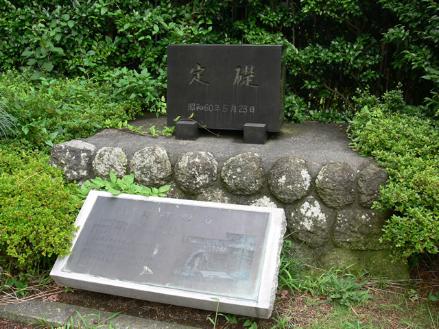
Foundation stone of Okuno Dam
A cornerstone has been placed at the dam site.
View of the emergency flood discharge
Free overflow typeemergency flood dischargeThe river is quite large. The fish are quite large, so if they had flowed over the river, we would have expected to see a powerful discharge.
View of the conduit
The angle is so steep that you cannot see beyond it.

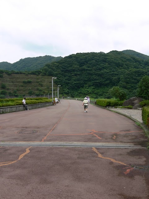
View of the top edge from the left bank
A sort of jogging competition was just being held, and the place was crowded with many participants. In the midst of it all, I was snapping pictures here and there.
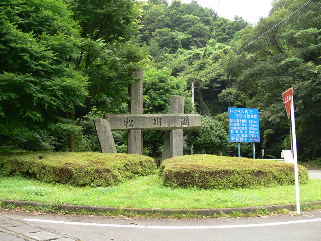
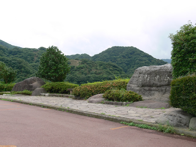
Stone monument at Okuno Dam and Matsukawa Lake
Stone monuments of a dam and a dam lake are lined up close together. I think it is rare to see stone monuments side by side like this.
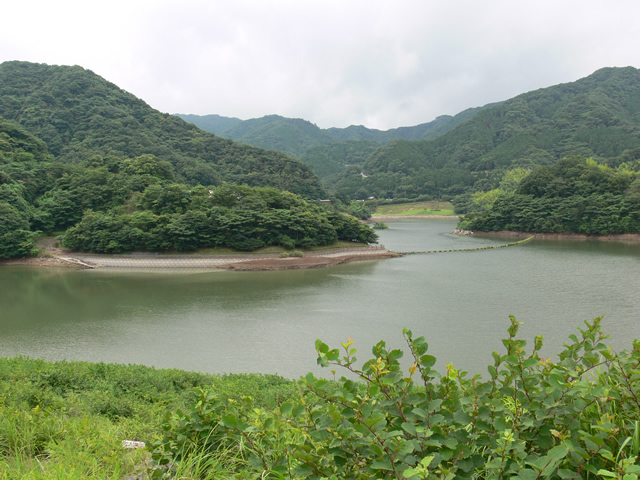
View of the dam lake from the top
The embankment on the dam lake side was also quite overgrown with grass.
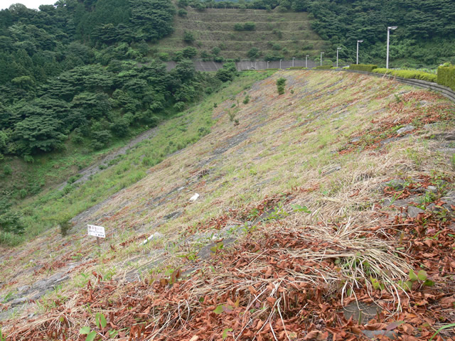
View of the levee downstream from the left bank
It's probably a riprap with a beautiful cross-section, but I can't tell for sure because the grass is covering it (laughs).
View downstream from the top
The Izu Peninsula is rich in nature. There are forests all around. I wonder if we could even see the ocean if the weather was nice.
View of the embankment on the lake side from the top
The grass is blighted like this.

View of the levee downstream from the right bank
The downstream side is also covered with weeds.

View of the top edge from the right bank
There seemed to be a boatyard and a data warehouse on the left, but we decided to turn around here in order to go to Aono Daishi Dam. (In the end, we did not reach the Aono Daishi Dam that day...)

View of the embankment on the lake side from the right bank
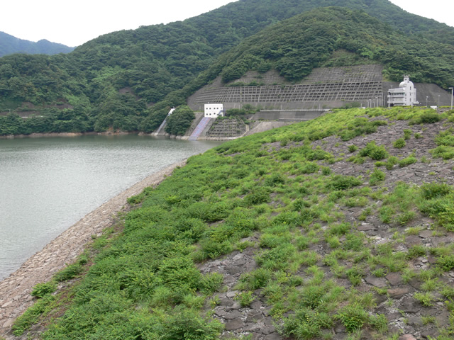
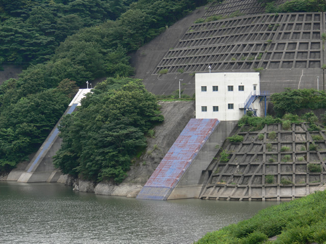
Intake tower for river maintenance and water utilization (back left) and permanent flood discharge (right)
The permanent flood discharge on the right is not visible on the screen, but rumor has it that it is a morning glory-shaped flood discharge. Further downstream, there seems to be a tunnel to the discharge outlet.
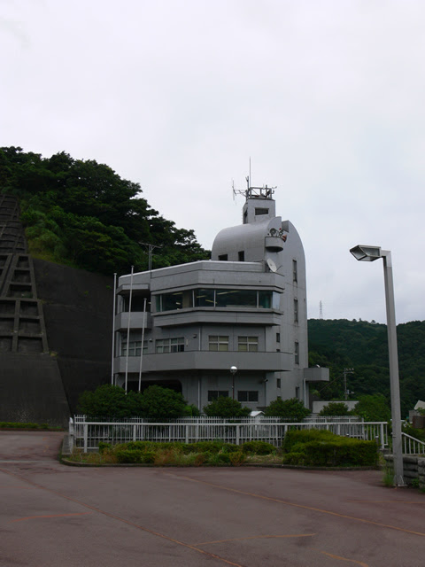
Okuno Dam Management Office
The design of the control center looks like it could be a planetarium if a round dome were placed on top.
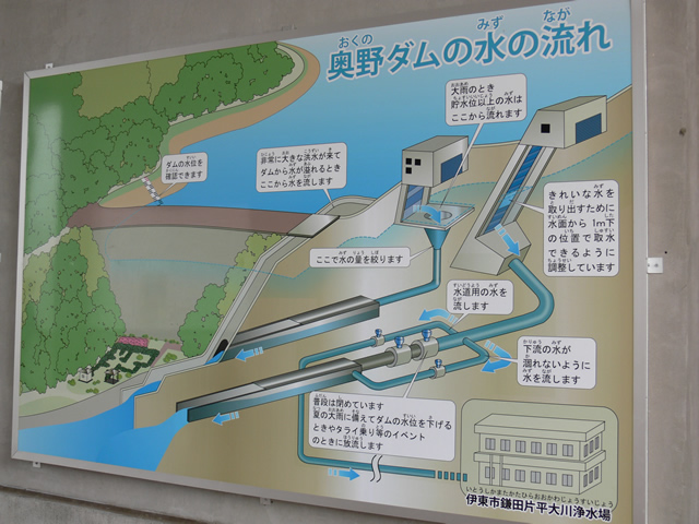
Water flow of Okuno Dam
Illustration of a morning glory-shaped flood discharge on a permanent flood discharge....
dam characteristics
| River Name | Ito-Ogawa River System Ito-Ogawa |
| Objective | Flood control, agricultural disaster prevention, unspecified water, river maintenance water, water supply water |
| Model | rockfill dam |
| Bank height | 63m |
| Bank length | 323m |
| Dam volume | 1,804,000m3 |
| Watershed Area | 11.7 km2 |
| Reservoir area | 31 ha |
| Total storage capacity | 5,100,000m3 |
| Effective water storage capacity | 4,600,000m3 |
| Dam operator | Shizuoka prefecture (Chuubu area) |
| Main body constructor | Kajima Corporation, Kumagai Corporation |
| Year of launch | 1972 |
| Year Completed | 1989 |
Other facilities/observations
It was a dam that looked like a place of relaxation for Ito citizens. It was also mentioned on a sightseeing map, so it is likely that some people visit the dam for sightseeing.
| Parking lot | ○ |
| Toilet | ○ |
| Park | ○ |
| PR Exhibition Hall | × |
| Fishing | × |
Accommodations that may be close to Okuno Dam


Comment