
Date of interview: Wednesday, 12/10/2014
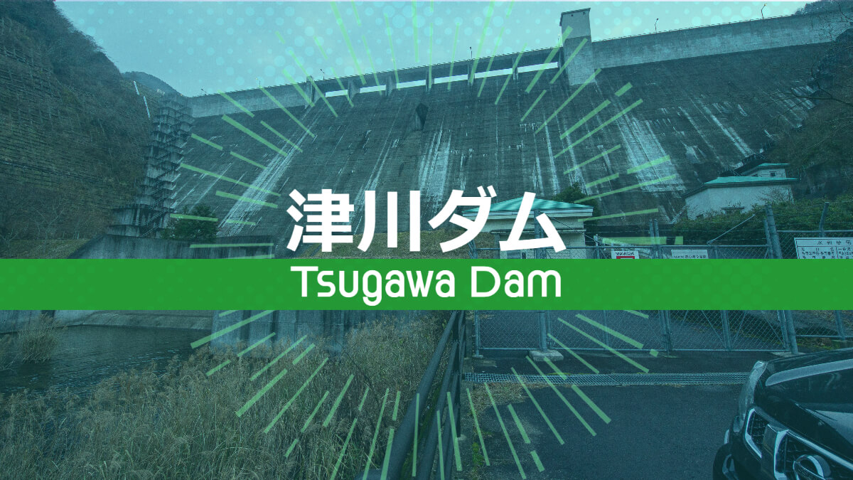
On this day, I decided to visit dams in Okayama Prefecture to collect materials for my annual dam New Year's card (even though it is already December), and Tsugawa Dam was the first dam I visited. Tsugawa Dam is a multi-purpose dam operated by Okayama Prefecture.
Some may feel uncomfortable with the name "Tsugawa River" for the river flowing through the Tsugawa Dam, but it is "Tsugawa River" because the river originally flows through a place named "Tsugawa.
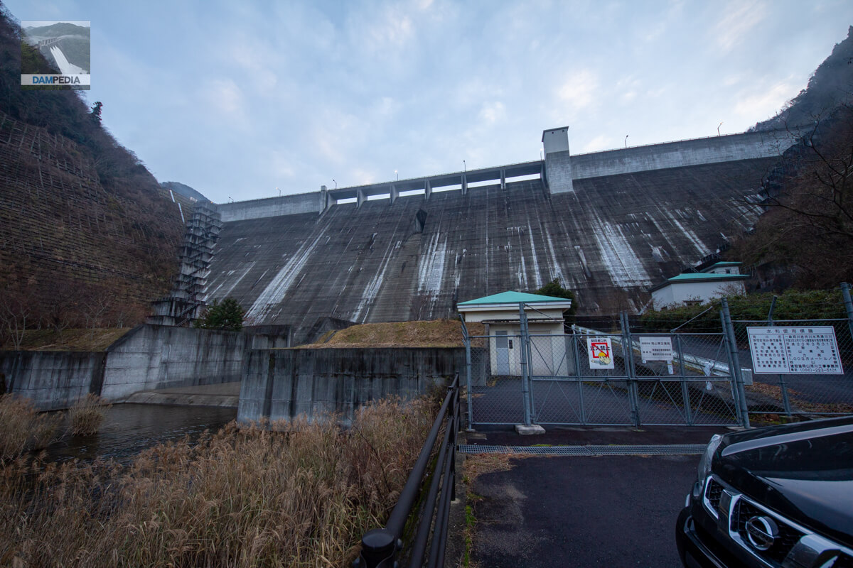
View of the levee from downstream
I think the time was just before 7:00, but it was quite dark, being December. The lights at the top end are still on.

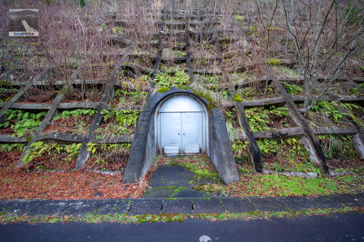
Audit corridor entrance?
A little before the photo above, on the right, there is a mysterious entrance as shown in the photo below. It appears to be connected to the levee, but I am not sure.

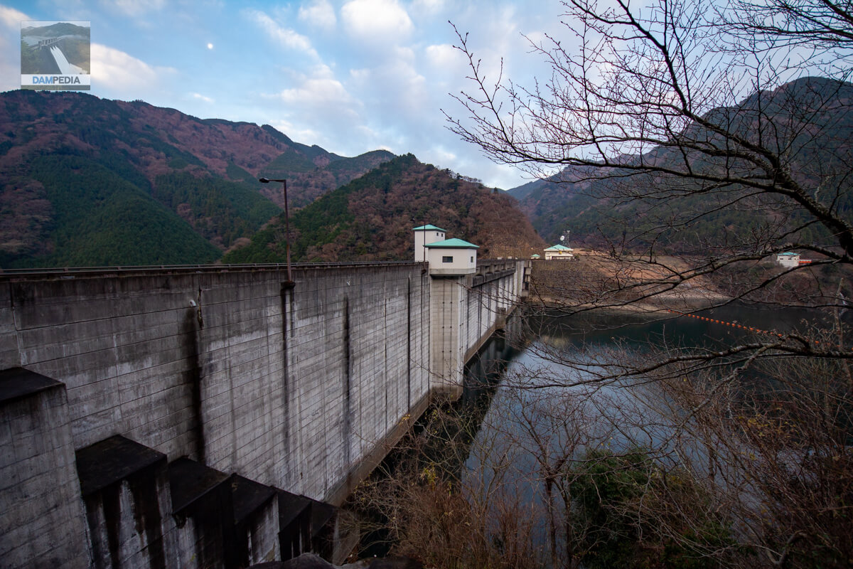
Try to get even closer to the levee than downstream
It has a nice wall feeling. Of the light blue roofs directly below, the one on the left is the Tsugawa Power Plant of the Okayama Prefectural Enterprise Bureau.
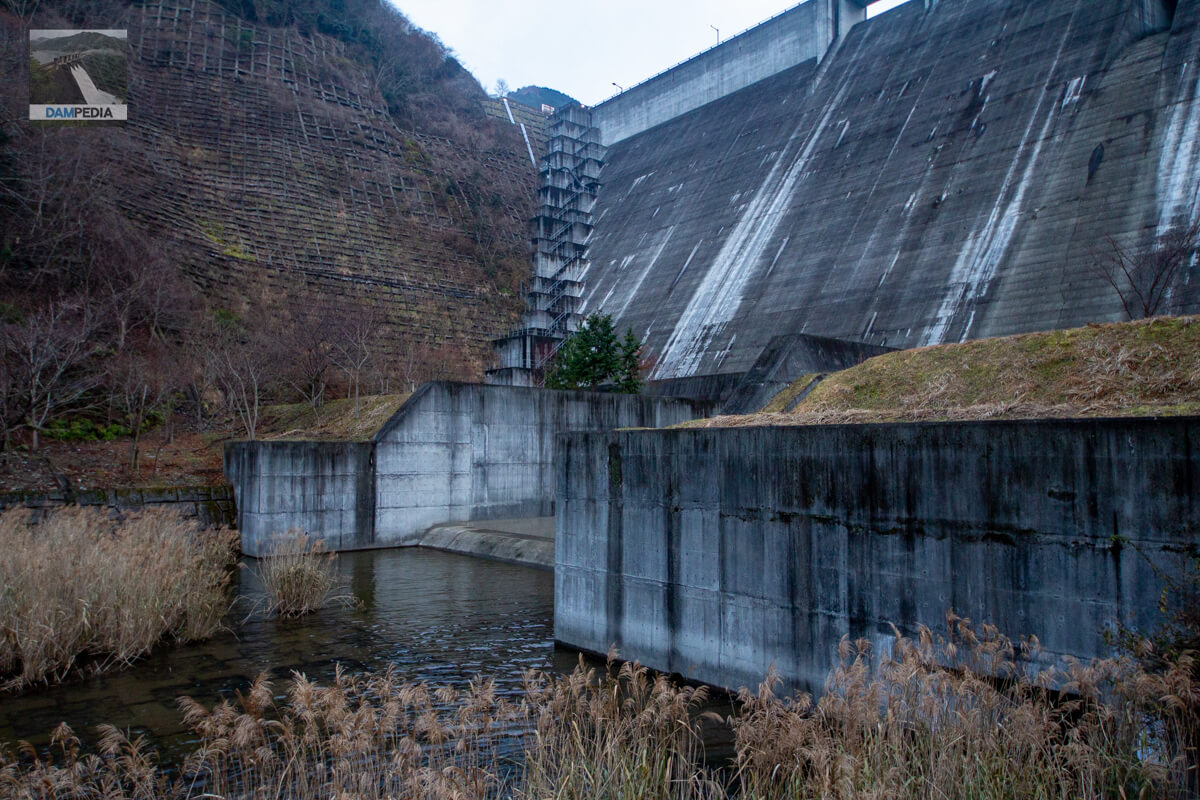
Around the dam reduction works and sub-dam
The abatement works and sub-dams can be seen, although they are a little hidden by the flow-conducting wall.
Looking downstream from the left bank
The sun has risen and the lights at the top of the river have gone out. Part of the left bank road has been widened downstream to provide a better view. I appreciate this kind of consideration.

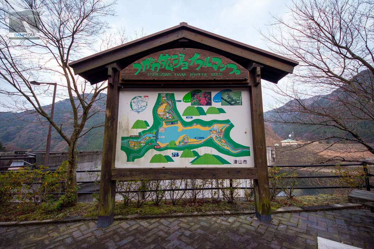
Tsugawa Dam Joyful Map
Parks and other facilities are located around the Tsugawa Dam, and there are also campgrounds and other facilities downstream.
Looking upstream from the left bank
The roofs of the intake gate operation room, elevator building, control center, and even the boatyard on the right side of the photo are all light blue, and the dam area is designed as a single space. As you may have already noticed, the roofs of the power plant buildings downstream are also unified in the same color.
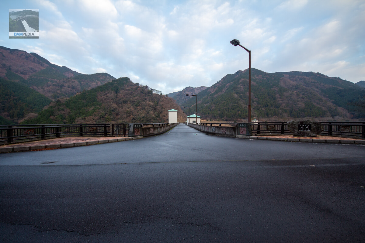
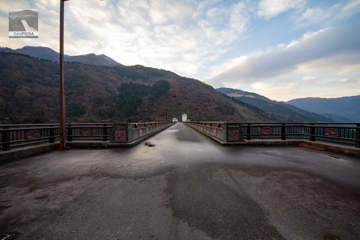
View of the top edge from the left bank
The top end is open to automobile traffic. The reservoir can also be circled.
Rim Tunnel on the left bank
It is an ordinary rim tunnel, but this is also an important facility for dam construction.
Looking downstream from the left bank
Although it has the appearance typical of a municipality-type dam, it seems rather large.
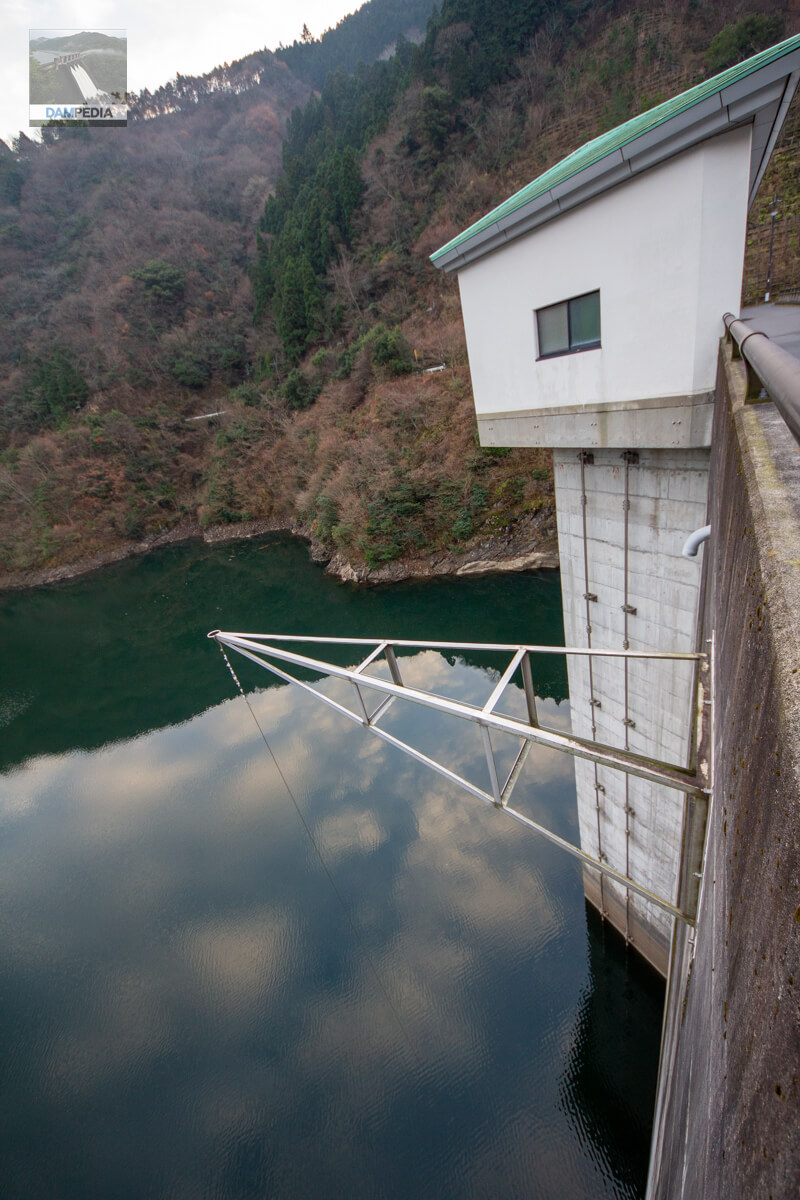
View of the intake tower from the top
I put a little too much weird perspective on it.... What is that triangular arm in the foreground? Is it related to water quality testing equipment?
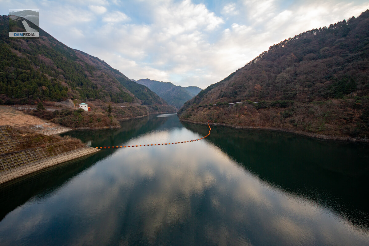
View of the reservoir from the top
The reservoir is quiet and empty because it is early in the morning on a weekday.
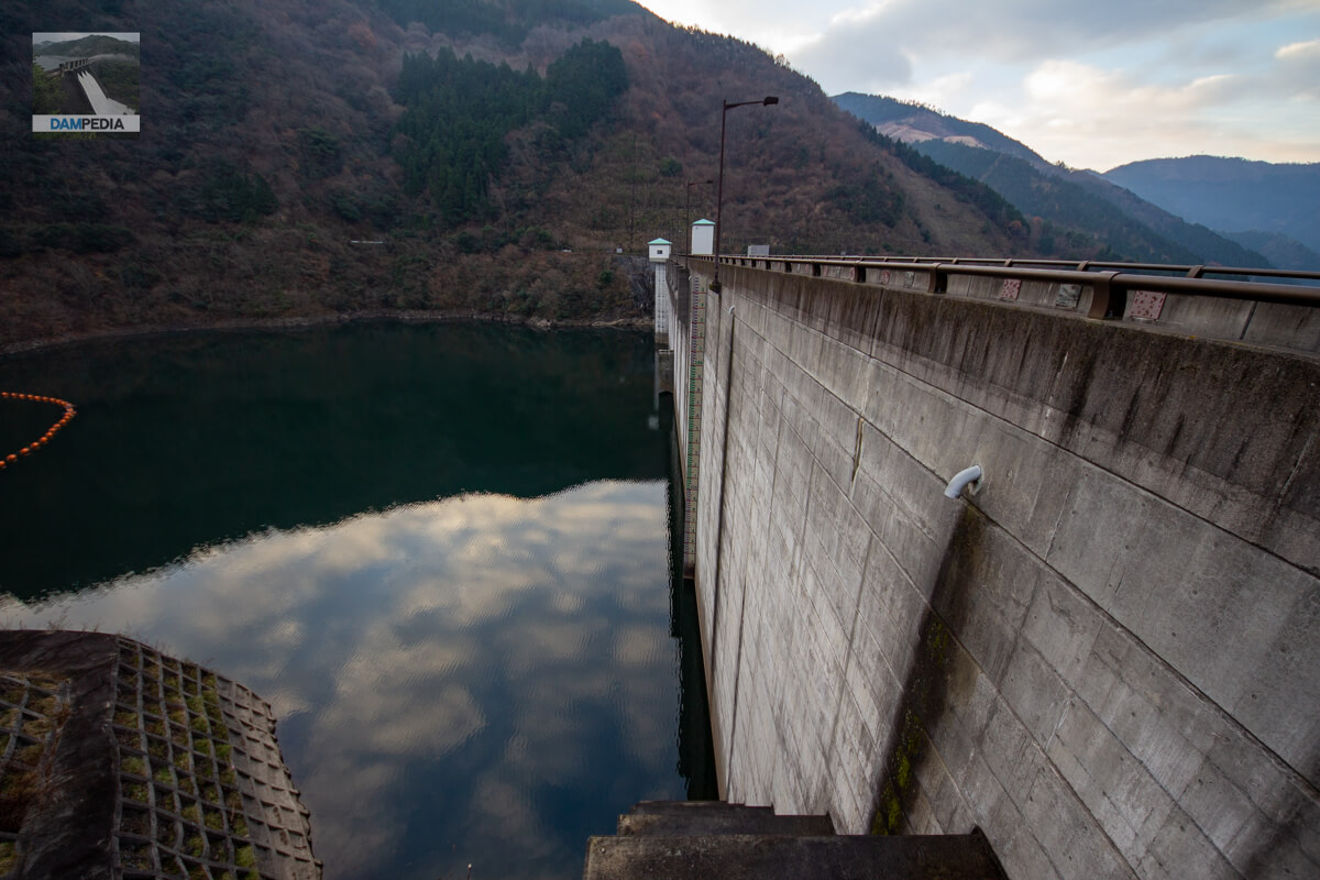
Looking upstream from the right bank
The water level seems low, but looking at the lakeshore, it seems that the water level is usually this low.
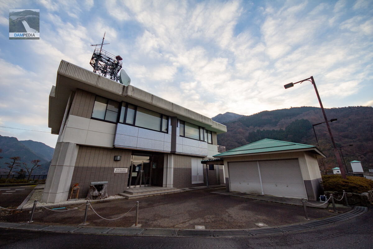
Tsugawa Dam Management Office, Mimasaka Prefectural Government, Okayama Prefecture
The roof of the lower building, which I assume is a garage, is also properly light blue. It's very thorough.
View of the top edge from the right bank
There is nothing special about this top edge, but it is full of a sense of openness.
Stone monument and overview panel at the right bank dam site
Construction of the main body of the Tsugawa Dam has been underway since the beginning of the Heisei era. Although it is a prefectural dam, the huge stone monuments, signboards, and various facilities in various places suggest that the budget was ample, partly because it was the end of the bubble economy.

Looking downstream from the right bank
Downstream, there is a water park where water is drawn from the river into an artificial stream, and the Okutsu River Rabin-no-sato leisure facility can be seen. Rabin-no-sato offers a place to catch amago, a barbecue site, and a campsite.

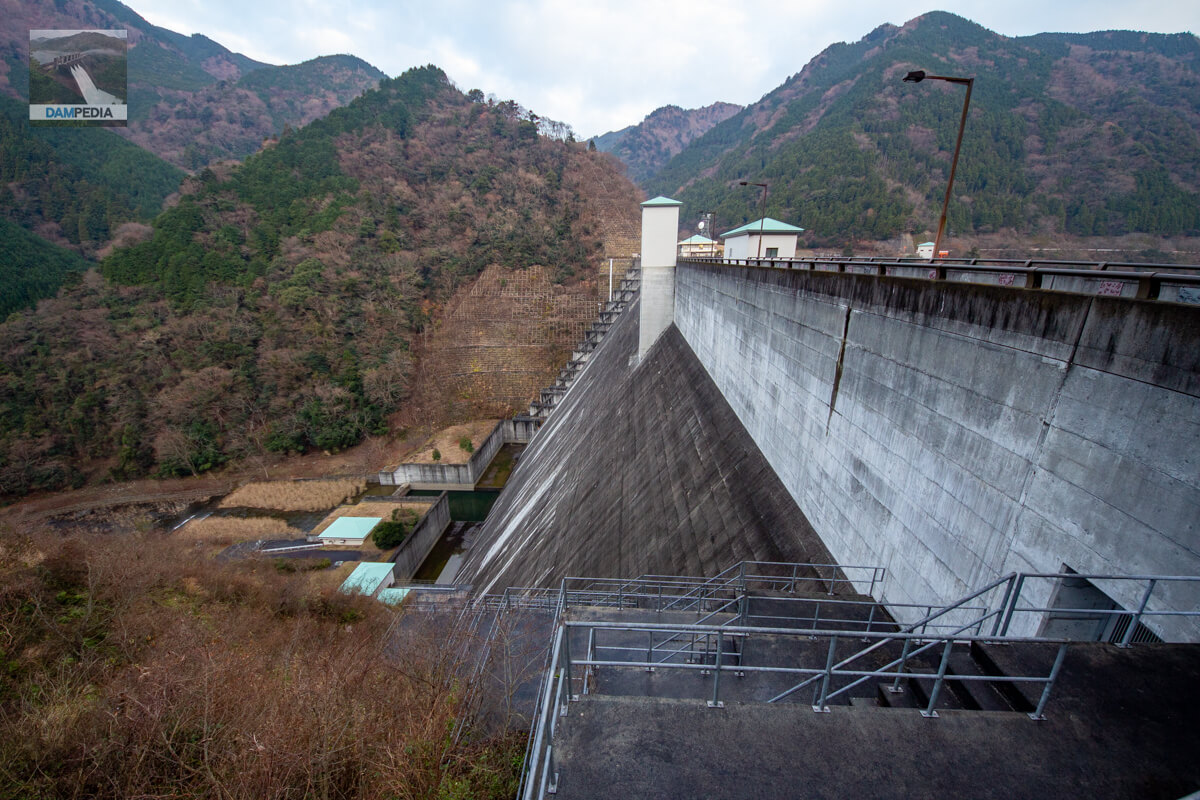
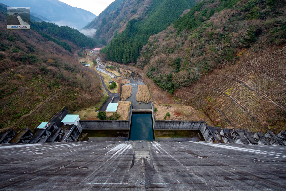
Looking downstream from the top
The orifice comes with a triangular spoiler. The reducer is symmetrical and the stored water reflects the sky. The roofs of the power plant and other buildings on the left bank are also unified.
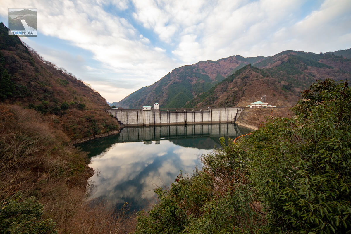
Looking upstream from the left bank
Move from the right bank across the top edge to the left bank and further upstream to see the upstream face of the dike. The reflection of the reservoir is beautiful.
It is very nice to be able to see the embankment from various angles. The Tsugawa Dam was a good start for this day's dam tour.
Tsugawa Dam Specifications
| Location | Okutsukawa, Tsuyama City, Okayama Prefecture |
| River Name | Yoshii-gawa River system Tsugawa River |
| Objective | F (flood control, agricultural disaster prevention) N (unspecified water, water for river maintenance) W(Water for water supply) P(Power generation) |
| Model | G(gravity-fed concrete dam) |
| Bank height | 76m |
| Bank length | 228m |
| Dam volume | 343,000 m3 |
| Watershed Area | 17.8km2 |
| Reservoir area | 24ha |
| Total storage capacity | 5,990,000 m3 |
| Effective water storage capacity | 5,450,000 m3 |
| Dam operator | Okayama prefecture (Chuugoku area) |
| Main body constructor | Tobishima Corporation, Hazama Corporation, Isawa Industries |
| Year of launch | 1975. |
| Year Completed | 1995 |
| Name of Dam Lake | - |
Other facilities/observations
| Parking lot | ○ |
| Toilet | ○ |
| Park | ○ |
| PR Exhibition Hall | × |
| Fishing | ○ |
| Viewing platform | × |
Map around Tsugawa Dam
Weather around Tsugawa Dam
Accommodations that may be close to Tsugawa Dam

Comment