
Location: 1073 Kotsuna, Fujiwara, Nikko-shi, Tochigi
Date of interview: Saturday, October 02, 2010
Kawaji Onsen Station
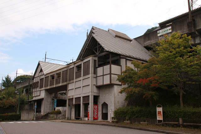
Kawaji Onsen Station is convenient for accessing the Koami Dam. If you are driving, there is a parking lot in front of the station. I am not sure how many people usually park there, but when I visited, it was Saturday and no one was parked there.
I mean, dams are nice, but I want to go to a hot spring....
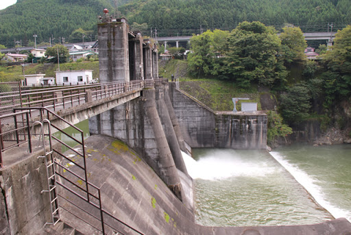
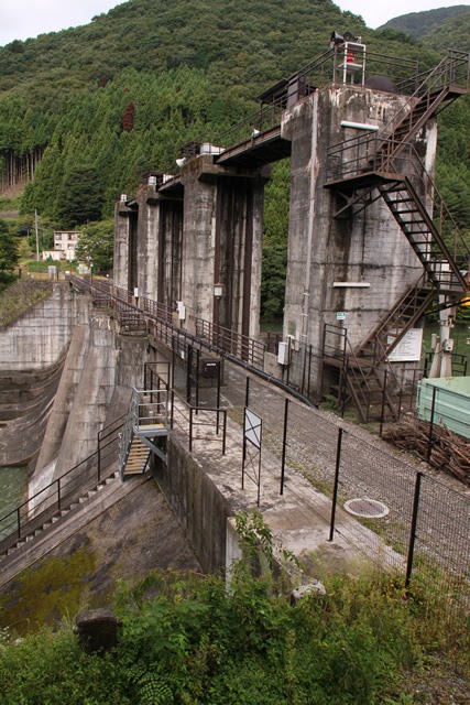
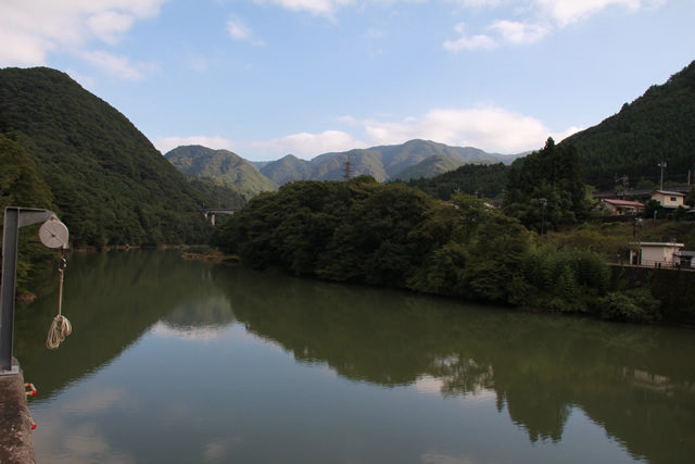
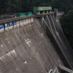
View of the levee from the left bank embankment road
When you get to the national highway, you will see a small clearing, and behind a hedge (?) you will see a dam. The dam can be seen beyond the hedge (?).
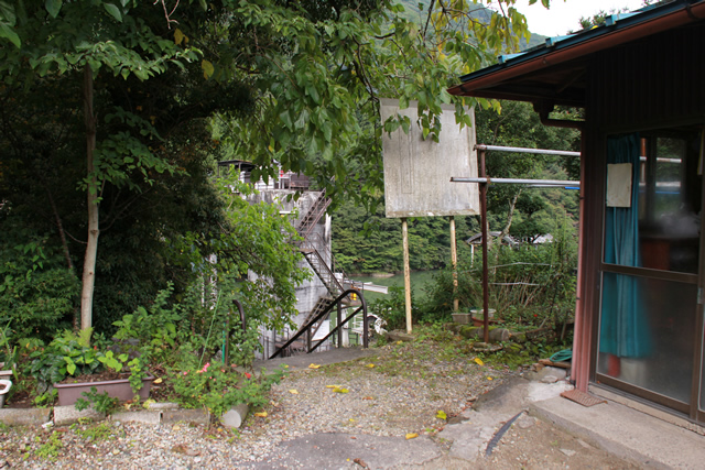
Passage entrance to the dam
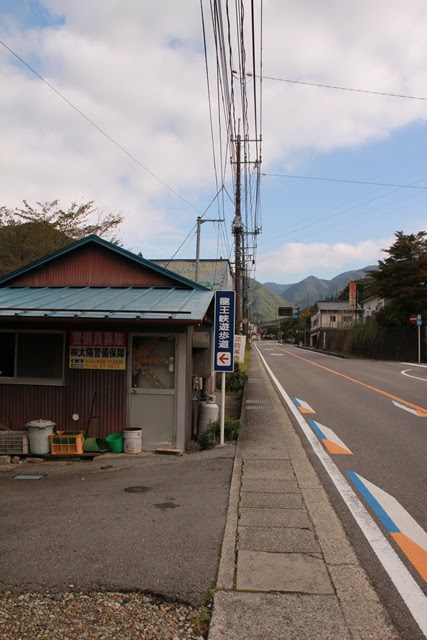
I had already checked in advance that there were stairs leading to the dam, but to be honest, I was a little lost. After leaving Kawaji Onsen Station and walking a little to the left, you will see a signboard that says "Ryuoukyo Trail" as shown in the photo.
Incidentally, I felt a slight line of sight from the building on the left, but it is nothing to be concerned about.
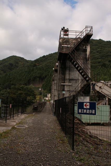
Stairway to the dam
When you go backward from the sign, you will see a staircase, which is a little difficult to enter, but you go down it regardless. Still, the sign warning against discharge is a bald, bald w
View of the levee from the stairs from the national road to the levee on the left bank
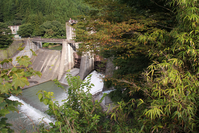
As you descend the stairs, the dam is clearly visible. Oh, and it looks like it's discharging water!
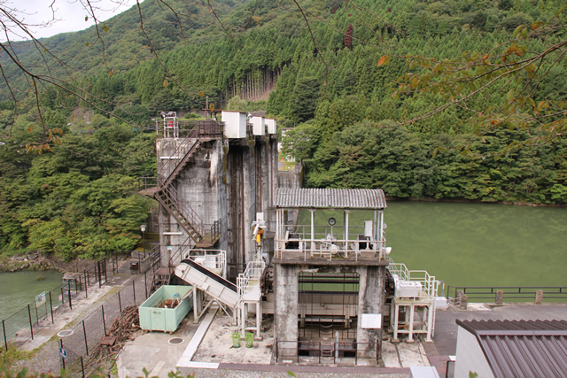
Water intake equipment, dust removal equipment, etc.
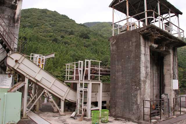
Water intake facilities and dust collectors are located on the left bank as shown here.
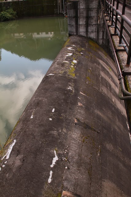
View of the top edge from the left bank
The Koami Dam is a passageway from Kawaji Onsen Station to the Ryuohkyo Trail, so that the top of the dam is walkable, which is unusual for a dam dedicated to power generation. What a delight this is!
Koami Dam seems to have been renovated very recently, and this top passage fence has been replaced with a new one, and the gate has been repainted in dark brown. Personally, I like the current Koami Dam better because it looks more austere.
Dam nameplate fitted on gate piers
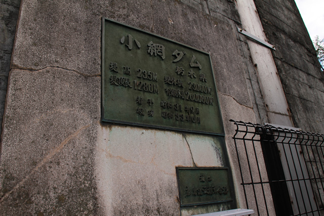
The dam nameplate is fitted into the gate pier, and what a magnificent nameplate it is.
I noticed here that the Koami Dam is a power generation dam operated by Tochigi Prefecture. I think it is rare to find a prefectural power generation dam. At least, I don't think there was one in Aichi Prefecture. As of 2010, there are apparently 28 prefectures and 1 city with public electric utilities, so it would be interesting to see how many of them have dams.
The Koami Dam is also a reverse control dam for the Kawaji No. 1 Power Plant and is the intake dam for the Kawaji No. 2 Power Plant and Koami Power Plant. Further upstream are the huge dams such as the Ikari Dam (0559-Ikari Dam) and the Kawaji Dam (0571-Kawaji Dam), and what a sight it will be when they are used for flood control....
View of the discharge from the top edge
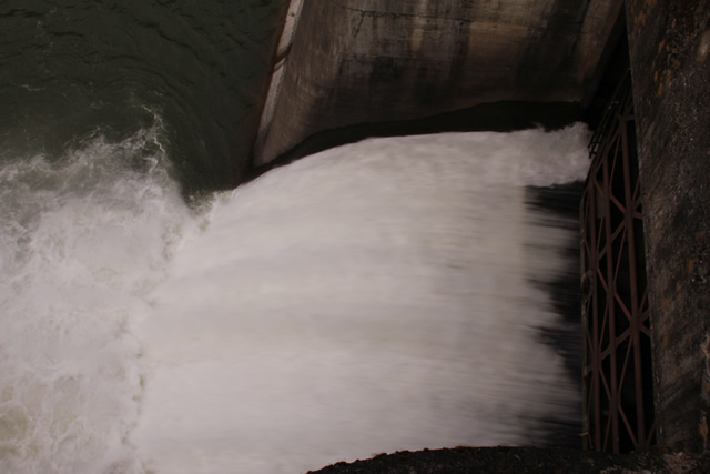
The fish are released into the water for a short while.
View of the roller gate from the top
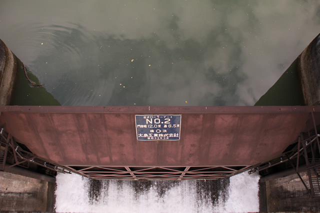
This is a view of the roller gate and discharge. The roller gate measures 12.0m x 8.5m and was manufactured by Oshima Kogyo Co. in March 1958. The gate was originally light green in color. Personally, I prefer this color now.
View downstream from the top

Nakaiwa Dam (0557-Nakaiwa Dam/Nakaiwa Dam) is located ahead.
View of the reduction work from the top edge
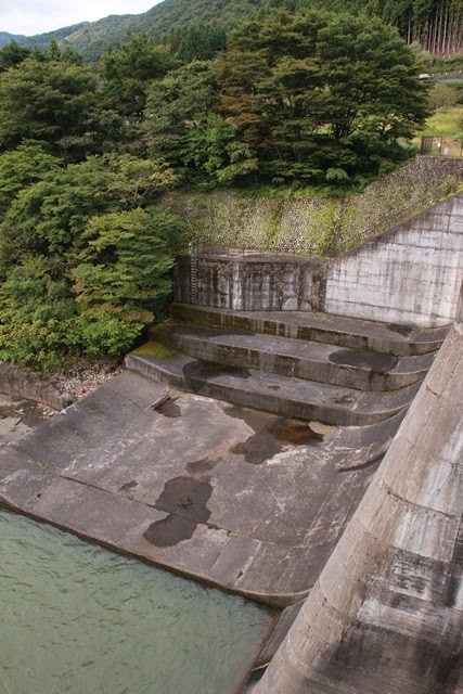
The flood discharge in this area is a natural overflow type, but I would like to see how it overflows.
View of the dam lake from the right bank
The bridge in the back is the Noiwa Railway Aizu Kinugawa Line. As was the case at the station, the cars do not show up very often. Maybe there are not so many services.
View of the natural overflow flood discharge from the right bank
I would like to see it overflowing from here. Will we be able to see it if flood control is carried out at the Gojuri Dam or Kawaji Dam?
View of the levee downstream from the right bank

This photo was taken through a wire fence. If there were no wire mesh, I would be able to admire it more, but for safety reasons, I had no choice.
View of the top edge from the right bank

This pole also appears to have been installed very recently. Did someone try to break in with a light car?
View of the levee downstream from the left bank embankment road
Before returning to the station, I suddenly thought I might be able to see it from the downstream side! But even though autumn is deepening, the grass and trees are still thick. It was not quite as I had hoped.
However, although it was a small dam, it was a dam that we were able to fully enjoy to the fullest.
dam characteristics
| River Name | Tone River System Kinugawa River |
|---|---|
| Objective | generation (e.g. power) |
| Model | gravity-fed concrete dam |
| Bank height | 23.5m |
| Bank length | 128m |
| Dam volume | 20,000m3 |
| Watershed Area | 606.5 km2 |
| Reservoir area | 10 ha |
| Total storage capacity | 627,000m3 |
| Effective water storage capacity | 260,000m3 |
| Dam operator | Tochigi prefecture (Kantou area) |
| Main body constructor | Kajima Construction |
| Year of launch | 1953. |
| Year Completed | 1958 |
Other facilities/observations
The parking lot does not belong to the dam, so △. There are no other facilities for the purpose of visiting, but it is one of the dams that I would definitely go back to see.
| Parking lot | △ |
|---|---|
| Toilet | × |
| Park | × |
| PR Exhibition Hall | × |
| Fishing | ○ |
Comment