
Location: Kawamata, Nikko-shi, Tochigi
Date of interview: 10/03/2010
Entrance to Kawamata Dam (Setoaikyo Trail entrance)
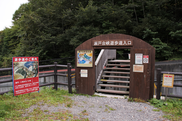
Kawamata Dam is only open to visitors from 9:00 in the morning.
Also, it closes at 4:00 p.m., so be careful if you go to the back of the building at that time.
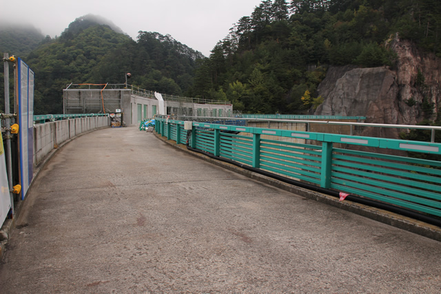
Slope to Kawamata Dam (the lower part of the slope is a snow shed on the administration road)
Below this is a managed road, which also serves as a snow shed in winter.
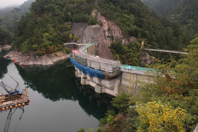
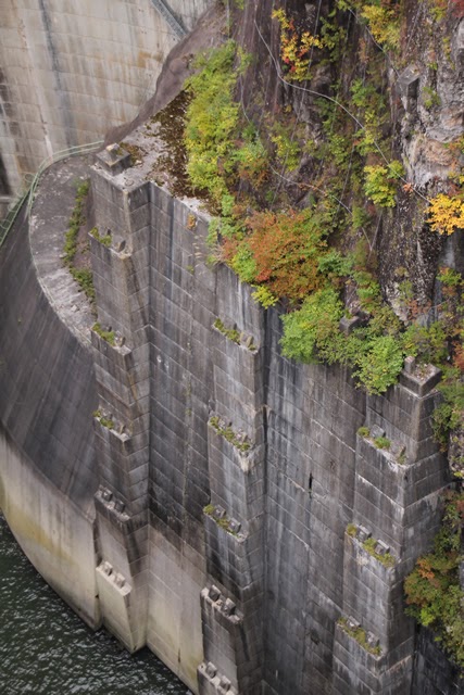
View of the embankment on the lake side from the right bank

After descending this slope for a while, the embankment comes into view. ...What's that?
crest gate

Something is under construction! I have a bad feeling about this somehow.
Still, the rounded part of this gate is indescribably sexy, even.
Inside the PR Exhibition Hall
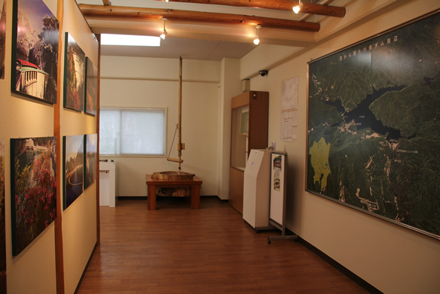
The path leads down the slope to the PR exhibition hall, allowing visitors to learn about the levee before going to the levee tour.
construction sign

I came to the top of the mountain, but my premonition was right. We could not enter the top edge due to construction work.
View of the top edge from the right bank
Woo, I want to walk on the edge of the sky.
Well, if it's construction, it can't be helped.
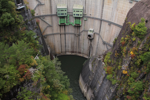
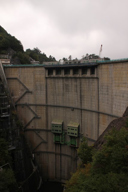
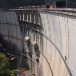
View of the levee downstream from the right bank
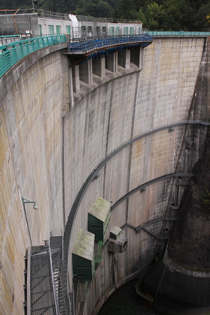
Kawamata Dam holds the record of being the longest vertical arch dam in Japan. It is a narrow but impressive embankment that compactly houses a variety of functions.
Howell Banger Valve (HBV)
It's a little hard to tell from this photo, but "HBV" is written at the entrance to the building at the top of the structure where the valve is located. It stands for "Howell Banger Valve.
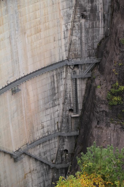
Catwalk from the right bank
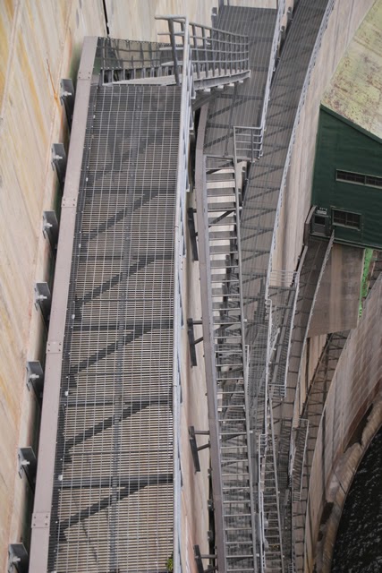
It is hard to tell whether the photo is of an ascent or a descent, but only an arch dam can produce photos like this.
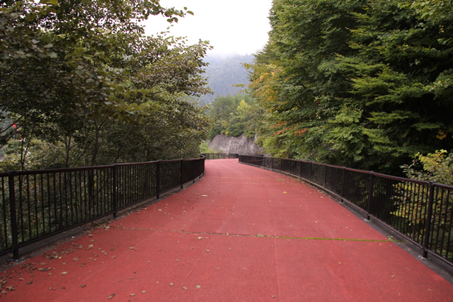
Entrance to Setogai Gorge Trail (No. 2)
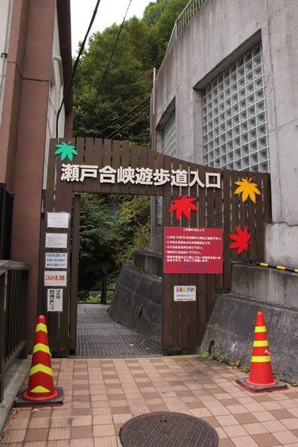
Now let's move downstream.
Still 200 steps
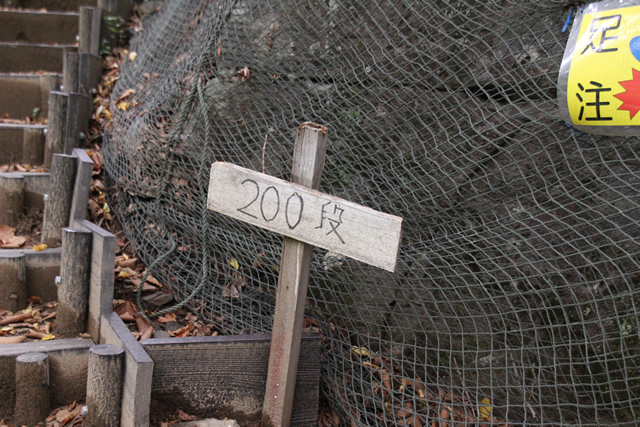
Zee-ha-ha-ha. Still 200 steps.
100 more steps...
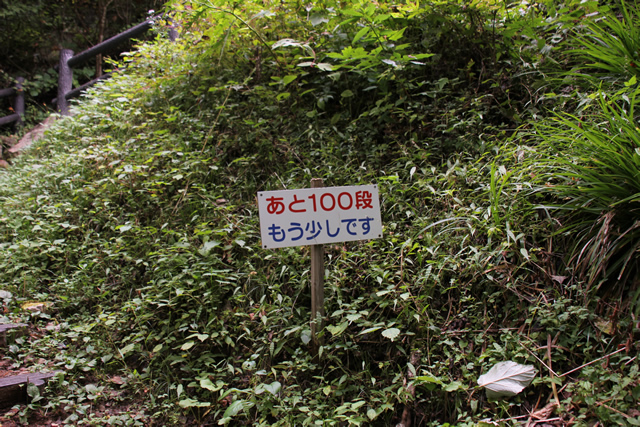
Ze-ha-ha-ha-ha-ha...100 more steps.
View of the levee from the middle of the promenade
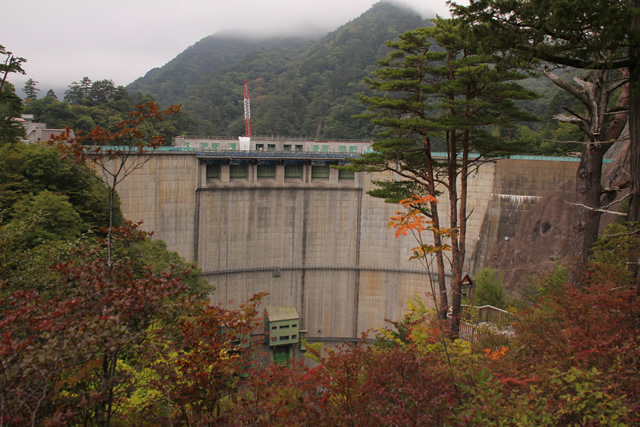
ぜーはーぜーはーぜーはーぜーはーぜーはーぜーはーぜーはーぜーはー・・・やっと下流側の堤体が見えてきた。
Angel Bells
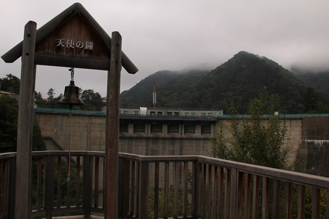
The "Angel's Bell", although many of the photos are very unfortunate because they are too underdone. And this place is called "Angel Hill". Don't make a mistake and say "you are the one who rings that bell" or something like that.
Angel Hill & Angel's Bell
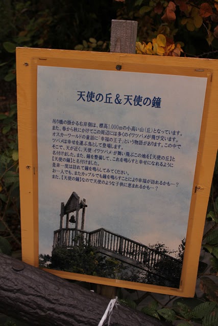
They say that ringing the bell will make you happy. I did not ring the bell for some reason. I am not sure why I did not ring the bell.
View of the embankment from the suspension bridge

The giant arch dams I have seen so far look like they have spread their wings, but Kawamata Dam looks like it has closed its wings.
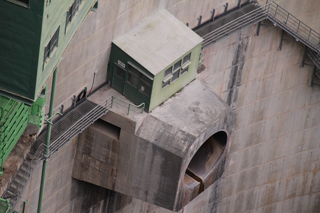
conduit gate
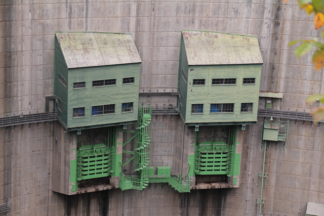
As a permanent flood discharge, the conduit gate has two roller gates.
crest gate
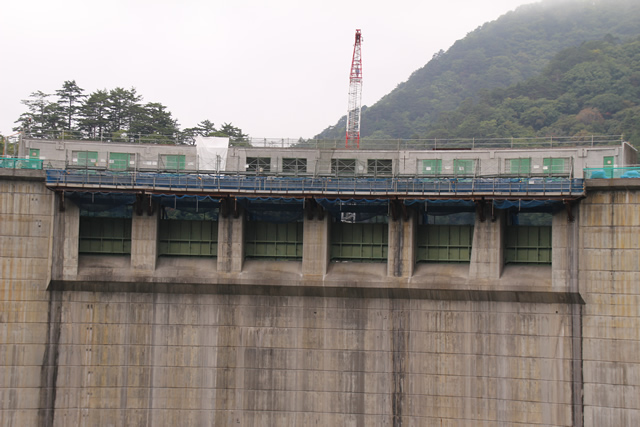
The crest gate as an emergency flood discharge has six roller gates.
Howell banger valve (auxiliary water discharge system)

And again, one Howell banger valve.
They call it a "transmitting wall."
I read on Night Sparrow's site that this location is a "transmitting wall," but it is kind of a strange structure.
View of the reduction work
Incidentally, I am taking this photo from the Watarashii Suspension Bridge, a suspension bridge installed on the downstream side of the dam, and although it is quite high, I had no fear in front of the dam.
This reduction work shows how narrow and steep the site was built.
View of the sub-dam

Looking from the suspension bridge in the opposite direction of the embankment, i.e., downstream, one can see a sub-dam. The sub-dam is also arched.
View of the suspension bridge further downstream
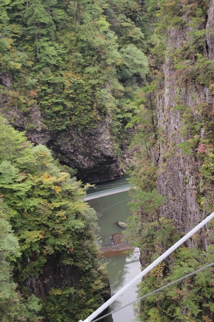
I didn't pay much attention when I was taking the picture, but there is another suspension bridge downstream of the sub-dam. I couldn't confirm with Google Maps, etc., whether it is a trail. Or is it an administrative pathway for the dam?
View of the right bank
It is a complex right bank structure.
View of the levee
Crossed the suspension bridge to the left bank and took a picture of the embankment. It is still a bit underdone.
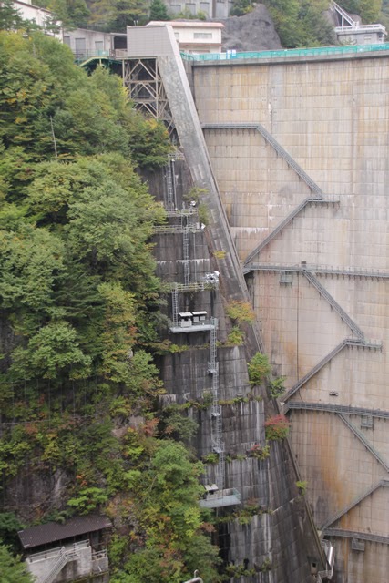
A pavilion-like structure on the lower right bank
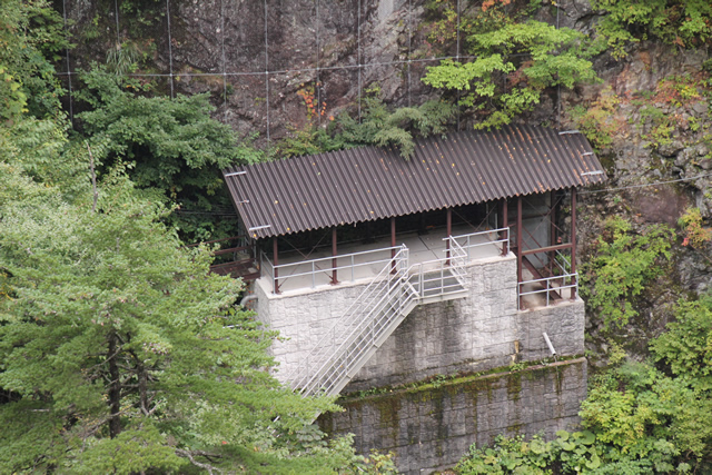
I would like to visit this place, but apparently it is on a controlled access road and the public is not allowed to go there.
Elevator entrance
This is the entrance to the elevator installed on the right bank. This is the only place where the elevator is strangely new, but it seems to have been built relatively recently. The embankment itself is old, but you can see that it has been improved over and over.
View of the left bank
And finally, we look at the left bank. Here, too, is a complex structure. However, if you look closely, you can see that it looks like the stage of a game that used to be on the Famicom (NES). I wonder what the name of that game was...
dam characteristics
| River Name | Tone River System Kinugawa River |
|---|---|
| Objective | Flood control, agricultural disaster prevention, unspecified water, river maintenance water, power generation |
| Model | arch dam |
| Bank height | 117m |
| Bank length | 131m |
| Dam volume | 147,000m3 |
| Watershed Area | 179.4 km2 |
| Reservoir area | 259ha |
| Total storage capacity | 876,000,000m3 |
| Effective water storage capacity | 73,100,000m3 |
| Dam operator | Kanto Regional Construction Bureau |
| Main body constructor | Kajima Construction |
| Year of launch | 1957 |
| Year Completed | 1966 |
| Name of Dam Lake | Kawamata Lake |
Other facilities/observations
Please note that access to the area around the dike is restricted from 9:00 to 16:00. Parking is available after hours. The restrooms are equipped with a rare (!!!!) Unusually, they are equipped with bidet toilets. Although I gave the park an "O", it is a long walk from the parking lot. I chose "○" for the park because it is a long walk from the parking lot, including the walk to the suspension bridge. However, if you are not confident in your leg strength, it may be a bit difficult.
| Parking lot | ○ |
|---|---|
| Toilet | ○ |
| Park | ○ |
| PR Exhibition Hall | ○ |
| Fishing | ○ |
Comment
[Auto-post] Damapedia Archives - Please take a look at it in your spare time - 0563-Kawamata Dam/Kawamatadamu http://t.co/f3FQWquuZ7