
Date of interview: Sunday, 04/20/2014
On this day, there was an award ceremony for a photo contest by the Japan Dam Association at Hiyoshi Dam, so I decided to visit nearby dams until it was time to attend the ceremony. I also decided to visit Tamba Sasayama for the first time in about three months.
Looking upstream from the left bank
We felt that the road on the right bank was a bit narrow, so we crossed the top edge and parked our car on the left bank. Therefore, we will approach from the left bank first.
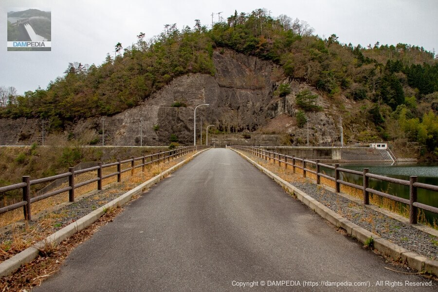
View of the top edge from the left bank
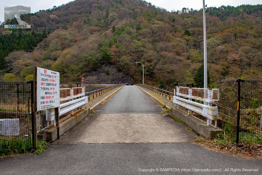
The reservoir can be circled in a single loop, so the top edge is also open to automobile traffic. The top edge of the reservoir is well maintained.
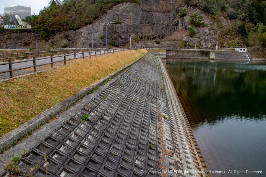
Looking downstream from the left bank
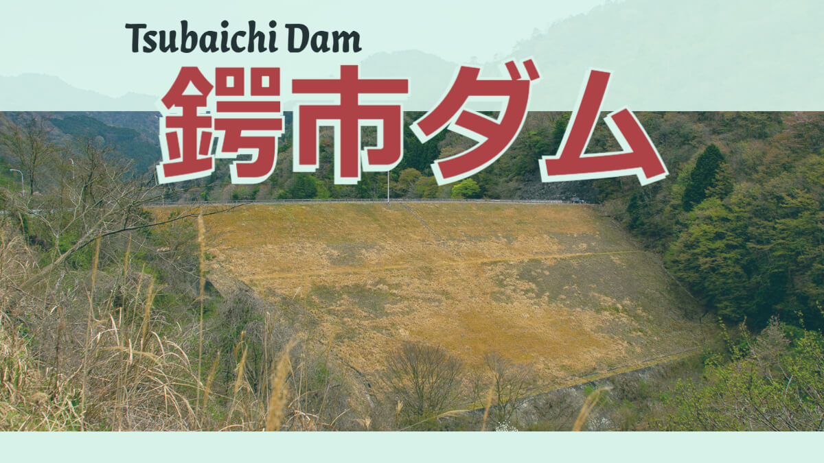
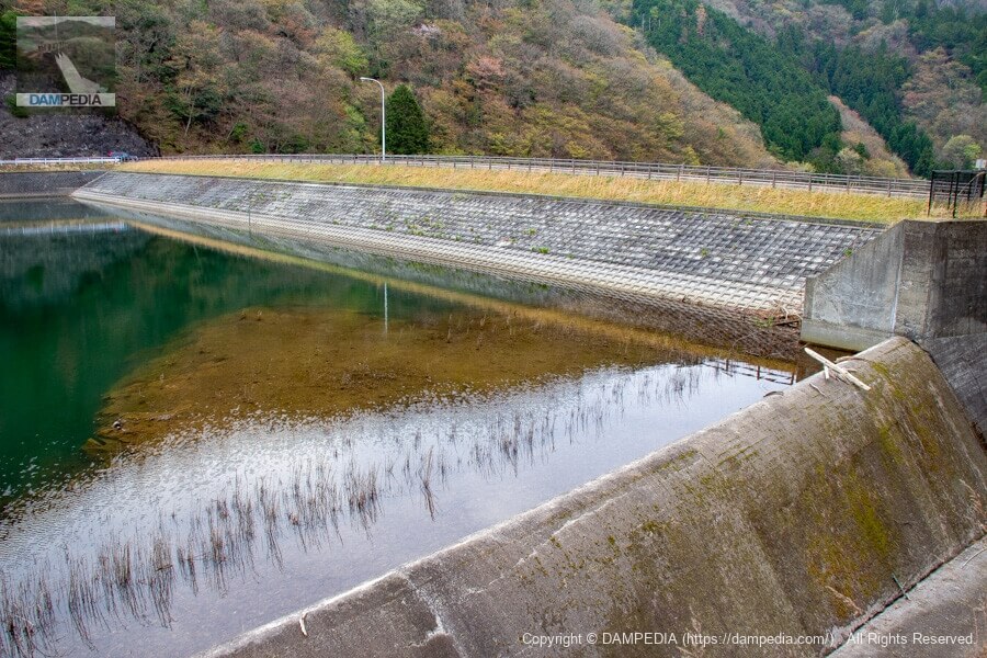
As you can see, the Tsubashi Dam is an earth dam, but on this day the grass on the slope of the embankment was neatly cut.
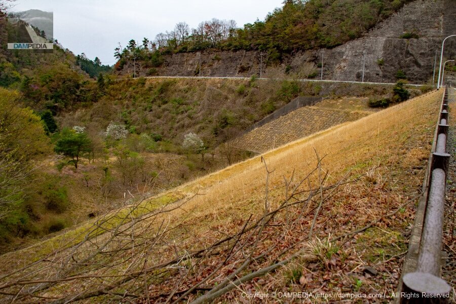
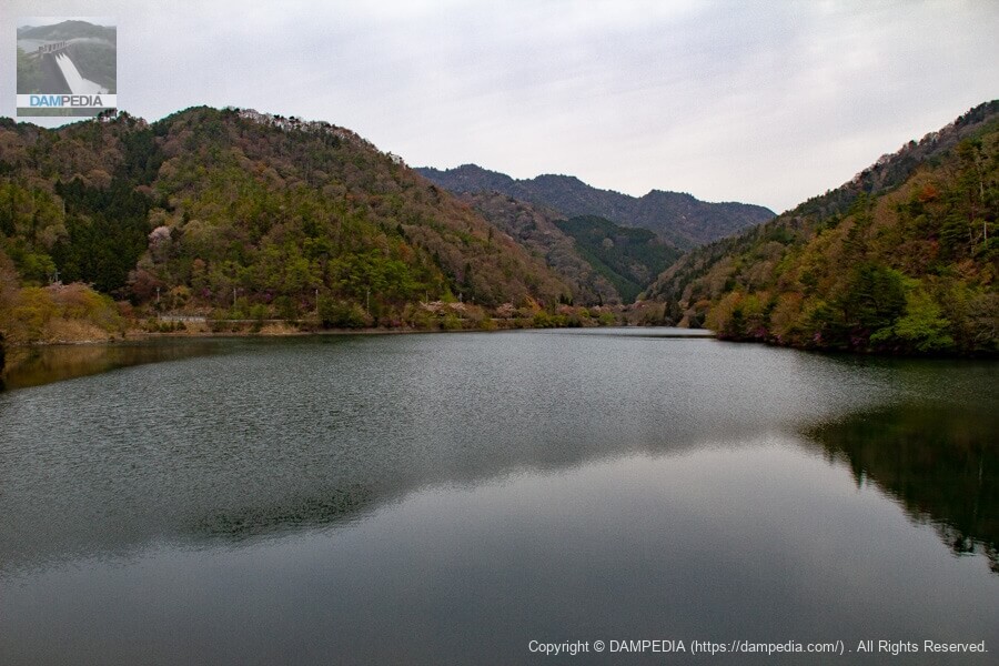
View of the reservoir from the top
There are no houses upstream, so the reservoir is clean and very quiet.
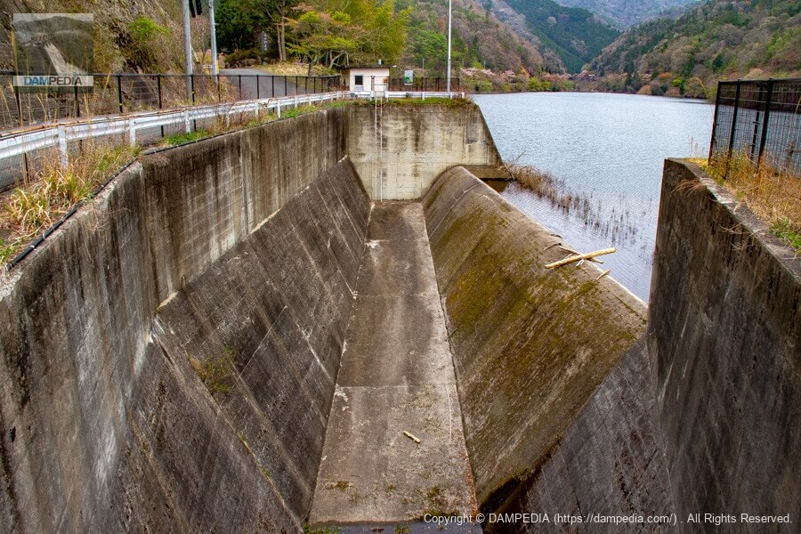
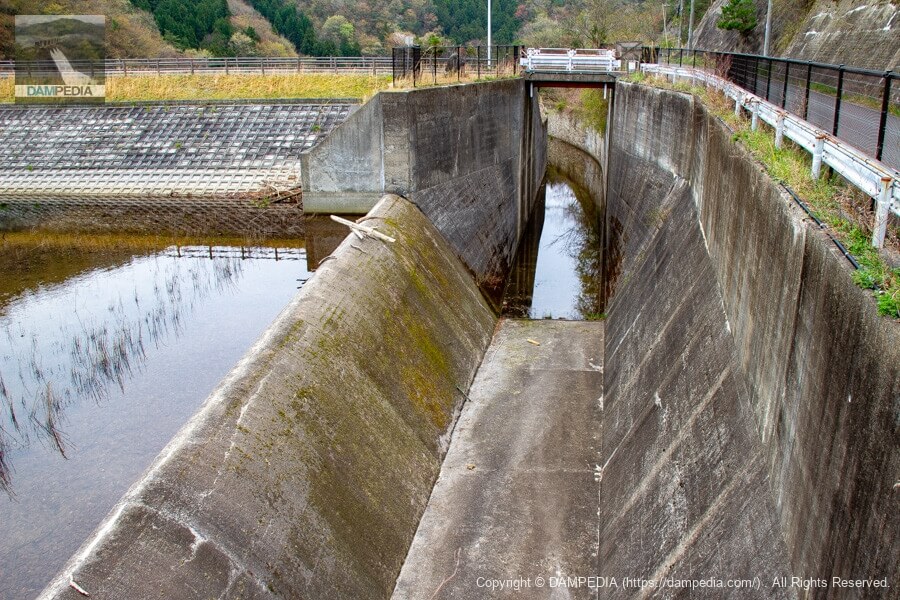
View of the spillway from the top
The spillway is a side channel type, which is common in earth dams. The slant-flume intake system can be seen in the back.

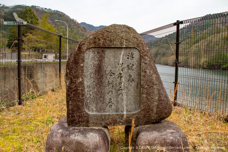
Stone monument on the right bank
floating nestling
 Tsuba City Dam
  Spring this morning
It is inscribed "Respectfully written by Hachiro Ueda, a member of the Hyogo Prefectural Assembly." At the time of construction, Mr. Hachiro Ueda was the chairman of the Sasayama River Coastal Land Improvement District, and he was also the founder and president of the Nada Sake Brewery. In any case, he seems to have been associated with Hyogo Prefecture.
Looking upstream from the bridge over the spillway discharge
The fact that driftwood is on top of the overflow bank means that it can overflow.
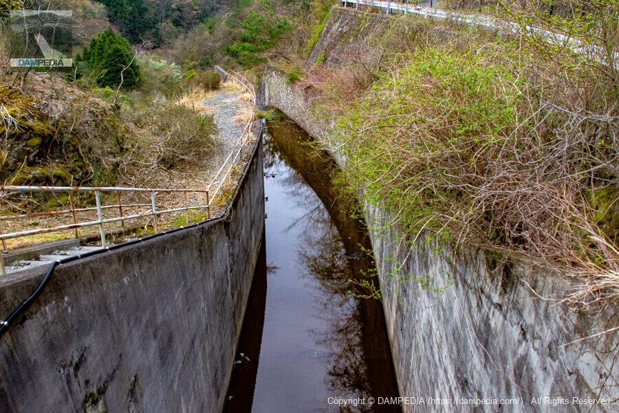
Looking downstream from the bridge above the spillway
The conduit section is bent to the left, so I cannot see beyond the chute section. I am a little concerned about what is going on.
Looking downstream from the right bank
It really is a beautiful levee. GSI maps and aerial photos show that there seems to be a road to just below the lower stream. However, it seems to be a rough road with no asphalt pavement, so you need to be prepared to go there.

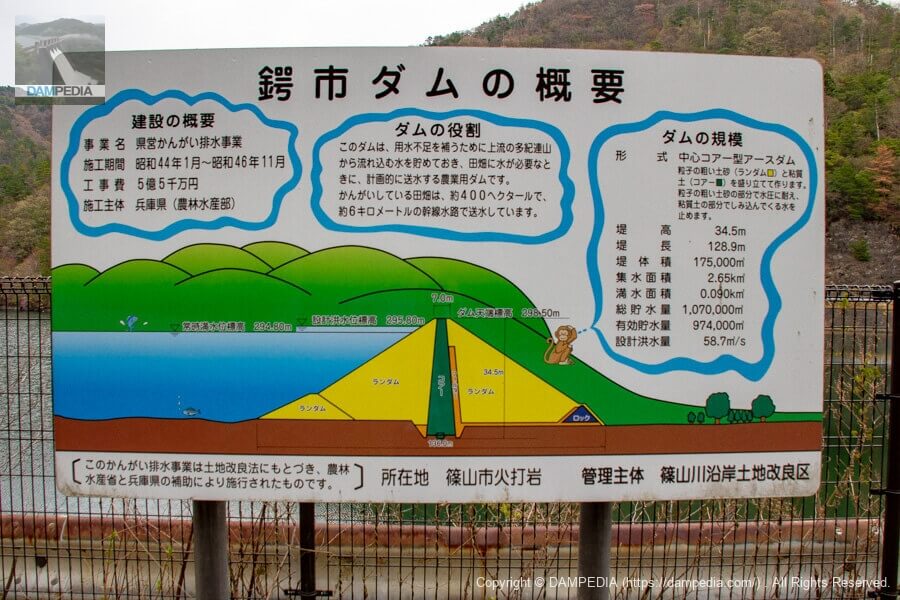
Summary signage for Tsubashi Dam
The sign is quite splendid for an agricultural dam. Incidentally, the location "Hiuchi Iwa" is read as "Hiuchi One," not "Hiuchi Iwa. Both the name and the reading are unusual, but I wonder if such a rock exists.
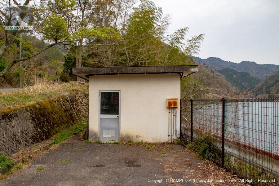
Slanted-flume water intake system operation room
Inside were machine-side devices and valves.
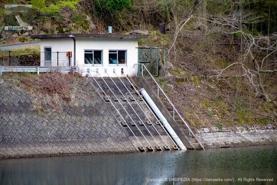
View of the slant-flume intake system from the top
You can see five diagonal gutters extending from the building in the photo above.
View of the residual water discharge from upstream
The residual water discharge can be viewed from various angles.
Looking upstream from the right bank
The upstream surface is also very clean and well captured.
View of the top edge from the right bank
The top edge is also nicely maintained. Aside from the guardrails on the bridge, the design of the fence at the top end is also well blended in with the site.
It is said that Herabuna are released into the reservoir of the Tsubashi Dam, and it is famous in the neighborhood as a fishing spot. The signboard on the left of the photo is by the Tsubasaichi Taro Fishery Association, which manages the reservoir.
- No boats, floaters, or swimming
- Entry Permit Required
- Funa and carp are strictly prohibited from being taken out of the area.
- Prohibit the re-release of non-native fish
The following was written about the project.
Stone monument upstream on the right bank
This stone monument is located behind the water intake facilities upstream on the right bank. Gakusui Junbi Fields" was written by Tokitada Sakai, the governor of Hyogo Prefecture at that time. It probably means "the water from the mountain makes the rice fields beautiful and moist.

Below the stone monument was a summary of the construction of the Tsubaki City Dam.
The Tsubashi Dam is an agricultural dam with an area of 9.1 hectares and a storage capacity of 1.07 million tons. Construction was completed in November 1971 at a total cost of 485 million yen.
The prefectural Tsubagashi area farm improvement project was carried out in the 25 villages of Hiauchiwa, Okuhata, Seri, Suga, Imatani, Hatamiya, Ohbuchi, Ogami, Wada, Hannwakuji, Shinso, Noma, Higashi Sawada, Okuma, Kitazawa, Mae Sawada, Kurooka, Terauchi, Sakura, Kumagaya, Guniya, Kasugahe, Kuratani, Izumi and Sanukitani, covering a total area of 496 hectares. Construction began in October 1971 and was completed in March 1982 at a total cost of 2.4 billion yen, thanks to the efforts of Mr. Kichiji Aoki, Chairman of the Tsubaki Water System Council, and the solidarity and cooperation of each village.
June 1982
From the local nameplate
Shoichi Fujii, Mayor of Sasayama Town
As shown on this nameplate, the Tsubashi Dam was maintained through the efforts of local people and loved by many helmsmen.
Tsubashi Dam Specifications
| Location | Hiuchiiwa, Tambasasayama City, Hyogo Prefecture |
| River Name | Kako River System, Tsubagaichi River |
| Objective | A (irrigation water) |
| Model | E(earth dam) |
| Bank height | 34.5m |
| Bank length | 128.9m |
| Dam volume | 175,000 m3 |
| Watershed Area | 2.7 km2 |
| Reservoir area | 9ha |
| Total storage capacity | 1,070,000 m3 |
| Effective water storage capacity | 974,000 m3 |
| Dam operator | Hyogo prefecture (Kinki area) (Hyougo) |
| Main body constructor | Taiho Construction |
| Year of launch | 1969. |
| Year Completed | 1971 |
| Name of Dam Lake | - |
Other facilities/observations
Parking will be available on the shoulder of the road. Restrooms are located in the Tsubagashi Nature Park at the upstream end of the reservoir.
| Parking lot | △ |
| Toilet | ○ |
| Park | ○ |
| PR Exhibition Hall | × |
| Fishing | ○ |
Map of the area around Tsubashi Dam
Weather around Tsubashi Dam
Accommodations that may be close to Tsubashi Dam
Comment