
Location: Kyokudani, Maibara City, Shiga Prefecture
Ibuki Town is located at the foot of the famous Mt. Ibuki, and the Anegawa Dam is located deep within the town. By the way, my niece's name is "Ibuki," but it has nothing to do with Mt. Ibuki because it is "breath blowing. Ha! I don't care about that.
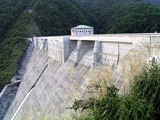
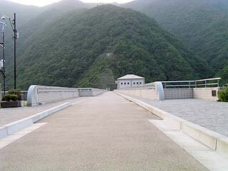
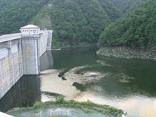
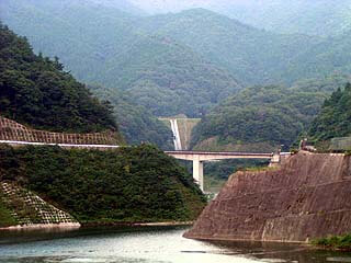
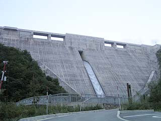
View of the levee from the control station on the downstream side of the right bank
As you can see, the silver grass was growing taller and the leaves were beginning to change color in the mountains, making it a bit chilly.

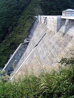
View of the levee from the control station on the downstream side of the right bank
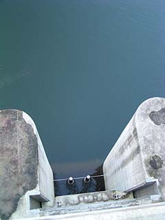
I thought it was difficult to image the height, so I photographed it in portrait orientation.
The dam was completed very recently, so it was very well maintained. The dam has no gates at all, and both the crest and orifice are natural overflows, a recent trend.
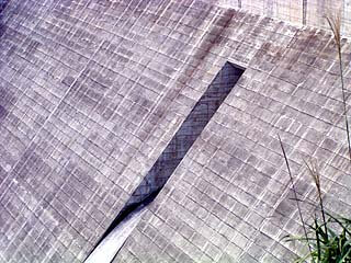
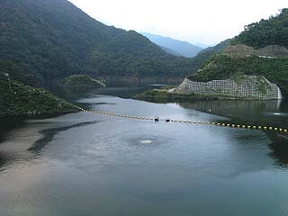
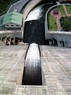
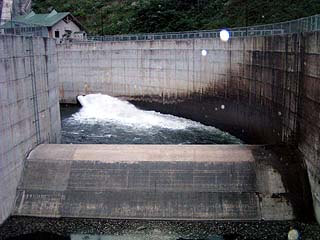
View of the permanent flood discharge from the control station on the downstream side of the right bank
This is a permanent flood discharge that was described as a "gateless orifice" on the website of the River Development Division, Department of Public Works and Transportation, Shiga Prefecture. It has a beautiful slit shape, but I personally wish it had been designed a little better.
Looking downstream from the control station on the right bank near the force-reducing structure.
The park is also very well maintained downstream.
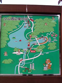
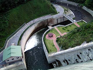
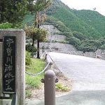
Guide map around the dam
Its maintenance is also quite extensive when looking around the dam lake. There is a water park and a lily garden.
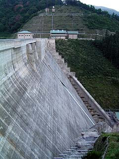
View of the top edge from the right bank
The top edge is also nicely maintained. However, there are cobwebs here and there, and if you are not careful, you can get caught in them. It is deep in the mountains, so it can't be helped.
Origin of Bailong Lake
The name of the dam lake is Bailong Lake. It is a very nice sounding name.
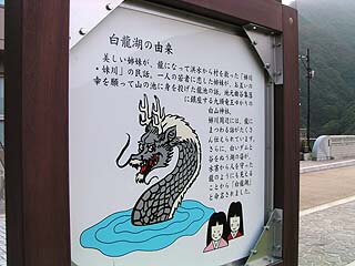
The origin of the name was described. The following is a quote from it.
The folk tale of Anegawa and Seo-gawa, in which two beautiful sisters saved their village from a flood by becoming dragons. The story of Dragon Pond, where two sisters in love with a young man threw themselves into a mountain pond to wish each other good fortune. Hakusan Shrine related to King Kutouryuu sits in the local village of Kyokudani. There are many stories related to dragons in the Anegawa River area. Furthermore, the lake was named "Hakuryu-ko (White Dragon Lake)" because its white dam and the lake that flows through the valley look like a dragon that protected people from flooding.
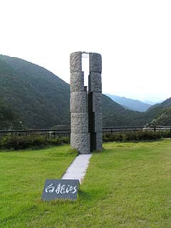
View Monument
It is a monument of an unusual shape. It is made of granite divided into two halves, with glass in between.
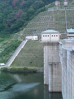
View of the dam lake from the left bank observation platform
The top of the compressor room at the left bank dam site is an observation platform from which you can look around. The white bubbles in the middle of the dam lake are not a sign that a dragon is about to appear, but rather a diffuser pipe, from which air is coming out. There seem to be three diffusers installed in the dam lake.
View of the dam lake from the left bank observation platform
There is something that looks like a UFO disk installed near the dike. This one was deep aeration.
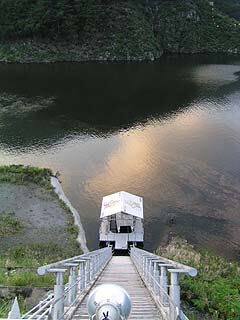
incline
The incline seems to lead directly to the compressor room. The roof of the mooring boat on the dam lake had a fox character painted on it.
View of the embankment (dam lake side) from the left bank observation platform
The remains of the dam construction can be seen on the mountainside on the right bank.
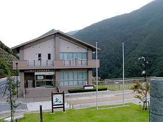
View of the management office (Anegawa Fureai Plaza) from the left bank observation deck
The management office is accompanied by an exhibition hall-like building called "Anegawa Fureai Plaza. Unfortunately, it was not open on the day of our visit, either because it was closed or because it was already past closing time.
View of the water intake tower at the top end
Large frontage and height shutters.
View of the discharge from the orifice from the top edge
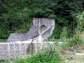
View of the reduction work from the top edge
As you can see, the reduction works are almost perpendicular to the embankment. This is quite unusual.
View of the water intake leading to the orifice from the top edge
Water was being sucked in from here. However, its volume is not so large.
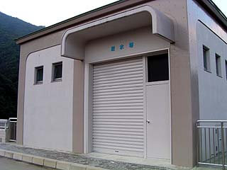
Audit corridor entrance?
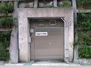
There is a door like this on the right bank, marked "Rim Tunnel". Perhaps it is an audit corridor, but even so, what does "rim tunnel" mean? The word "rim" means "ring" or "ring-shaped," so I wondered if it meant that the audit corridor was built in a ring. I thought so, but it is a complete mystery.
*04/09/15 postscript, information provided by ash ace (Thanx!):
The purpose is for rim grouting and for water sealing the bedrock on both sides of the dam. Rim is used to mean "rim (fringe)".
View of the embankment from the right bank dam lake side
View of the levee from the downstream side of the right bank
Looking to the left from here, we could see what looked like a lookout tower on the hill beyond the administration office, but we could not figure out where to climb up from and it was getting dark, so it was still unclear after all.
View near the lily garden from the top
I saw what looked like an earth dam and a flood discharge on the other side of the bridge, and when I actually went there, I found that it was not a dam but a hill, and there was a lily garden on the hill, and the structure used to channel the water there looked like an earth dam flood discharge. The lily garden, however, was in a state of disrepair and looked very different from the area around the embankment.
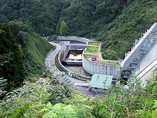
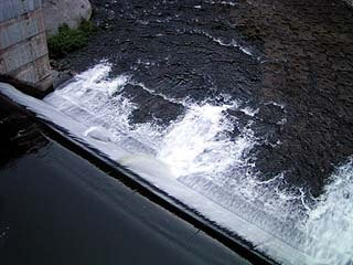
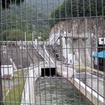
View Force Reduction Works
Now, let's go downstream to check out the force-reducing structure. There is a bridge over the force-reducing structure, so we can see the structure up close. However, the water from the water discharge for irrigation is quite strong, so much so that the camera lens gets wet.
Water flowing out of force reducers
From here, it flows down the Anegawa River to Nagahama and then to Lake Biwa.
Mysterious door installed on the right bank downstream
When I saw it from afar, I thought it was a gate for discharge or something, but from up close, there is a door, and it looks like water does not come out of here. I wondered if this also led to the audit corridor. I thought so.
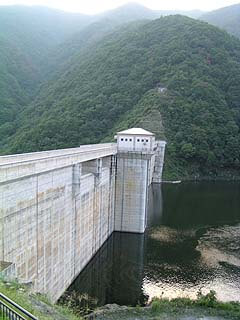
View of the levee from downstream
Anegawa Dam Specifications
| Model | gravity-fed concrete dam |
| Objective | Flood control and agricultural disaster prevention, Unspecified water, water for river maintenance |
| Bank height | 80.5m |
| Bank length | 225m |
| Dam volume | 302,000m3 |
| Watershed Area | 28.3km2 |
| Reservoir area | 33ha |
| Total storage capacity | 7,600,000m3 |
| Effective water storage capacity | 6,500,000m3 |
| Name of Dam Lake | Bailong Lake |
| River Name | Yodo River system Anegawa |
| Year of launch | 1977 |
| Year Completed | 2002 |
| Access | The nearest interchanges to the Anegawa Dam are Nagahama, Maibara, and Sekigahara, It can be reached from any of the interchanges at a similar distance. Here is how to access from Maibara. Exit at the interchange, turn right and go straight on Route 21. Turn left at Isshiki intersection Go straight on Prefectural Road No. 19. Go straight at the Noichishiki East intersection, but beyond this point the road becomes Prefectural Road No. 40. Then just drive along the road. Looking right (east) around County Road 40, The long-lasting Sumitomo Osaka Cement conveyor belt can be seen. It is really long, so don't be surprised, but don't just take a side glance. |
Other facilities/observations
There are ski resorts in the vicinity, so if I ever visit those ski resorts in the winter, I would like to cover the dam in the winter.
| Parking lot | ○ |
| Toilet | ○ |
| Park | ○ |
| PR Exhibition Hall | ○ |
| Viewing platform | ○ |
Comment