
Date of interview: Sunday, 3/2/2014
After touring Shingu Dam and Yanase Dam, participating in an event at Hayamoura Dam, and staying overnight in Kochi City, we came to Yoshino Dam in Kami City. Our plan for the day was to tour the dams along Route 195 and return home.
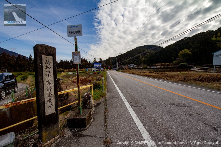
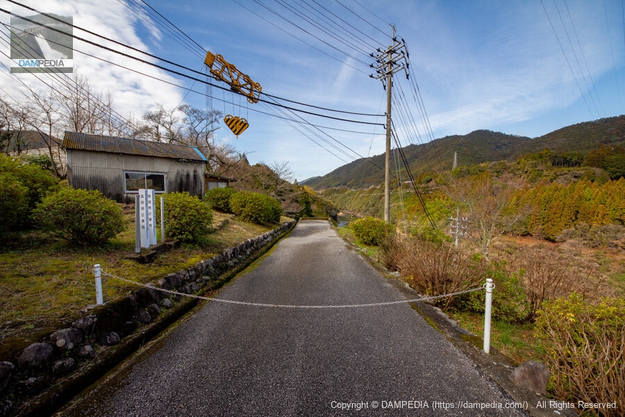
Entrance along the national highway
This photo was taken on the way home. The Yoshino Dam is located within the prefectural Yoshino Power Plant, so the nameplate of the power plant, not the dam, is engraved on the gatepost. The bus stop is also in front of the Yoshino Power Station.
Yoshino Power Plant Overview and Water Use Sign Sign
There is an overview and water use sign along the national highway. I think the fact that it is placed along the national highway rather than at the back of the site is intended to appeal to the public, but I wish they would budget more money to make the sign bigger and more conspicuous, including a diagram.

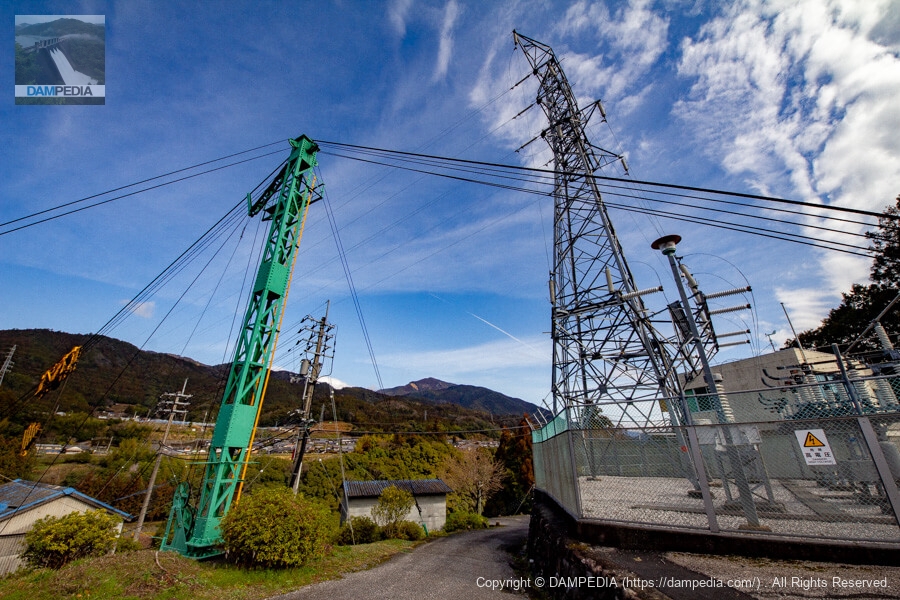
Near parking lot
A short distance from the entrance on the national road, you will see a parking lot, so park your car there and walk to the embankment. In the vicinity are substation facilities and cranes for carrying in materials and equipment.
View of the top edge from the left bank
After descending the stairs and ramps, the embankment comes into view, but only the top end is still visible.
Space for loading and unloading equipment and materials?
There is a crane on top. The dam and the power plant are built in a valley, so it will be a bit difficult to bring in and out equipment.
View of the embankment from the left bank
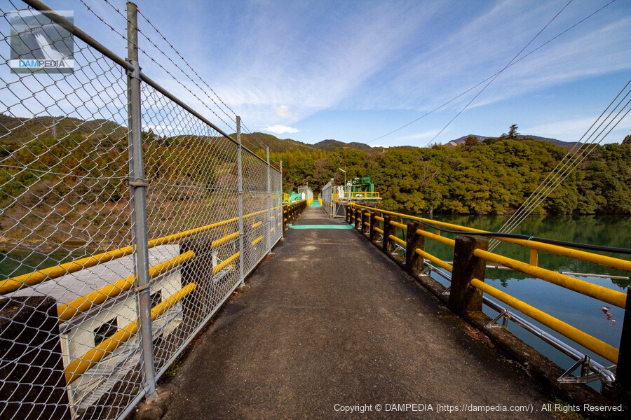
We are gradually approaching the embankment. The winding route is a bit frustrating, but it is a good thing because it allows us to take our time and look at the embankment.
View of the top edge from the left bank
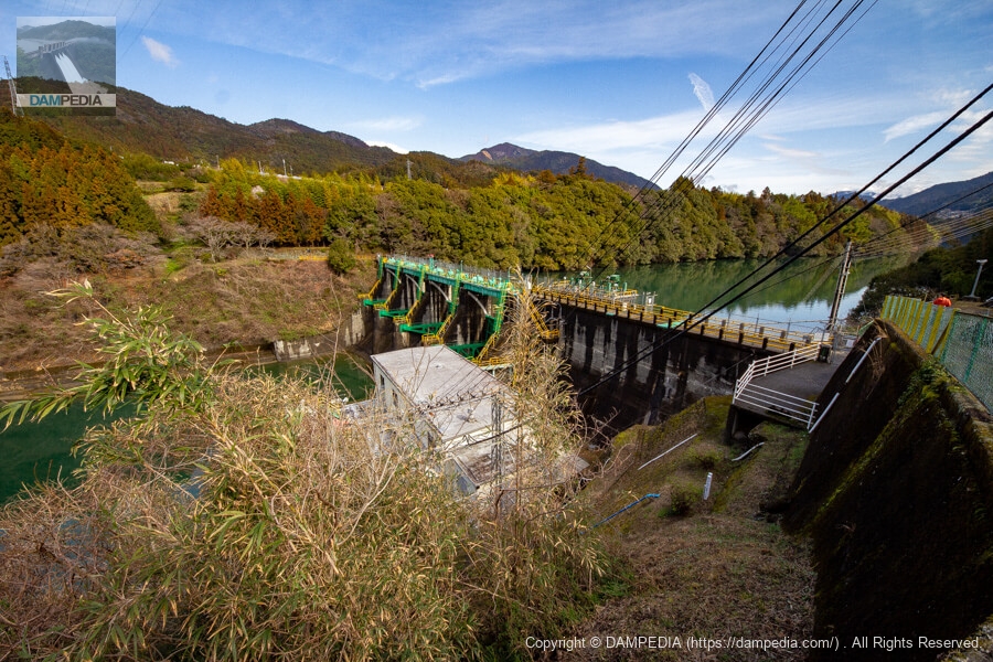
The dam is very colorful. The green base color with the yellow as a subtractive color is similar to that of the Sugita Dam, but since they are both prefectural dams located upstream and downstream from each other, the colors must have been matched.
Looking upstream from the left bank
I thought I would be able to see the downstream side of the river because of its height, but I was a little disappointed because of the power plant building and overgrown grass and trees. However, I was a little disappointed to see the power plant building and the overgrown vegetation.
Looking upstream from the left bank (top end level)
The part protruding from the dike in the foreground is the intake that sends water to the power station.

View of the top edge from the left bank
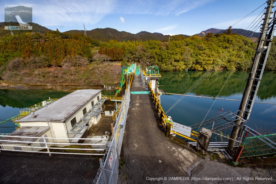
I understand that the reason the top of the dam is walkable even though it is a power generation dam is so that local people can use it as a bridge, but I am very grateful that we dam enthusiasts, who are not locals, can also take advantage of it.
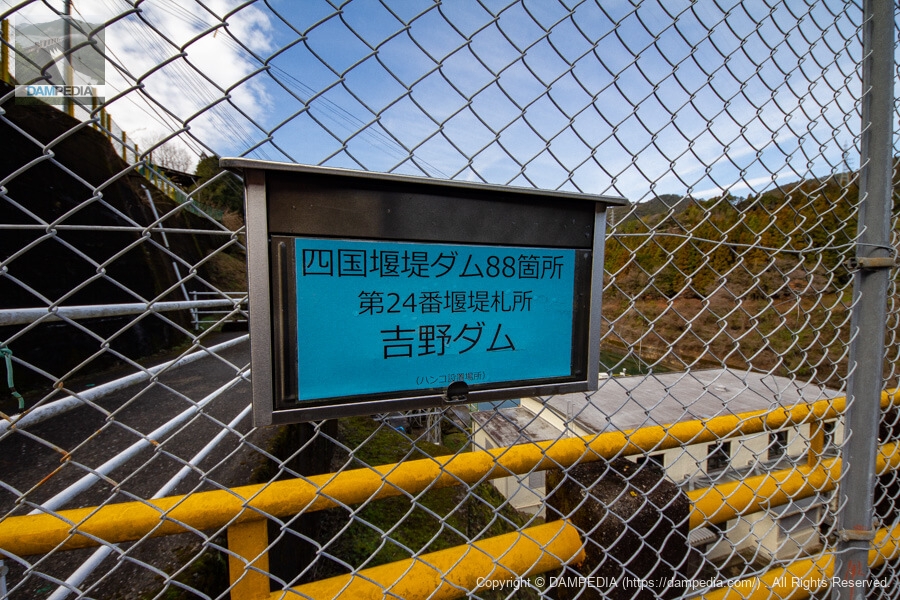
Stamp Location
Yoshino Dam is designated as the 24th of 88 weir dams in Shikoku.
nameplate on the main pillar
The words "Yoshino Dam" written in dark green. This green color seems closer to the color of the reservoir rather than the color used for the embankment.

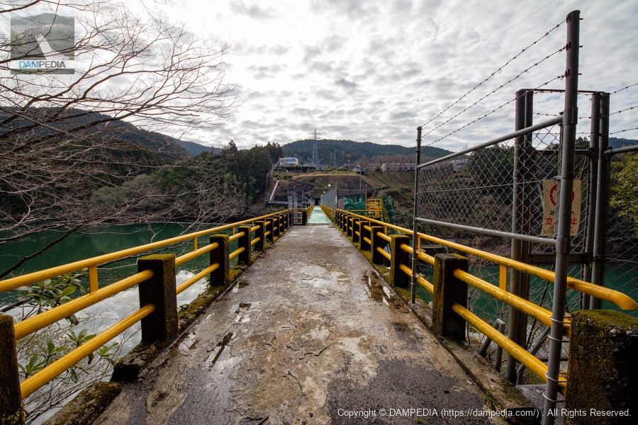
View of the top edge from the right bank
With the equipment on the left bank being so high, in my layman's opinion, it would have been nice to have a higher embankment height, but I wonder if the right bank side has a lower elevation than the left bank.
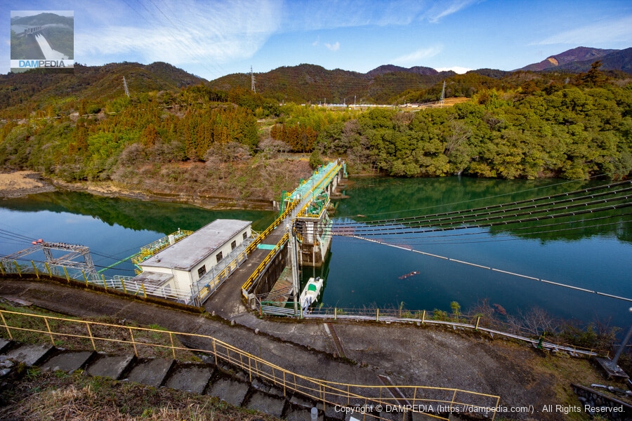
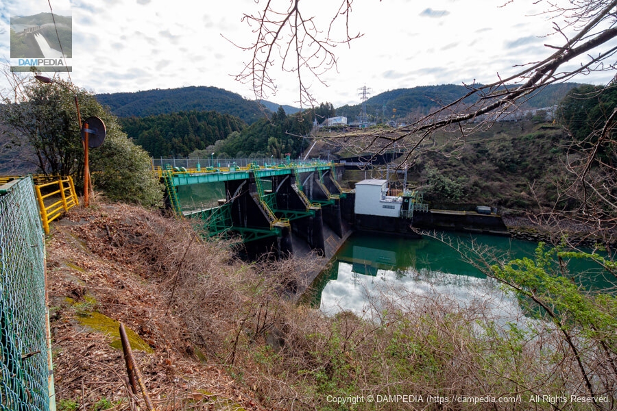
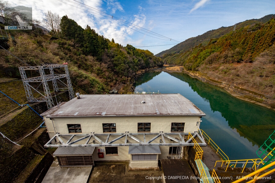
Looking downstream from the right bank
I would have liked to have a more luxurious view, but this was the best I could do. The white building on the left bank is a power plant that generates a maximum of 4,900 kW with a single Kaplan turbine. The building is small because it is not large. By the way, I did not notice at the time, but there is a curve mirror on the left side of the photo. It is facing the levee, so I guess it is for checking the status of the levee, gate, and discharge.
Crestgate nameplate
There was a nameplate of the manufacturing company around the windlass of the crest gate. Sakai Ironworks is an Osaka-based company, but it was probably chosen because its founder, Toryuzo Sakai, is from Kochi. The company, which began as a manufacturer and installer of hydraulic iron pipes, grew and became a listed company on the Second Section of the Osaka Securities Exchange, but was delisted in the mid-Heisei period and was subjected to the Civil Rehabilitation Law. Today, the company mainly manufactures and designs steel towers, but I hope that it will survive as one of the companies that support Japan's power supply development.

View of the crest gate through a gap in the top edge
The crest gate holds the water in place. Still, it is a bright green color. You might say it is the color of celeste. Sugita Dam is the same color, so we should say that the Monobe River's Bianchi (an Italian bicycle brand, called "celeste" because of the unique green color used for the frame of the car. The Bianchi brand of the Monobe River is the same color as the Sugita Dam, which is called "celeste" because of the unique green color used for the frames of its vehicles, or Monobe green.

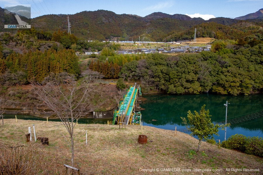
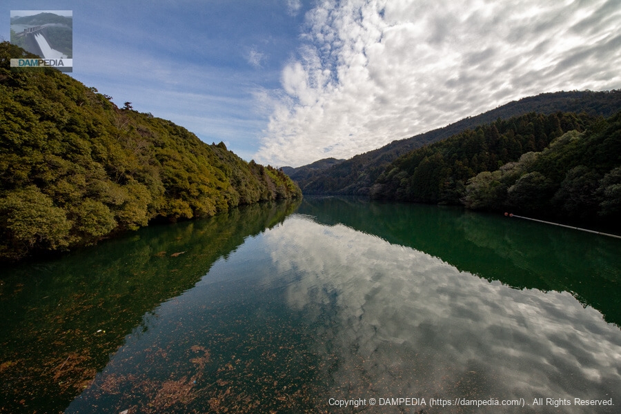
View of the dam lake from the top
The surface of the lake is calm. Nagase Dam is just ahead.
View of the power plant building from the top
If there is a building directly under the dam, I am a little worried that it may have some impact like the old control center of the Maruyama Dam (Gifu) or the Miseya Dam.
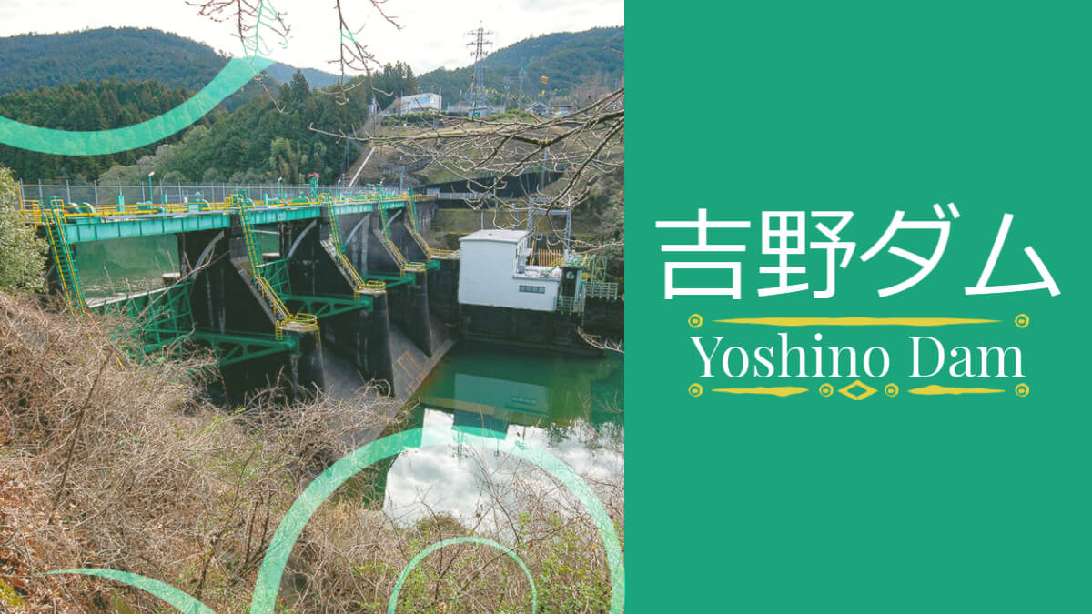
It was a small dam at a small power plant, but the coloring of the Yoshino Dam was very flashy.
Yoshino Dam Specifications
| Location | Yoshino, Kakita-cho, Kami City, Kochi Prefecture |
| River Name | Monobe River System Monobe River |
| Objective | P(Power generation) |
| Model | G(gravity-fed concrete dam) |
| Bank height | 26.9m |
| Bank length | 115.5m |
| Dam volume | 22,000 m3 |
| Watershed Area | 343.4 km2 |
| Reservoir area | 32 ha |
| Total storage capacity | 2,091,000 m3 |
| Effective water storage capacity | 474,000 m3 |
| Dam operator | Kouchi (Kochi) prefecture (Shikoku) |
| Main body constructor | set of staggered shelves |
| Year of launch | 1951 |
| Year Completed | 1953. |
| Name of Dam Lake | - |
Other facilities/observations
Fishing is prohibited between the upstream end of Yoshino Dam and the 355-degree line from the fishing area sign constructed at the mouth of the downstream oak valley.
| Parking lot | ○ |
| Toilet | × |
| Park | × |
| PR Exhibition Hall | × |
| Fishing | ○○ (excluding no-take zones) |
Map around Yoshino Dam
Weather around Yoshino Dam
Accommodations that may be close to Yoshino Dam

Comment