
Date of interview: Sunday, 3/2/2014
Following the Yoshino Dam, we went up the national highway along the Monobe River and came to the Nagase Dam.
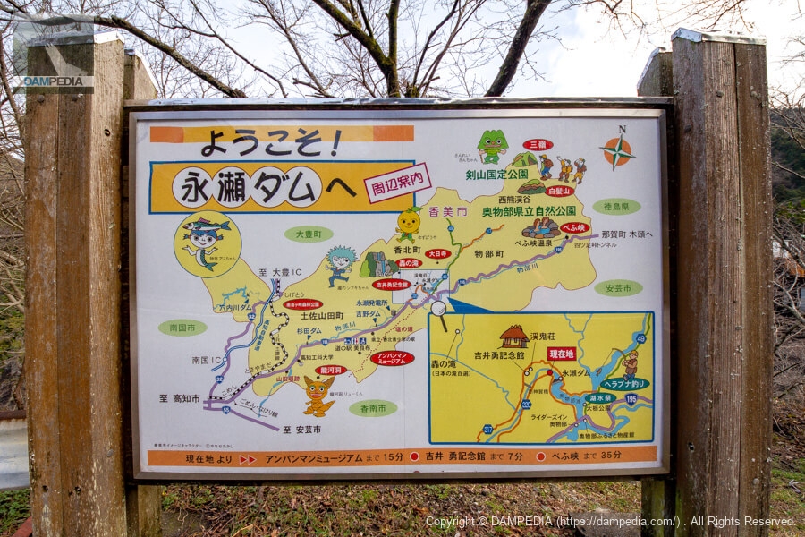
Sign standing on the right bank
The unique characters depicted on the signs that guide visitors to the area are the work of the late Yanase Takashi, a cartoonist and picture book author with local connections.
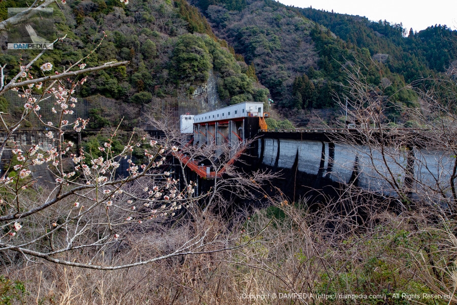
Looking downstream from the left bank
The Nagase Dam, like the Sugita and Yoshino dams, is operated by Kochi Prefecture, but the color orange is used instead of green or yellow, probably because the department that manages the dam is different from that of the Sugita and Yoshino dams. The difference is that the Sugita and Yoshino dams are managed by the Corporate Affairs Bureau, while the Nagase Dam is managed by the Public Works Department.
And the season was early March. Plum blossoms were still in bloom. (...hmm? Plum blossoms, right?)
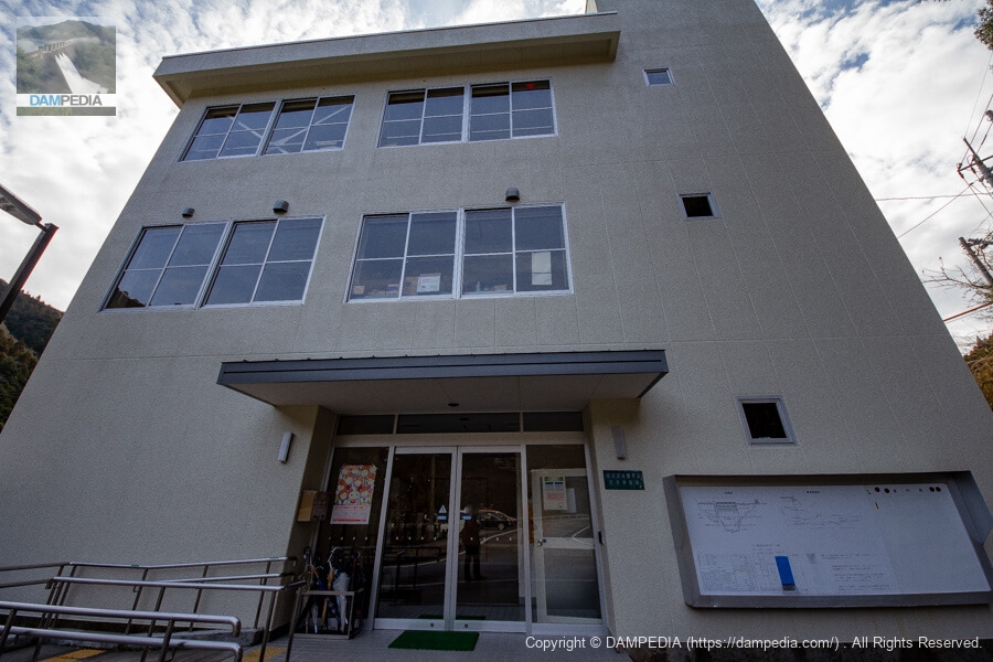
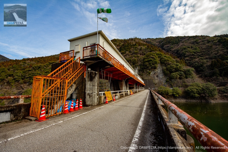
Nagase Dam Management Office, Kochi Prefecture
It is a relatively large three-story control center. By the way, I was touring with a fellow dam enthusiast, Mr. Kao3541, from Yoshino Dam, although we did not meet by chance.
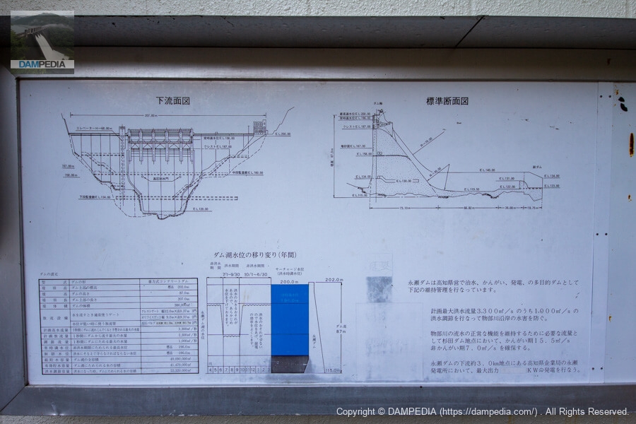
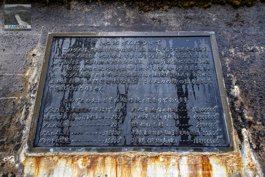
Explanatory sign by the administration office
An explanatory signboard is posted beside the control center, giving an overview of the Nagase Dam. Originally, the Monobe River was a raging river and the upper reaches of the river were a high rainfall area, but the rainfall was not always high, and the area was plagued by drought.
This led to the construction of the Nagase Dam to control floods and maintain the normal functioning of the river, as well as to generate electricity using the abundant water volume of the Monobe River. The downstream Sugita and Yoshino dams were constructed by the Kochi Prefectural Bureau of Public Enterprises for the sole purpose of power generation, but the Nagase Dam and other dams were developed as Kochi Prefecture's first comprehensive river development project under the National Land Development Law as a public works project funded by the national government.
The comprehensive river development project itself is led by the national government, but after the Nagase Dam is constructed, the management of the project is taken over by Kochi Prefecture.
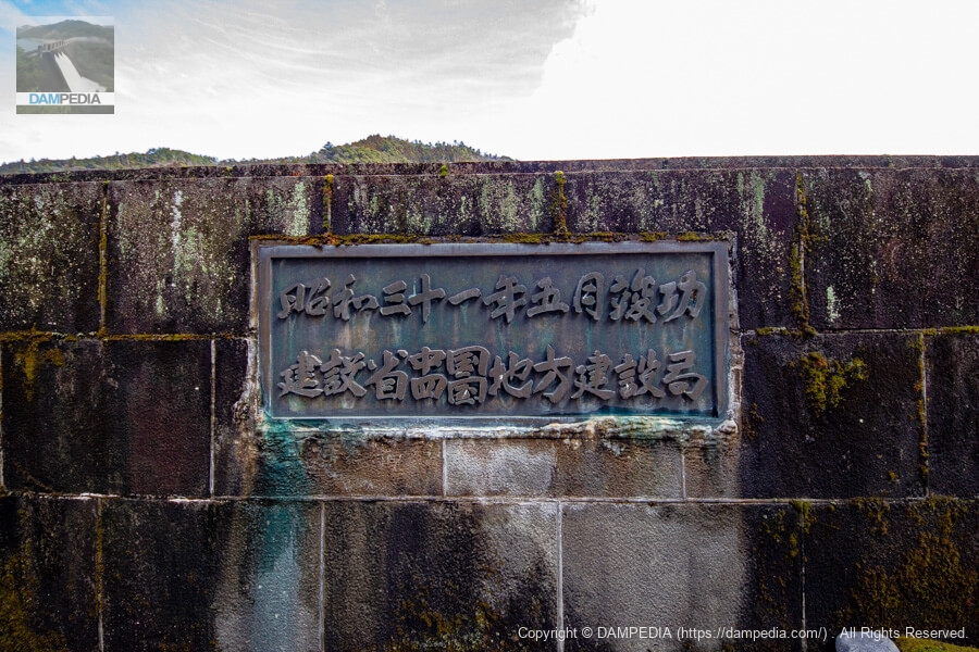
Nameplate on top edge railing
Therefore, the nameplate on the top rail of the embankment is the name of the Chugoku and Shikoku Regional Construction Bureau of the Ministry of Construction at that time.
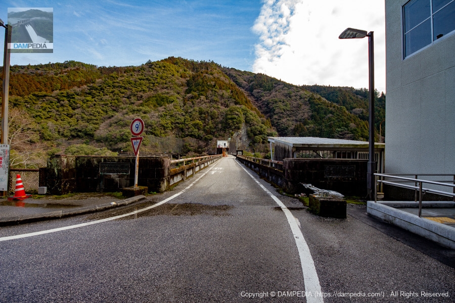
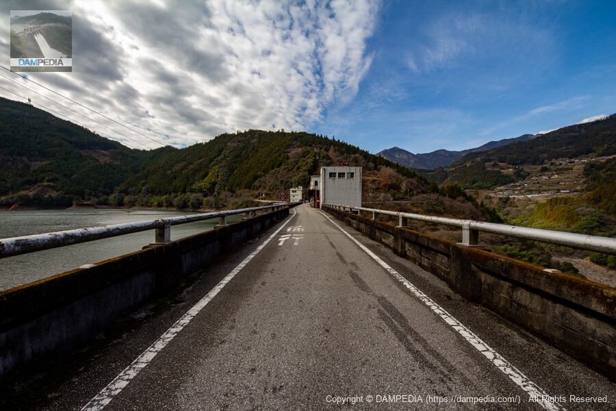
View of the top edge from the left bank
The top end is open to automobile traffic.
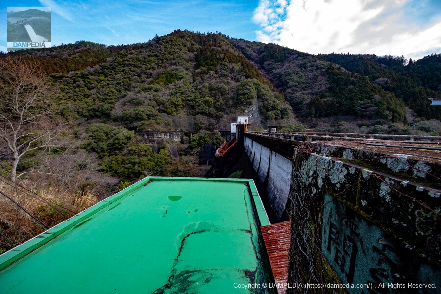
Looking downstream from the left bank
It was completed in 1956 and has a stately appearance similar to the Maruyama Dam in Gifu, which was completed in 1955. The "Construction Hazama-gumi" on the main pillar is also austere. It is a mystery to me that I did not take a picture of this nameplate while writing this. Incidentally, the Maruyama Dam was also constructed by Hazama.
What is the building below? It looks like a building leading to an audit corridor. The green roof is probably for waterproofing, but it reminds me of the Sugita Dam and Yoshino Dam.
Nameplate on the left bank
A nameplate is embedded in the slope on the left bank. The sentence is more important than any specification: "The 792 people who left their longtime homes or donated land to build this dam must never be forgotten for a long time.
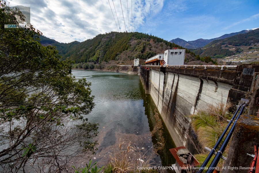
Looking upstream from the left bank
The levee is seen from behind the control center. The vertical embankment is white in color but has a stately appearance.

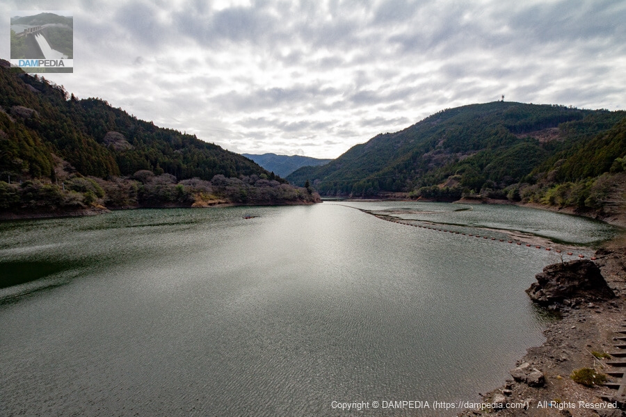
View of the dam lake from the left bank
The water level is a little low, probably because it is early spring.
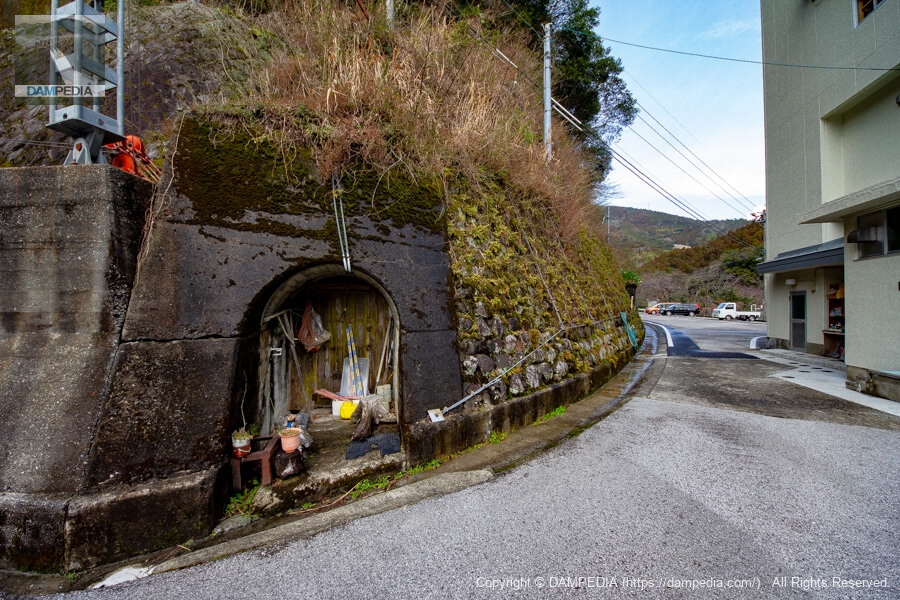
Rim tunnel?
Most rim tunnels are located straight from the top, but the Nagase Dam was in the wrong direction. Whether it was really a rim tunnel in the first place is a mystery...
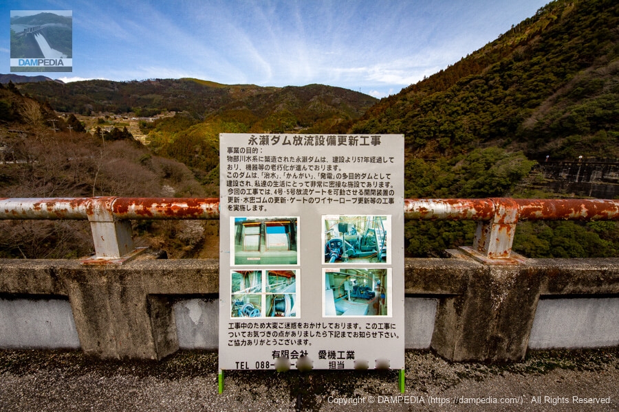
Nagase Dam discharge facility renewal work sign
It is a construction sign, but it was easy to understand what kind of construction work was being done. Aiki Kogyo is a company in Kochi that is responsible for the construction of sluice gates and pumping facilities.
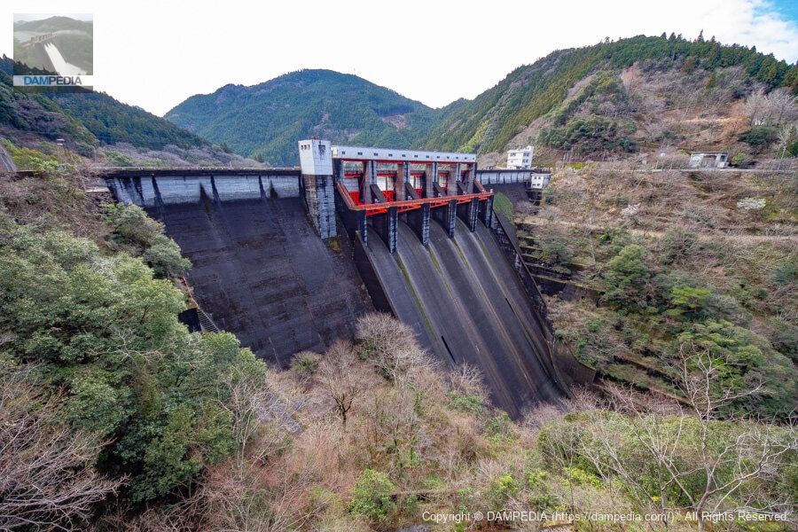
View of the gate pier and gate operation room from the top
It was a Sunday and the construction was closed. The gate pier and operation room are very large.
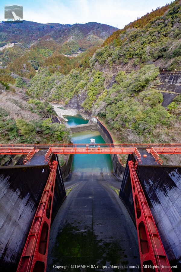
Looking downstream from the top through the crest gate
A control bridge is located downstream of the crest gate. The Maruyama Dam has a circular terrace, while the Nagase Dam is made up of straight lines. Even though they are similar dams of the same age, there is a slight difference between them.
I can't.
For some reason, I failed to capture this photo with my SLR camera at the time and uploaded it to Instagram. It is a signboard written in the local language that indicates "No Trespassing" in a very Kochi-like manner.
View of the top edge from the right bank
The cranked top edge is also typical of dams of this era.
Looking upstream from the right bank
The curve from the bottom to the top of the upstream face of the embankment is also nice.
Looking downstream from the right bank
It is a very well-proportioned dike. It is also wonderful that it has an austere appearance. Incidentally, there is a concrete structure in the downstream direction of the left bank, which is the foundation of a cement silo, a relic from the time of the Nagase Dam construction. There was a plant on top of the mountain, so the atmosphere at the time of construction and immediately after must have been quite different from that of today.
View of the downstream face of the embankment from further downstream on the right bank
I moved to a place where I could see the downstream face of the levee right in front of me. The well-balanced embankment is a sight to behold from any angle. There are five radial gates on the crest of Nagase Dam, and the three gates in the middle arecrest gate(12.0m wide by 9.37m high), with one gate of different widths on each side of the bank.orifice gate(9.0m wide by 9.37m high).
It seems unusual that a narrow gate with the same bed height as the crest gate has an orifice, but I guess such a combination is possible. In addition, there are two high-pressure valves for low water level discharge in the middle of the embankment, and for some reason the diameters are different: Φ1.0m on the right bank and Φ0.7m on the left bank. We would like to ask questions about this area on our next visit.
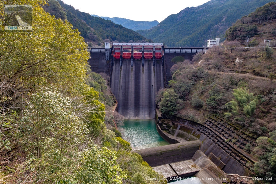
The Nagase Dam was completed in 1956 and has a long history, yet it has a wonderful, well-balanced embankment of smoked silver. The Nagase Dam also holds several mysteries.
Nagase Dam Specifications
| Location | Nagase, Kakita-cho, Kami City, Kochi Prefecture |
| River Name | Monobe River System Monobe River |
| Objective | F (flood control, agricultural disaster prevention) N (unspecified water, water for river maintenance) P(Power generation) |
| Model | G(gravity-fed concrete dam) |
| Bank height | 87m |
| Bank length | 207m |
| Dam volume | 380,000 m3 |
| Watershed Area | 295.2 km2 |
| Reservoir area | 208ha |
| Total storage capacity | 49,090,000 m3 |
| Effective water storage capacity | 41,470,000 m3 |
| Dam operator | Shikoku Regional Construction Bureau → Kochi Prefecture |
| Main body constructor | set of staggered shelves |
| Year of launch | 1949 |
| Year Completed | 1956 |
| Name of Dam Lake | Okumonobe Lake |
Other Equipment/Specifications
| Parking lot | ○ |
| Toilet | ○ |
| Park | × |
| PR Exhibition Hall | × |
| Fishing | ○ |
Map around Nagase Dam
Weather around Nagase Dam
Accommodations that may be close to Nagase Dam

Comment