
Date of interview: Sunday, March 24, 2013
After receiving our dam enthusiast helmets at Nanashiki Dam, we moved on to Ikehara Dam. This is also owned by Power Development and is an arch dam dedicated to power generation.
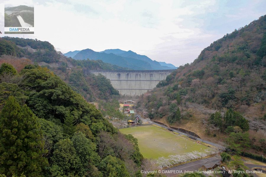
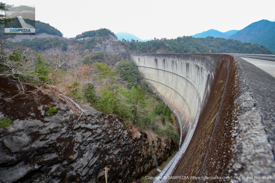
Downstream view of the levee from Route 169
Ikehara Dam does not have an overflow section on its embankment, and its flood discharge is located elsewhere.left bank (of a river)interpoint (interword separation)right bank (shore)The expressions "upstream" and "downstream" are a bit complicated. However, we will proceed as if there is a river here.
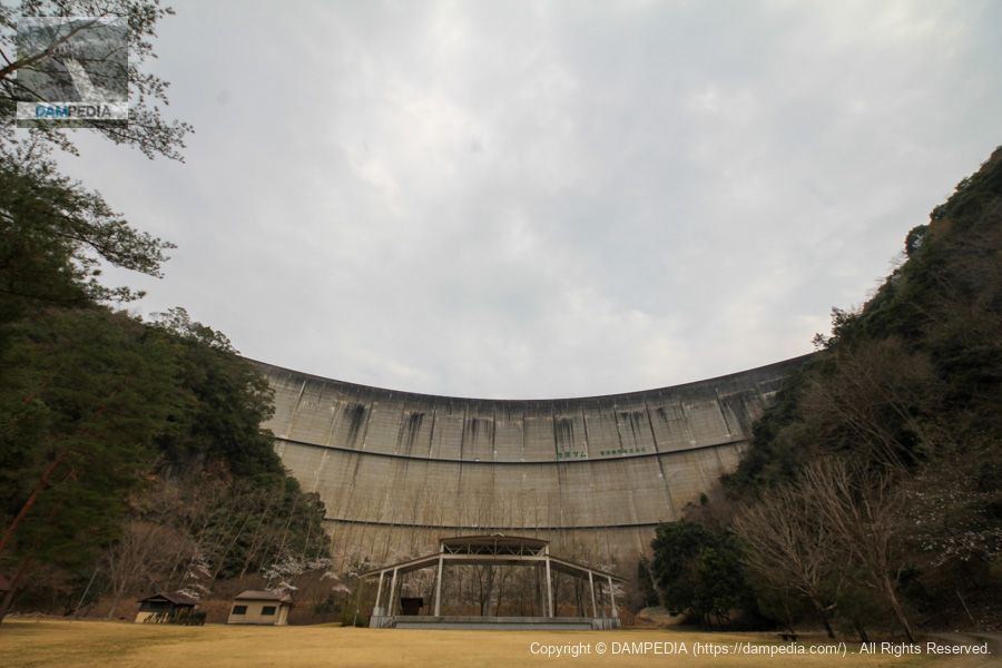
Directly below the embankment is the Kitayama Sports Park, which offers a campground, soccer and tennis courts, and other playgrounds.
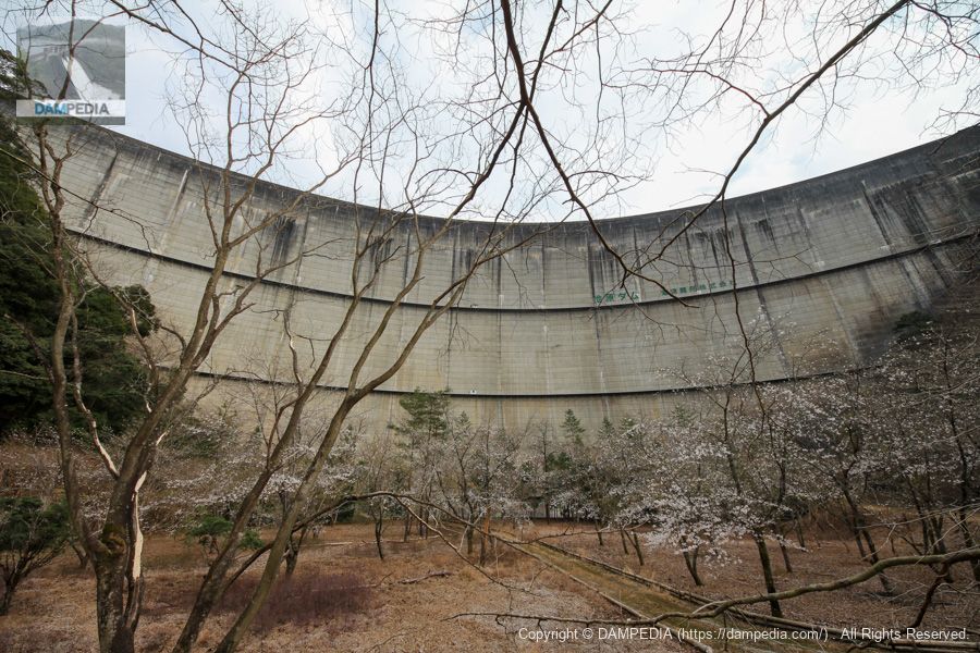
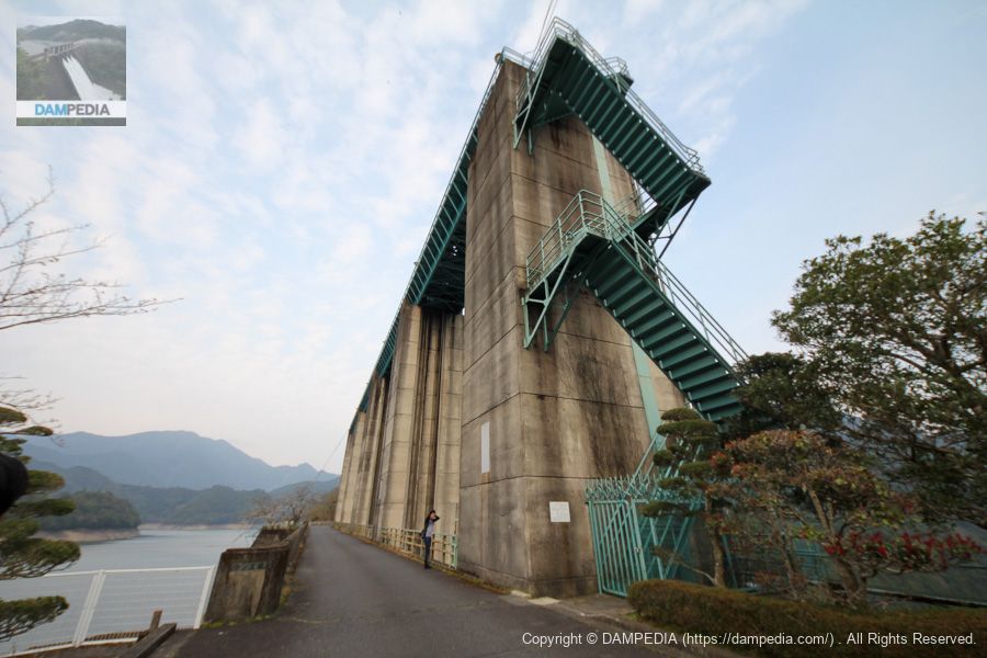
Downstream view of the levee from Kitayama Sports Park just below the levee
We have come to Kitayama Sports Park. You can "look up" at the non-overflow domed arch dam. There is also a stage, so I would like to do a live dam concert.
Let's get even closer to the levee.
Beyond the stage and approaching the embankment, there is an area where the earth is piled up like an earthwork, but it is unclear why it is done this way.
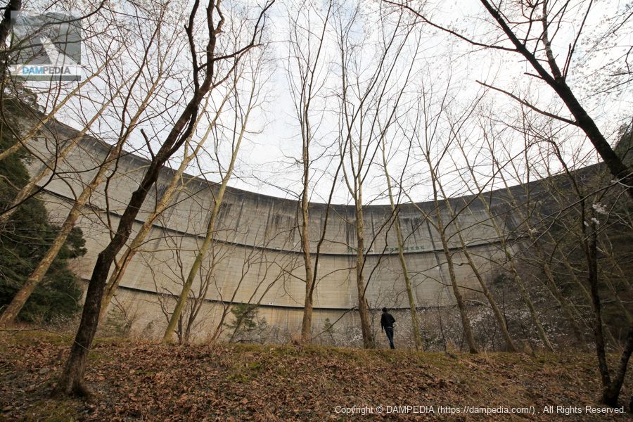
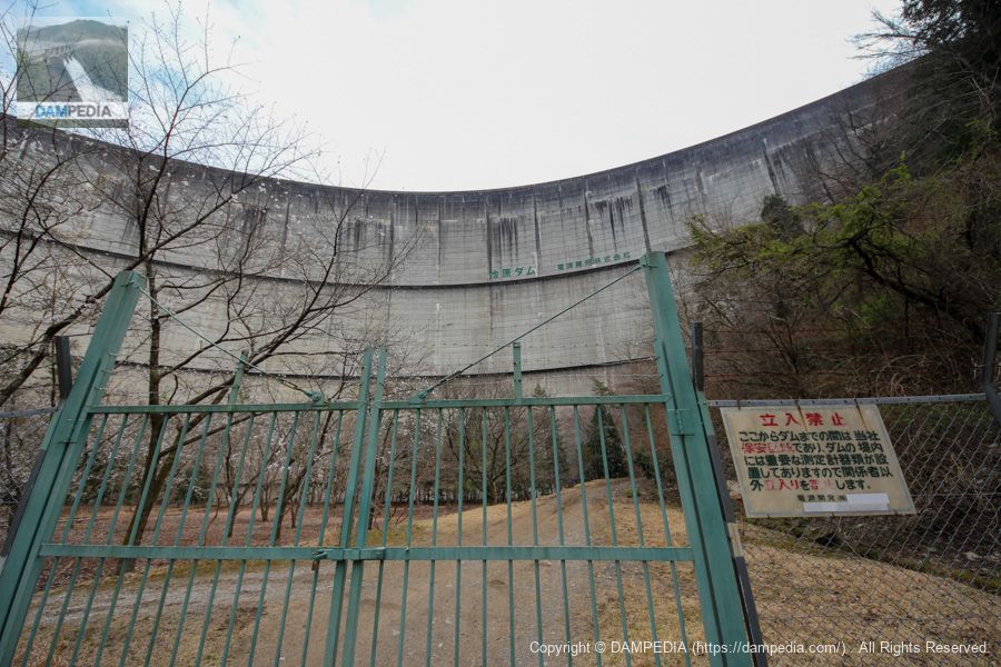
Fences and gates directly below
Unfortunately, once you cross that earthwork-like structure, you are blocked by a fence and cannot get any closer.
A view of the nadir
A cherry tree was planted directly below, with a few blossoms here and there.
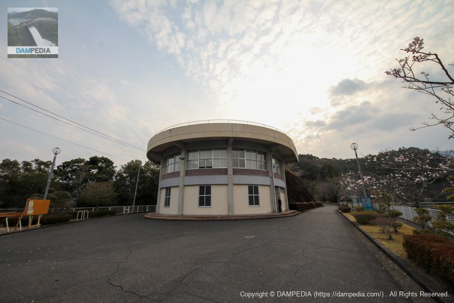
Management Office & Observation Deck & Restrooms
Although we have reached the top level, we will visit the water intake facilities and flood discharge area first, not the levee. This cylindrical building is a combination of an unmanned control center, observation deck, and restrooms. It looks like a water wheel, but what do you think?
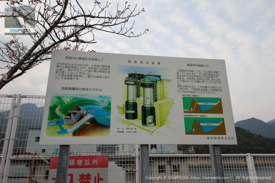
water intake facility
Water intake facilities for power generation. From left to right are No. 1, No. 2, No. 3, and No. 4. No. 3-4 are surface intake facilities for turbidity control during flooding.
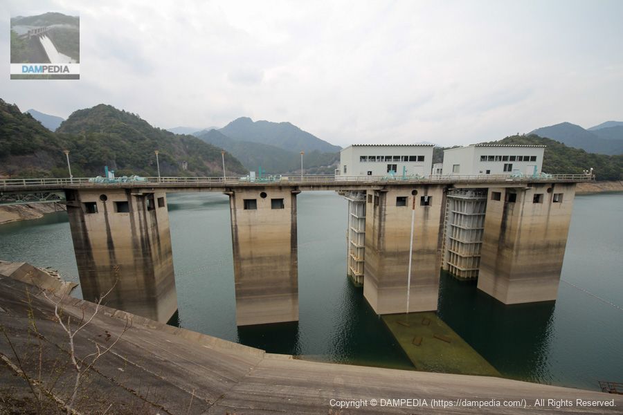
Signboard explaining surface water intake facilities
Here is a sign explaining the surface intake facilities.
View of the upstream face of the embankment from the observation platform
You can capture the upstream face from the observation platform. It is a little hazy, but you can see that the water is firmly dammed.

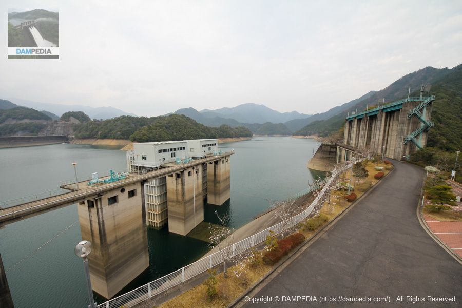
Water intake facilities and flood discharge
This is a view of the intake system and flood discharge from the observation platform. The upstream face of the levee is visible at the far left, so you can see the positional relationship between the two.
Viewing platform
Next to the building where the rooftop is an observation deck is a landslide, which can be reached by crossing a small bridge, which was also open to the public as an observation deck.

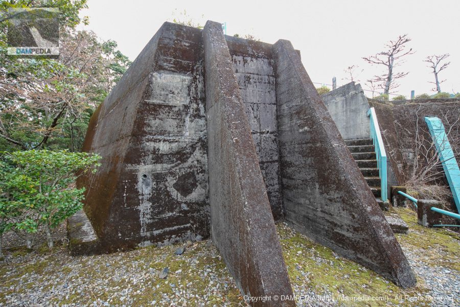
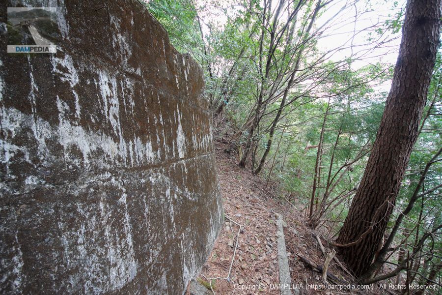
Mysterious Remains
These may be the remains of the construction. You can see them at the viewpoint of Jizan.
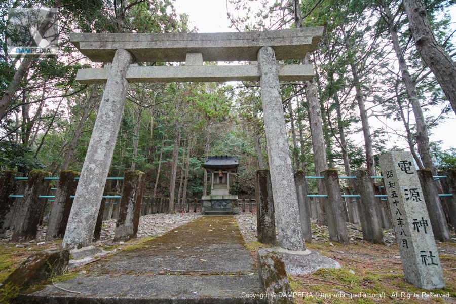
Cenotaph and stairs to the power supply shrine
Further in, you will see the cenotaph and the stairs to the power supply shrine.
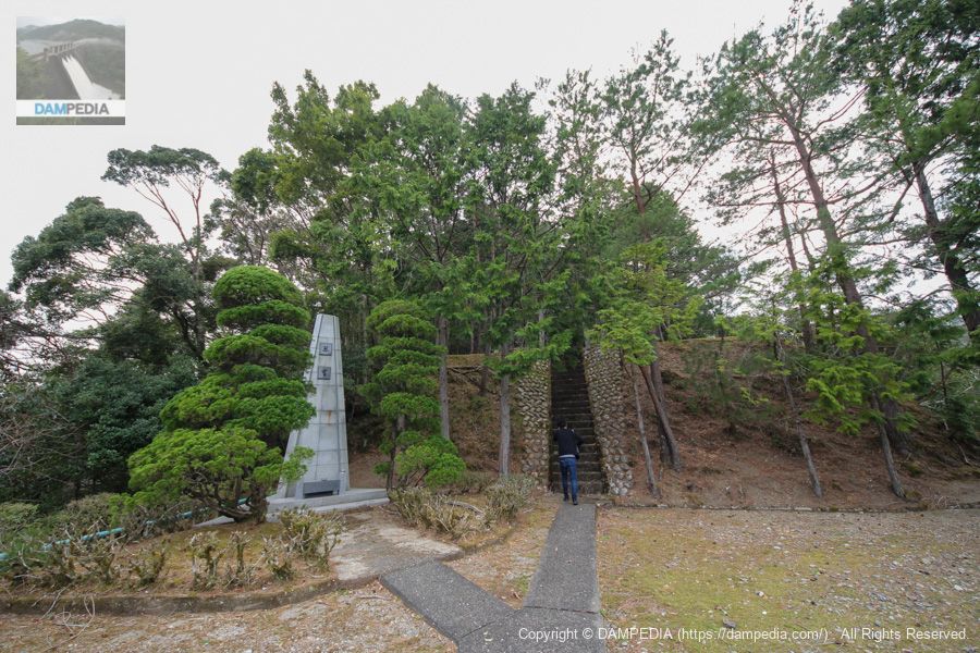
Ikehara Power Shrine
We will visit the Shrine of Power Supply. It is a small shrine, but the torii gate is made of stone and is extremely magnificent.
View of the upstream face of the embankment from near the power supply shrine
It is a high point to be able to see the levee from various places.
Mysterious Remains Part 2
The surrounding area is dotted with such remains. Were these also used during construction?
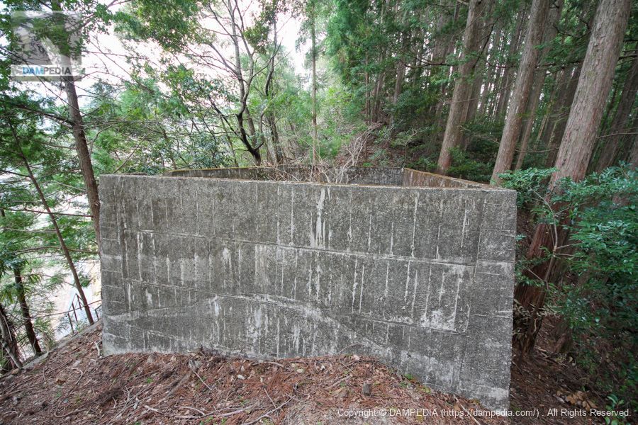
Mysterious Remains Part 3
I'm sure it would be different if I knew what the remains were, but I never get tired of looking at them.
Flood discharge gate pier
The roller gate of the Ikehara Dam is 15.0 m wide by 16.842 m high; to support such a huge structure, the gate piers are also huge.
View of roller gate and chute section and downstream
This is the roller gate. Since there are four such huge roller gates, the chute section is also huge. The force reducer is also a curious structure.
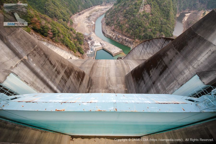
Looking downstream from the flood discharge
Still, it is an amazing sight. The power plant facilities can be seen below, although they are hidden by the flow-conducting wall. It is also amazing that the Kitayama River flows like a hairpin curve. However, it is a bit strange to see a hairpin of the river at the end of the flood discharge.
Normally, a dam is constructed along the flow of a river, so that the river begins again downstream from the damming. In the Ikehara Dam, however, the river crosses below the flood discharge.
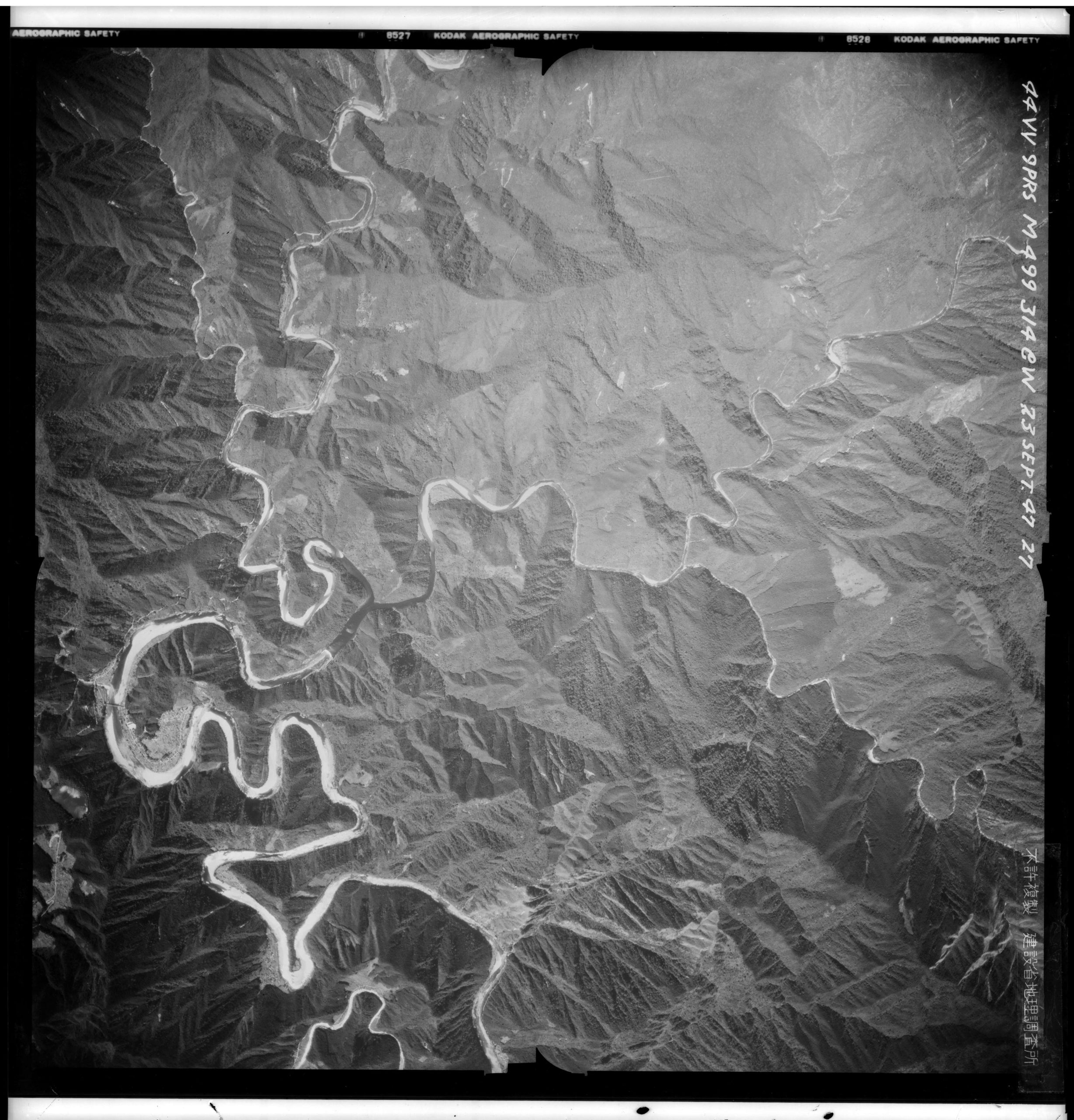
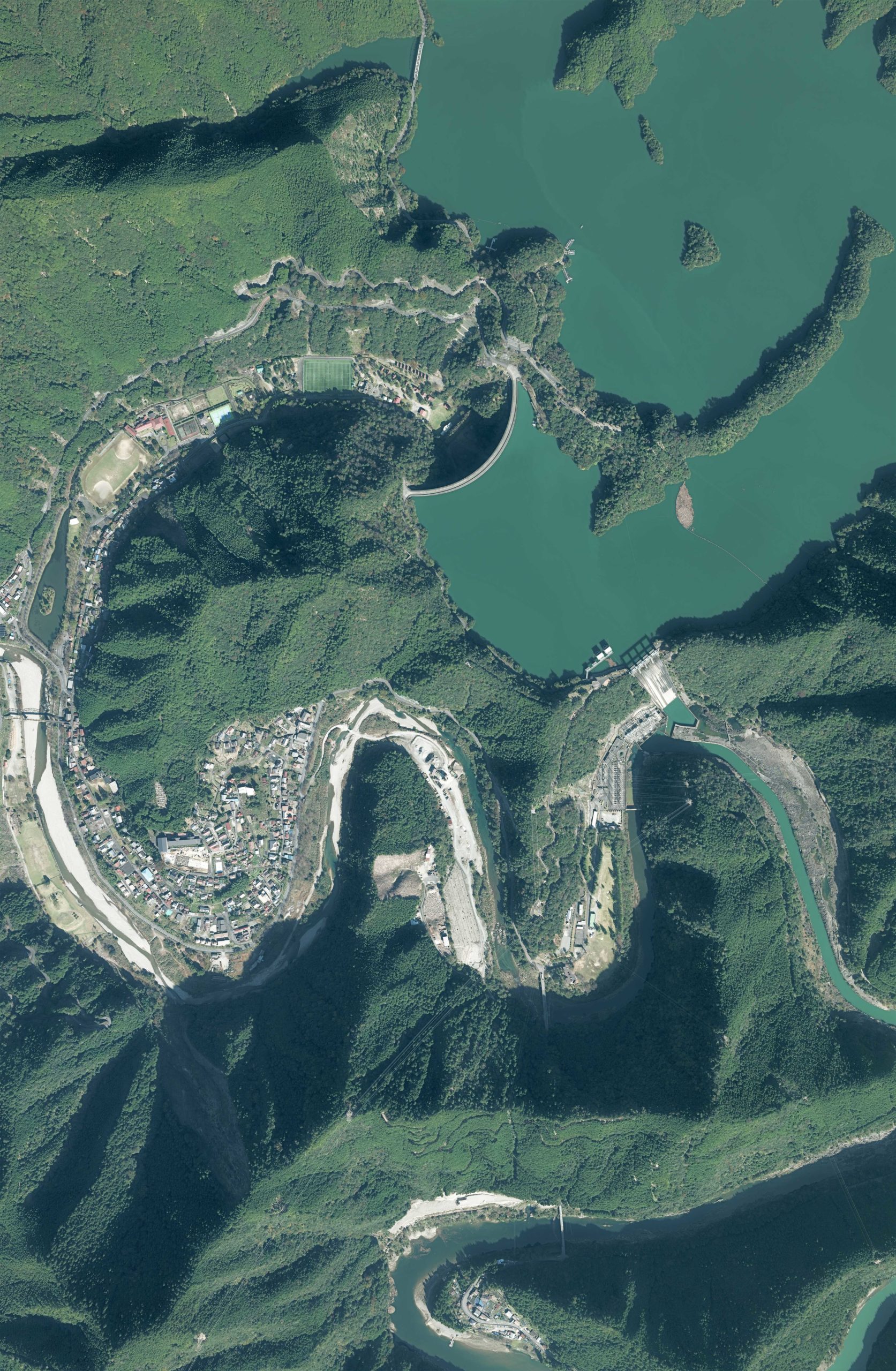
Pre-construction aerial view
I thought it was strange, so I obtained aerial photos taken by the U.S. military before construction (1947/9/23, 1947) from the GSI website.
Aerial view of the Ikehara Dam area after construction
And here is an aerial view of the Ikehara Dam area after construction. Just looking at it makes my nose bleed. (Taken on 11/05/2019, the first year of 2019)
Location of flood discharge vs.
I then zoomed in on the area around the dam in the pre-construction aerial photograph. I also plotted the location of the embankment and flood discharge in comparison with the current aerial photograph. To our surprise, we found that the area downstream of the levee where Shimokitayama Sports Park is located was originally the Kitayama River.
There is a large pond at the southern end of the park, which was a remnant of the Kitayama River. Moreover, you can see that the flood discharge was installed on the mountain ridge as a shortcut to the Kitayama River.
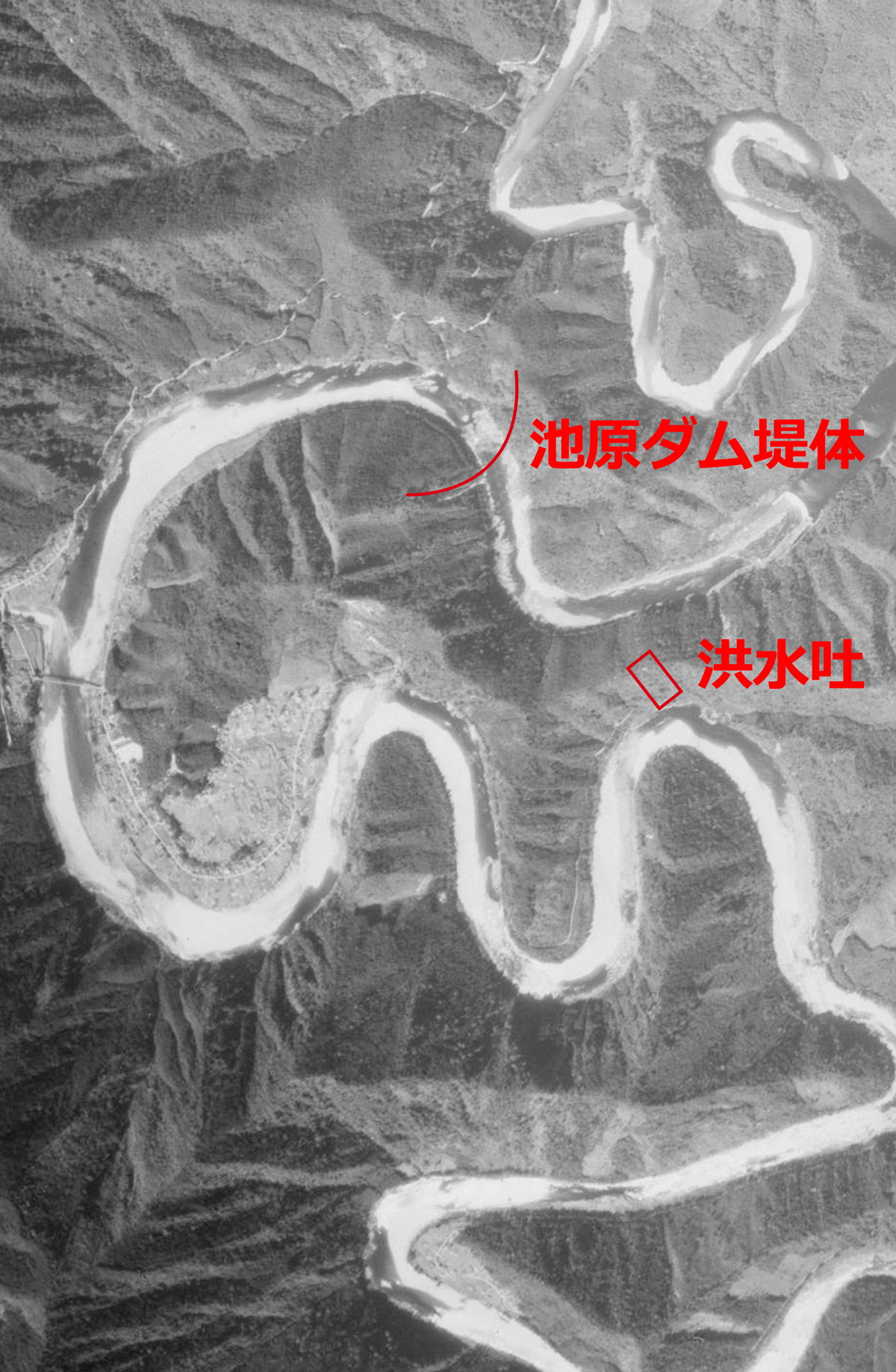
From the west (left side of the photo), the Ikego River originally joins the Kitayama River at the southern end of Shimokitayama Sports Park, but after construction, the Kitayama River from the confluence to the flood discharge area was changed to the Ikego River, and the Kitayama River downstream from the flood discharge was redefined as the original Kitayama River.
Now I understand why the river crosses under the flood discharge. Still, it's amazing...
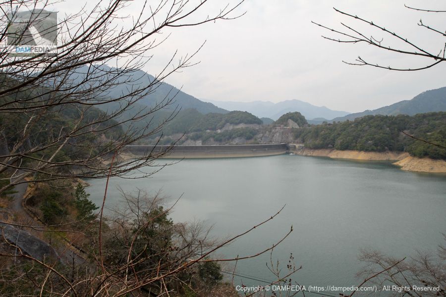
Downstream view of the levee from the left bank
We finally reached the dike.
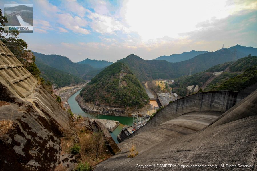
View of the dam lake, intake facilities, and flood discharge from the left bank
When I think about the fact that that flood discharge was originally a mountain, I am struck by the power of human beings.

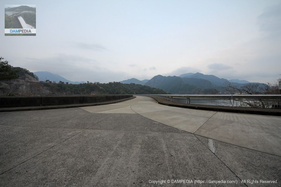
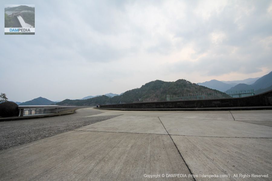
View of the top edge from the left bank
It is a very wide top end. It is open to automobile traffic and, like the Shichiro Dam, is a national road at the top end.
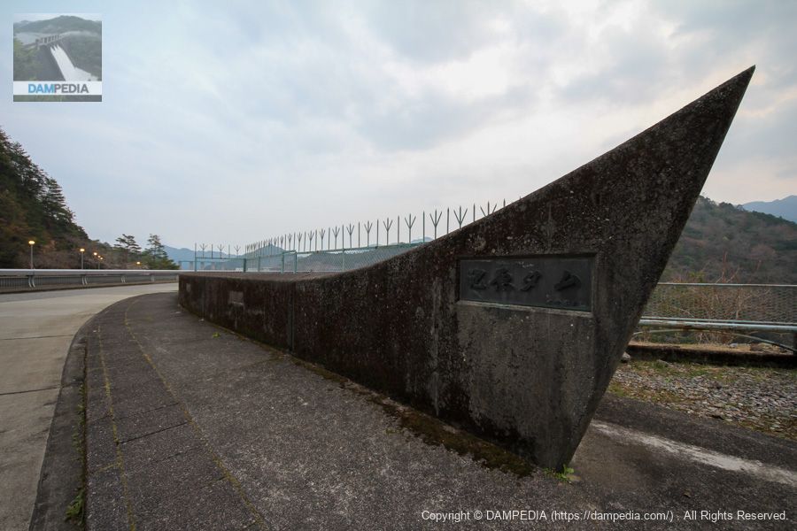
Nameplate of the 100 Dam Lakes
Ikehara Reservoir, the dam lake of Ikehara Dam, was recommended by Kamikitayama Village and Shimokitayama Village, and is recognized as one of the 100 best dam lakes by the Japan Water Environment Center. The nameplate has become dirty, but I need a cleaning tool for this kind of situation.

Ikehara Dam is also a mecca for bass fishing, as is Shichiro Dam, and it is said that large fish of 50 cm or more, called "lunker size," can be targeted.
View downstream from the center of the top edge
It is no longer a river, so the term "downstream" may be too subtle, but I guess it is the old lower reaches of the river. Still, it is quite wide from the fence to the levee, as seen from here.

Top railings downstream of the right bank
It is a high column with a tremendous sharp-edged design.
View of the top edge from the right bank
The right bank is also wide. Although it is deep in the mountains, tourists can be seen here and there, including anglers and families. You can also see a family in this photo.
View of the upstream face of the embankment from the right bank
The rounded embankment has an indescribable glamour.

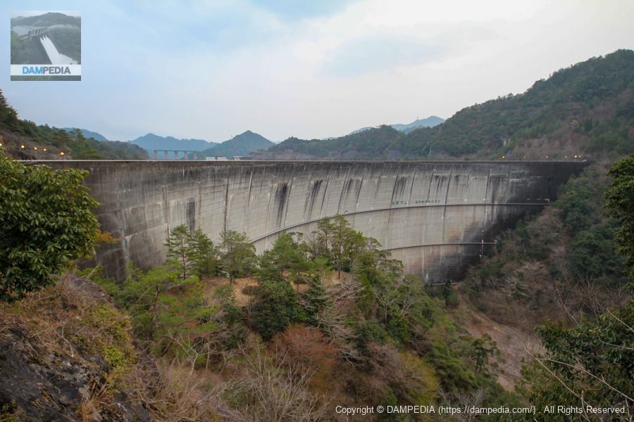
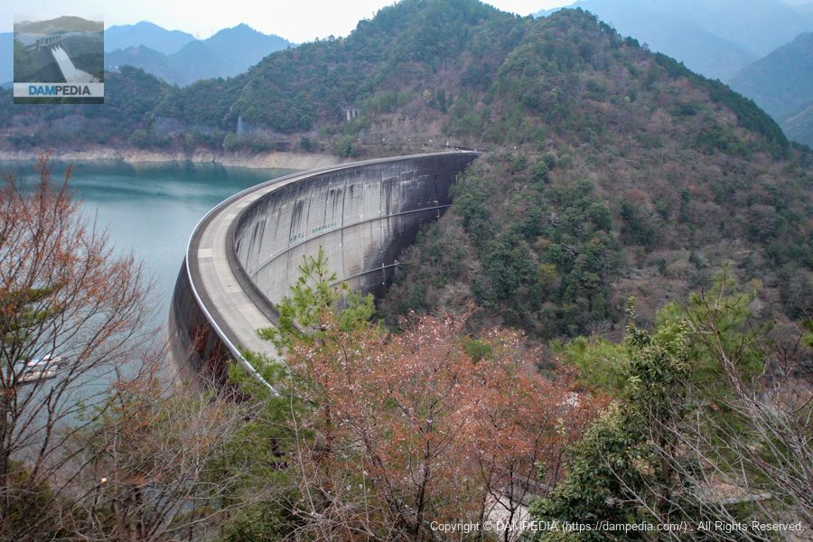
Downstream view of the levee from the right bank
After all, the best thing about a domed arch dam is that it looks like a bird spreading its wings. It is so cool that you don't want to leave.
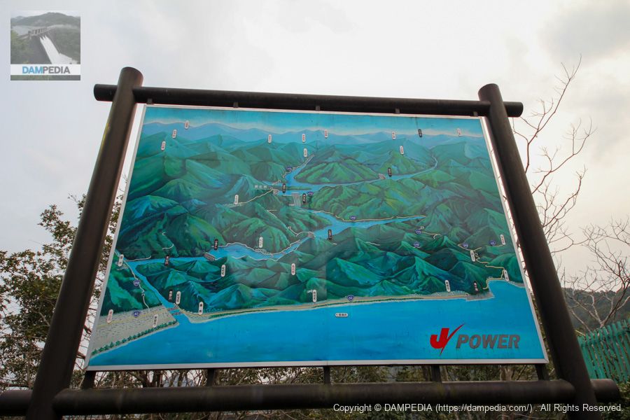
Bird's eye view of the location of the surrounding dams
A bird's-eye view showing the location of Sakamoto Dam (Nara), Ikehara Dam, Nanashiki Dam, and Komori Dam (Mie) was installed at the dam site. However, we were unable to visit the Sakamoto Dam this time because Route 425 is closed to traffic and we did not have enough time to visit the Komori Dam. We hope to visit again someday.
View of the levee from the right bank observatory
On the ridge on the right bank, there are cottages in Shimokitayama Sports Park, and on the way to the park, there is a place where the embankment can be seen.
Ikehara Dam is a dam with a lot to see, with its embankment and flood discharge visible from various locations. It is a mecca for bass fishing, a famous cherry blossom viewing spot, a hot spring, and a campground, making it a dam where you can play all day long.
Ikehara Dam Specifications
| Location | Kamiike, Shimokitayama-mura, Yoshino-gun, Nara-ken |
| River Name | Shingu River system Kitayama River |
| Objective | P(Power generation) |
| Model | A(arch dam) |
| Bank height | 111m |
| Bank length | 460m |
| Dam volume | 647,000m3 |
| Watershed Area | 300 km2 (direct: 277 km2, indirect: 23 km2) |
| Reservoir area | 843ha |
| Total storage capacity | 338,373,000m3 |
| Effective water storage capacity | 220,083,000m3 |
| Dam operator | Power Development Co. |
| Main body constructor | Kumagai Gumi |
| Year of launch | 1962 |
| Year Completed | 1964 |
| Name of Dam Lake | Ikehara Lake(in Japanese history)Ikehara Reservoir) |
Other facilities/observations
| Parking lot | ○ |
| Toilet | ○ |
| Park | ○ |
| PR Exhibition Hall | × |
| Fishing | ○○ (excluding no-take zones) |
Map around Ikehara Dam
Weather around Ikehara Dam
Accommodations that may be close to Ikehara Dam

Comment