
Date of interview: Sunday, March 24, 2013
Next to the Okuri Dam, we visited the Nanashiki Dam for our mission to pick up the dam enthusiast helmets that had been completed to the Nanashiki Dam. The Shichishiki Dam is a power generation-only dam owned by J-Power Development, and also serves as a downstream adjustment reservoir for water from the Ikehara Power Station upstream.
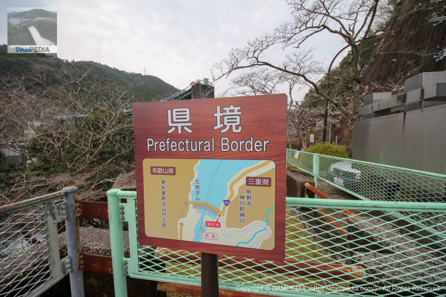
The left bank of the dam is located in Kumano City, Mie Prefecture, and the right bank in Kitayama Village, Higashimuro-gun, Wakayama Prefecture, on the border between the two prefectures.
Kitayama Village is also famous for being the only village in Wakayama Prefecture as of 2020 and the only municipality in Japan with an enclave surrounded by Nara and Mie prefectures on all sides.
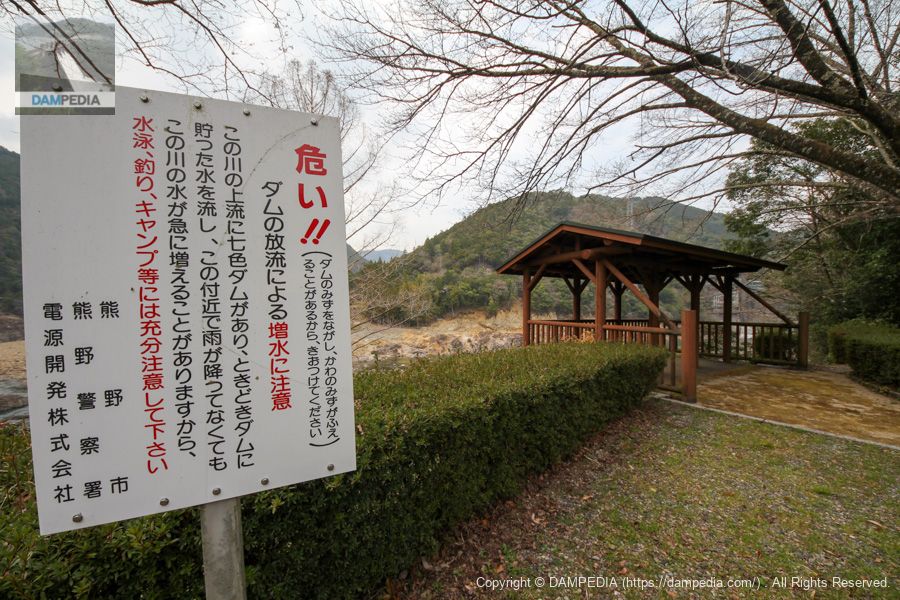
Observation deck and mini discharge warning sign
Arriving at the Nanashiki Dam, we safely receive our helmets and tour the embankment. The Nanashiki Dam has two such observation decks on the downstream side. The sign warning of the discharge is quite compact.
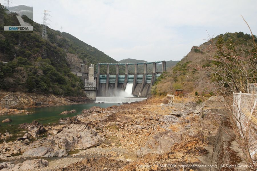
Downstream view of the levee from the observation platform
The water was just being released from Gate No. 4 in the center. It is unclear whether this was by accident or on purpose, but there are seven gates at Nanashiki Dam.
You will see a pavilion on the right toward the levee, and that is the other observation deck.
Around the observatory
However, the area around the observatory was in serious disrepair due to a broken seawall. This must have been caused by the 2011 Kii Peninsula flood.

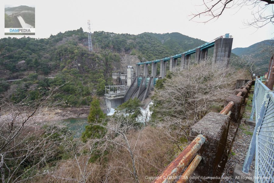
Downstream view of the levee from the top end level of the left bank
The left bank at the top end level is well maintained, with a sign explaining the Nanashiki Dam, benches, and some space for a parking lot. It is just a little regrettable that the grass and trees hide a part of the embankment.
border sign
This sign indicates that the Kitayama River flows along the border between Mie and Wakayama prefectures and that the Nanashiki Dam is located on the border between the two prefectures. The top end is on National Route 169, but the "gravity arch dam+Isn't "+ prefectural border + skyline national highway" the strongest?
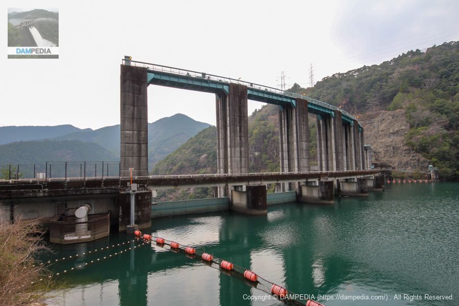
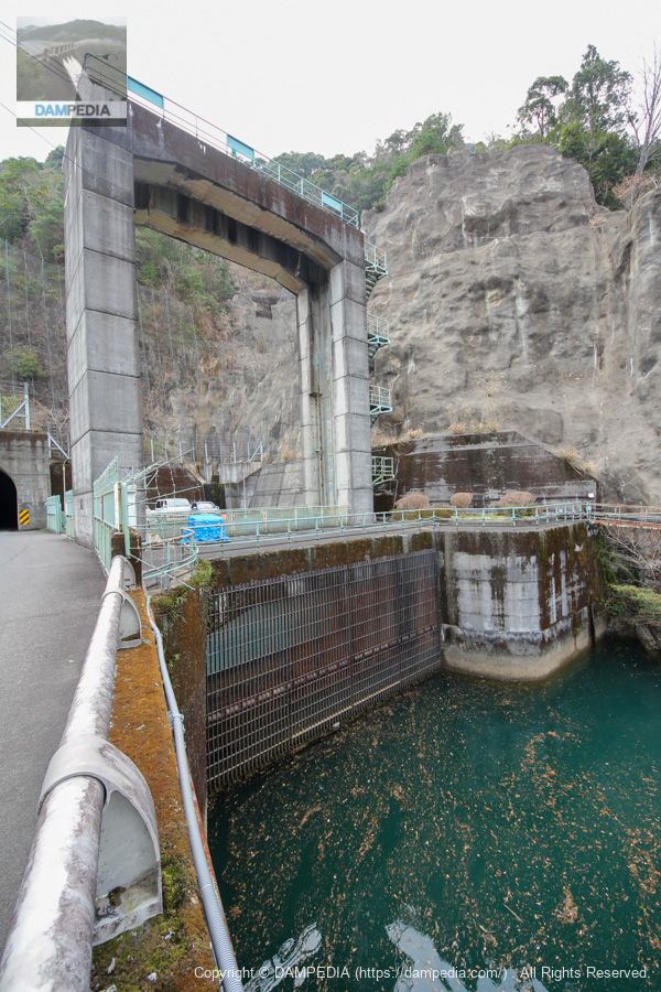
View of Gate Pier from the left bank
It is a little disappointing that the entire embankment cannot be seen, but the imposing gatepiers of the gravity arch can still be seen. The design of the gravity arch is different from that of a dam like the Eagle Dam, which is also a gravity arch.

View of the top edge from the left bank
A massive top-end national road.

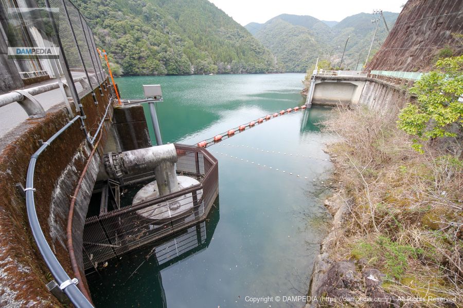
View of the upstream face of the embankment from the left bank
You can see that most of the gate is submerged in water. The silver structure attached to the embankment on the left bank is a water intake facility for river maintenance. The water is taken in by a siphon system and used to generate electricity, and is discharged between 0.23 and 2.0 m3/s.
Water intake facilities for river maintenance
This is the water intake facility. You can see that it is neatly surrounded by a netting area.
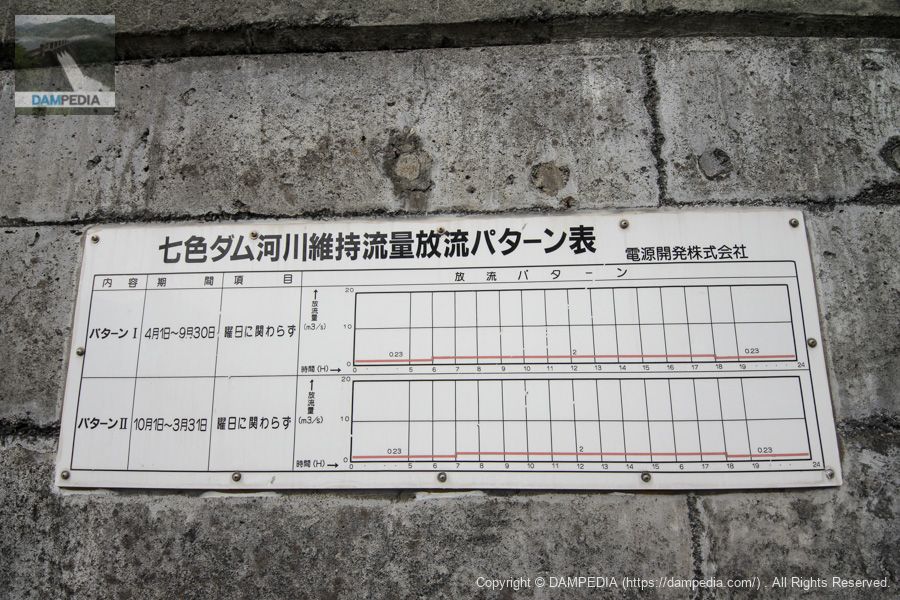
Shichishiki Dam River Maintenance Flow Discharge Pattern Table
What was interesting was this chart. Although the amount of discharge only deviates by one hour depending on the time of the year, the fact that the chart is so ritually presented gives us a glimpse of the seriousness of the corporate structure of the power supply development company.
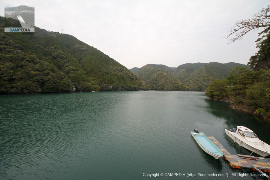
View of the dam lake from the top
The Shichiro Dam is also known as a mecca for fishing, and TOKIO's Nagase, who loves dams, said on TV that it was his favorite dam. (In his case, however, his love of fishing has grown...)
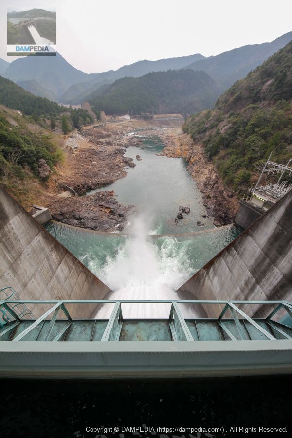
View downstream from the top
This is a view from Gate 3 where the water is discharged. There is a sub-dam that matches the embankment's arbor, and a wide abatement basin that is dammed by it.
Roller gate specifications are as follows
Model/Quantity: 7 roller gates (1 of which has a decanting board)
From the local nameplate
*The local nameplate copies "purgation" to "sanzui".
Net diameter x door height: 14.863m x 15.481m
Opening/closing speed: 0.3 m/min
Door weight: 101.7t
attachedpurging panel (of a firearm)
Model/Quantity: Spindle type decompression board 1 gate
Net diameter interval x door height: 6.0m x 1.5m
Date of production: April 1965
Production: Tahara Manufacturing Co.
The "breakwater board" is a flush board, a small board attached to the top of the gate to channel driftwood and other floating debris downstream. It is attached to the gate on the right bank. Unfortunately, I did not take a picture of that part of the gate because I completely missed this information at the time...
Also, Tahara Seisakusho was transferred to Toyokuni Kogyo in 2005, and unfortunately no longer exists as a company. However, I am sure that the mindset and spirit of the company have been inherited by Toyokuni Industries.
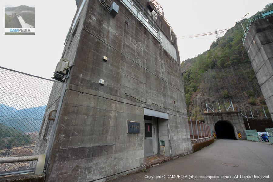
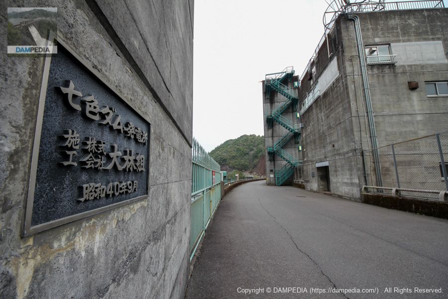
Shichishiki Power Plant Management Station
The power plant is located on the right bank side. The Nanashiki Power Plant started operation on July 28, 1965, with a maximum output of 82,000 KW, a maximum water consumption of 140 m3/s, and a maximum effective drop of 69.30 m.
View of water intake
This is a roller gate for a huge water intake.
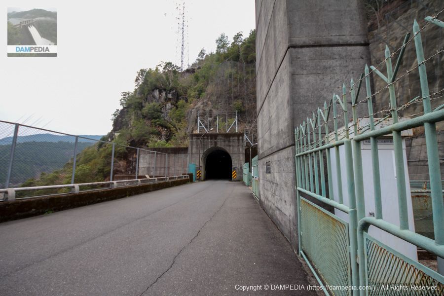
View from the top toward the right bank
The right bank leads directly to the tunnel.
View of the top edge from the right bank
It is a quality nameplate. This alone is very cool.
Maybe one day I will meet Mr. Nagase of TOKIO here. And like the flashboard, there are many things I missed, so I would like to visit the Nanashiki Dam again.
Extra discharge video
A video of the discharge from the Nanashiki Dam.
Shichishiki Dam Specifications
| Location | left bank (of a river)Aza Yokoyama, Kamigami, Kamikawa-cho, Kumano City, Mie Prefecture, Japan right bank (shore)Kitayama Village, Higashimuro-gun, Wakayama Prefecture |
| River Name | Shingu River system Kitayama River |
| Objective | P(Power generation) |
| Model | GA (gravity arch dam) |
| Bank height | 61m |
| Bank length | 200.8m |
| Dam volume | 157,000m3 |
| Watershed Area | 462km2 |
| Reservoir area | 332ha |
| Total storage capacity | 61,300,000m3 |
| Effective water storage capacity | 10,700,000m3 |
| Dam operator | Power Development Co. |
| Main body constructor | Obayashi Corporation |
| Year of launch | 1963. |
| Year Completed | 1965. |
| Name of Dam Lake | - |
Other facilities/observations
Parking is available here and there, so you should have no difficulty parking. Restrooms are located at the second observation deck and at the campground.
| Parking lot | ○ |
| Toilet | ○ |
| Park | ○ |
| PR Exhibition Hall | × |
| Fishing | ○○ (excluding no-take zones) |
Comment