
Location: Nishiyama, Ikeda-cho, Miyoshi City, Tokushima Prefecture
Date of interview: Wednesday, November 17, 2010
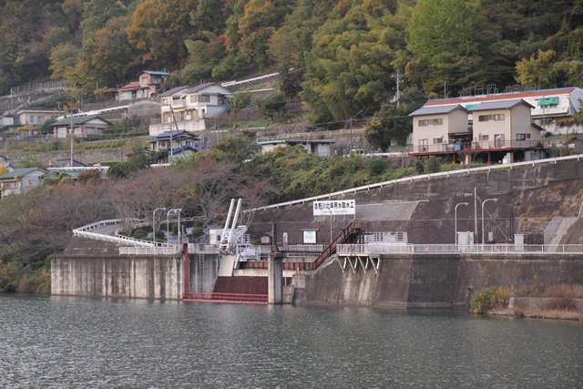
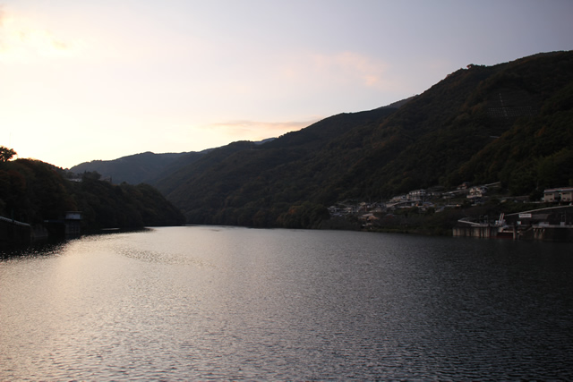
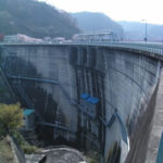
View of the levee from the downstream side of the left bank
The Ikeda Dam, along with the Hayamoura Dam and others, is the "cornerstone" dam for flood control and water utilization in Shikoku. Although the embankment is not very high, it is an all-purpose dam that provides not only irrigation, flood control, water supply, industrial water, and river maintenance, but also power generation.
Nevertheless, it was completely dark, and I had to forcefully correct some of the photos, including this one.
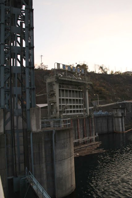
View of the power plant outlet from the downstream side of the left bank
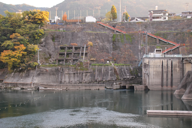
The square structure on the right is the outlet of the power plant. Can you see the water flowing out of it? To the right is a fish passage.
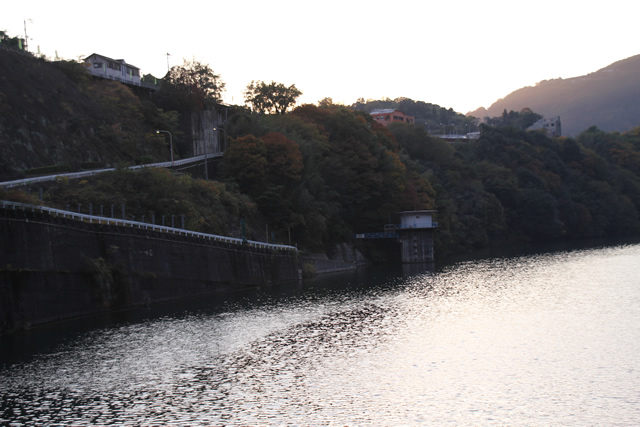
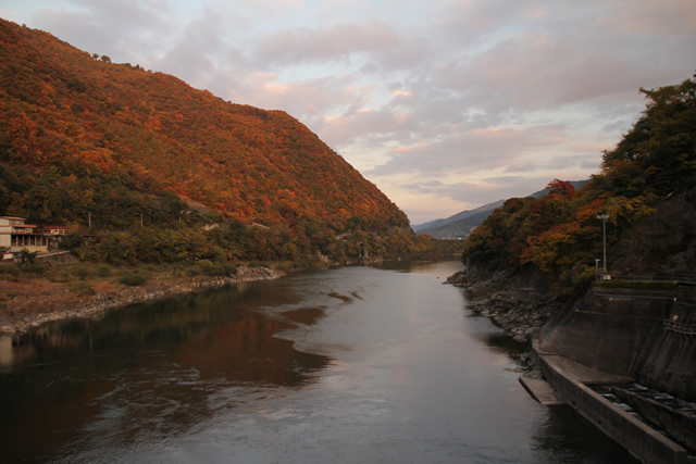
Looking downstream from the downstream side of the left bank
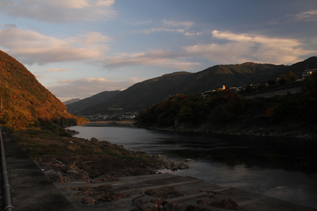
The setting sun was further illuminating the fiery autumn leaves in bright red.
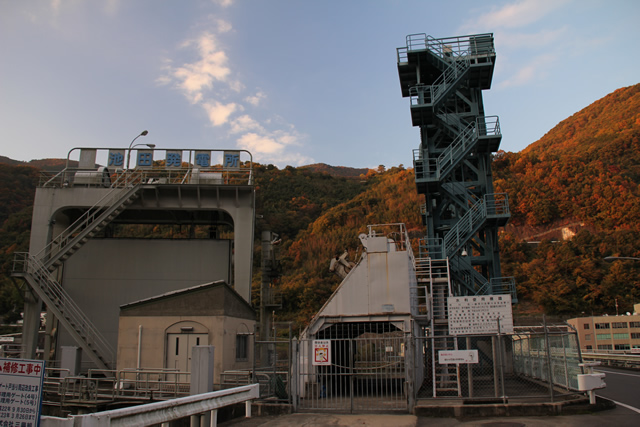
Ikeda General Administration Office, Japan Water Agency
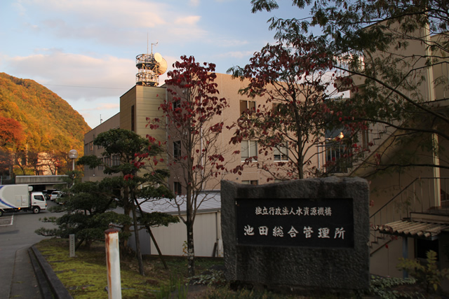
I went to the management office to get a dam card. Incidentally, the Yoshino River Dam Integrated Management Office of the Ministry of Land, Infrastructure, Transport and Tourism is also located in the same building, and you must go to the Water Resources Agency to get a dam card, but I went to the Ministry of Land, Infrastructure, Transport and Tourism by mistake at first (sweat).
Yoshino River Dam Integrated Management Office, Ministry of Land, Infrastructure, Transport and Tourism
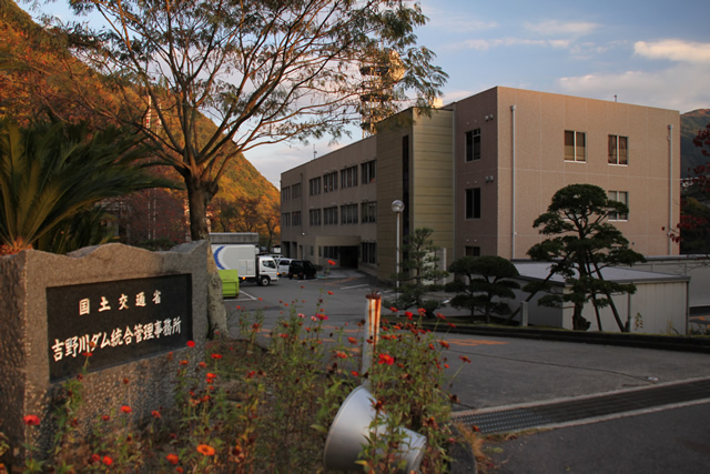
And here is the stone monument of the Yoshino River Dam Integrated Management Office of the Ministry of Land, Infrastructure, Transport and Tourism. The office itself is on the first floor of this building. Please note that you cannot get a dam card there.
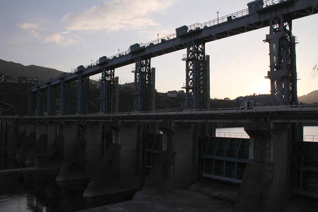
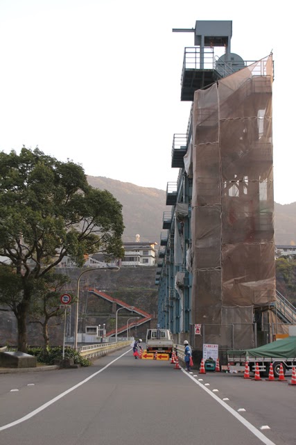
View of Gate Pier from the left bank
The photo was unfortunately very underexposed and very dark, so I corrected it to the best of my ability. On this day, there was construction work going on at the leftmost gate.
Stone monument of "Kaname

At the beginning of this article, I mentioned that this dam was the "keystone" of Shikoku's flood control and water utilization, and this stone monument is a testament to that. This stone monument shows that the people of Shikoku were in need of water to the extent that such a monument was installed. This is also a reminder of the necessity and importance of this dam.
View of the sky end and gate pier from the left bank
Together with the Hayamaura, Shingu, and Yanase dams, the Ikeda Dam is responsible for flood control in the lower reaches of the Yoshino River. In addition, the Ikeda Dam works in conjunction with the Hayamaura Dam to adjust low water flows, stabilize the intake of water for existing use, and maintain the river. In addition, it also takes in water for the north bank of the Yoshino River, which is supplied by combining a portion of the existing water supply in the middle and lower reaches of the Yoshino River and the water volume secured by the Hayamaura Dam. The Ikeda Power Plant also takes in water for the Kagawa River, which is supplied from the water volume secured by the Hayamaura Dam. The Ikeda Power Plant generates 5,000 kW of hydroelectric power.
......Just by reading this, you can understand how important this dam is.
Since this kind of dam is not found in the Tokai region, it was quite a new sensation for me. It does not look like a dam at a glance, you might say. But it is very important.
View of the left bank incline
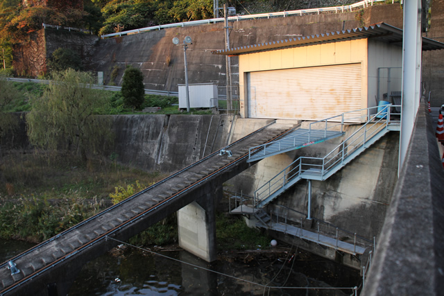
An incline was provided on the left bank. The embankment height is low for a multipurpose dam, so the scale is small.
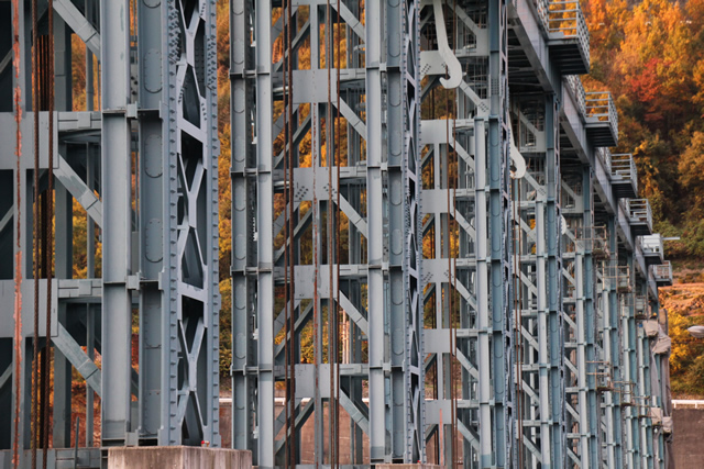
View of roller gate
Ikeda Dam is equipped with a total of nine roller gates: seven 15 m wide and 13.7 m high, and two 15 m wide and 8.7 m high.
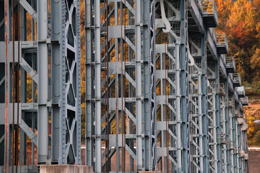
Looking up at Gates Pier
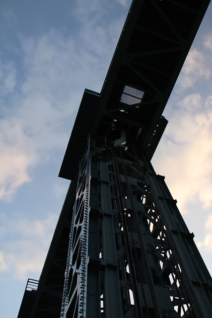
This gate pier is made of a steel frame so large that you can look up at it. The rivets also give the steel frame a nice taste.
Chugoku and Shikoku Agricultural Administration Bureau, Ministry of Agriculture, Forestry and Fisheries Water intake works for the north bank of the Yoshino River
This is a water intake work for the north bank of the Yoshino River by the Chugoku-Shikoku Agricultural Administration Bureau of the Ministry of Agriculture, Forestry and Fisheries.
View of the water intake tower
It is a little hard to tell what the intake tower is.
Ikeda Power Plant water intake
This is the water intake of Shikoku Electric Power Company's Ikeda Power Plant.
Training scene of Ikeda High School baseball team

As I was taking the picture, I heard the sound of footsteps. I heard the sound of footsteps. It was the baseball team of Ikeda High School, a prestigious high school baseball team, running. Ikeda High School is on the left side of the stairs. I took this photo in a hurry, so the picture is skewed, lol.
While running, each and every one of them greeted me with a proper "Hello! They greeted me with a "Hello!
Still, it looks like it would be hard to dash down those stairs... lol.
Training scene of Ikeda High School baseball team, Part 2
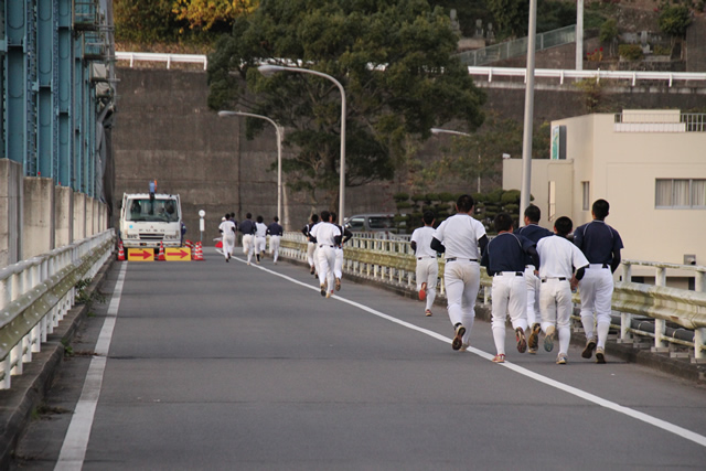
I wonder what they thought when they saw the person holding the camera on the dam's top edge lol.
I had no idea that the Ikeda Dam was part of the training program, and Ikeda High School's strength may be due to the Ikeda Dam.
View of Gate Pier from the top edge
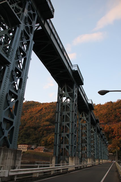
Now that the club members have run off and quietness has returned, I must say that the steel gate piers are a spectacular sight. When they become professional baseball players, I am sure they will be as stout as this steel gatepiers. I don't know what that means anymore.
Gate pier with cool steel frame assembly
It is not so much "cool" as "too cool. It is a work of art made of steel.
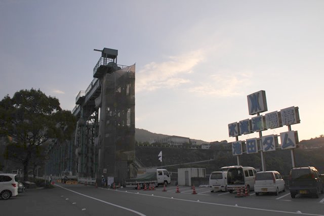
Dam stop south of Ikeda Dam

For dam stop handbookI snapped a photo to the
View of Gate Pier and Ikeda Power Plant intake from the right bank
From left to right: the Ikeda Power Plant intake, a dust remover (?) and gate pier. It looks like a dock of a space battleship.
The Ikeda Power Station uses Shikoku's largest tubular turbine, which can efficiently generate electricity by changing the angle of the turbine blades according to the amount of water. The tubular turbine is also known as a "horizontal-shaft cylindrical movable-blade propeller turbine.
View of the top edge from the right bank

The top of the top edge is open to automobile traffic. Not only is it a running route for the Ikeda High School baseball team, but it also seems to be a daily road for residents, and there was a good amount of traffic there.
Signboard for "Hometown Power Plant Tour
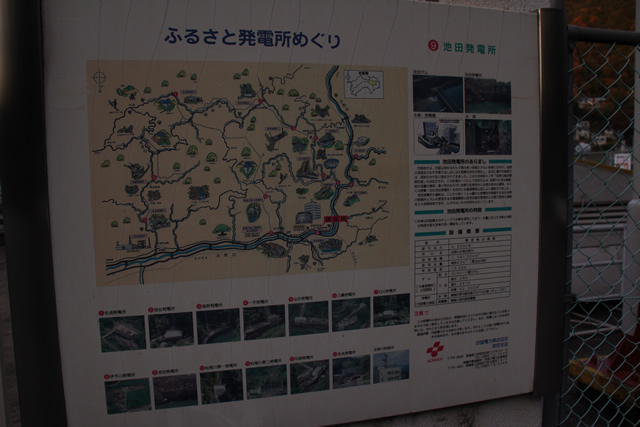
It is not clear if anyone other than enthusiasts are touring power plants, but it seems that Shikoku Power Generation is doing something quite chic.
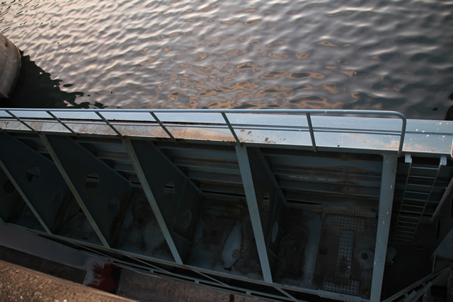
View of the fishway
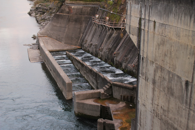
This is a stairway-type fish passage. Ayu (sweetfish), a specialty of the Yoshino River, is said to run upstream.
View of the dam lake
It is a precious water resource that is full of water.
Looking downstream
You can see the ripples caused by the water that has worked its way out of the power plant.
Dam stop north of Ikeda Dam
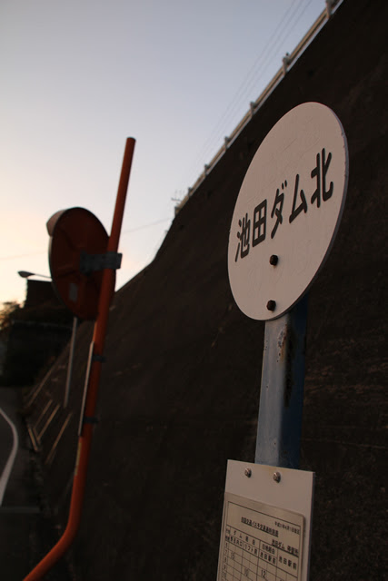
The dam stop I mentioned earlier was on the right bank, but there was also a dam stop on the left bank, lol.
Ikeda Dam Specifications
| River Name | Yoshino River System Yoshino River |
|---|---|
| Objective | Flood control, agricultural disaster prevention, unspecified water, river maintenance water, irrigation water, water supply water, industrial water, power generation |
| Model | gravity-fed concrete dam |
| Bank height | 24m |
| Bank length | 247m |
| Dam volume | 52,000m3 |
| Watershed Area | 1,904 km2 |
| Reservoir area | 144 ha |
| Total storage capacity | 12,650,000m3 |
| Effective water storage capacity | 4,400,000m3 |
| Dam operator | Shikoku Land Construction → Water Authority of Japan, 1st Engineering Dept. |
| Main body constructor | Kajima Construction |
| Year of launch | 1968. |
| Year Completed | 1974 |
| Name of Dam Lake | Ikeda Lake |
Other facilities/observations
| Parking lot | ○ | Especially since there is a parking lot for visitors on the left bank. You can park here and take a good look around. |
|---|---|---|
| Toilet | × | |
| Park | × | |
| PR Exhibition Hall | × | |
| Fishing | ○ |
Comment