
Date of interview: Wednesday, September 18, 2019
We would like to express our deepest sympathies to all those affected by Typhoon No. 19 in 2028 and their families. We sincerely hope for your safety and the earliest possible recovery of the afflicted areas.
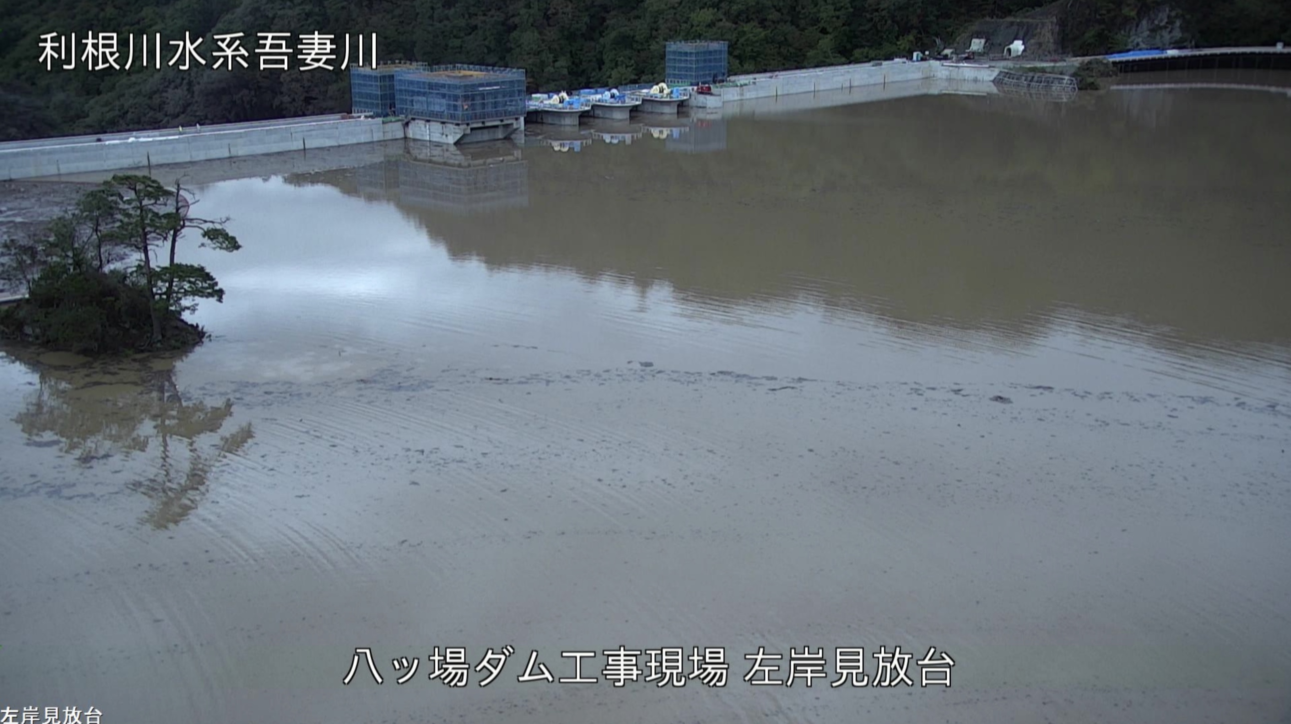
The Yamba Dam, which stored water during the test flooding due to the heavy rainfall caused by Typhoon No. 19, finally reached its highest normal storage level (normal level of water supplyThe water level has reached up to 1.5 m (1.2 ft.). Actually, I had the opportunity to visit the site on September 18, before the test waterlogging began, and would like to report on that visit.
*This photo was taken with permission.
We are accompanied by Ministry of Land, Infrastructure, Transport and Tourism (MLIT) staff to ensure the safety of our visitors.
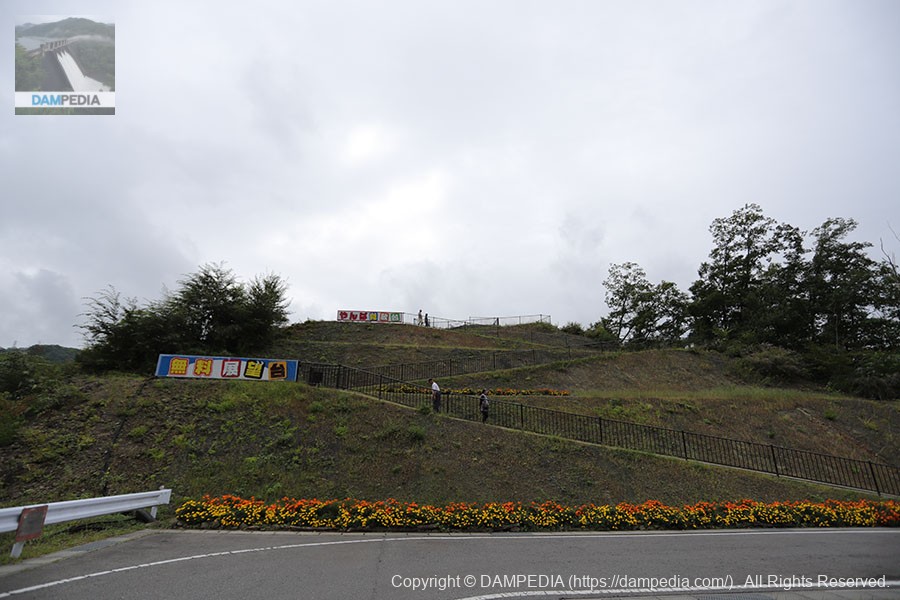
Yanba Lookout on the left bank
This was our first visit to the Yamba Dam in a year and a month. Since we had some time before the meeting time, we first visited the dam from the observation platform "Yanba-miho-dai" on the left bank.
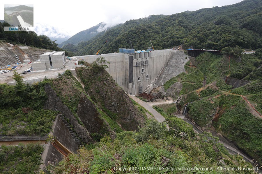
View of the levee from Yanba Lookout
This is what it looked like a month before the typhoon. Because it was before the test flooding, of course the water flow was only about the same as the flow of the Agatsuma River.
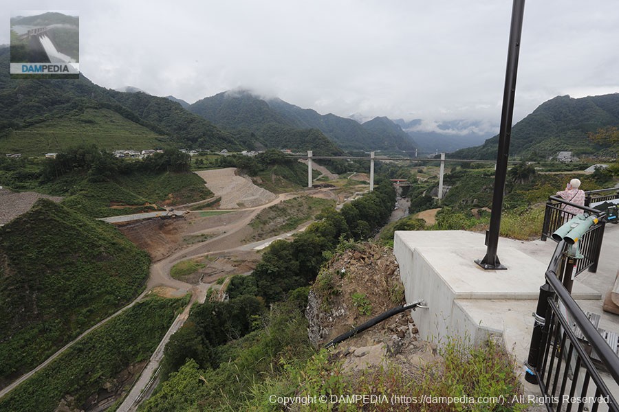
View upstream from Yanba Lookout
One elderly lady was pointing her camera at the area that was to be submerged. I thought to myself at the time that this landscape would soon be submerged.
View of the old national highway and the ruins of the old Agatsuma Line from Yanba Mihodai
The old national highway bridge and the old Agatsuma Line railway bridge will be submerged as they are.
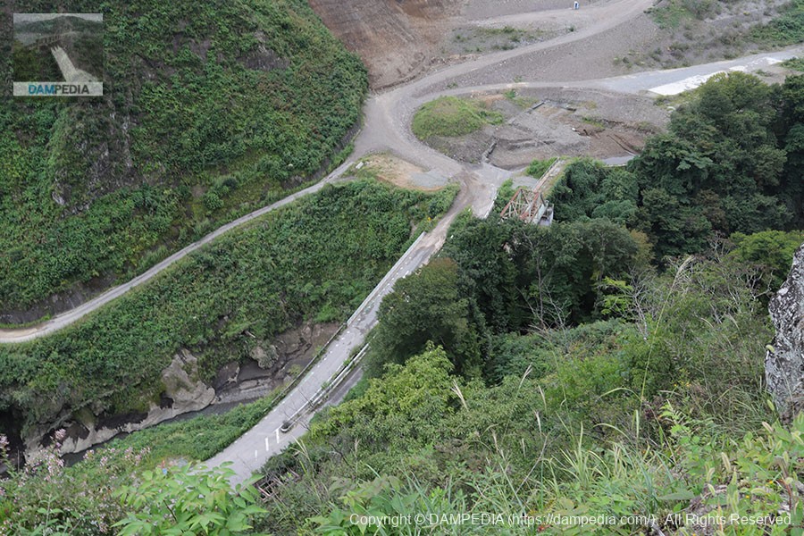
View of the bungee jump platform and the embankment from the Yamba Ohashi Bridge
Unfortunately, the Yamba Bungee was not open that day, and jumping was not possible. Too bad, because the Yamba Bungy was not open on that day.
Also, on that day, I declared, "I'll fly if everyone funds it!" but in the end, the water was full and the business was closed without anyone offering funds. Too bad.
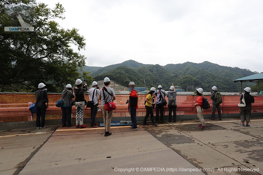
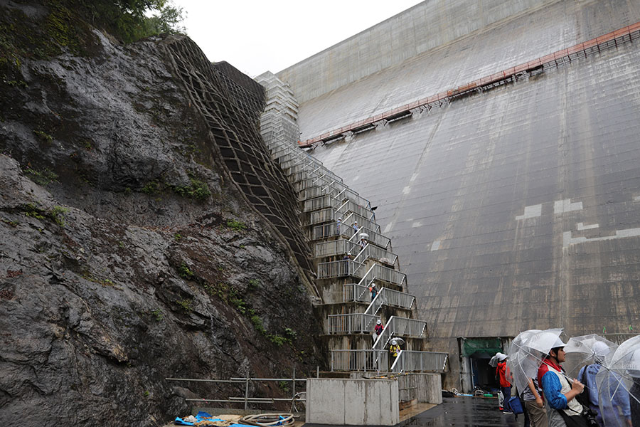
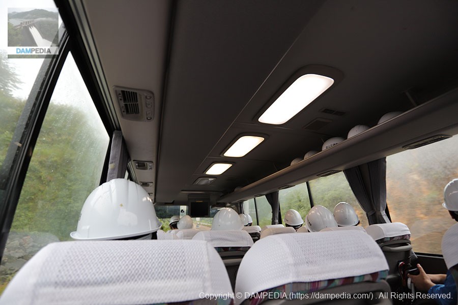
Participants from the right bank
It was time to go, so we headed to the right bank parking lot where we were to meet. Participants gathered one after another and then followed the course of Yanba Tours to the levee.
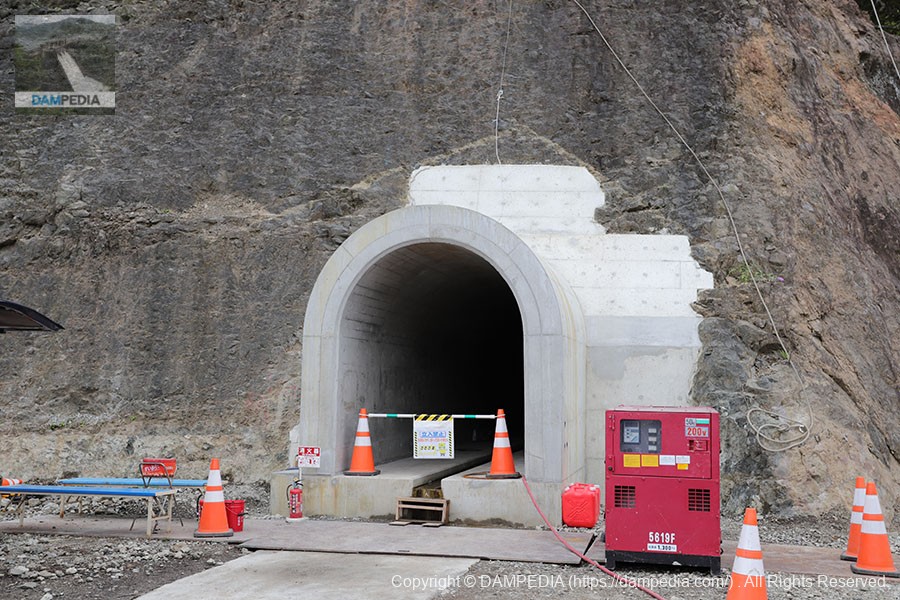
Rim Tunnel on the right bank
This is a tunnel for rim grouting work, in which cement milk is injected into gaps in the bedrock to make it difficult for water to pass through. It is about 300 meters long on both the left and right banks.
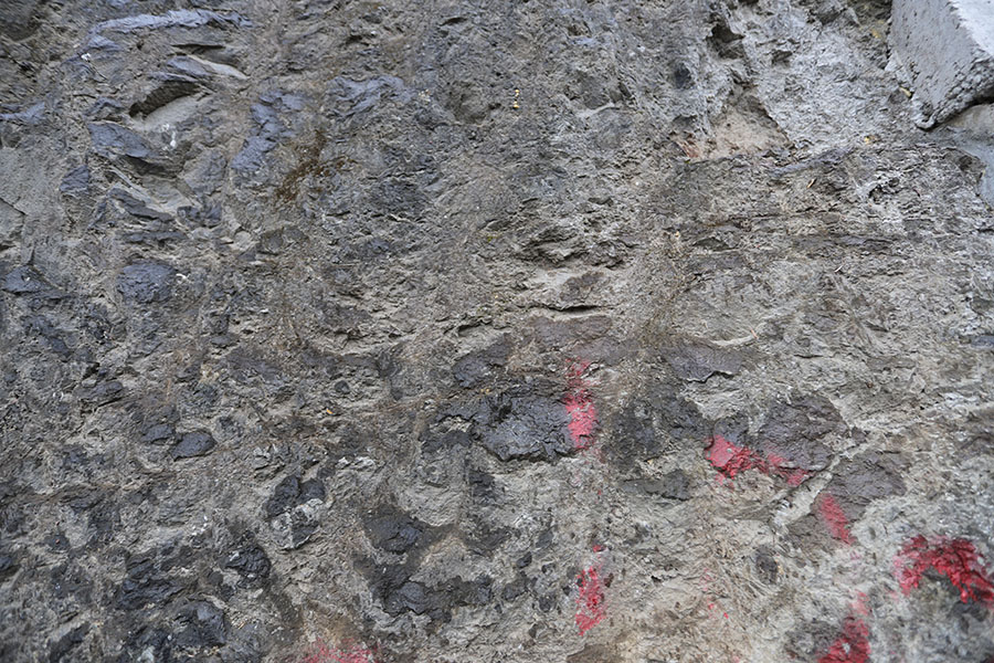
Bedrock on the right bank
This is the exposed bedrock next to the rim tunnel on the right bank. All we know is that it looks strong, but it is an important bedrock that supports the embankment of the Yamba Dam.
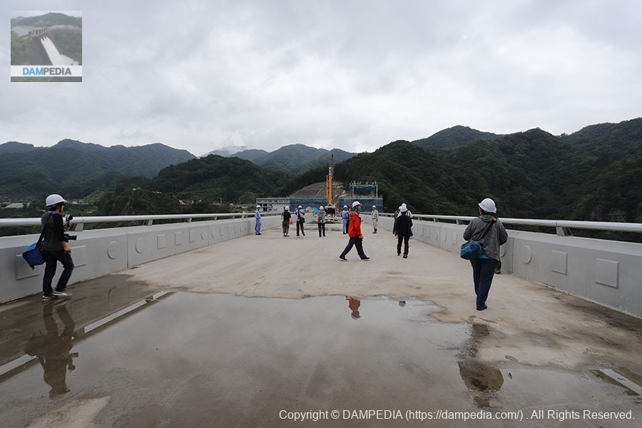
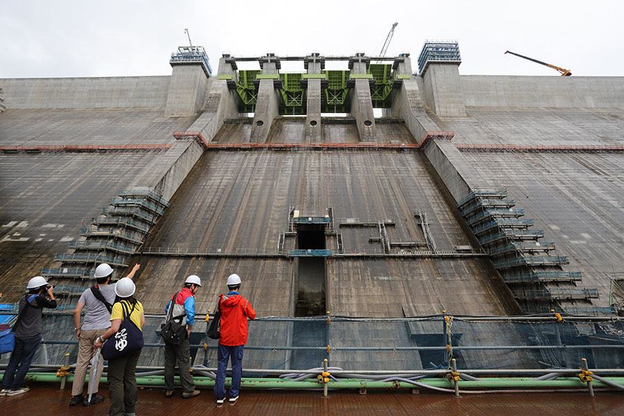
View of the top edge from the right bank
The Yamba Dam has been poured and is finally visible.Top (Crest)The road will be paved with asphalt and other materials later on. In fact, it will not look like this as it will be paved with asphalt and other materials later, but we are happy to be able to walk one step ahead of the others.
View upstream from the top
Never thought I'd see the day when I could look upstream from the edge of the sky...!
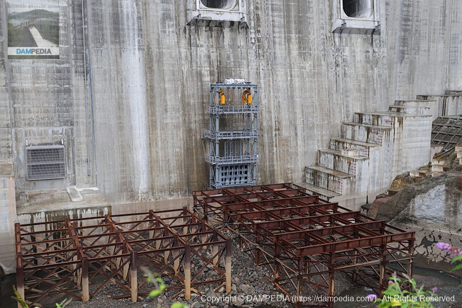
elevator tower
The elevator tower is still under construction to great acclaim. They are going to install a multi-purpose and an inspection elevator that visitors can also use, respectively.
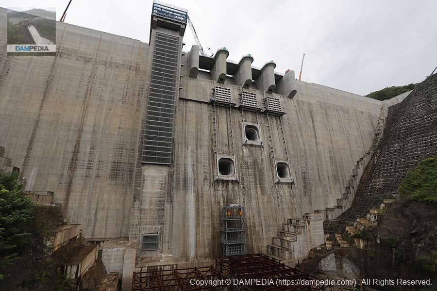
crest gate
This is a brand new Crestgate in such close proximity. The crest gate arrived in pieces and was assembled on site.
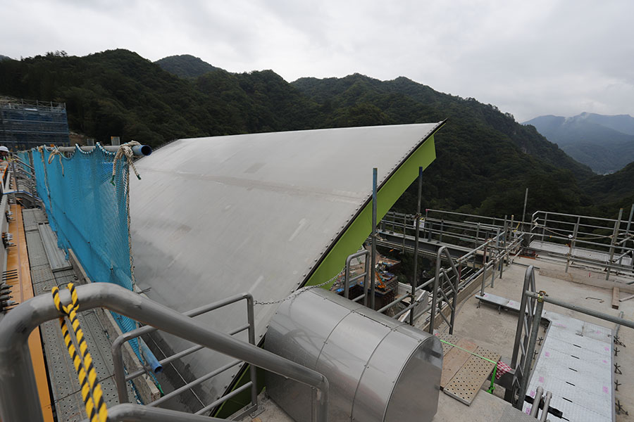
Lower part of crest gate
The crest gates were operated and inspected many times.
Crest gate (downstream side)
The green color was decided in consideration of the landscape. Also, like the Otaki Dam, it is hydraulically operated. It may be that the hydraulic system, rather than the wire system, will become the mainstream in the future.
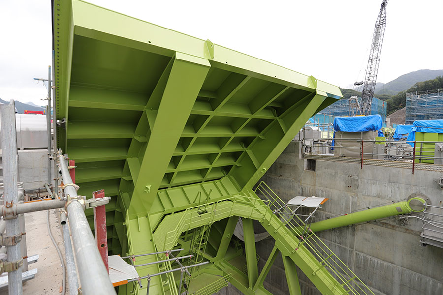
Wire rope winch type gate hoist
Huh? Then what is this? This is a windlass for a reserve gate. The pale yellow ones in the front and at the back are spare gate winders for the normal flood discharge, and the blue ones in the middle are spare gate winders for the water level maintenance discharge system. They can be recognized by their colors. Incidentally, the hoist is bare at the moment, but the building will be constructed in the future.
Spare gate for permanent flood discharge
This preliminary gate is connected to the light yellow hoist mentioned earlier. The gray steel frame below that is a gate for closing the temporary drainage channel in the dike, and preparations for the test flooding are steadily underway. The brown steel frame is part of the piers of a temporary bridge erected for the passage of self-propelled cranes and other vehicles during construction. They are going to be sunk at this point.
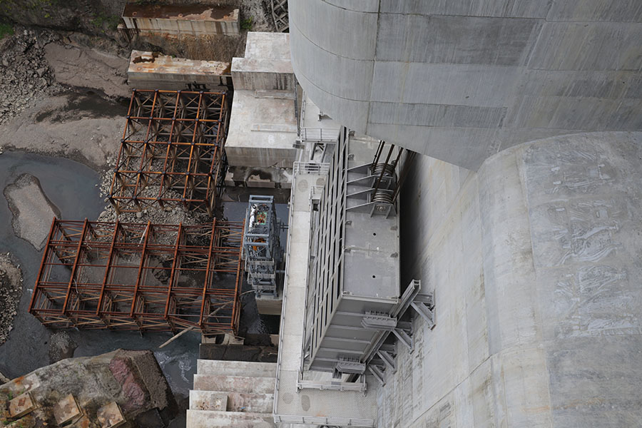
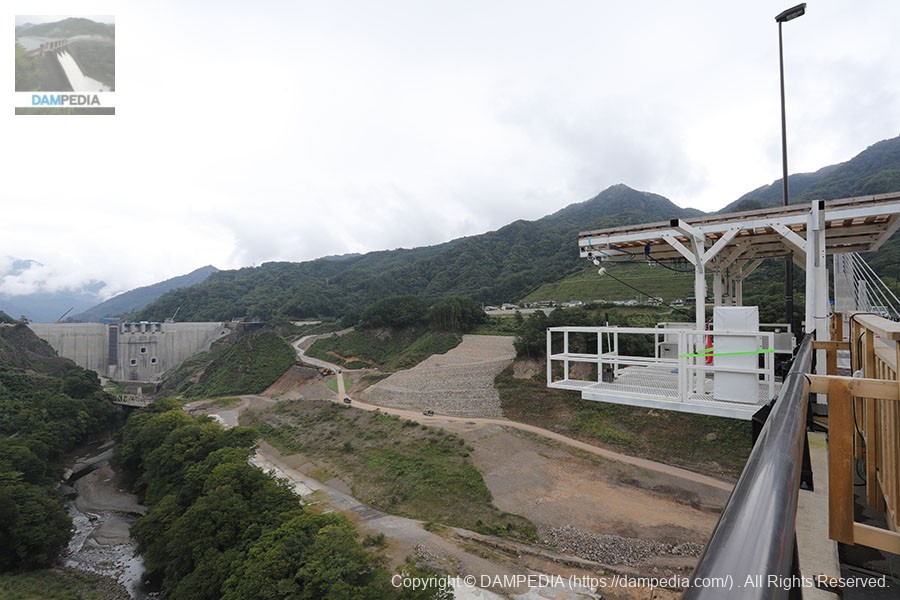
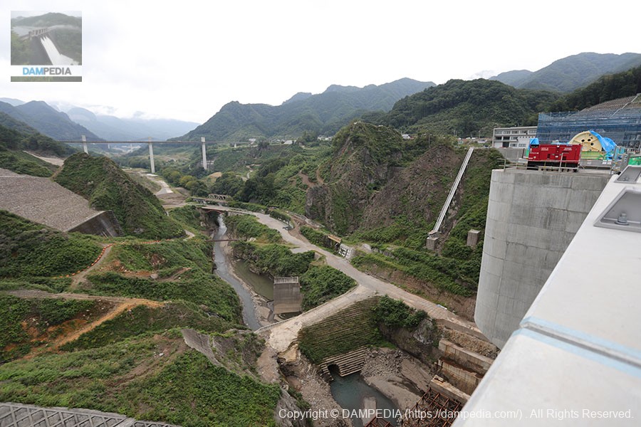
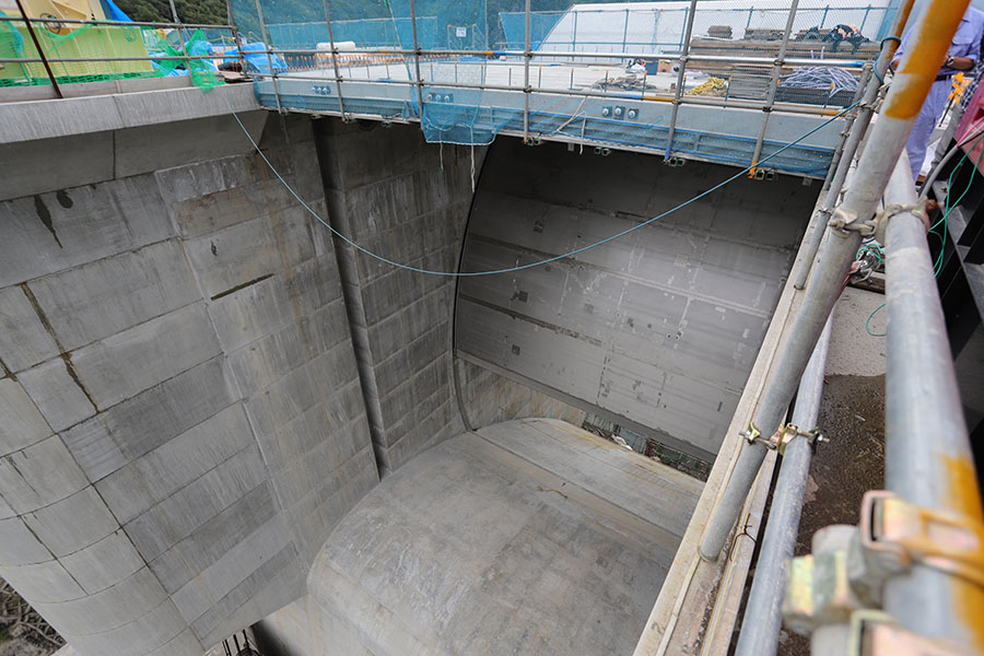
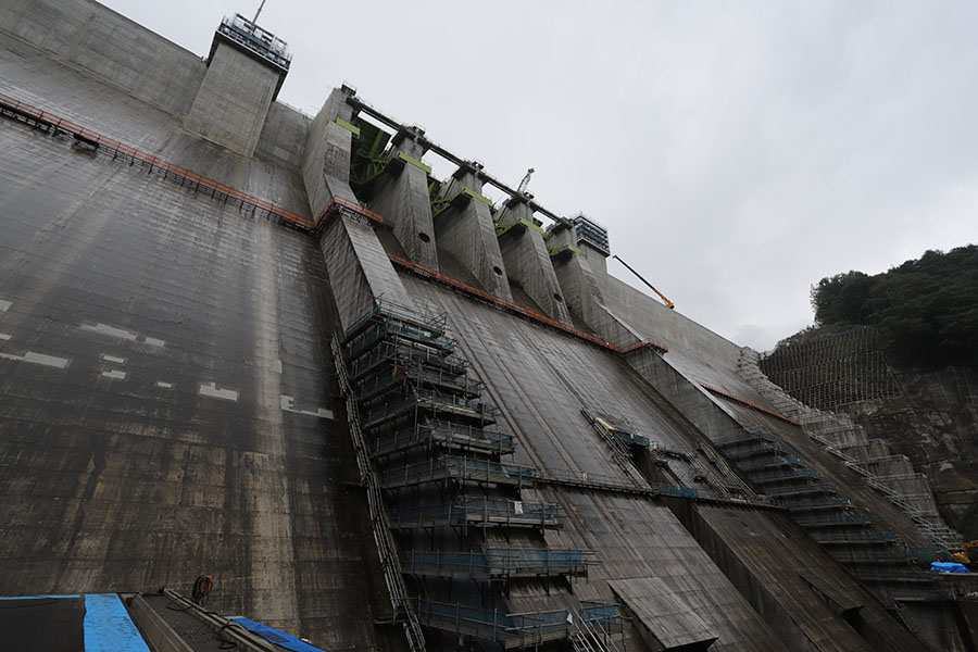
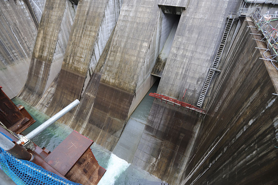
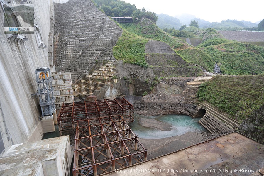
View of the reduction work from the top edge
The downstream side was still under construction. A temporary bridge is being built over the reduction work, and a bridge for observation and management will be built in front of it. Also, a power plant is being constructed on the left bank.

Inside the selective water intake system
As you can see, there are a large number of pipes inside. The selective intake system of the Yamba Dam is a continuous siphon system, which has been used at the Tono Dam and the Yunishigawa Dam. This is another trend of the times.
Apparently the upper part of the Plum Line is in this area.
It is hidden by the equipment, but there is a plumb line under it.
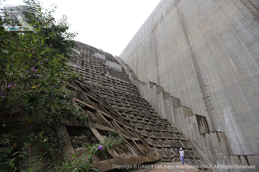
Down the footing on the right bank.
Hagiwara's VideoI thought the footing looked narrow at first, but it was really narrow (laugh).
corridor connecting an annex to a pond-side building (in traditional palatial-style architecture)
This is a beautiful precast audit corridor. Unfortunately, we only had a glimpse of the audit corridor this time. We are looking forward to seeing it during formal tours, such as during the "Friendship Season for Forests and Lakes".
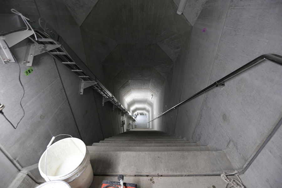
View of footing on right bank from downstream
My knees were laughing hysterically when I got down to the very bottom due to lack of exercise.
View of the embankment from downstream on the right bank
Although it is still under construction, I am very happy to see this appearance downstream.
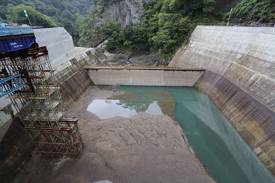
View of the reduction work from the temporary bridge
This is a large scale abatement work. I had assumed that the walls of the left and right banks of the abatement pond were generally vertical, but they are slanted toward the abatement pond.
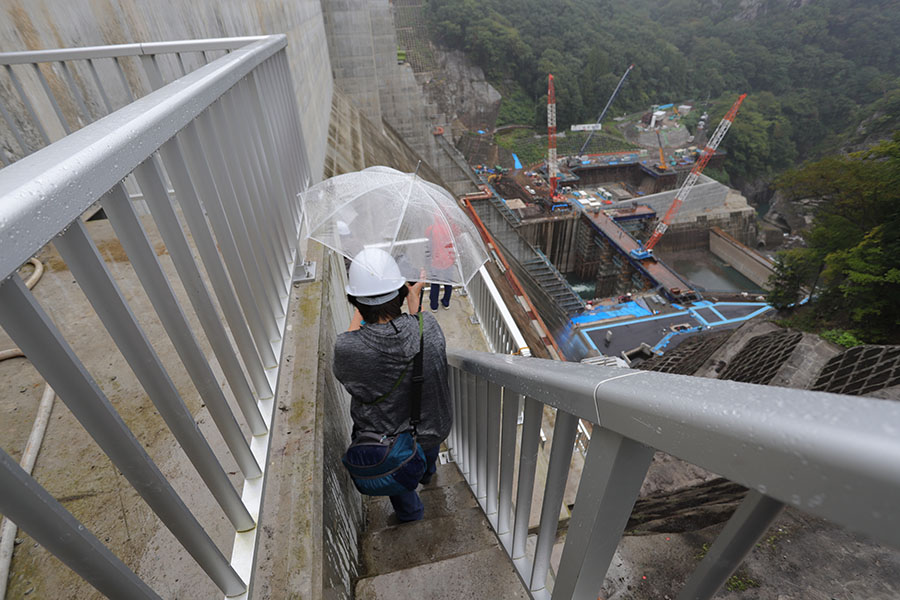
View of the levee from the temporary bridge downstream
This is it. I drove over 4 hours to see this. There are still some construction scaffolds in place, but it is a beautifully symmetrical downstream face.
Temporary drainage channel discharge in embankment
There is a temporary drainage channel outlet in the embankment at the lower part of the permanent flood discharge on the left bank side. After the upstream side is closed, this area will be filled with concrete.
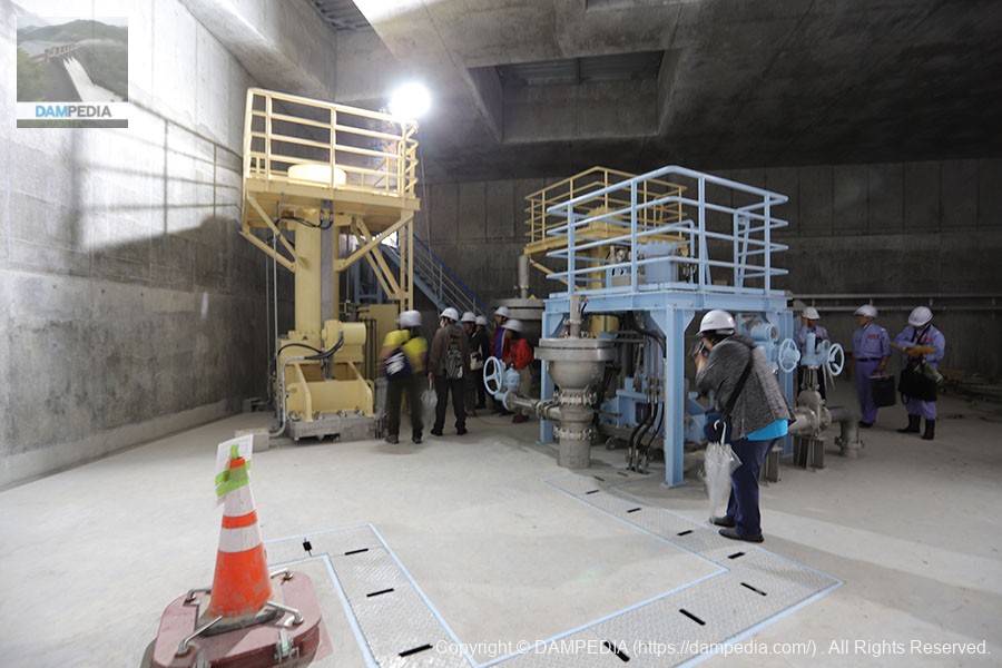
Into the irrigation room
Cross the temporary bridge and descend the stairs to enter the irrigation chamber.

Water discharge facility located in the irrigation room
Water taken from the dam lake is supplied here to the Gunma Prefectural Enterprise Bureau for power generation and to cities downstream as water supply and industrial water while preserving the landscape of the Agatsuma Valley.
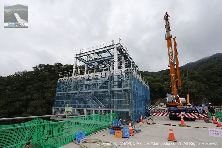
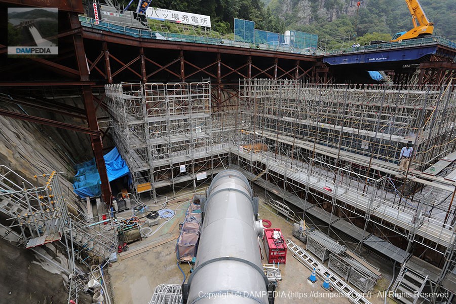
Gunma Prefectural Enterprise Bureau's Yamba Power Station
A semi-underground power plant is under construction beyond the water diversion and discharge facility. When completed, the power plant will have the following scale
Maximum output: 11,700 kW
Annual power generation: approx. 42 million kWh (equivalent to the power consumption of approx. 12,000 average households)
Maximum water consumption: 13.60 m3/sec
Effective drop: 105.80 m
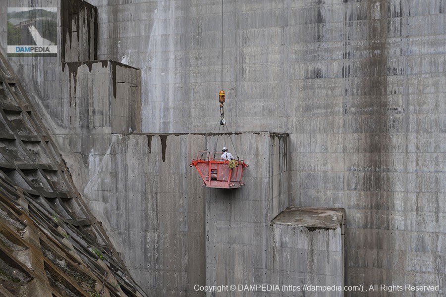
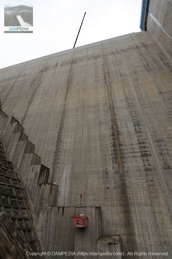
Levee wall surface cleaning in progress
A high-pressure washer was used to wash away the dirt on the dike wall surface. I don't think it was a Kärcher, as expected, but it was nice to watch as it became cleaner as I watched.

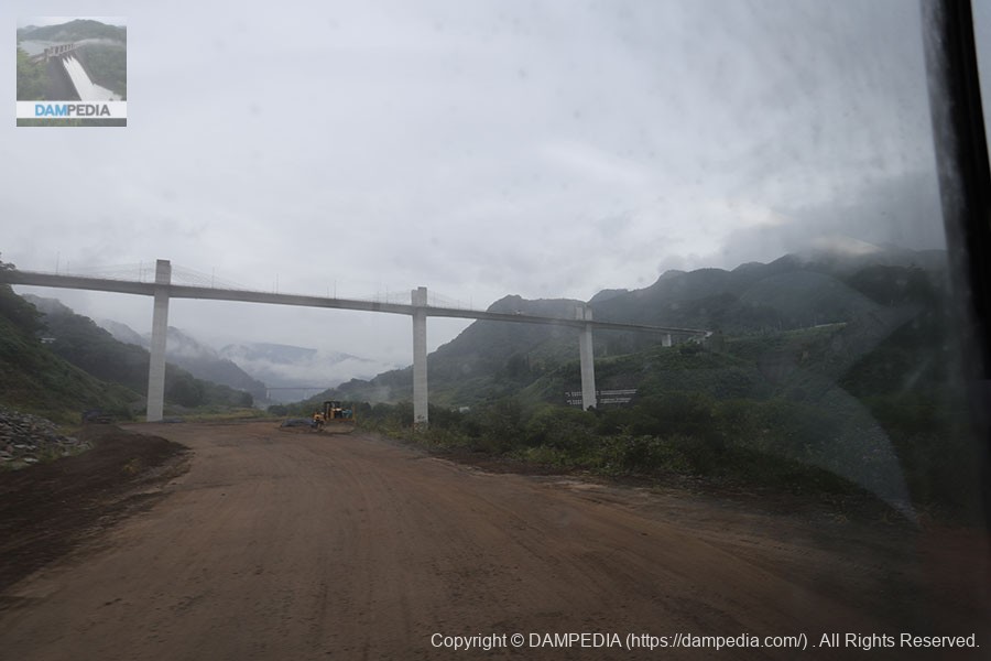
Move to the upstream side by bus
After visiting the downstream side of the river, we will take a bus to the upstream side of the river.
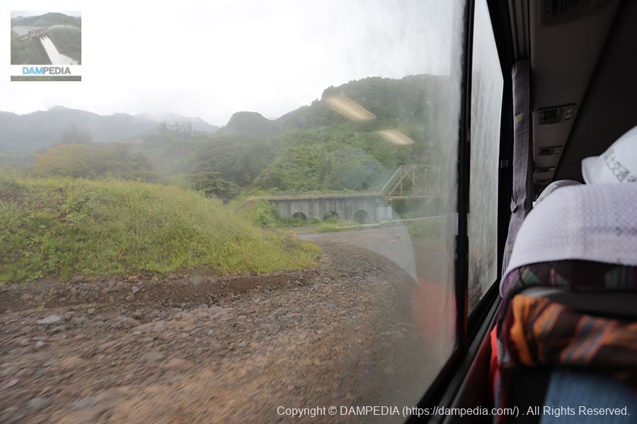
Yamba Bridge from the bottom of the lake
The Yamba Bridge can be seen from the bus window. Naturally, this area is also submerged.
old Azuma Line
The old Agatsuma Line is now in sight. It is not a very good picture in the moving, rocking bus, but the old national highway is visible in front of the old Agatsuma Line.When I first visited the area 10 years agoI was so impressed by the fact that I passed through here....
mooring facilities
This is a mooring facility. The Yamba Dam is not an incline system, but a floating pier system. It looks like a slide or a small ski jump.

View of the levee on the upstream side
The downstream side is good, but the upstream side is a valuable shot because it will not be visible (or even accessible) when the river is flooded.
Gate for temporary drainage channel closure in embankment
This gate is lowered to close the temporary drainage channel in the dike at the start of test waterlogging.
View upstream from the temporary breakwater
The concrete structure on the right is the drinking mouth of the temporary drainage tunnel. This is the last time we will see this view. I will not only photograph it, but also burn it into my eyes and heart. I am not a local, but I am deeply moved to know that this place will soon be under water.

Temporary embankment of trapezoidal CSG
This is the top of the temporary embankment of the trapezoidal CSG that has served its purpose, although it has been considerably scoured by rain and other factors.
View of work in progress at the upstream embankment
Whether it was for finishing or inspection, workers were working on a gondola.
Gondola suspended by crane
They are hung like this...amazing. But I guess it is everyday life for the workers.
Between temporary breakwater and embankment
You can see the hole in the trapezoidal CSG temporary embankment that was built to divert the flow of the river during the construction of the main body, through which the river water flows into the temporary drainage channel in the embankment.
Abutment on the left bank
Can you tell how huge it is in comparison to the person? Even just looking at this place, it is cool. It gives a sense of firm support of the embankment, or a sense of holding back the bedrock, or a sense of power.
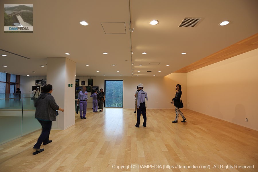
Hall on the 2nd floor of the administration office
After the upstream tour, we took a bus to the management office on the left bank. The inside of the management office had the smell of so-called new construction. In the future, the first floor and this second floor space will be used as exhibition space and will serve as a public relations facility. As a matter of fact, a meeting was held this time to exchange opinions about the contents of this exhibition, and as an enthusiast, I expressed various opinions. The content is a secret, but I would be happy if it is adopted.
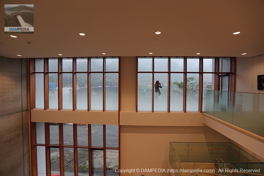
View of the atrium and south window from the second floor exhibition space
Outside this window is a view of the embankment on the left, which will become an expansive view of the dam lake when it is flooded.
Other preparations for dam management seemed to be steadily underway in the control center. In fact, this place must have been the main battleground during Typhoon No. 19, which struck after our visit.
The Yamba Dam will reach its highest normal storage level (always full) much earlier than scheduled on October 15, 2019, and from here it will be lowered again to its lowest level, which will finally complete the test waterlogging. There is still a lot of construction work going on at the top end and downstream, but the completion of the project is just around the corner! The situation is such that the construction will be completed soon.
After a long period of opposition to the Yamba Dam, a suspension of construction by the Democratic Party of Japan, and its resumption, the dam is finally taking on a full-fledged role as a dam. Before that, the dam was suddenly put into practice by Typhoon No. 19, and there is no shortage of topics, but we would like to continue to watch over the dam as it plays an active role in flood control and water utilization.
Accommodations that may be close to the Yamba Dam

Comment