
Date of interview: Sunday, 08/04/2013
The Muromaki Dam is located southward from the Yatsuo Dam. If you follow Prefectural Route 230 southward along the Muromaki River (Ida River), you will naturally reach the dam. However, according to the Toyama Prefecture website, the road downstream is not good, so please enter Prefectural Road 230 from the west side entrance of the Masama Tunnel on National Road 472 and go upstream to the management office.
At the time of our visit, the upstream side was closed to traffic, but the situation seems to have changed now. Still, I think the upstream side is not a very good road. (This is just a general opinion. I personally love narrow roads.)
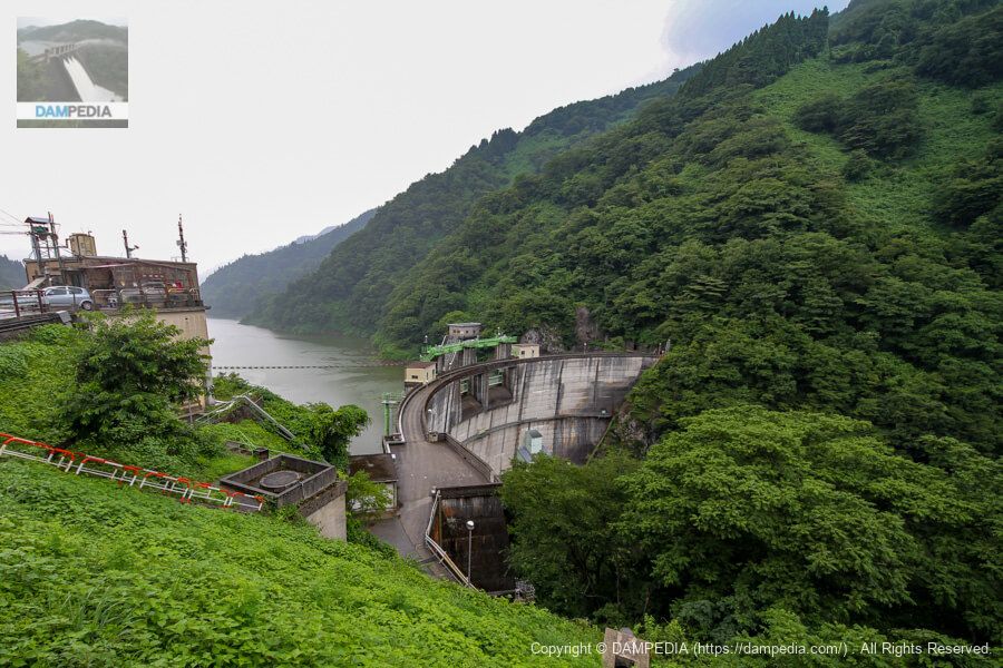
Looking downstream from the right bank
It has been a long time since I have seen this arch dam. Even here, I thought I couldn't see well because of the overgrowth of vegetation...

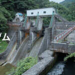
View of the top end and downstream face of the embankment from the left bank
Moving upstream, we managed to find a place where we could look down on the embankment. However, although the upper half of the embankment is visible, the lower half is not. There are two crest gates. Below them, a structure that looks like a conduit gate can be seen on the left bank. According to the Toyama Prefecture website, there are two conduit gates on both sides, and the spare gate on the upstream side seems to be a coaster gate.
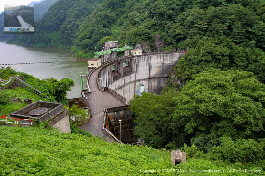
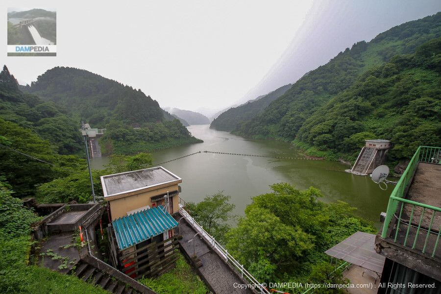
View of the levee and control center from the left bank
Unfortunately, however, the top edge and other parts of the levee are usually off-limits, so it is not possible to view the levee at close range. It is a pity, because the arch looks quite cool in the rain.
Toyama Prefecture Muromaki Dam Management Office
It is a cozy three-story administrative building with the entrance on the top floor.
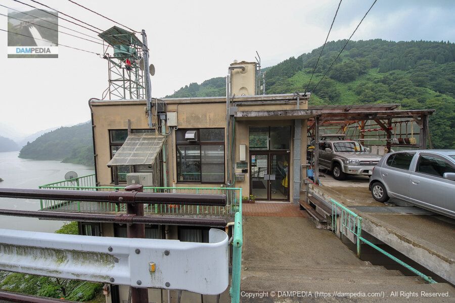
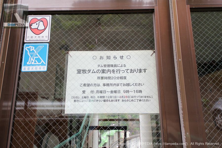
"We provide information on the Muromaki Dam."
On weekdays, the Muromaki Dam management staff will give you a guided tour of the dam. However, on this particular Sunday, it was after 4:20 p.m., so we could only watch with our fingers in our mouths. It is not clear if they still accept tours, but dam cards are distributed. (As of May 2021)
Also, please note that the prefectural road is closed for the winter from late November to late April. (Dam cards will not be distributed during this period.)
View of the reservoir from the entrance of the control center
right bank (shore)(The left photo shows the incline.left bank (of a river)(The water taken from the intake facility (left) is sent to the Muromaki Power Plant, located 2 km downstream and upstream of the Yatsuo Dam, to generate up to 22,000 kW of electricity.
Although it is located in a difficult-to-access area, it is a cool arch dam that can be viewed from a bird's eye view, so if you have the opportunity, I highly recommend a visit to the Muromaki Dam.
Muromaki Dam Specifications
| Location | Kotani Kitahara, Yatsuo Town, Toyama City, Toyama Prefecture |
| River Name | Jinzu River System Ida River |
| Objective | F (flood control, agricultural disaster prevention) N (unspecified water, water for river maintenance) P(Power generation) |
| Model | A(arch dam) |
| Bank height | 80.5m |
| Bank length | 153.1m |
| Dam volume | 55,000 m3 |
| Watershed Area | 128.3 km2 (direct: 85.2 km2, indirect: 43 km2) |
| Reservoir area | 71ha |
| Total storage capacity | 17,000,000 m3 |
| Effective water storage capacity | 13,500,000 m3 |
| Dam operator | Toyama prefecture (Hokuriku area) |
| Main body constructor | Sato Kogyo |
| Year of launch | 1956 |
| Year Completed | 1961 |
| Name of Dam Lake | - |
Other facilities/observations
There is space to park downstream and on the shoulder of the road around the administration office.
| Parking lot | △ |
| Toilet | × |
| Park | × |
| PR Exhibition Hall | × |
| Fishing | ○○ (excluding no-take zones) |
Map around Muromaki Dam
Weather around Muromaki Dam
Accommodations that may be close to Muromaki Dam
The actual accommodations are listed below.


Comment