
Date of interview: Saturday, March 10, 2012
Location: 162-1-18 Hongo, Ooi-machi, Oi-gun, Fukui Prefecture
This year, 2012, was a banner year for test releases, with the Otsuro Dam in Fukui Prefecture releasing water only one month after the Tatsumi Dam test release. There is one more dam, but I will disclose it later.
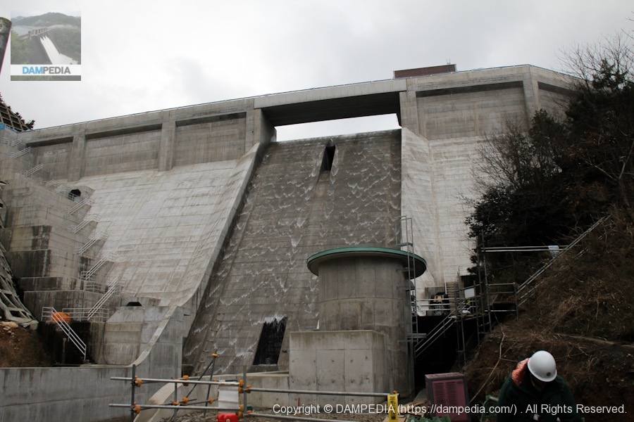
Well, here we are at the Otsuro Dam. At that time, the Maizuru-Wakasa Expressway was not yet connected, and I remember that I drove the national road from the Tsuruga Interchange on the Hokuriku Expressway at a leisurely pace.
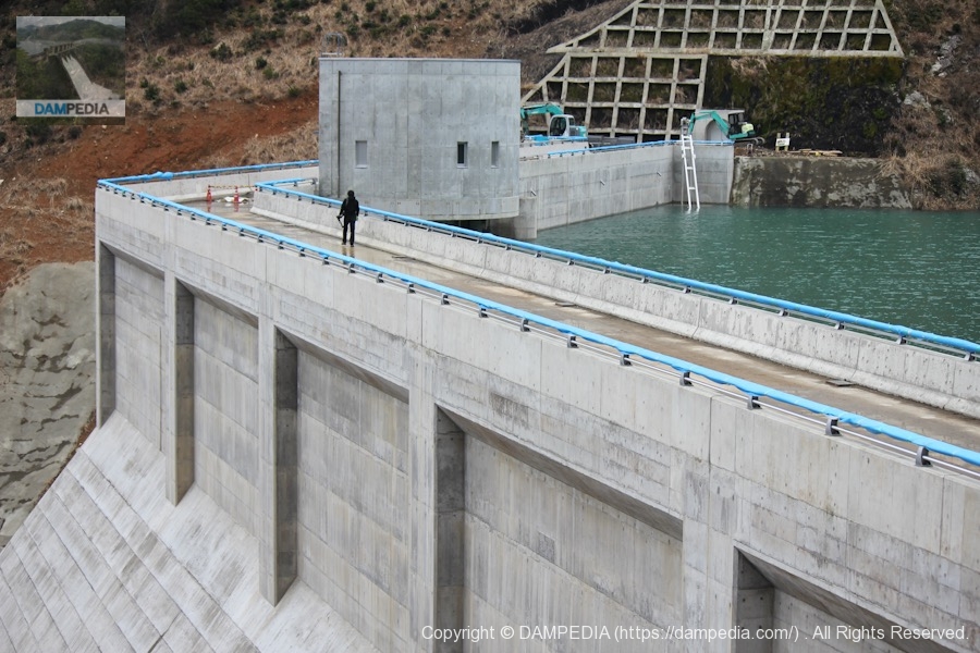
View of the embankment from the left bank
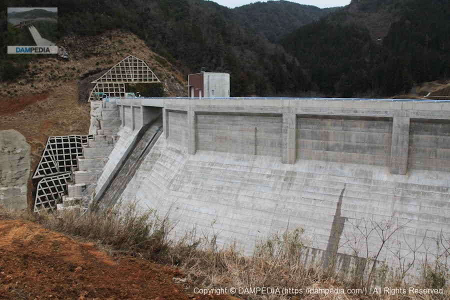
What caught my attention as soon as I arrived was this dike. It is bent in a spectacular manner.
View of the embankment from the left bank
This is a splendid collaboration of water storage and the folding of the embankment. The reason why the embankment is bent is that a construction abutment was built on the left bank in the foreground of the photo, and the embankment was connected to this abutment to reduce the volume of the embankment and save construction cost by not cutting bedrock and downstream landslides.
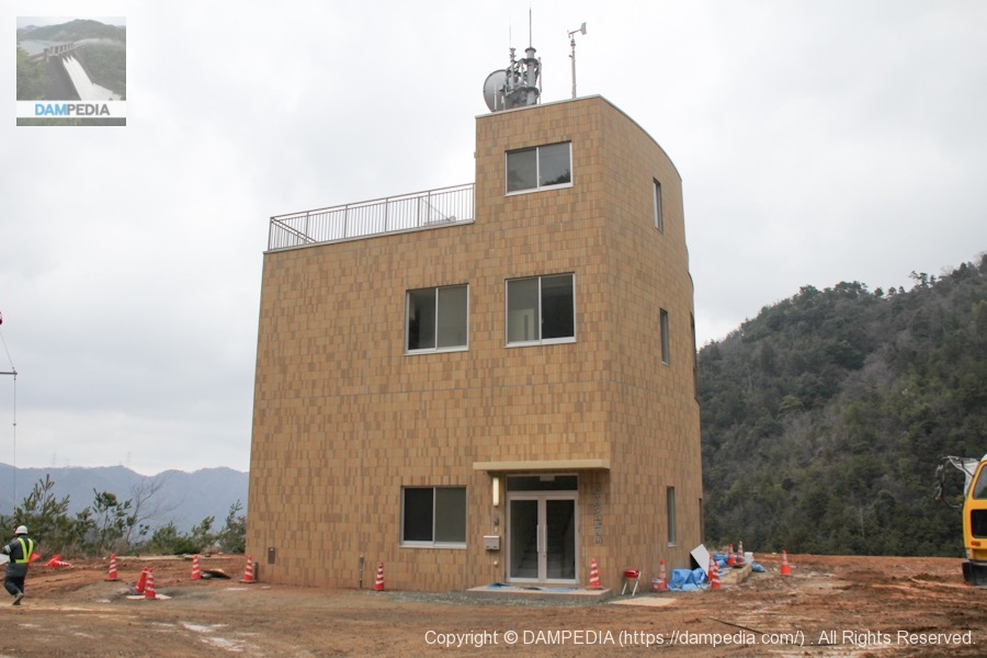
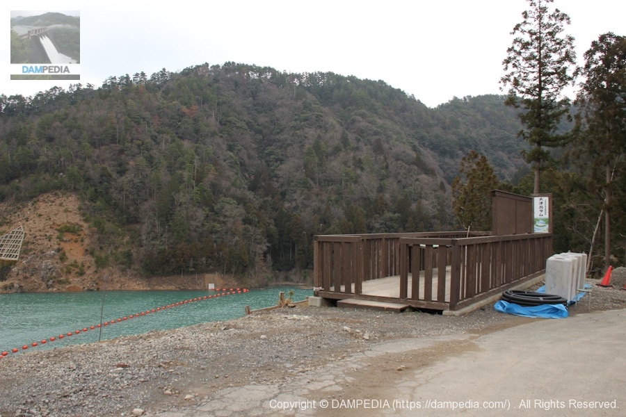
Otsuro Dam monitoring station
It is a monitoring station, not a management office. The actual management office is located in Obama City. The rooftop is like a terrace from which you can see the levee, but unfortunately it is not an observation deck. We would like to see it reconstructed and turned into an observation deck.
View of the embankment from the left bank
View of the levee from the top level. From here, we cannot see downstream at all.
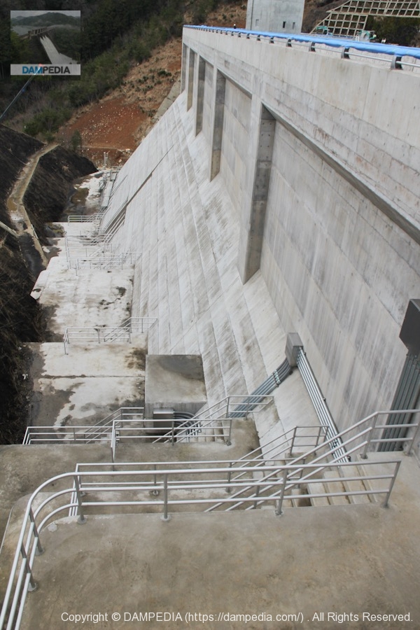
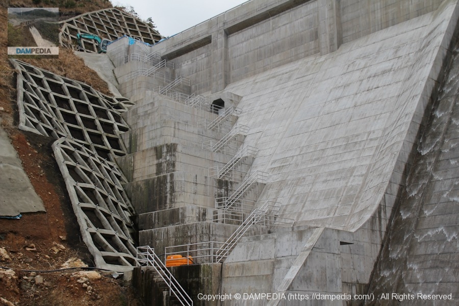
Left bank footing and downstream embankment
The footing of a typical gravity concrete dam is like a narrow section between the abutment and the reduction works, but this dam has a distance from the folded portion of the embankment to the abutment.
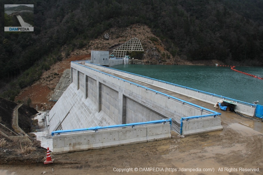
View of the levee downstream from the left bank
It is a difficult subject to know how to photograph.
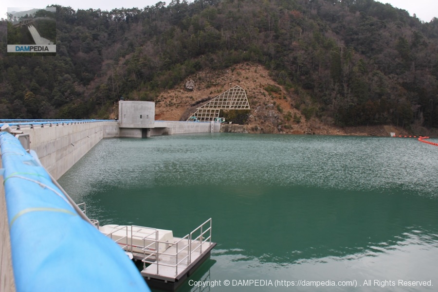
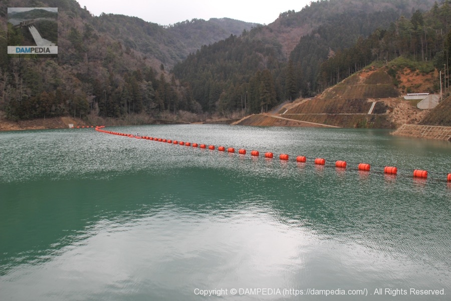
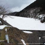
View of the dam lake
It is a fairly small dammed lake with a waterlogged surface area of 3 ha. It is so small that the backwater can be seen immediately from the embankment.
View of the top edge from the left bank
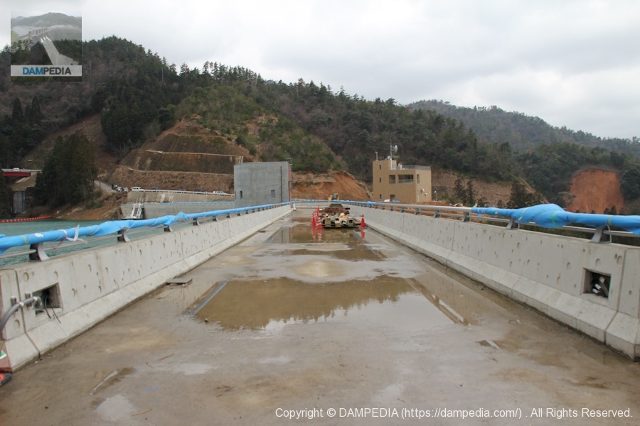
As with the test discharge at Tatsumi Dam, the top edge had not yet been paved.
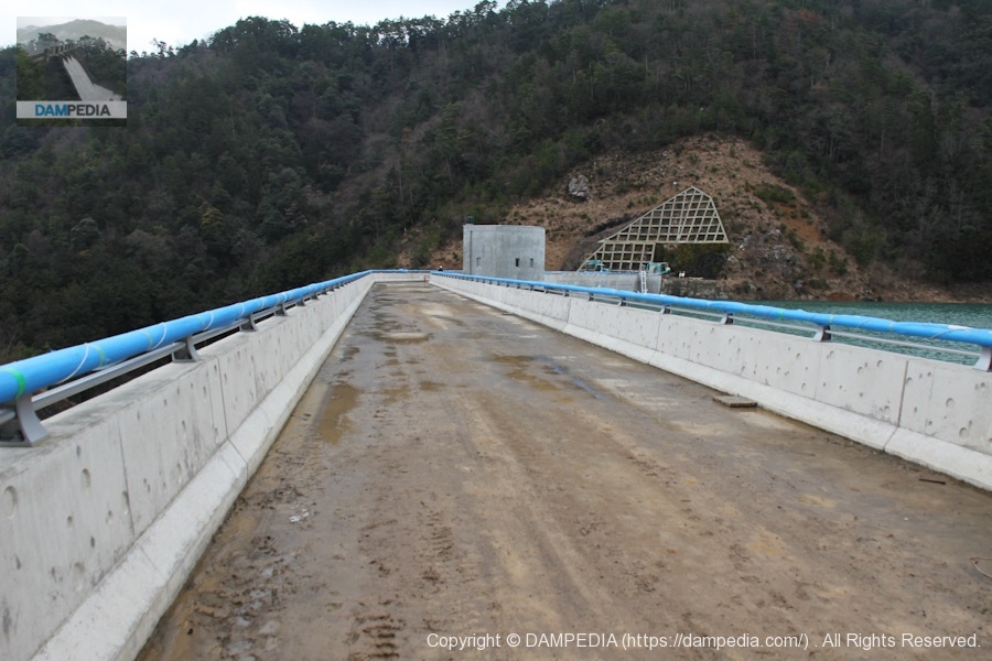
View from the center of the top edge looking downstream
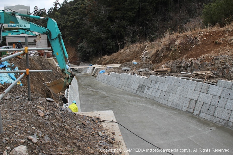
You can hardly see the discharge from near the bank on the left bank, but you can finally see it when you get to this point. The downstream side was still under construction. It seems that they are working on the revetment and the river channel.
View of the top edge from the right bank
Puddles have formed and the footing is poor, but now, of course, it is maintained to make it easier to visit.
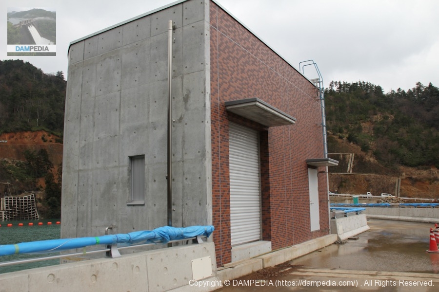
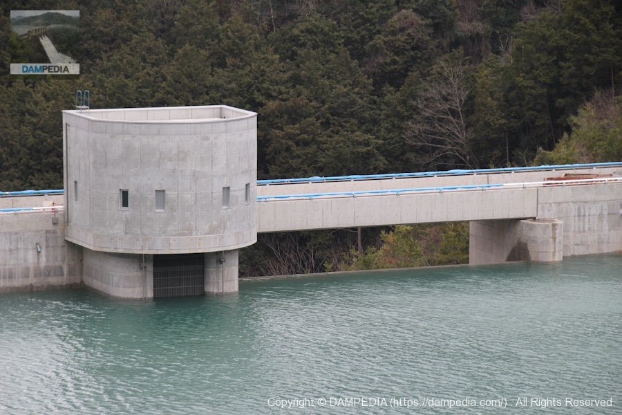
Water intake equipment operation room
The walls are covered with brick tiles.
View of the embankment on the lake side from the right bank
The parapet is still cured.

View of the levee downstream from the right bank
We have reached the right bank. I wish I could see a little more downstream, but this is the best I can do. The white of the concrete is a nice complement to the discharge.
View of the levee downstream from the left bank
We visited the site from the top of a landslide on the downstream side of the left bank. This area is now fenced for safety. I am a little concerned about the leakage on the left bank.
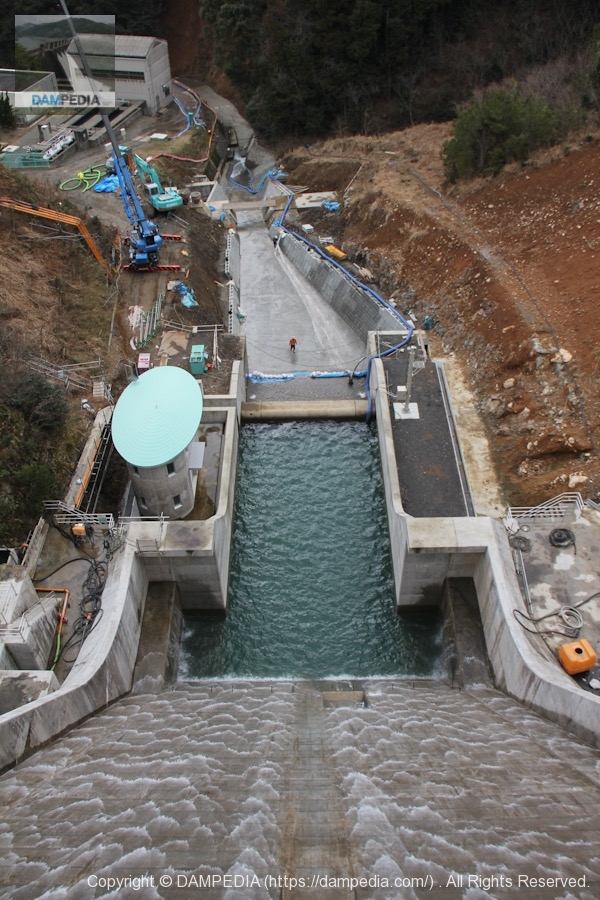
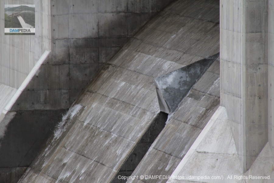
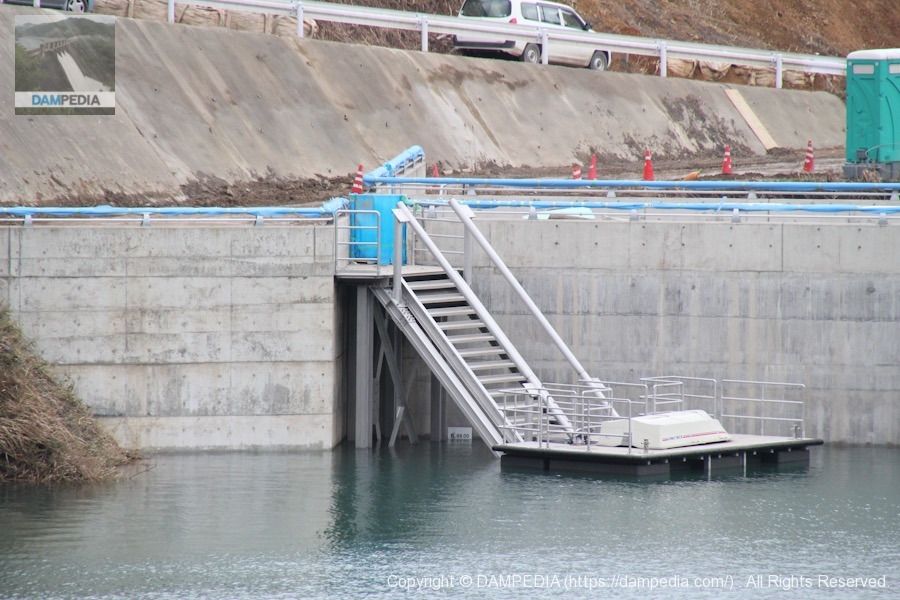
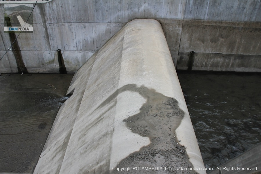
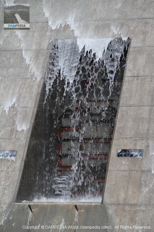
Deflector in conduction section
The triangular structure above the permanent flood discharge is a deflector that regulates the discharge flow so that the flow from the emergency flood discharge does not block the flow from the permanent flood discharge.
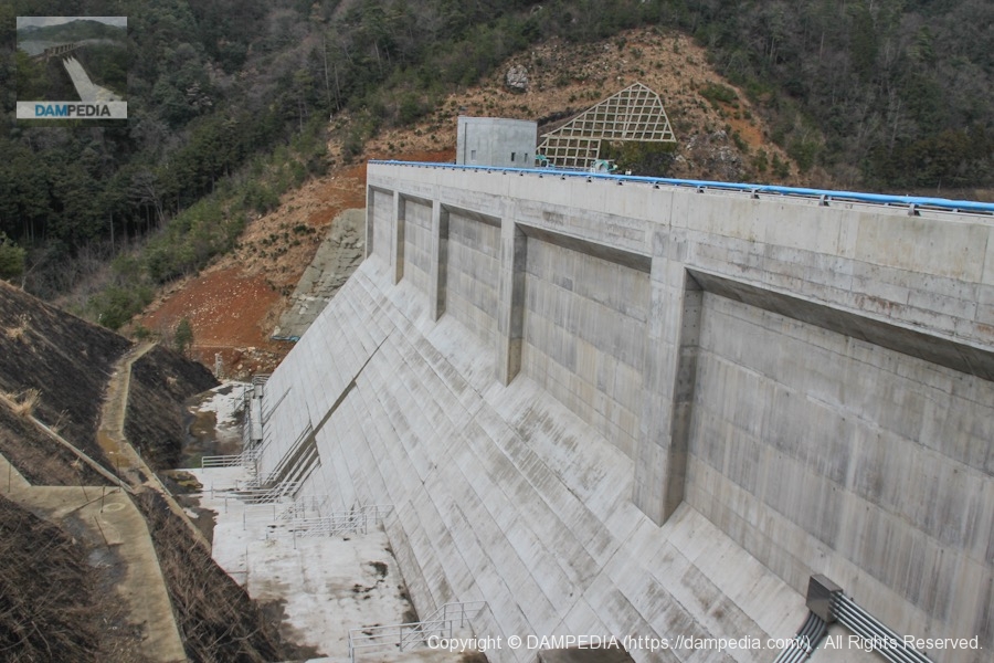
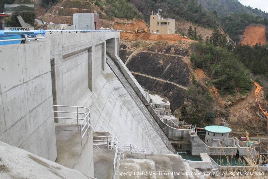
View of the levee from the high ground on the left bank
We decided to go upstream to the observation deck with other dam enthusiasts who had come to observe the test discharge, so we headed upstream on foot. The photo shows the view of the embankment from the hill we climbed on the way there.
View of the dam lake and embankment from the erosion control dam on the left bank
One of the streams flowing into the dam lake has an erosion control dam. It appears to be an existing one from its antiquity.
Viewing platform
We reached the observation deck. I was very happy to see that it was built with a tour in mind beforehand.
Inside the observatory
An explanatory map is located inside.
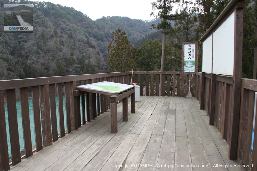
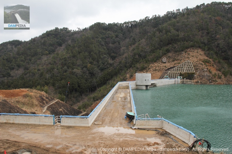
View of the embankment on the lake side of the dam from the observation deck
Personally, my ideal viewing platform is one that offers a view of the levee on the downstream side, but even on the dam lake side, the view from the viewing platform is quite good and betrays me in a good way. It is especially nice to see this torrent of water praising the water right in front of your eyes.

View of the flood discharge and water intake facilities from the observation deck
Zooming in on the flood discharge and intake facility area from the observation deck. The water in the dam lake is a little wavy because of the strong wind.
Surcharge water level is EL.99.6m
The water level indicator board naturally shows the surcharge water level.

Incline Float Boat
There was an incline and a float on the left bank, and boats were placed on the float. It was a simple structure, and I felt that it was quite cost-effective.
Lined enthusiasts' automobiles and embankments
On the way back from the observation deck, I took this photo of the enthusiasts' cars lined up in a row. The lead Pajero is a JV car. The other two cars have been replaced and can no longer be seen.

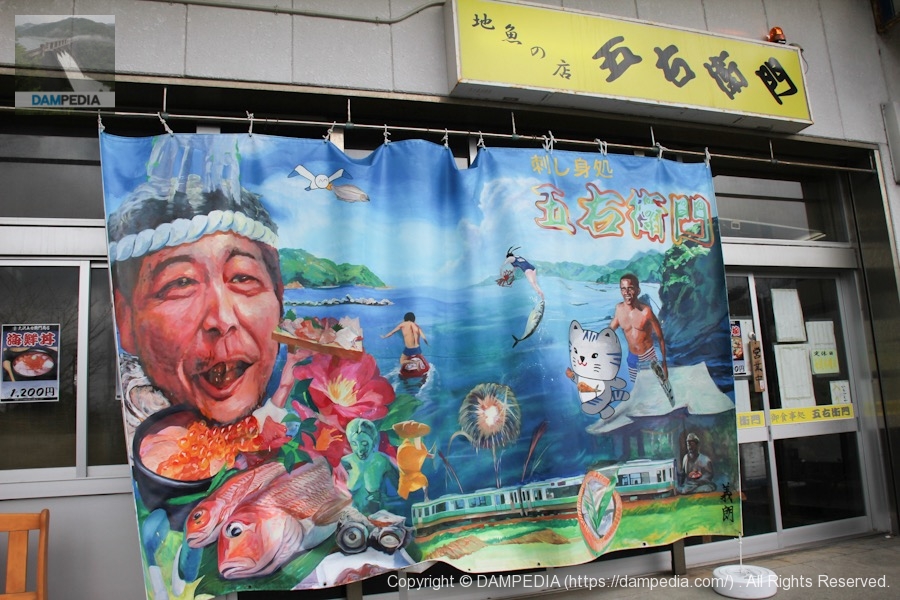
Goemon at Obama Fishing Port
It was time for lunch, so all the lovers came to a restaurant called "Goemon" in Obama Fishing Port. The restaurant is marked by a tarpaulin hung with an illustration of Mr. Obama, who was president at the time, because Obama and Obama are Obama and Obama are Obama and Obama is Obama. It was still there after he became President Trump.
Goemon's location is here↓.
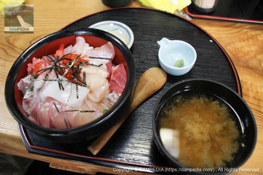
Eat a bowl of seafood at Goemon in Obama Fishing Port
I chose the seafood bowl. This was delicious again!
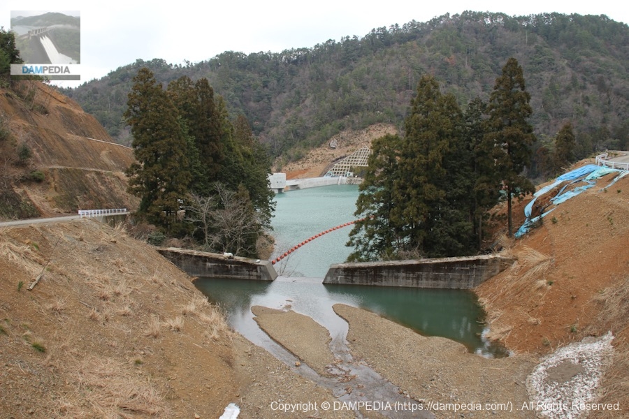
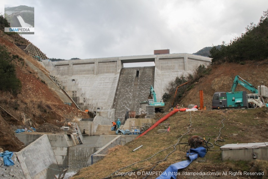
View of the levee from downstream
After lunch, we went back to the Otsuro Dam again, took some pictures and headed home, when Dashiello-san called me back immediately and said, "Go back to !!!!" I was just about to leave when I received a call from Dashiro-san saying, "Go back immediately to . To my surprise, the JV was kind enough to show me around the downstream side of the dam. (The following photos were taken with permission.)
View of the sub-dam from the left bank
Sub-dam at zero distance.
Blocked permanent flood discharge
The permanent flood discharge was also seen this close up.
View of footing on right bank
The footings on the left bank side are quite unique in length, while the right bank side is a common size.
Looking downstream from the left bank
This is a view of the seawall construction and river channel maintenance.
View of the levee from downstream
You can see that the downstream is terraced like an erosion control.
Video of Otsuro Dam test discharge
I have compiled a video of this event. The quality of the video is not very good, as I am still getting used to making videos, and there is still a lot of dust on the inside of the camera, and it was very windy that day, but I hope you can get an idea of the test discharge.
It has been one month since the test discharge at Tatsumi Dam. Although Otsuro Dam is very compact in scale compared to Tatsumi Dam, we were very satisfied to see the precious test discharge and also to eat seafood from the Sea of Japan.
Otsuro Dam Specifications
| River Name | Saburi River System Otsuro River |
|---|---|
| Objective | F (flood control, agricultural disaster prevention), N (unspecified water, water for river maintenance), W (water for water supply) |
| Model | G(gravity-fed concrete dam) |
| Bank height | 40.6m |
| Bank length | 158.5m |
| Dam volume | 75,000m3 |
| Watershed Area | 1.6 km2 |
| Reservoir area | 3 ha |
| Total storage capacity | 485,000m3 |
| Effective water storage capacity | 430,000m3 |
| Dam operator | Fukui prefecture (Hokuriku area) |
| Main body constructor | Shimizu Corporation |
| Year of launch | 1989 |
| Year Completed | 2011 |
| Name of Dam Lake | - |
Map of Otsuro Dam
There is a gate in front of the Otsuro Dam, but it is for preventing animal damage, so just open it once and close it after passing through. The same goes for the return trip.
Other facilities/observations
| Parking lot | Fat. |
|---|---|
| Toilet | Fat. |
| Park | × |
| PR Exhibition Hall | × |
| Fishing | ? |

Comment