
Location: Hirao, Tarui Town, Fuwa-gun, Gifu Prefecture
Date of interview: Wednesday, 08/18/2010
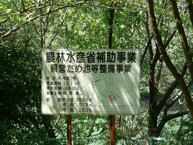
signboard
This was the next dam I visited after the Fuwa Hokubu Disaster Prevention Dam (1122-Fuwa Hokubu Disaster Prevention Dam), but to be honest, I got lost several times before I arrived here. The car navigation system listed the pond, but not the road, and I had no idea how to get there. Fortunately, I was able to get there with the iPhone's map software. Note that Hirao No. 2 Reservoir is sometimes clearly marked as "Hirao No. 2 Dam" on the map. I think this is probably a better name.
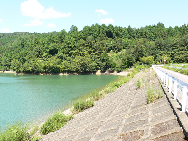
View of the embankment on the lake side from the right bank
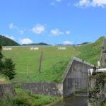
Now, there is the Hirao No. 2 Reservoir. It was built as a subsidized project by the Ministry of Agriculture, Forestry and Fisheries, and is an earth dam exclusively for irrigation and is not so large in scale, but it is a bit difficult to get to because it is lost and covered with weeds (laugh).
The embankment on the dam lake side looks somewhat like Ootani Pond (1048-Ootaniike/Ootaniike).
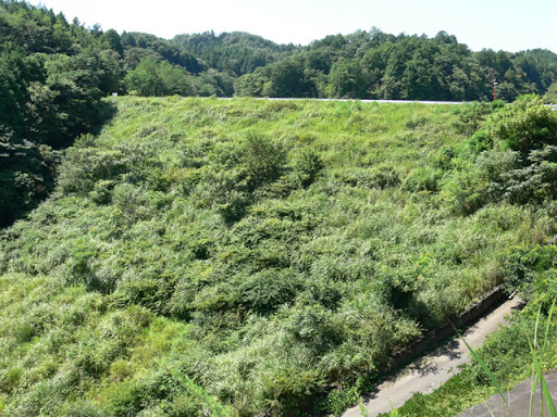
View of the top edge from the right bank
The grass on the right side (downstream) is so overgrown that you are unlikely to notice unless you are told that this is the top of the dam.
View of the dam lake from the right bank

It is quiet. No one likes to come here.
Hirao No. 1 Reservoir (1052-Hirao No. 1 Reservoir) is located behind Hirao No. 2 Reservoir, but they are connected by a siphon and the water levels are the same.
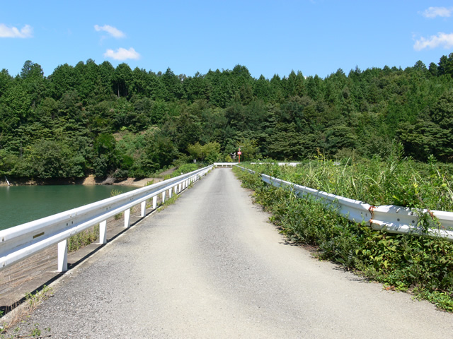
View of the top edge from the left bank
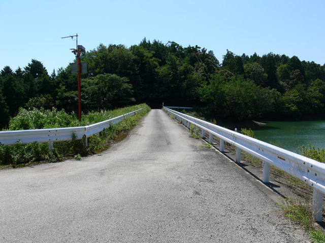
I am concerned about the antenna-like thing standing to the left. Incidentally, the top edge is open to automobile traffic.
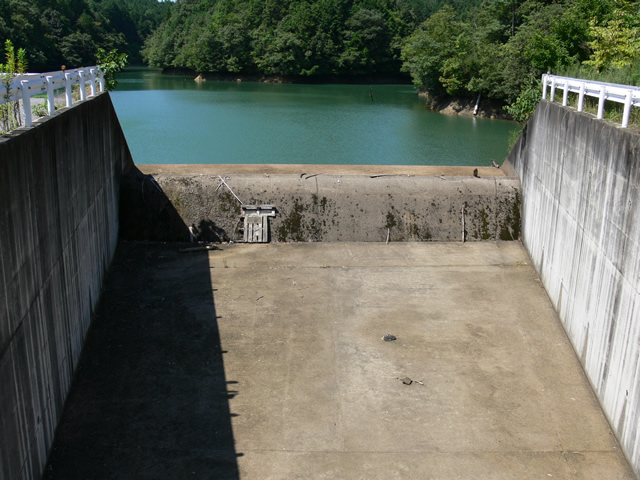
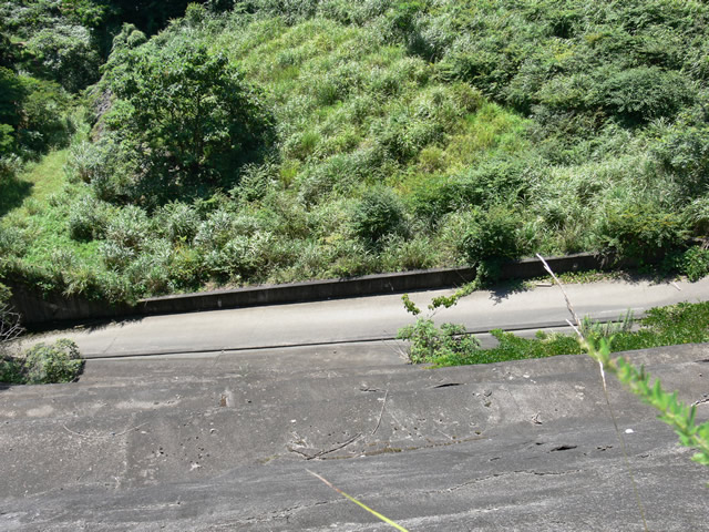
View of flood discharge

This is the atmosphere that was previously overflowed. There are driftwood and debris here and there in the flood discharge.
View of the conduit

It is now a mystery why I took this shot, but it is a large conduit for its size.
View of the flood discharge from another angle
I didn't shoot in the middle, so it's obvious that I'm hot and Texan (laughs).
View of the conduit
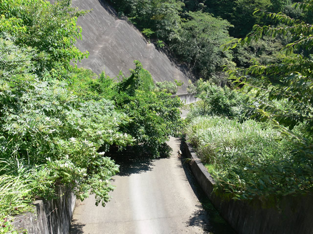
Like a jungle.conduitThe road curves to the right. It curves to the right, but the vegetation is so overgrown that it is difficult to see what is ahead.
View of the levee downstream from the left bank

It is covered with weeds, creating an atmosphere that only those who know it is a dam can understand.
The map shows that there is a path leading downstream. However, I remember that there was a fork between the road leading downstream and the road leading to the top of the mountain, and that the road leading downstream was in disrepair. I think you would have to do something like a jungle expedition to reach it.
View of the flood discharge and conduit from the left bank
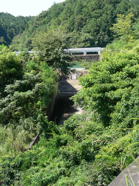
It's hard to tell what I'm shooting because of the slant and the overgrown grass (laughs).
View of the conduit from the left bank
This is the chute section. This is the only place with clean concrete.
Renovated Monument and Suijin Shrine
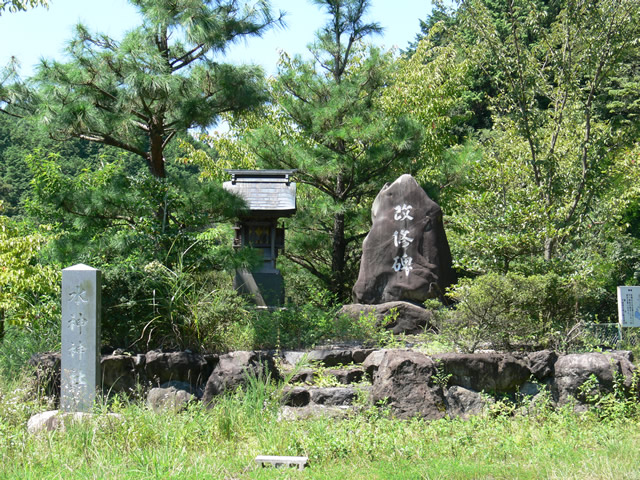
Since most of the irrigation reservoirs are old, completed before the war, they were probably originally unstable, simply filled with earth. I believe this stone monument commemorates the renovation of these.
What is even more interesting is the neighboring shrine. It is called "Suijin Shrine. I am a rain man turned water god, so you might think that I am enshrined at this shrine. When you visit there, please think of me and visit the shrine. But, putting the joke aside, I guess this shrine is the guardian god of this area as well as the tame pond.
dam characteristics
| River Name | Kisogawa River System Hanguse River |
|---|---|
| Objective | outside the control or jurisdiction (of) |
| Model | earth dam |
| Bank height | 25m |
| Bank length | 107.9m |
| Dam volume | 126,000m3 |
| Watershed Area | 0.12km2 |
| Reservoir area | 3 ha |
| Total storage capacity | 359,000m3 |
| Effective water storage capacity | 359,000m3 |
| Dam operator | Fuwa-gun Northern Land Improvement District |
| Main body constructor | Directly managed by Northern Arable Land Consolidation Association |
| Year of launch | - |
| Year Completed | 1916. |
Other facilities/observations
There are a few dirt sections along the way. The parking lot is more like a parking lot, or rather, you park in the open space at the dam site.
| Parking lot | ○ |
|---|---|
| Toilet | × |
| Park | × |
| PR Exhibition Hall | × |
| Fishing | ○ |

Comment