

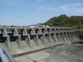
Location: Oaza Wachi Aza Harita, Yaotsu-cho, Kamo-gun, Gifu Prefecture
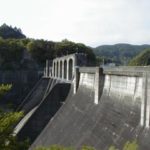
View of the embankment from the right bank
Located downstream of the Maruyama Dam, the dam is not very high, but the many gates are quite spectacular.
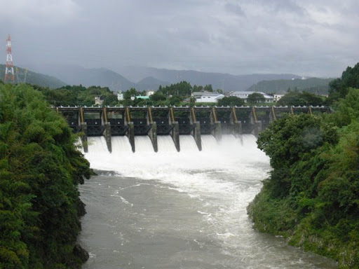
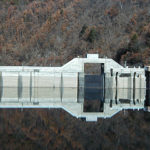
Release on July 27, 2009 (Part 1)
This is the scene of the discharge of water from the Kaneyama Dam on the way back from an event held in July 2009 during the "Friendship Season for Forests and Lakes". The discharge of water from the Maruyama Dam was also impressive, but the discharge from the Kaneyama Dam was also impressive.
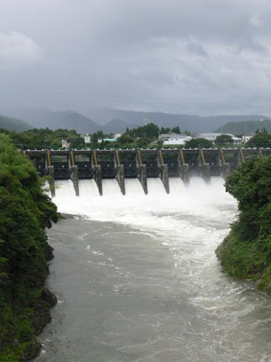
Release on July 27, 2009 (Part 2)
I also took a picture of it in portrait orientation, although it is not particularly meaningful. I think all the gates were discharged.
Kaneyama Dam Specifications
| Model | gravity-fed concrete dam |
| Bank height | 36.3m |
| Bank length | 205.7m |
| Dam volume | 105,000m3 |
| Watershed Area | 3452 km2 |
| Reservoir area | 102ha |
| Total storage capacity | 9392,000m3 |
| Effective water storage capacity | 3703,000m3 |
| Year Completed | 1943. |
Other facilities/observations
To get to the dam, head toward Yaotsu-cho from National Route 41 at the Moriyama 3-chome intersection and drive along Prefectural Route 350, and you will see a sign, so it should be easy to find.
| Parking lot | ○ |
| Toilet | × |
| Park | × |
| PR Exhibition Hall | × |
Accommodations that may be close to Kaneyama Dam
Comment