
Date of the interview: Sunday, October 6, 2013
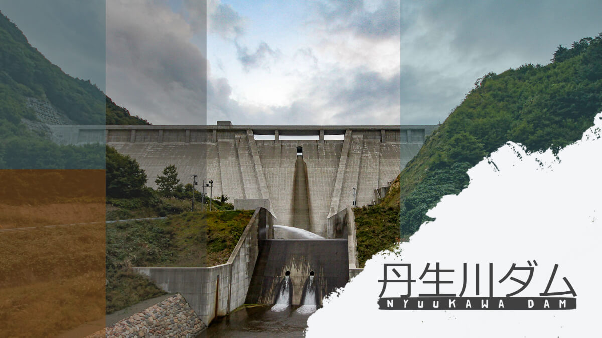
The final destination of our tour of the Kiso River dams to take dam photographs for the presentation and exhibition at DAM NIGHT in Nagoya was the Tanbogawa Dam. The Niu River Dam is a multi-purpose gravity concrete dam operated by the Gifu Prefectural Government.
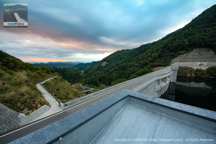
Looking upstream from the right bank
Arrival time was around 17:20. It was already late in the evening because we had passed through Misogawa Dam and Nagawa Watershed Dam. As you can see in the photo, the concrete was still fresh.
View of the top edge from the right bank
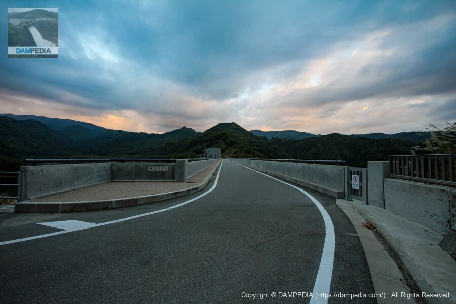
The top end of the dam is open to automobile traffic, but it is not possible to go around the dam lake as it is not connected to the surrounding area by a road.
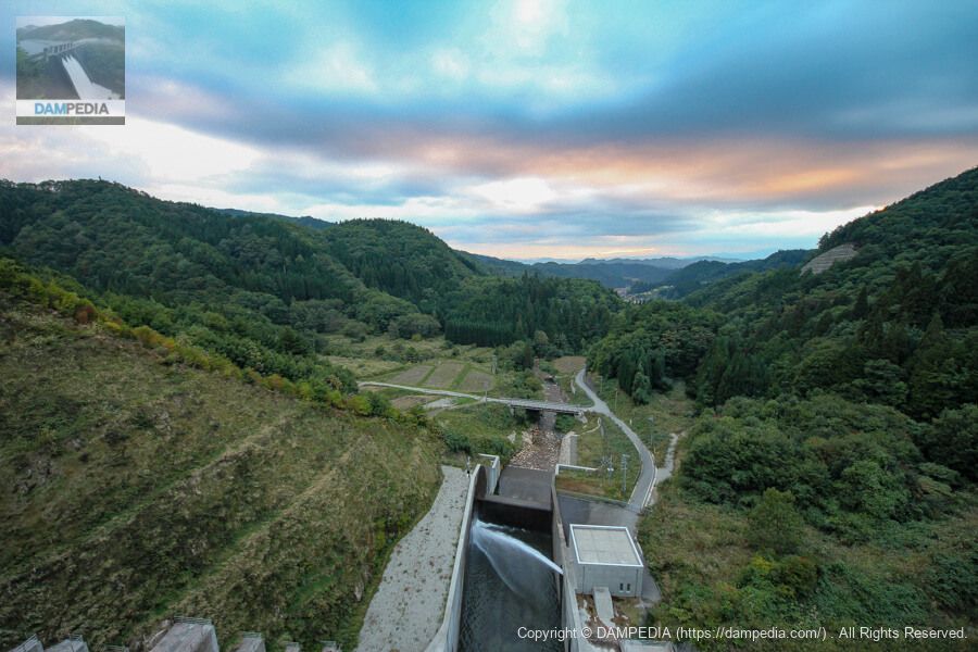
View of the flow guide and reduction works from the top edge
Both the crest and orifice of the Niu River Dam are free overflow type. The operation room of the discharge facility can be seen downstream of the dam, and water is being discharged from the valves for the maintenance of the river.
Incidentally, in 2016, three years after this visit, the Niu River Hydroelectric Power Plant, which utilizes the river's maintained flow, will be expanded by Chubu Electric Power Company further downstream of the discharge facility. The maximum output is 350 kW, so the atmosphere may be a little different now.
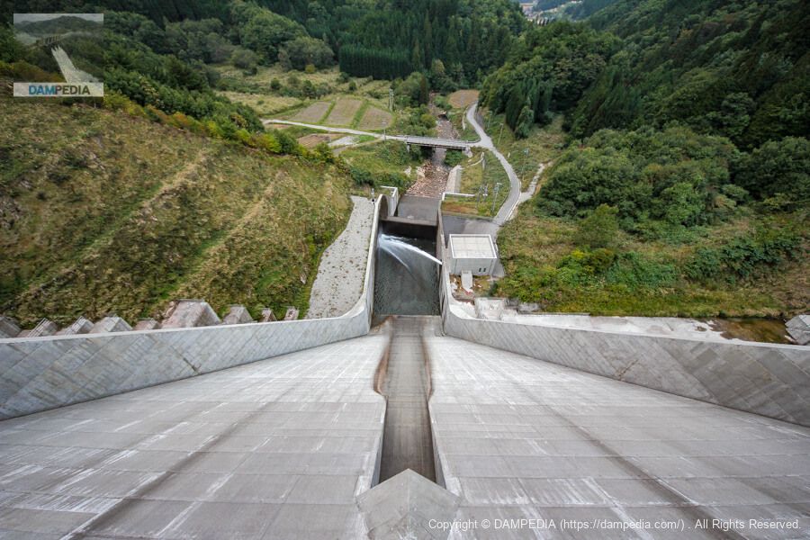
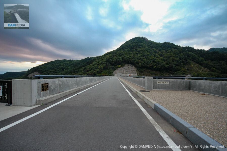
Looking further downstream from the top
The village seen in the distance is Oshikiji, a district that, like the dam area, is home to a small one-day hot spring facility called Aragusuku Onsen Ebisunoyu, which has many fans.
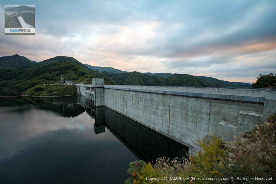
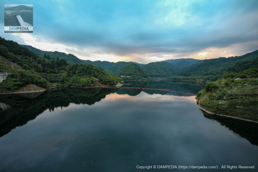
View of the dam lake from the top
It is a quiet dammed lake. The lake is named Gomiharako, after the submerged district.
Water intake and discharge system
This is a square design intake and discharge facility building. It appears to house a selective intake gate and a slide gate for lowering the water level. Water taken in here is discharged at the downstream discharge facility.
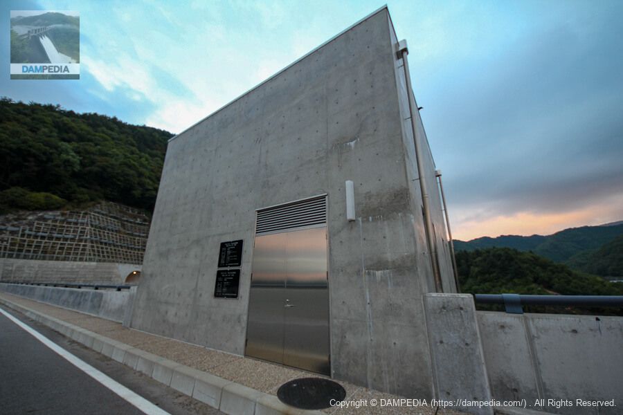
Niu River Dam water intake and discharge facility, selective intake gate
Completed in June 2012
| Business Name | Comprehensive Public River Development Project |
| manager | Gifu prefecture (Chuubu area) |
| name | Selective intake gate |
| structural form | Circular multistage cylinder gate |
| volume | 1 gate (4 steps) |
| straight-radius interval | 2.50m |
| Water intake range | 15.5m (EL857.00 to EL841.50) |
| watertight system | rubber-tight |
| open/close system | Wire rope winch (1M1D type) |
| Opening and closing speed | 0.3m/min |
| door weight | 16 ton |
| constructor | IHI/Marutoku Specific Construction Joint Venture |
Niu River Dam water intake and discharge facility, gate for lowering water level
Completed in June 2012
| Business Name | Comprehensive Public River Development Project |
| manager | Gifu prefecture (Chuubu area) |
| name | Water level lowering gate |
| structural form | Slide gate |
| volume | (one) gate |
| size of the mouthpiece | 1.20m dia. |
| watertight system | Metal watertight |
| door weight | 0.5 ton |
| constructor | IHI/Marutoku Specific Construction Joint Venture |
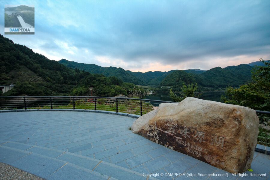
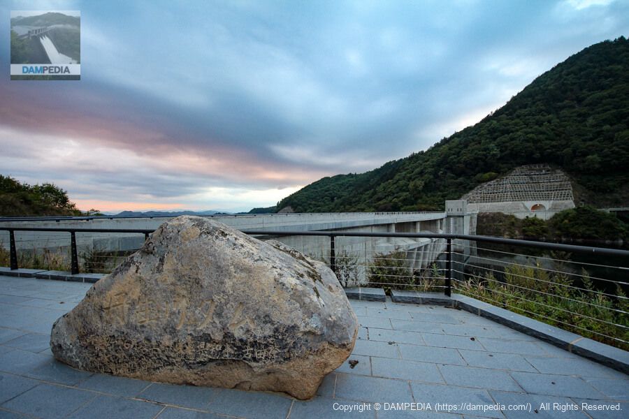
Lake Gomihara Stone Monument
We have come to the left bank. A stone monument with the name of the reservoir has been placed.
Niu River Dam Stone Monument
There is a stone monument with the name of the dam facing somewhat the other way. The name of the reservoir is engraved with the name of the mayor of Takayama, and the name of the dam is engraved with the name of the governor.
Looking upstream from the left bank
The Niu River Dam was awarded the 2013 Good Design Award for its harmony with the surrounding landscape, including not only the embankment but also the management office and surrounding plaza. It also received the JSCE Design Award 2014 Incentive Award.
On the upstream side of the dam, the gently curving mouth of the flood discharge and the lower columns that support it show the excellence of the design. Although it may not be necessary to go this far in designing a dam in general, it will be necessary in the future to design a dam that will be familiar to the public as a public infrastructure. (Personally, I also like rugged designs that place the highest priority on function.)

Front facade of the administration office
The design reveals the intention of the designers and architects that the control station must be symbolic next to the dike.
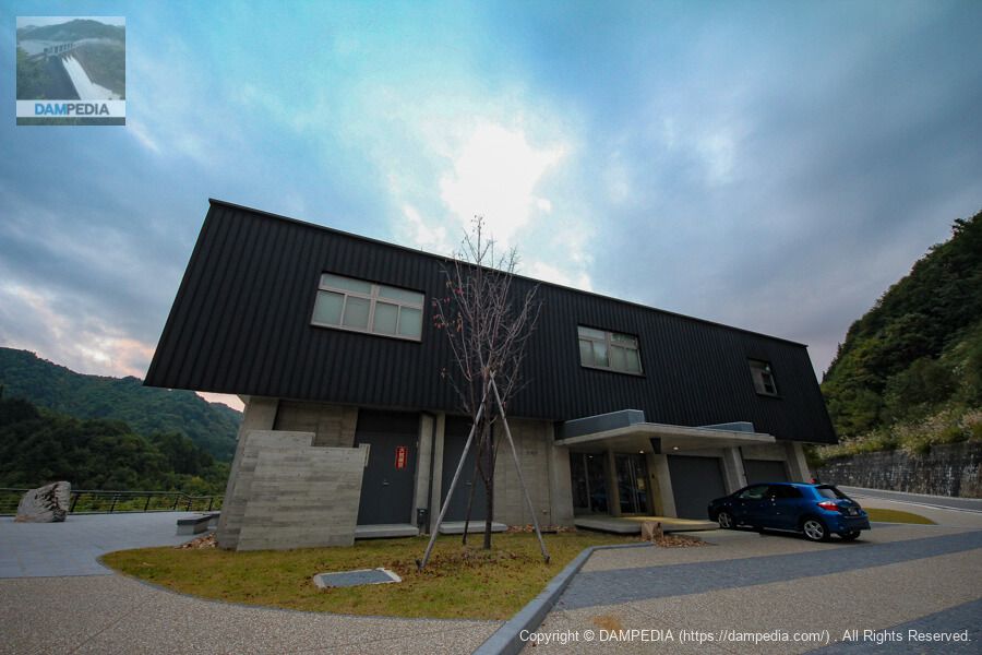
There was a car parked there that appeared to be on duty, but it was long past the time to get a dam card, so I gave up and decided to look around elsewhere.
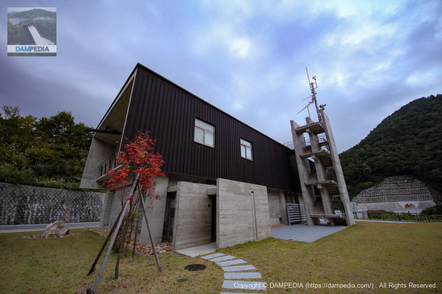
behind the control center
The back side of the control center is also not left out. Incidentally, the front of the building is a restroom, and the stairs in the back lead to the observation deck on the roof of the control center.
View of the levee from the stairs to the observatory on the roof of the control center
Personally, this is the point where I think it was not packed well.... I would like the stairs to be closer to the dam so that the building of the administration office is out of sight. (I know this is selfish 😁)
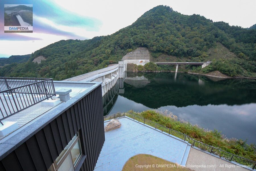
View of the levee from the rooftop observation deck
This is another point of personal disappointment. I am not sure if the fence could not be erected until the very last minute due to the structure of the control center, or if it was for safety reasons, but part of the control center is in view from here as well. The observation deck is a bit disappointing, but the fact that a boardwalk is provided on the left bank is a super high point. I will try to go there later.
View of the top edge from the left bank
The top rail section seems to have been kept as simple as possible. The budget may have been allocated for the design of the flood discharge and the maintenance of the surrounding area.
Downstream view of the levee from the walking trail on the left bank
The promenade looks as if it was built with the intention of allowing visitors to see the downstream side of the levee, but I believe it is fulfilling its role.
The most distinctive feature of the design on the downstream side of the embankment is the three-tiered flow-conducting wall on each side. The three-tiered flow-conducting wall, instead of a single, gradual-reduction type, gives the impression of being slightly softer than the deeply sculpted, crisp appearance of the previous design.
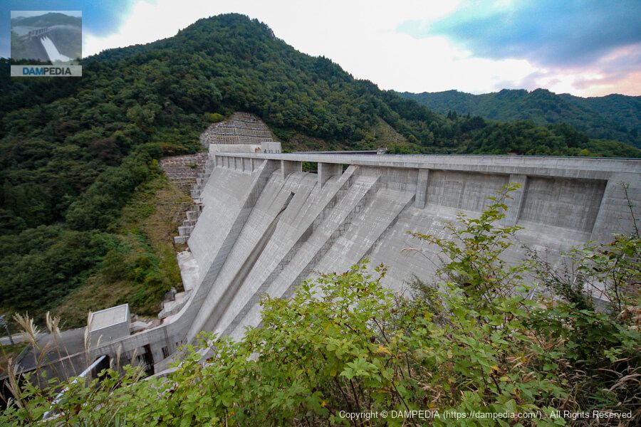
Downstream view of the levee from the bridge downstream
I moved downstream, even though it was already dark. While the function of the dam itself is simple, as is often the case with municipal dams, the design of the dam is so elaborate that it is truly fascinating to watch.
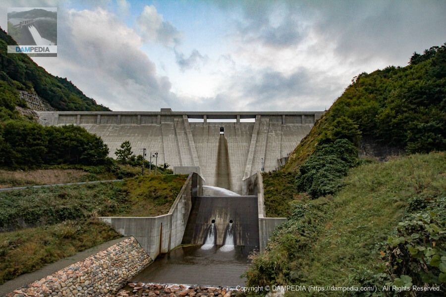
View of the downstream face of the levee from the fence of the discharge facility downstream of the right bank
I would love to see that distinctive conduction wall up close and personal from directly below.

The dam was awarded the Good Design Award 2013 and the JSCE Design Award 2014 Incentive Award, and with its integrated landscape design of the embankment, management office, and plaza, it will surely be loved by everyone for the next 100 years.
Niu River Dam Specifications
| Location | Orishikiji, Niuukawa-cho, Takayama City, Gifu Prefecture, Japan |
| River Name | Jinzu River system Aragusuku River |
| Objective | F (flood control, agricultural disaster prevention) N (unspecified water, water for river maintenance) W(Water for water supply) P(Power generation) |
| Model | G(gravity-fed concrete dam) |
| Bank height | 69.5m |
| Bank length | 227m |
| Dam volume | 231,000 m3 |
| Watershed Area | 23km2 |
| Reservoir area | 32 ha |
| Total storage capacity | 6,200,000 m3 |
| Effective water storage capacity | 5,300,000 m3 |
| Dam operator | Gifu prefecture (Chuubu area) |
| Main body constructor | Obayashi Corporation, Sumitomo Mitsui Construction Co. |
| Year of launch | 1975. |
| Year Completed | 2012 |
| Name of Dam Lake | Lake Gomihara |
Other facilities/observations
| Parking lot | ○ |
| Toilet | ○ |
| Park | ○ |
| PR Exhibition Hall | × |
| Fishing | ○? |

Comment