
Date of interview: Saturday, July 06, 2013
On this day, my family and I went for a drive to Anno Dam, and then visited this Kimigano Dam. In fact, the Kimigano Dam is one of the dams that I have not been able to visit despite the fact that it is relatively close by.
On the way from Anno Dam to Kimigano Dam,river in which worshippers wash their hands (and rinse their mouth) prior to entering a shrineand the JR Meimatsu Line run side by side on the prefectural road. The JR Meimatsu Line is shut down every time there is a typhoon or heavy rain, and the Unodate River has repeatedly overflowed due to flooding. I wanted to visit this dam because the lower reaches of the Kumode River are protected by the Kimigano Dam.
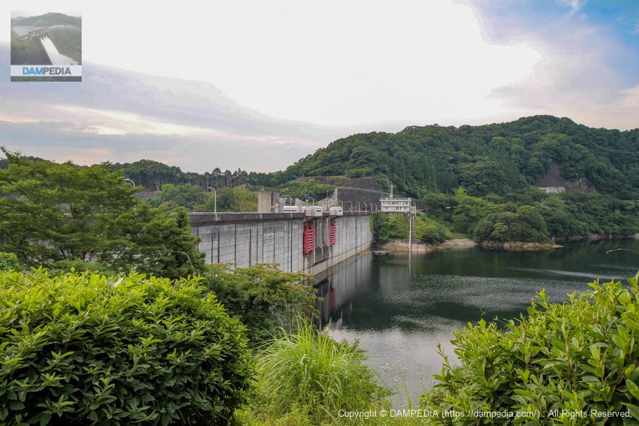
View of the top edge from the right bank
The levee can be viewed from the downstream side, but we came to the top end first.

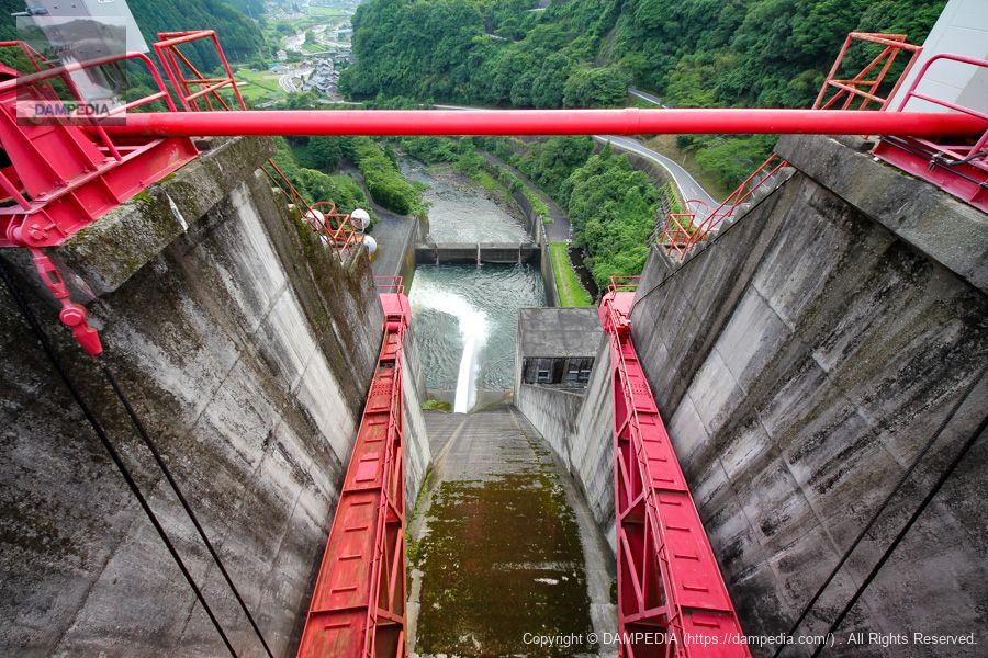
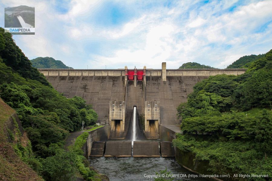
View of the flood discharge from the top
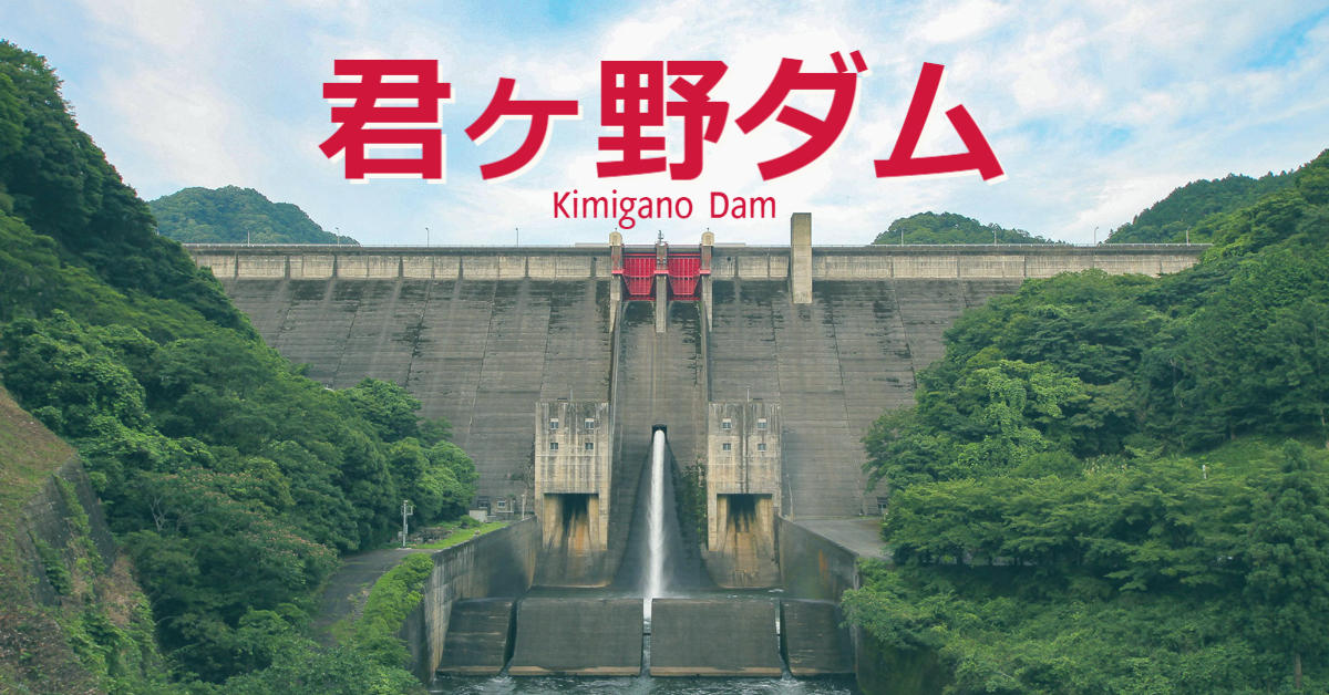
Crest is equipped with two radial gates. The size is 9.77 m high and 8.00 m wide; incidentally, they were described locally as tenter gates, not radial gates. If you look directly down, you can see that the water is discharged through a Φ900mm hollow jet valve.
Downstream view of the levee from the left bank
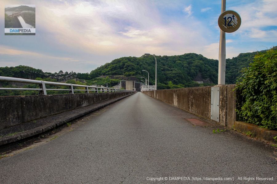
We came to the left bank on foot. The length of the top of the bank is 323 meters, which is a moderate distance.
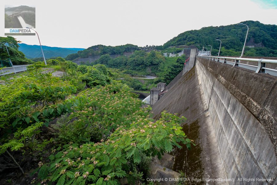
We moved a little downstream and looked at the downstream face of the dike...
Unfortunately, the grass was overgrown and the view was not very good.
View of the upstream face of the embankment from the left bank
Now we move upstream to look at the upstream face of the embankment. The red gate on the upstream side of the embankment is a coaster gate used for inspection of the orifice gate.
View of the top edge from the left bank
The top end is open to automobile traffic because there is a Tsu City-operated lodging facility called Lakeside Kimigano on the left bank.
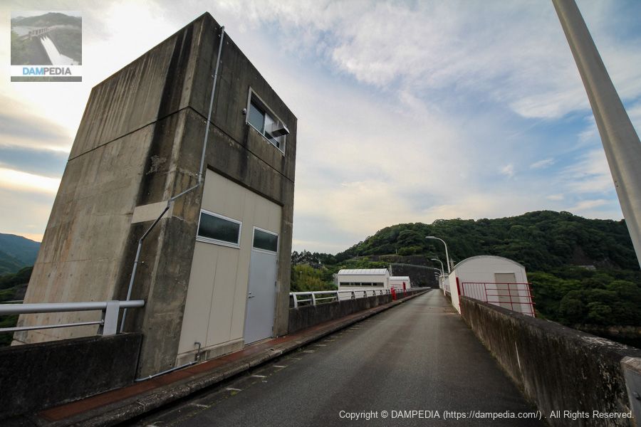
Elevator tower (front)
The gate operation room, unified by the vaulted roof, can be seen behind the elevator tower.
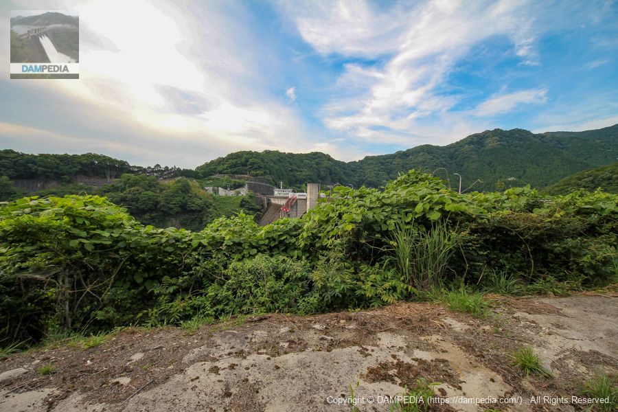
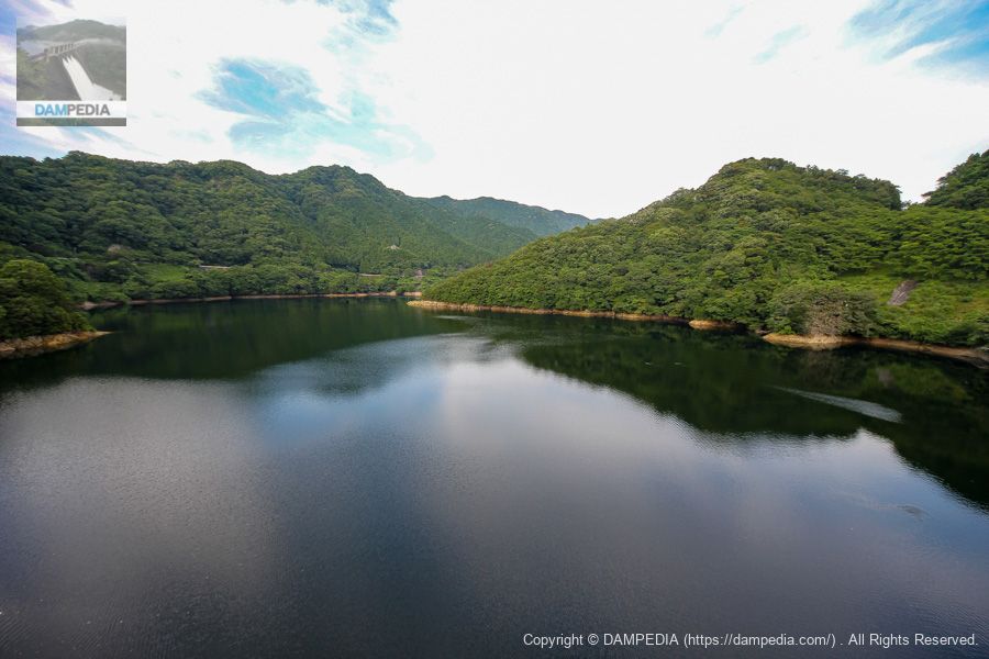
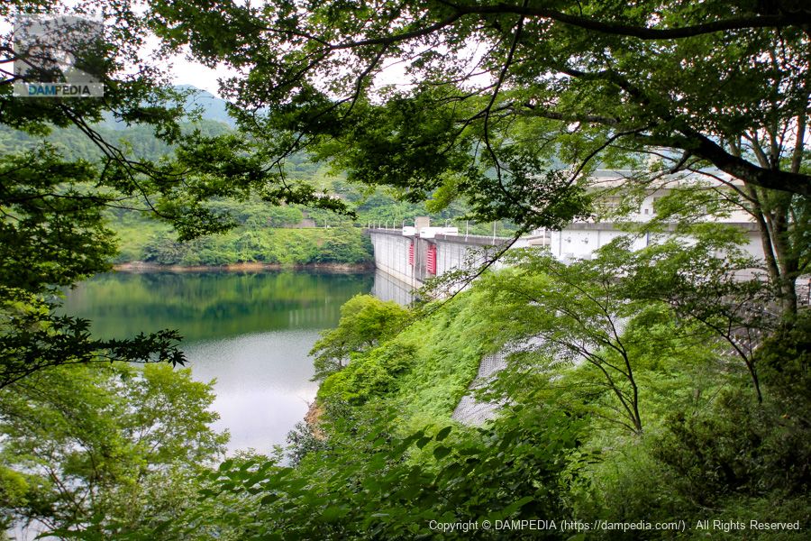
View of the dam lake from the top
A tributary of the Unde River,river in which worshippers can swim with the tideThe lake was created by damming up the Kumogano Dam. By the way, the names of both the Kumoide River and the Hattemata River are difficult to read.
Kimigano Dam Management Office
The management office retains a Showa-era atmosphere. I received a dam card here.

right-of-way
We continue our walk on the right bank. We looked to see if there was an observation deck on the right bank, but unfortunately it was blocked by a gate. There also seems to be a "Kimigano Dam Observation Plaza" at Lakeside Kimigano on the left bank, but we did not go there because we judged from a distance that the view was not good. I wish they would somehow budget to build an observation deck.

View of the upstream face of the embankment from the right bank
We looked for a point where we could see the upstream face of the embankment, but this was the limit at the dam site. If we go further upstream, we may be able to find a point from which we can see it.
View of the downstream face of the levee from the footpath downstream of the right bank
The season is summer and the grass and trees are overgrown, but the downstream side of the bank on the right bank is clearly visible.
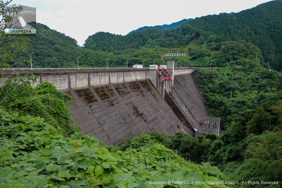
View of the downstream face of the embankment from the hairpin curve on the downstream right bank
We have moved to the downstream side. It is nice to see the downstream face of the levee right in front of us. The box-shaped structures on the downstream side of the embankment, on both the left and right banks, are orifice gates for the permanent flood discharge. For some reason, it was described as a conduit gate on the local signboard. The gate structure is a high-pressure radial gate, 3.20 m high by 3.20 m wide, with one gate each on the left and right banks.

View of the downstream face of the dike from downstream
It is also nice to see the downstream face of the dike directly in front of you. The red crest gate is very impressive. Also, the area from the crest gate to the sub-dam through the orifice gate protruding downstream from the crest gate is symmetrical, and perhaps that is why the face looks more neat. The Ichiko Dam in Hyogo Prefecture has a similar design, but this structure looks cooler.
The Kimigano Dam was constructed in the wake of Typhoon Isewan, but the lower reaches of the Unde River have suffered from flood damage many times even after the dam was completed. Of course, the flooding has been reduced by the Kimigano Dam to prevent further damage, but there is no more room for a dam upstream on the Undo River.
Therefore, the only way to prevent flooding is to improve the levees and river channel in the downstream area, or to develop a flood control area. In this sense, the Kimigano Dam is the last stronghold of flood control for the Undo River.
In addition to flood control, it also supplies water to the 3,000 ha of agricultural land downstream of the dam as water for shortages, to Tsu City and Matsusaka City as water supply, and to the Nakasei Industrial Zone as industrial water.
The Kimigano Dam will continue to protect the people of Tsu City and Matsusaka City in Mie Prefecture. I would like to continue to watch over the Kimigano Dam.
Kimigano Dam Specifications
| Location | Hachinemata, Misugi-cho, Tsu City, Mie Prefecture |
| River Name | Hachimata River, Unde River system |
| Objective | F (flood control, agricultural disaster prevention) N (unspecified water, water for river maintenance) W(Water for water supply) I (industrial water) |
| Model | G(gravity-fed concrete dam) |
| Bank height | 73m |
| Bank length | 323m |
| Dam volume | 331,000 m3 |
| Watershed Area | 80km2 |
| Reservoir area | 80 ha |
| Total storage capacity | 23,300,000 m3 |
| Effective water storage capacity | 19,700,000 m3 |
| Dam operator | Mie prefecture (Kinki area) |
| Main body constructor | Kumagai Gumi |
| Year of launch | 1964 |
| Year Completed | 1971 |
| Name of Dam Lake | - |
Other facilities/observations
| Parking lot | ○ |
| Toilet | ○ |
| Park | ○ |
| PR Exhibition Hall | × |
| Fishing | ○○ (excluding no-take zones) |

Comment