
Date of interview: Saturday, November 9, 2013
On the way to Kawakami Dam before starting construction of the main body, I visited this Madori Dam after Takeya Pond and Teratani Pond. It is a bit difficult to read. Since the Madori Dam is also an earth dam, it was the third earth dam we visited on that day.
View of the upstream face of the embankment
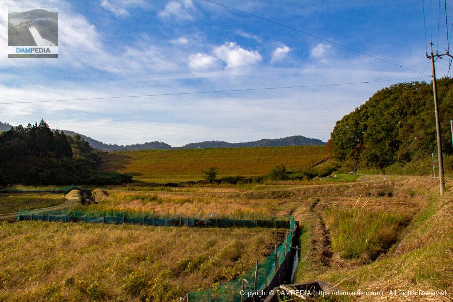
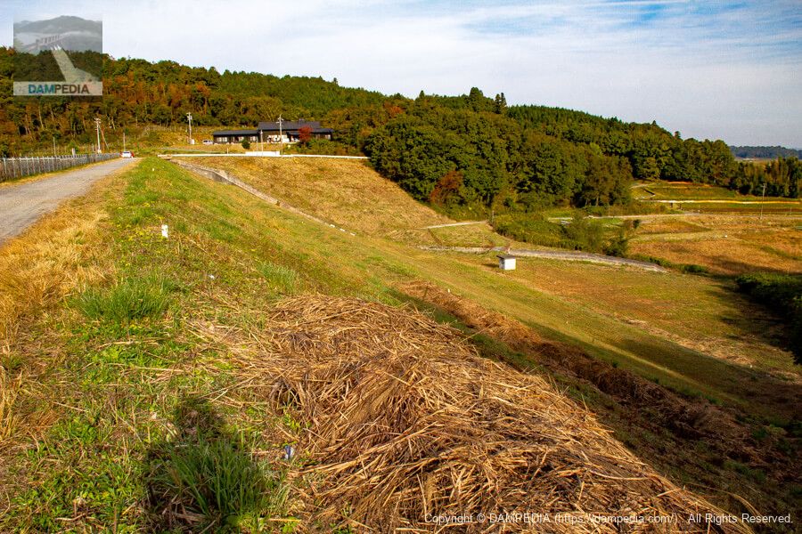
The earth dam was nothing special, except that it was larger than the two we had visited earlier in the day, but it was nicely mowed.
View of the conduit from the bridge downstream
There is a path on the right bank that leads to just below the downstream face of the embankment, and a bridge provides a good position to view the embankment.
Downstream view of the levee from the bridge downstream
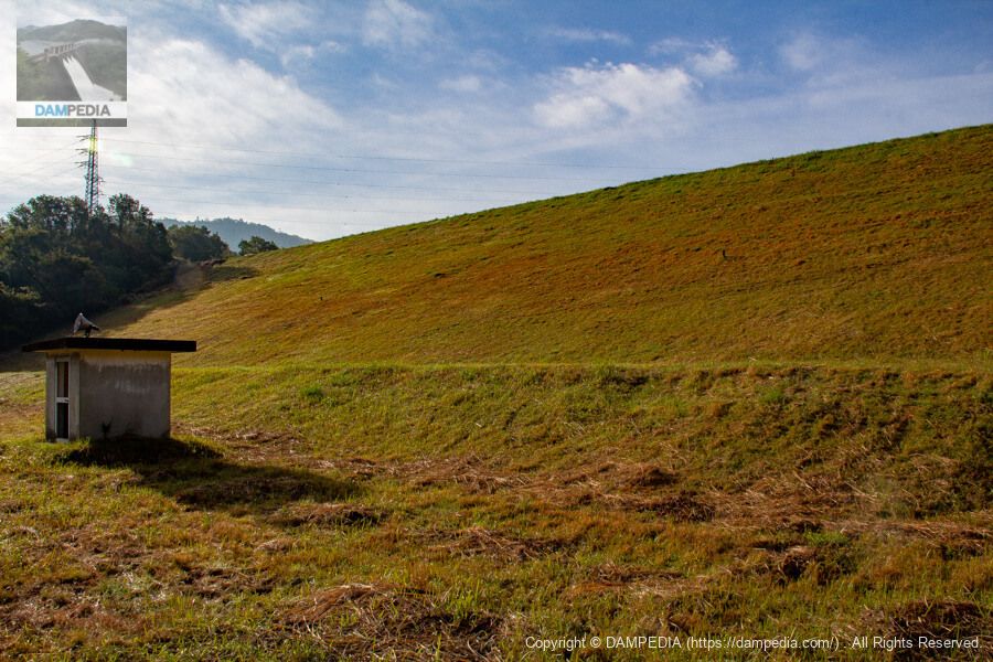
The embankment is quite clean, as the grass seems to have been mowed recently. The concrete building downstream is a mystery, but is it for broadcasting something as there is a loudspeaker...? (It does not seem to be in use now.)
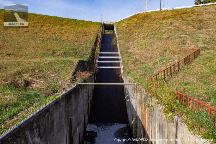
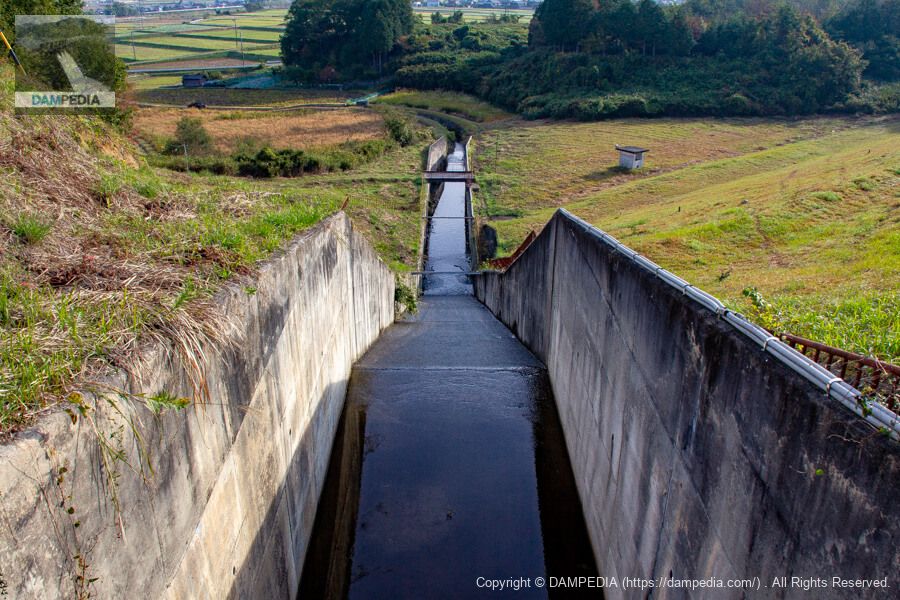
View of the flood discharge from the bridge at the top
The flood discharge is a certain type of side channel system with a fill dam. On this day, there was only a small amount of overflow.

View of the reservoir from the left bank over the flood discharge
According to the official website of the Mie Prefecture Tourism Federation, the reservoir of the Madori Dam is a popular spot for bird watching, as many ducks and other waterfowl fly in during the fall and winter. Also, although there were people enjoying fishing that day, fishing and boating are prohibited at the Madori Dam.

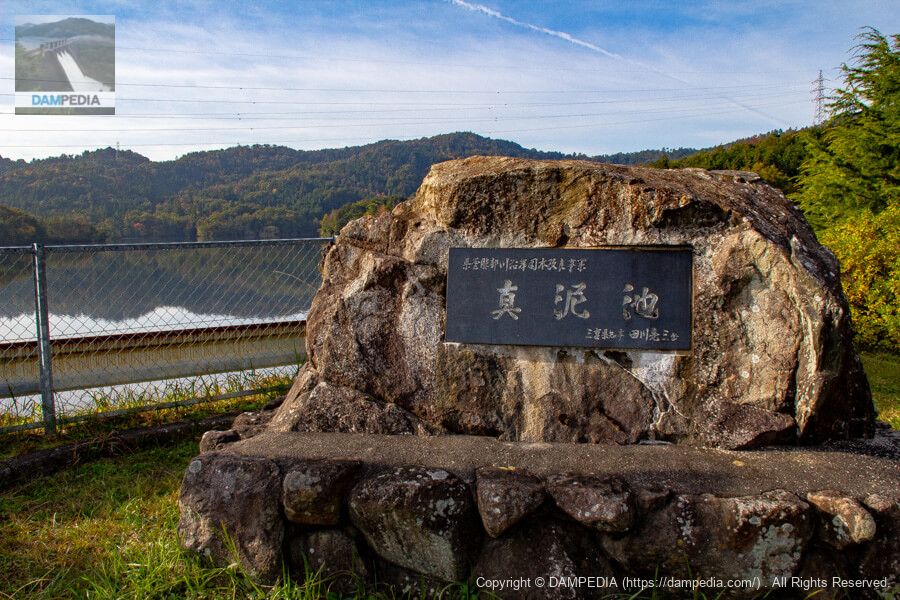
Mamuro-ike Stone Monument
On the left bank, there is a stone monument of Madoro Pond. As indicated on the monument, Madoro Dam was constructed as part of the prefectural Hattori River Coastal Water Improvement Project.
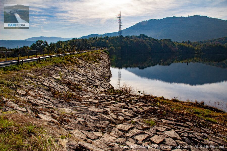
Looking upstream from the left bank
The upstream dike was constructed of coarse stones.
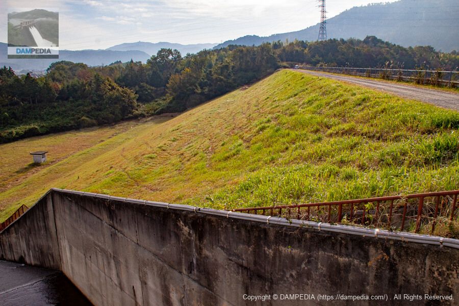
Looking downstream from the bridge at the top
The name of the river is Hino River. It joins the Hattori River downstream, and the Hattori River joins the Tsuge River, which soon joins the Kizu River.
Looking downstream from the left bank
According to the dam handbook, the embankment height is 26.2m and the crest length is 180m. Incidentally, the Mie Prefecture Reservoir Database, to which we often refer, lists the embankment height as 24.5m.
Looking downstream from the right bank
We have reached the right bank. The rice paddies are spreading downstream, giving it the appearance of an earth dam. The building on the left bank is a group home called "Oyamada Ikoi-no-Sato. It is a little bit nice that it is located so close to the dam.
View of the reservoir from the top
The surface of the lake is calm. It may be a perfect watering hole for birds to rest their wings. On the other side of the lake, you can see a house or a villa. There seem to be several other houses built on the shore of the lake, and I am longing for a house by the lake.
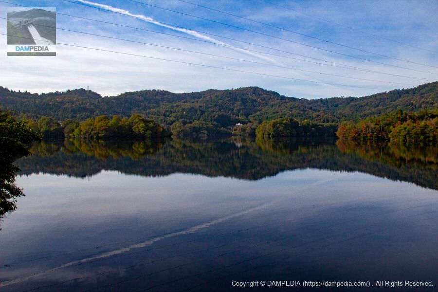
The embankment is an ordinary earth dam, but it is a true mud dam that provides a resting place for citizens and birds.
Mamoru Dam Specifications
* The markings are taken from the Mie Prefecture Reservoir Database.
| Location | 2577 Aza Takinotani, Mado, Iga City, Mie Prefecture * |
| River Name | Yodo River System Hino River |
| Objective | A (irrigation water) |
| Model | E(earth dam) |
| Bank height | 26.2m (24.5m *) |
| Bank length | 180m |
| Dam volume | 127,000 m3 |
| Watershed Area | - km2 |
| Reservoir area | 20 ha |
| Total storage capacity | 1,291,000 m3 |
| Effective water storage capacity | 1,291,000 m3 |
| Dam operator | Mie prefecture (Kinki area) |
| Main body constructor | Tobishima Construction |
| Year of launch | 1953. |
| Year Completed | 1970 |
| Name of Dam Lake | muddy pond |
Other facilities/observations
There is no parking, but there is space to park at the top or shoulder of the road. Also, as mentioned above, boating and fishing are prohibited.
| Parking lot | △ |
| Toilet | × |
| Park | × |
| PR Exhibition Hall | × |
| Fishing | × |

Comment