

Location: Shimoizumi, Nakakawane-cho, Haibara-gun, Shizuoka Prefecture
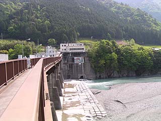
View of the top edge from the left bank
May 2004 "Oigawa River Systemdam tourThe third dam is the Shiogo Dam.
Strictly speaking, this is not a "dam" but a "dam" because the embankment is less than 15 meters high.weirIt is a "dam". However, since it is officially called "Shiogo Dam" both on maps and in public, we will call it by that name on this site as well.
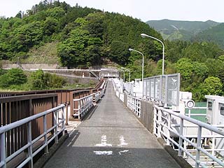
Although the top edge is narrow, it is still accessible to vehicles. Vehicles entering from both the left bank and the right bank must check to make sure there are no vehicles coming from the opposite bank before entering the top edge.
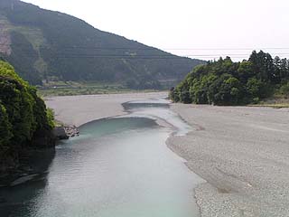
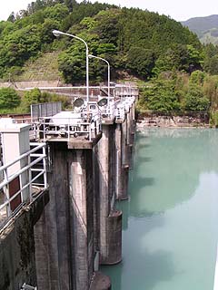
View downstream from the top
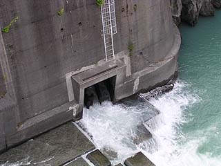
Shiogo Dam completely dams the main stream of the Oigawa River, and water taken from this dam is carried to the Sasama River Dam through a conduit tunnel.
In this way, it's built like a washing weir.momentum reducer(?) It is.
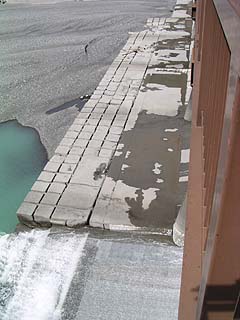
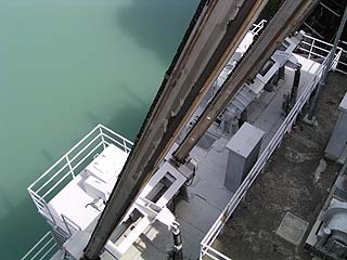
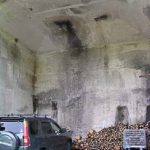
View of the outlet from the gap between the sidewalk and the roadway
The roller gate for water diversion was slightly open. The water is flowing out quite briskly.
This stream is very important to the local residents. The Oi River, dammed by this dam, had become a desert downstream, and the residents rose up at the time of the renewal of the water rights in April 1988 to restore the water of the Oi River as it once was, and obtained a discharge of 5 tons per second.
Please take a close look at that precious water.
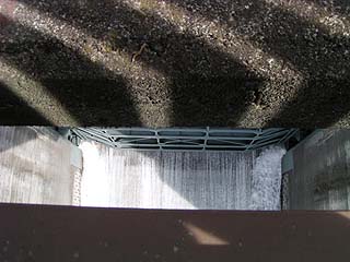
Fish passage outlet View of
This is believed to be a tunnel-type fish passage.
View downstream from the top
Although not visible in this photo, there is a suspension bridge downstream. I wanted to see the dike from here, but gave up due to time constraints.
View of the dam lake from the top
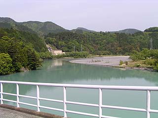
There is a campground on this right. There are many places to play outdoors in this neighborhood.
View of the downstream side of the levee and the control center from the top end (near the right bank)
Mystery Gate
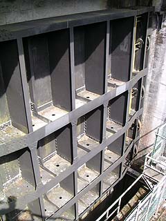
There is a gate on the right bank, although I don't know what it is for. Anyway, it is very large. Is it an intake for power generation? If so, it is very simple.
View of the levee from the downstream side of the right bank
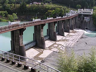
There are eight roller gates. The gates are so small that the water seems to overflow as it is.
Mysterious machine on the left bank
Perhaps this is also a gate for water intake, but there was a big "bee" and I couldn't get a closer look.... Phew.
View of the embankment from the left bank (dam lake side)
dam characteristics
| da mu | Model | gravity-fed concrete dam |
|---|---|---|
| Objective | generation (e.g. power) | |
| Bank height | 3.2m | |
| Bank length | 146.0m | |
| River Name | Oigawa River System Oigawa River | |
| Year of launch | 1958 | |
| Year Completed | 1960. | |
| Access to D@M | Get off at Sagara Makinohara IC of Tomei Expressway The rest of the way is National Route 473 heading north toward Kawane Town. After entering Kawane Town and eating taiyaki at Ieyama, take Prefectural Route 63. Furthermore, it heals fatigue at Kawane Onsen, goes north, passes through a tunnel near the Sasamagawa Dam, turns left, and goes to Prefectural Road No. 77. After passing Shiogo Station on the Oigawa Railway, pass under the suspension bridge and turn left. | |
Other facilities/observations
| Parking lot | × | Shiogo Dam is the lowest dam on the main stream of the Oigawa River. This may be why it is small in scale, but still there are problems related to the dam. This dam made us realize that dams, no matter how big or small, have some problems. |
|---|---|---|
| Toilet | × | |
| Park | × | |
| PR Exhibition Hall | × |
Comment