
Location: Kawane Honmachi, Haibara-gun, Shizuoka Prefecture
Date of interview: Friday, November 08, 2010
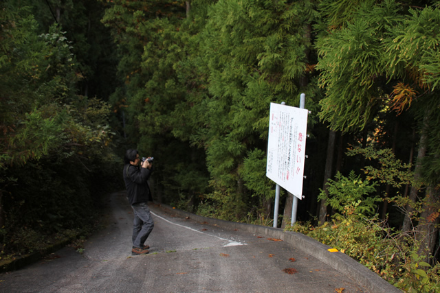
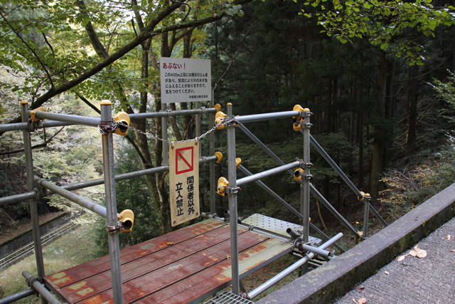
Mr. Miyajima photographing the sign warning of water discharge at the entrance of the passage to the Yokosawa River No. 2 Dam.
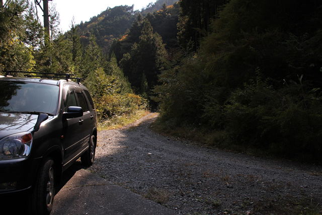
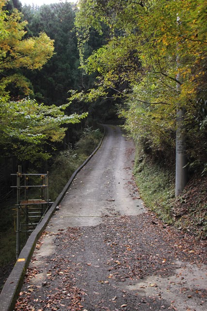
We started from the Ota River Dam, met up with Mr. and Mrs. Miyajima at Senkashira Station, and came to the Yokosawa River No. 2 Dam. However, we had received advance information that the road was quite rough, so this was where my CR-V, with its high ride height, came into play.
To reach this point, we had to enter the forest road from Prefectural Route 77. Although we entered the road from what looked like a quarry, only the entrance to the quarry was quite steep. It looked as if a normal vehicle might slide on its stomach.
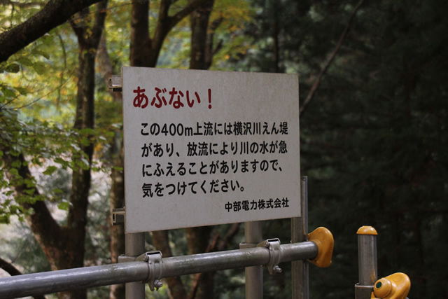
Now, you may pass by the Yokosawa River No. 2 Dam if you continue on the forest road, but you will see this concrete slope and a sign warning of the discharge of water. We will park our car beside it for a little while.
Looking back at the path we have taken
It is mostly dirt. Sedan-type vehicles can still be used in this area, but there are deep ruts along the way, so you may want to refrain from using a vehicle with a low vehicle height.
Mysterious caution sign
Get out of the car and walk down the somewhat steep slope. A compact discharge warning sign is posted slightly before you descend to the flat road.
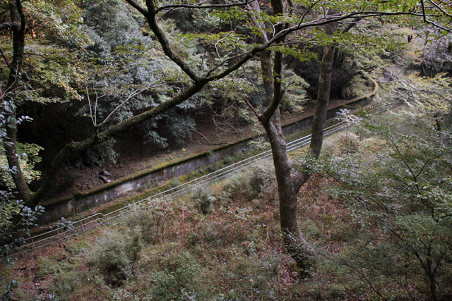
Stairway down to the canal
There is a channel on the downstream side, and it seems that the levee can be viewed from the downstream side, but unfortunately, it was off-limits.
View of the waterway
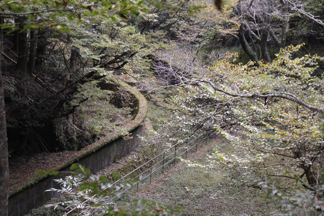
View of the waterway from a distance.
View of the end of the canal
Beyond that, it seems to turn left. Still, I'd like to go down here...
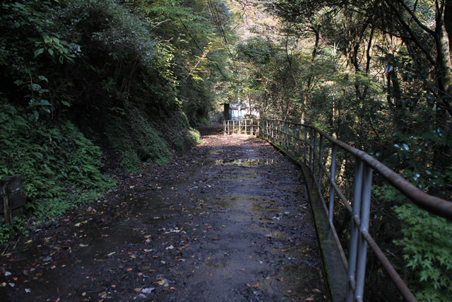
The road to the dam...
The road surface was quite wet, and I wondered if sneakers would be enough. It is getting to the point where sneakers may not be enough. Boots might be better during or after stormy weather.
Looking back at the slopes we've walked up.
It is hard to tell from the picture, but it is quite a steep slope. It is a slope that might be enduring for those who are not athletic when they return home.
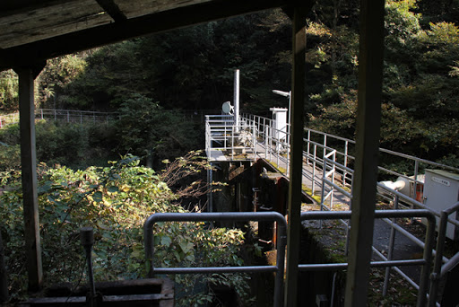
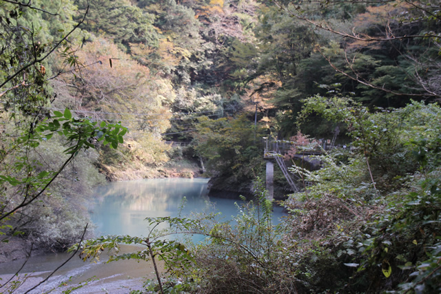
View of the levee downstream from the right bank
Come on! We are at the embankment! But I can't see it because of overgrown trees and grass........
And in the photo, it's dark in the shadows... orz.
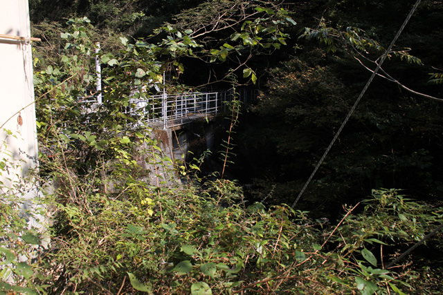
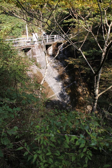
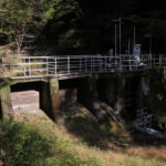
The Yokosawagawa No. 2 Dam is a dedicated power generation dam owned by Chubu Electric Power Company and is very compact, with an embankment height of 18.5m. The crest length is only 39.8m. Moreover, this dam was built before World War II and is supposed to be old-fashioned, but this photo does not convey the old-fashionedness of the dam. The photographer is required to reflect on this photo.
View of the top edge from the right bank
This is a top end typical of a small levee. It is narrow and small.
View of the embankment on the lake side from the right bank
I went a little closer to the lake side of the dam.

Water Use Signs
Water use sign. Maximum water withdrawal is 72.35 m3/s.

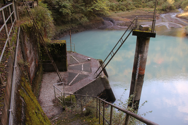
View of the water intake from the right bank
Water taken from the Oigawa and Sunmata River dams is collected at this Yokosawagawa No. 2 Dam and sent to the Oigawa Power Plant.
Water from streams flowing into the dam lake
Looking upstream, the water from the stream flowed into a milky dammed lake.
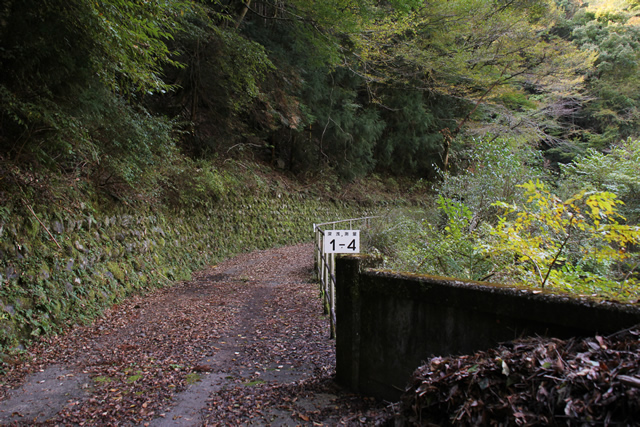
Road leading to the first weir of the Yokosawa River
Ahead is the first weir of the Yokosawa River. Let's go there later.
View of the dust collector
A dust remover to prevent trash from accumulating at the water intake. When it comes to trash, there does not seem to be any plastic bottles or other trash that people produce, as is the case with the dam downstream.

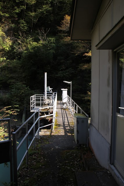
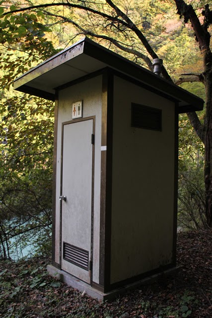
Toilets appear out of nowhere, and they are unisex
There is a toilet by the dam lake.... It seems to be unisex. I never opened the door.... I thought it might be used by Chubu Electric Power Company during their inspection tour, but it might be used by climbers unexpectedly.
One of the streams joining the Yokosawa River
Here, too, is a stream that joins the Yokosawa River. Oh? There is something in the back...

Masonry erosion control dam
Oops. There was an austere masonry erosion control dam.
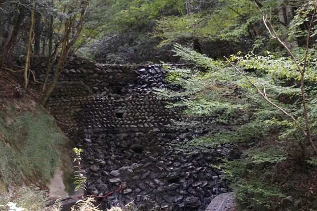
Another masonry erosion control dam
There was another old-fashioned masonry erosion control dam on another stream.

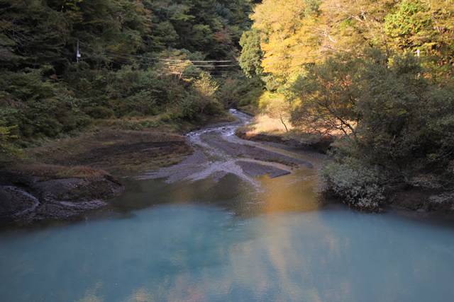
View of the dam lake from upstream
Looking at the dam lake from upstream. I thought I could see the embankment on the lake side of the dam, but unfortunately I could not.
View of the levee downstream from the right bank
I went to the Yokosawa River first weir and went back and looked at the Yokosawa River second dam again from another location and managed to take a picture of the old-fashioned embankment. I would like to see it from below if possible, but it is off-limits.
dam characteristics
| River Name | Oigawa River System Yokosawa River |
| Objective | generation (e.g. power) |
| Model | gravity-fed concrete dam |
| Bank height | 18.5m |
| Bank length | 39.8m |
| Dam volume | 3,000m3 |
| Watershed Area | 9.3 km2 |
| Reservoir area | 1 ha |
| Total storage capacity | 72,000m3 |
| Effective water storage capacity | 61,000m3 |
| Dam operator | Chubu Electric Power Co. |
| Main body constructor | set of staggered shelves |
| Year of launch | 1934. |
| Year Completed | 1936. |
Other facilities/observations
and i don't know if you can or can't use the bathroom!
| Parking lot | × |
| Toilet | ○ |
| Park | × |
| PR Exhibition Hall | × |
| Fishing | ? |
Lodging facilities that may be close to Yokosawa River No. 2 Dam
Comment