
Date of interview: Saturday, August 03, 2013
The Kumanogawa Dam came after visiting the Arimine Dam, Sukenobu Dam, Oguchigawa Dam, and Omata Dam. Looking at the dam name alone, it looks like it might be in Mie or Wakayama Prefecture, but it is located in Toyama Prefecture. Also, although we had seen Hokuriku Electric Power Co. dams all day, the Kumanogawa Dam is a Toyama Prefecture-operated dam. Furthermore, although it looks like it is on the Joganji River system because of its proximity to the Joganji River, it is on the Jinzu River system because the Kumanogawa River joins the Jinzu River.
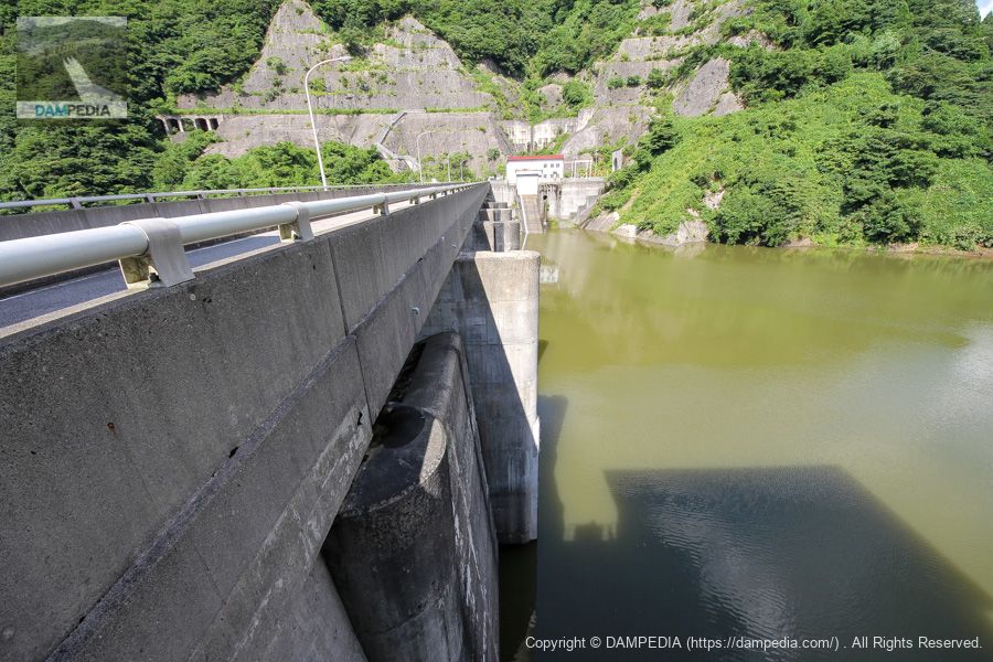
Looking downstream from the left bank
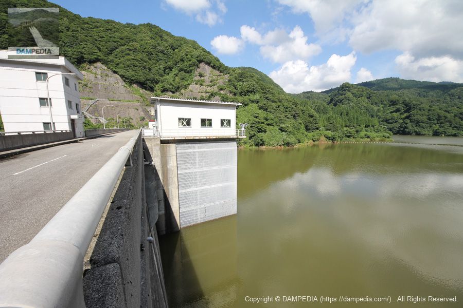
There is no road that leads directly to the downstream face of the embankment, so you will naturally arrive at the left bank of the dam. There are a number of natural overflow type emergency flood spouts, which are common in municipal dams, but the most distinctive feature of this dam is the three orifices with deflectors in the center, which are used as a normal flood discharge. Like Crest, it is a free overflow type, but the combination of three orifices is not often seen.
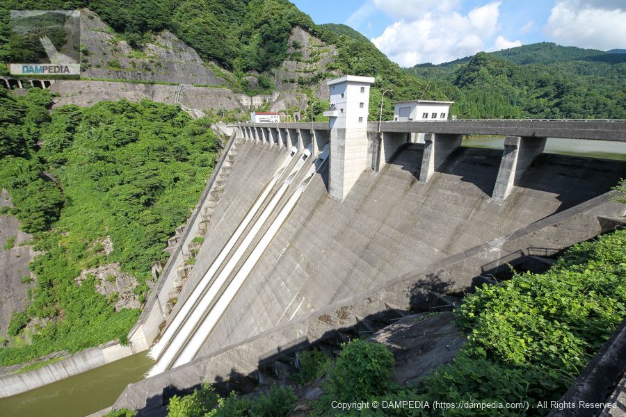
orifice
What is even more distinctive is that only the perimeters of these three orifices are white. In fact, this is a trace of renovation work, which lowered the orifices by 2.9 m from their original positions.

In fact, the Kurokawa Dam, as it is called, was to be constructed on the Kurokawa River, located to the west of the Kumano River Dam, for the purpose of flood control and unspecified water use. However, it turned out that there were no good quality rough stones in the vicinity of the planned construction site, and the project cost would skyrocket due to higher transportation costs. Moreover, the Kumanogawa Dam was also intended for use as a water supply system, but it was never used. Besides, the time was the early 2000s, when the country was shaken by the declaration to abandon the dam.
Under such circumstances, it was inevitable that the plan to build a new dam in the next valley over the ridge would be abandoned.
However, since the effectiveness of the Kumano River Dam in controlling floods was recognized, the flood control capacity of the Kurokawa Dam was transferred to the water supply capacity of the Kumano River Dam. The orifice height was lowered by 2.9 m during the renovation work conducted from 2008 to 2013 to further enhance the flood control function.
This work not only lowered the bed elevation, but also improved the flood discharge itself from 4.5 m wide by 3.0 m high to 3.35 m wide by 3.3 m high.
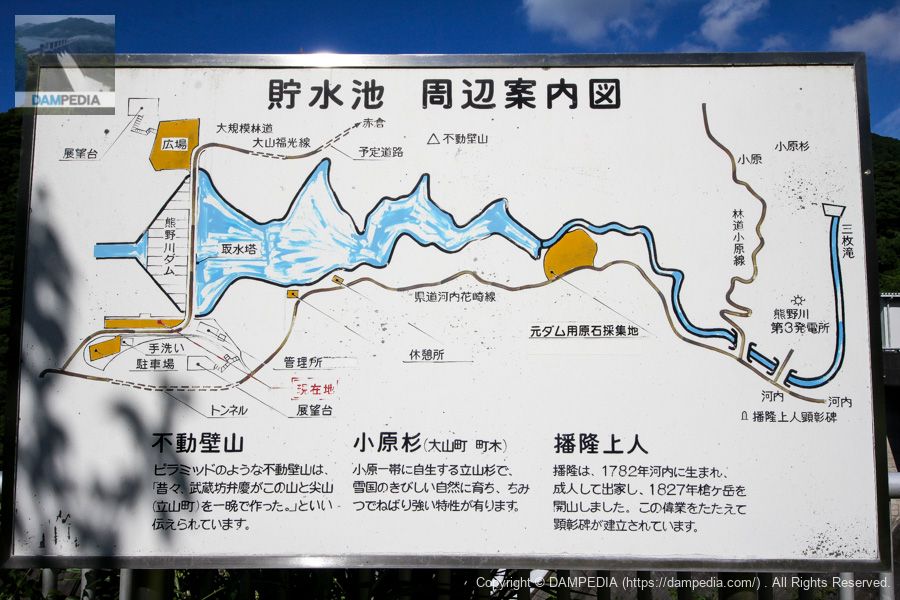
Reservoir area guide map
This is a guide map of the area around the dam reservoir. Upstream is the Kumanogawa No. 3 Power Plant, and there seems to be a monument in honor of the monk who founded Mt. Also, although I was not paying attention when the photo was taken, there seemed to be observatories on both the left and right banks of the Kumanogawa Dam (I am not sure of my memory, but it seems that I am not up to the top). (I am not sure of my memory, but the fact that I did not climb up there may have meant that it was off-limits at that time.)
Plaza on the left bank
The left bank is more of a plaza than a park, but the original stones used as aggregate for the Kumanogawa Dam are placed like a stone monument.

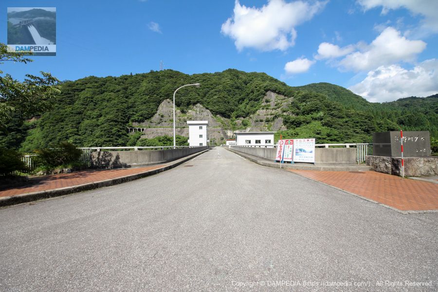
View of the top edge from the left bank
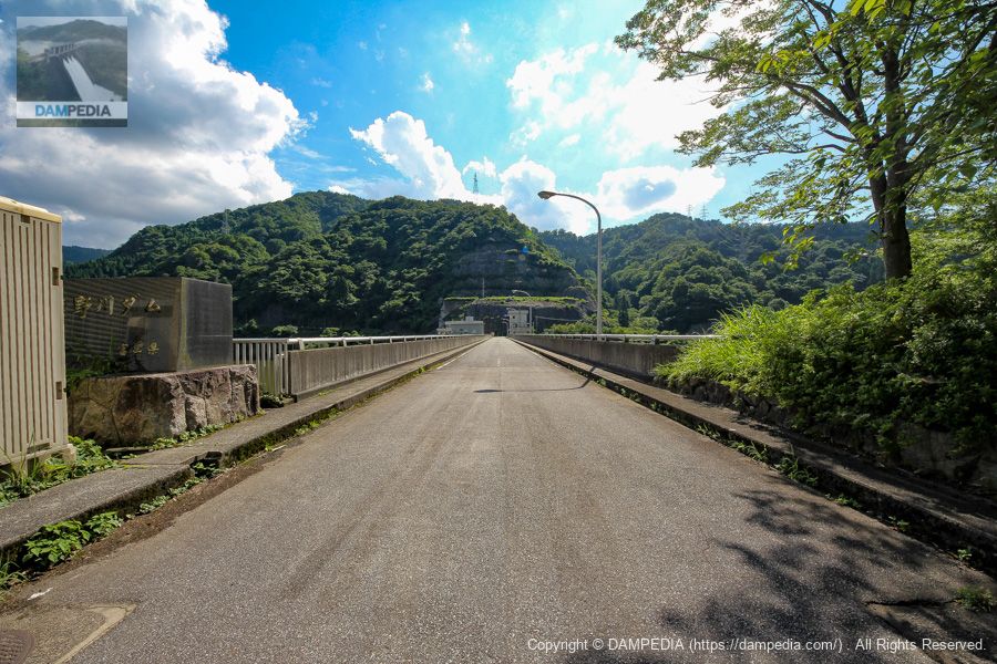
The top end is now open to automobile traffic. A construction sign is posted, but it reads "Permanent Flood Discharge Improvement Work," so it seems that the orifice was still under construction at that time. It seems that the orifice was still under construction at that time. The atmosphere of the orifice was not visible from the downstream side, so it was just in the final stage of construction. You can also see the remains of the crane foundation that was used during the construction of the main body on the right bank.
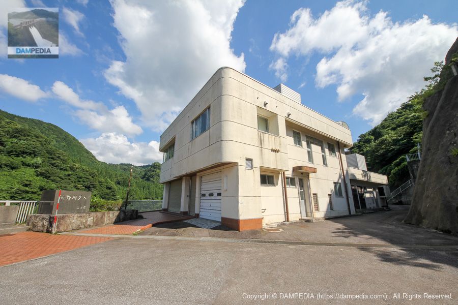
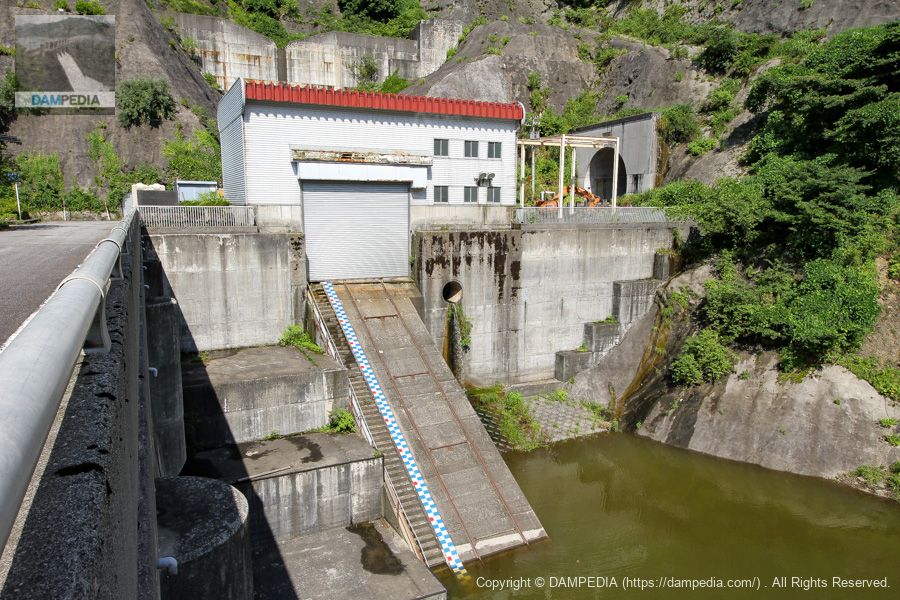
administration office
You can see a staircase at the back of the administration office, which seems to have been the stairs to the observatory.
Selective water intake system
Selective intake system consisting of intake gate and bottom intake gate. It was manufactured in September 1983 by Sato Iron Works Co.
Intake gate
| Door height x number of bays | 36.00mx6 steps |
| Water intake pipe diameter | 1.60m to 2.60m |
| number of gates | (one) gate |
| Opening and closing speed | 0.3m/min |
| door weight | 54.56t |
Bottom intake gate
| straight-radius interval | 1.25m |
| volume (e.g. drinking, spigotting, etc.) | 1.25m |
| number of gates | (one) gate |
| Opening and closing speed | 0.3m/min |
| door weight | 5.32t |
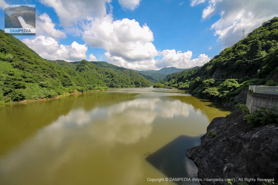
View of the reservoir from the top
The Kumano River No. 3 Power Plant is located upstream of this site.
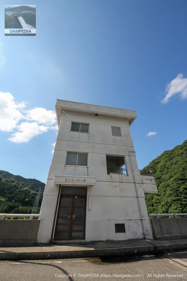
Elevator room
The elevator room is an oddly large three-story building. Unfortunately, the elevator is not open to the public, but it is unlikely that individuals will have the opportunity to ride it, as it does not appear to host events such as the Forest and Lake Friendship Season.
Looking upstream from the selective intake facility
In the gate piers at the back of the building, a trench for corner drop-offs can be seen, which is used for maintenance and other purposes. During the orifice gate repair work, it appears that steel angle drop plates were dropped in here to stop the water.
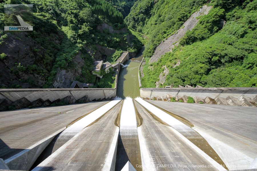
View of the chute from the top edge
You can see the water flowing nicely in three streaks through the newly improved orifice gate. By the way, the triangularity of the deflector is amazing. I heard that during the renovation work, anchors were driven and a working trestle was constructed with steel materials, and I would have liked to have seen that too.
Note that the water taken from the selective intake facility is branched downstream and one leads to a Φ350 mm main discharge and a Φ700 mm emergency jet flow gate. That is the one that pours into the reducer pond at the back of the reducer. The other is fed into the Kumanogawa Power Plant owned by Nihonkai Power Company, which generates up to 7,000 kW of electricity.
Kumanogawa Dam discharge animation
We also made a video of the discharge.
Boathouse and Incline
It is a magnificent boatyard and incline. The water mark is attached to the incline, and on this day it showed EL315.8m. The height of the orifice gate before the renovation was 318.5 m. After the renovation, the height was lowered by 2.9 m, making the height EL315.6 m.
View of the top edge from the right bank
The remains of the cable crane foundation can also be seen on the left bank. I wonder what has happened to it now. 8 years have passed, and my memory of those days is becoming vague with age, so I should have taken a picture of it even if it was off-limits.... As I write this article, I am reflecting on the past.
Looking upstream at the right bank road
On the right bank, in addition to a magnificent erosion control dam, there is another magnificent tunnel, but the only thing behind it is a shrine called Tao Shrine. Why is there such a magnificent tunnel? I found a clue in the aforementioned guide map of the reservoir area.
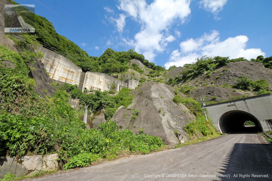
The reservoir area guide map shows this road as a "large-scale forest road Oyama Fukko Line" and describes it as a "planned road. The "large-scale forest road Oyama Fukko Line" is a large-scale forest road with a total length of 77.8 km, starting from Komi in Toyama City near Arimineguchi Station and ending in Tori in Nanto City where Tori Dam is located, and a section of the road has already been completed.
Apparently, the plan was to connect the road to the entrance of the Oguchigawa line of the Arimine Forest Road, but most of the road has not been completed to date. I don't know if the plan has been completely scrapped or cancelled, but I have a feeling that it will remain as it is for a long time to come, as it is unlikely to generate any traffic demand in the future.
Although the embankment itself looks quite ordinary for a municipal dam, the Kumanogawa Dam has some interesting anecdotes, such as the interesting orifice gate repair work and the episode of the large-scale forest road.
Kumanogawa Dam Specifications
| Location | Teide, Toyama City, Toyama Prefecture |
| River Name | Kumano River, Jinzu River System |
| Objective | F (flood control, agricultural disaster prevention) N (unspecified water, water for river maintenance) P(Power generation) |
| Model | G(gravity-fed concrete dam) |
| Bank height | 89m |
| Bank length | 220m |
| levee length and width | 7.5m |
| Dam volume | 371,000 m3 |
| Watershed Area | 39.8km2 |
| Reservoir area | 34 ha |
| Total storage capacity | 9,100,000 m3 |
| Effective water storage capacity | 6,600,000 m3 |
| Dam operator | Toyama prefecture (Hokuriku area) |
| Main body constructor | Maeda Corporation, Taisei Corporation, Marushin Shiko Construction Co. |
| Year of launch | 1970 |
| Year Completed | 1984 |
| Name of Dam Lake | - |
Other facilities/observations
| Parking lot | ○ |
| Toilet | ○ |
| Park | × |
| PR Exhibition Hall | × |
| Fishing | ○ |
Map around Kumanogawa Dam
Weather around Kumanogawa Dam
Accommodations that may be close to Kumanogawa Dam


Comment