

Location: Kobata, Asahi-cho, Toyota City, Aichi Prefecture
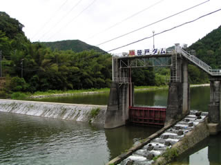
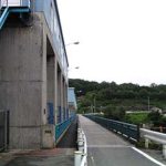
View of the embankment from the left bank
Height (mm)Bank heightIt is not a dam because its height (15m) is less than 15m, but Chuden seems to call it "Sasado Dam" as shown on the sign. It is a weir, but I have a connection (?) with this place, so I will introduce it here. I introduce it here because it is a place that I have a connection (?) with.
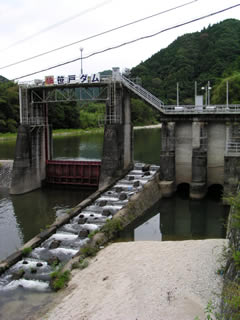
Gates and fish passage
The Sasado weir is an intake weir that leads water to the Sasado Power Plant about 6 to 7 km downstream from here. Therefore, the "Sasado" of the Sasado weir seems to have been named after the power plant, not after the place. As proof of this, the area around this weir is called "Kowatari.
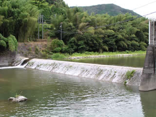
Overflowing embankment
It is a very small levee.
dam characteristics
| Model | gravity-fed concrete dam |
| Objective | generation (e.g. power) |
| Bank height | m |
| Bank length | m |
| Dam volume | m3 |
| Elevation of non-overflow area | E.L.m |
| catchment area | km2 |
| Reservoir area | km2 |
| Total storage capacity | m3 |
| Effective water storage capacity | m3 |
| Year Completed | counter for years (following a number in the hito-futa-mi counting system) |
| Access to D@M | Get off at Sanage Green Road Shidare Interchange turning left at the light Continue north on Prefectural Road 11. After 20 km, enter the Kowatari area and turn right at the next traffic light after the "Kowatari" intersection. Drive 500 meters and you will see it on your left. (Be careful, it's pretty easy to miss.) |
Other facilities/observations
Specifications are unknown... The Sasado area has a (minor) hot spring, which is popular among the locals. Also, every summer, a festival with a fireworks display is held, albeit on a small scale, which can be quite nice.
There is one in the Kowatari area, but I have never been to the festival here.
| Parking lot | × |
| Toilet | × |
| Park | × |
| PR Exhibition Hall | × |
| Fishing | ○ |
Comment