Location: Kawajiri, Shiroyamacho, Tsukui-gun, Kanagawa Prefecture
Official Web site:.Honzawa Dam (Sagami River Comprehensive Development Joint Project) - Kanagawa Prefecture Web site
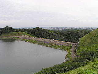
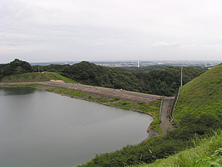
View of the embankment from the right bank
The Honzawa Dam was built as part of the Sagami River Comprehensive Development Project for an artificial lake to generate power from the Shiroyama Dam and a pure pumped storage system.
Incidentally, the dam lake of the Honzawa Dam is "Shiroyama Lake" and the dam lake of the Shiroyama Dam is "Lake Tsukui.
In other words, the water in Shiroyama Lake (Honzawa Dam) was drawn from the lower elevation Lake Tsukui (Shiroyama Dam)... and it is confusing.
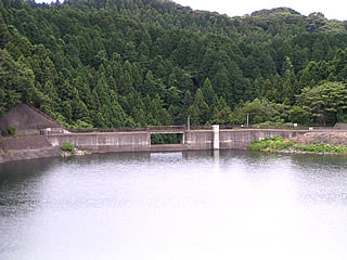
View of the flood discharge from the right bank
We did not have much time for this interview, so we did not even go to the top end of the building. If I had more time... If there was no traffic jam, we would have had plenty of time....
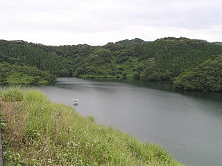
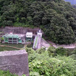
View of the dam lake from the right bank
Surprisingly, there were many tourists. They seemed to be fishing, but if pumped storage power is being generated, the water level must change a lot, and I think fishing is also prohibited, but I am not sure if fishing is prohibited or not.
There is what appears to be a surface aeration facility on the left side of the photo, but this too has not been confirmed.
dam characteristics
| da mu | Model | rockfill dam |
|---|---|---|
| Objective | generation (e.g. power) | |
| Bank height | 73.0m | |
| Bank length | 234.0m | |
| Dam volume | 1,852,000m3 | |
| savings water (esp. cool, fresh water, e.g. drinking water) pond | Watershed Area | – |
| Reservoir area | 20 ha | |
| Total storage capacity | 4,740,000m3 | |
| Effective water storage capacity | 3,825,000m3 | |
| Name of Dam Lake | Shiroyama Lake | |
| River Name | – | |
| Year of launch | – | |
| Year Completed | 1965. | |
| Access to D@M | If you take the Tomei Expressway, you can get there from the Yokohama-Machida Interchange, The nearest interchange is Exit 1 of the Chuo Expressway. From there, head south on Route 16. Via Hachioji Bypass (250) on the way After driving for a while after the end of the bypass, you will see an overpass bridge, Drive on the side road without crossing and turn right at the intersection with Route 413. Go west on Route 413 for a while to Shiroyama Town. Turn right at the signal intersection "Toizawa" with Bamiyan on the right hand side The rest is straight down the road. | |
Other facilities/observations
| Parking lot | ○ | Since this is not a dam associated with a river, the basin area and river name are not available. Some dams are for water supply, while others are built only for pumped-storage power generation. Kanagawa's dams may have a small number of units, but they are deep. In addition, there may have been a restroom.... |
|---|---|---|
| Toilet | × | |
| Park | ○ | |
| PR Exhibition Hall | × |

Comment