
Date of interview: Monday, July 15, 2013
I went from Arima Dam to Chichibu City and tried to have lunch, but all the places were full, so I wandered up to Urayama Dam thinking that there would be something to do while moving around. My family was with me, but they said they would wait in the car, so I just went around to take pictures. (In other words, I couldn't leave my family behind to take a leisurely tour of the dam.)
Downstream view of the levee from the right bank
I knew that the Urayama Dam could be seen from downstream, but decided to go to the top end first.

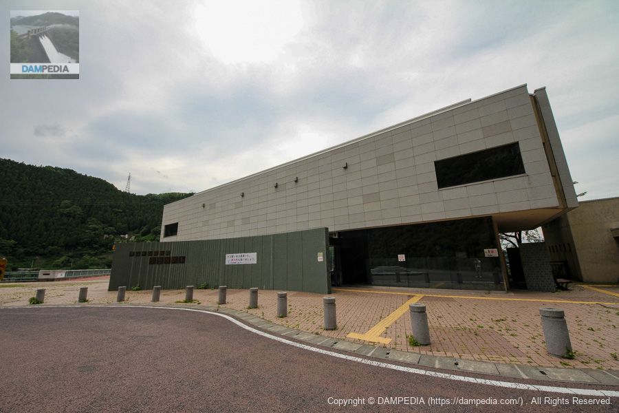
Urayama Dam Disaster Prevention Museum "Urarapia
Since I left my family in the car, I passed on visiting the inside of the museum this time.
View of the top edge from the right bank
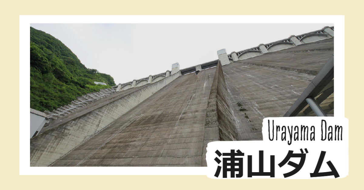
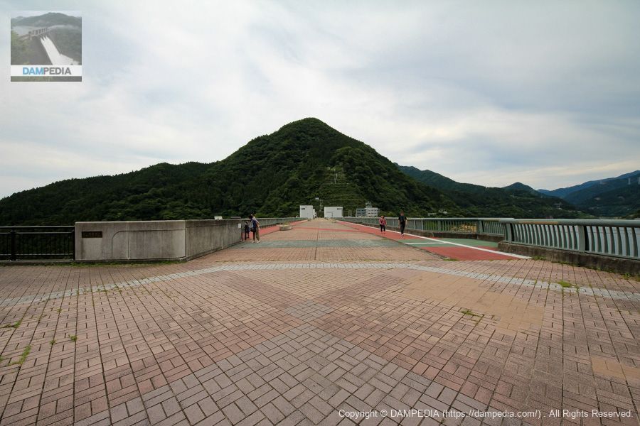
The top end of the dam is quite wide, reminiscent of the top end of Miyagase Dam. The Urayama Dam has hosted several "Shigeki no Urayama Dam" events, in which painted cars and cosplayers were displayed in a row on the top edge.

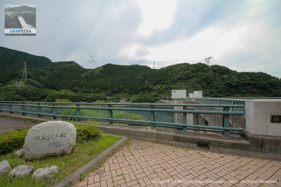
Stone monument with the name of the dam lake on the right bank
The name of the dam lake is Chichibu Sakura Lake. The name was given because Chichibu is famous for its cherry blossoms.
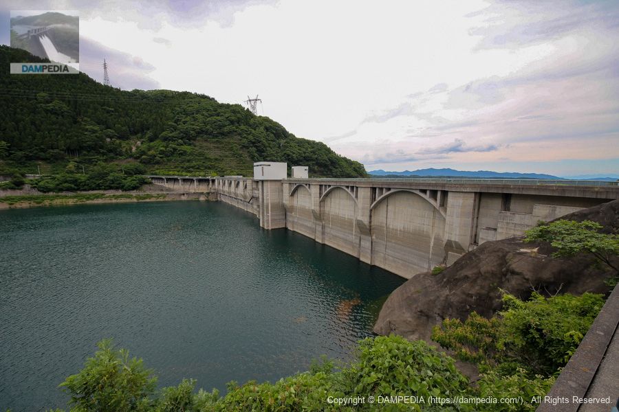
View of the upstream face of the embankment from the right bank
The arched design on the embankment was designed in the motif of the Old Chichibu Bridge, which is a symbol of Chichibu. Incidentally, the Old Chichibu Bridge is also known as the sacred place for the anime "We Still Don't Know the Name of the Flower We Saw That Day.
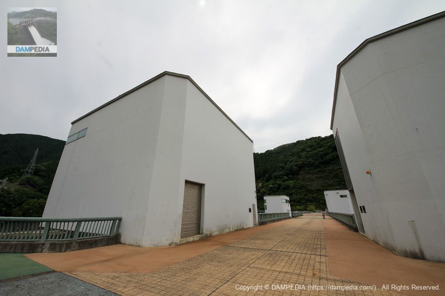
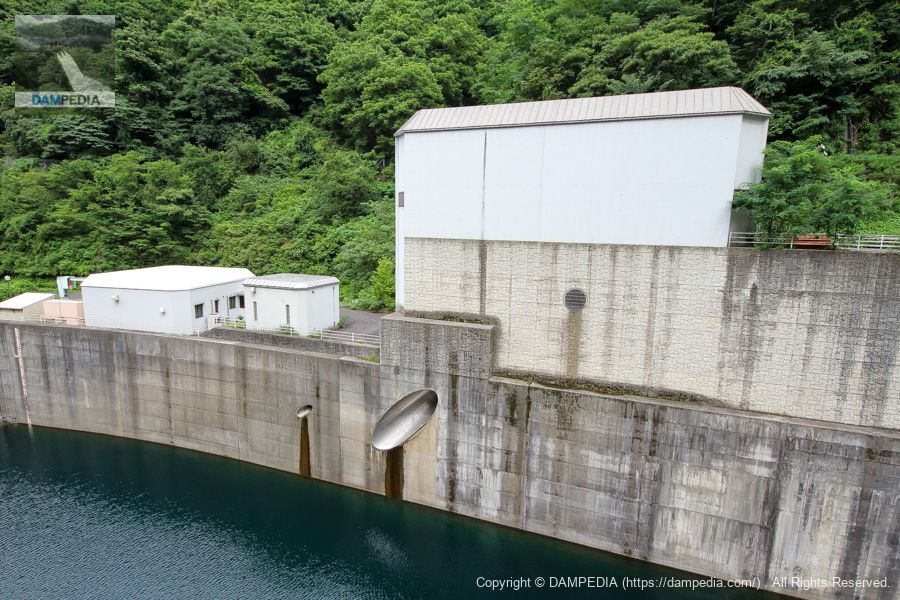
Selective intake tower and elevator tower
This area has an atmosphere somewhat typical of the Water Resources Agency.
View of the emergency flood discharge from the left bank
The emergency flood discharge of the Urayama Dam is a free overflow type without gates.
View of the dam lake from the top
Chichibu Sakura Lake was formed when the Urayama River was dammed by the Urayama Dam. A prefectural road that runs up the Urayama River leads to the Arima Dam. However, the route was very winding, so we did not take that route for fear that my family would get car sick.

View of the top edge from the left bank
Perhaps due to the size of the 156-meter-high dam owned by the Japan Water Agency, there were a good number of visitors to the site.
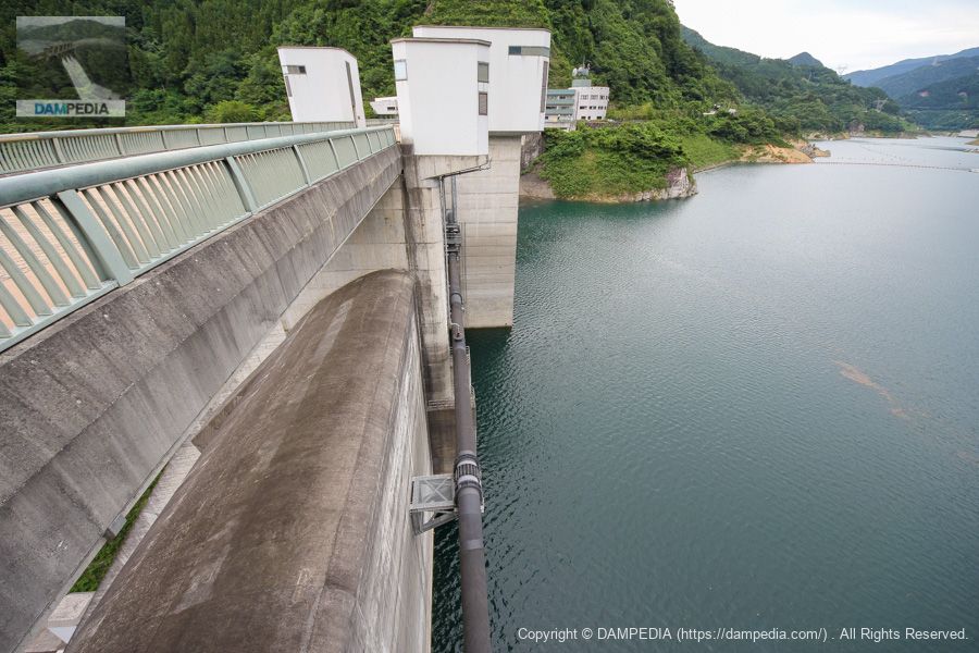
View of the upstream face of the embankment from the left bank
I am curious about the concrete structure submerged in the dam lake in front of the left bank. I wonder what it is.
The pipes that are installed on the upstream face of the dike to connect to the selective intake system from the left bank,clear (pure) waterThis is a facility for treating turbid water that takes clean water from upstream before it enters the reservoir in a portion of the bypass and discharges it through a selective intake facility.

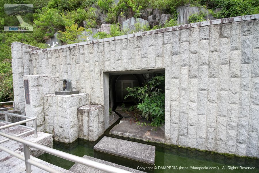
left bank abutment
A huge rock with the name of the dam is placed on the left bank abutment. It too is a valuable name as the "Water Resources Development Authority". The concrete structure in the foreground is a mystery, but there is a rim tunnel in the back. There is also a Benten-sama (Goddess of Benten) enshrined here, named Sakura-benzaiten.
There's a rim tunnel in the back like this.
The door to the rim tunnel can be seen at the back.
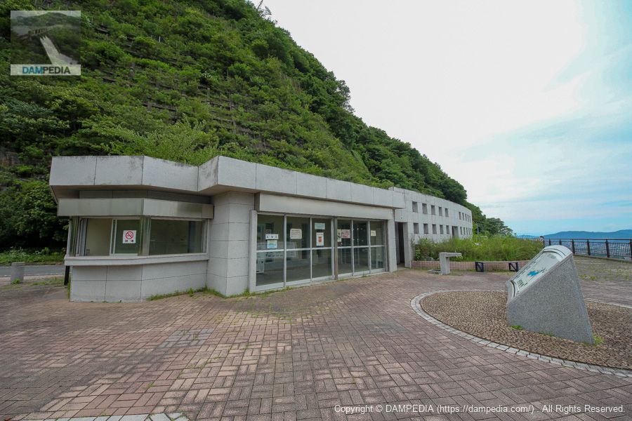
Rest areas and restrooms
This is a great rest area and restroom. It looks like it could be used for a small event.
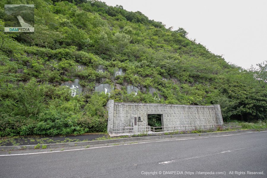
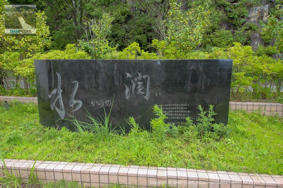
Moisture from water.
Since the surrounding mountains are the source of water for life, cherry trees were planted and a stone monument was erected by the construction workers in hopes of eternal blessings for future generations. Cherish the water.
Downstream view of the levee from the left bank
The downstream face of the bridge also features the design of the old Chichibu Bridge. The depth of the bridge shows that it was built in a very three-dimensional way. It would be difficult to design a dam this well these days due to budget constraints.
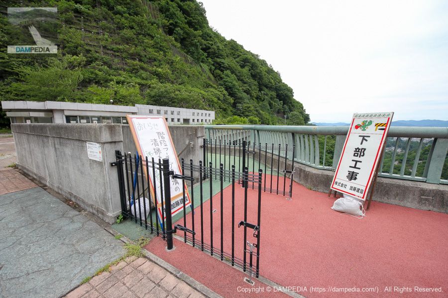
Footing Staircase Entrance
At the Urayama Dam, the footing stairs are usually open for visitors. However, I have to go back to the parking lot on the right bank because I have parked my car with my family in it. It is not because I don't want to go back and forth up the stairs, you know? Ah, ah, what a pity, what a pity.
View downstream from the top
156 meters is high and scary. But this fear is sometimes one of the charms of dams.

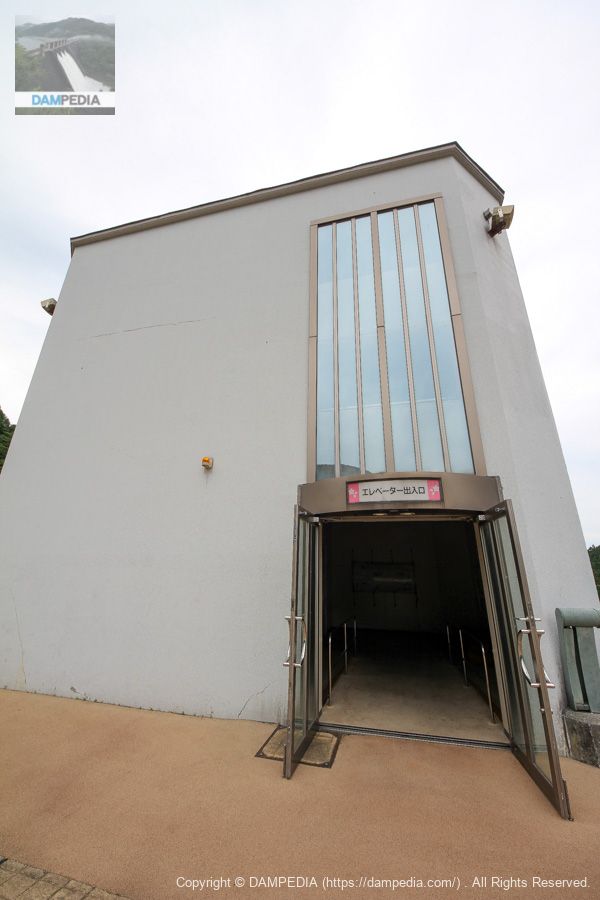
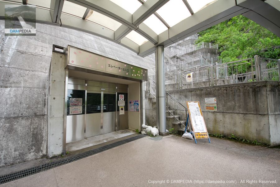
Elevator Exit
Of course, not only stairs but also elevators are open to the public. When going back and forth to the downstream, you can use the stairs to go down and the elevator to go up.
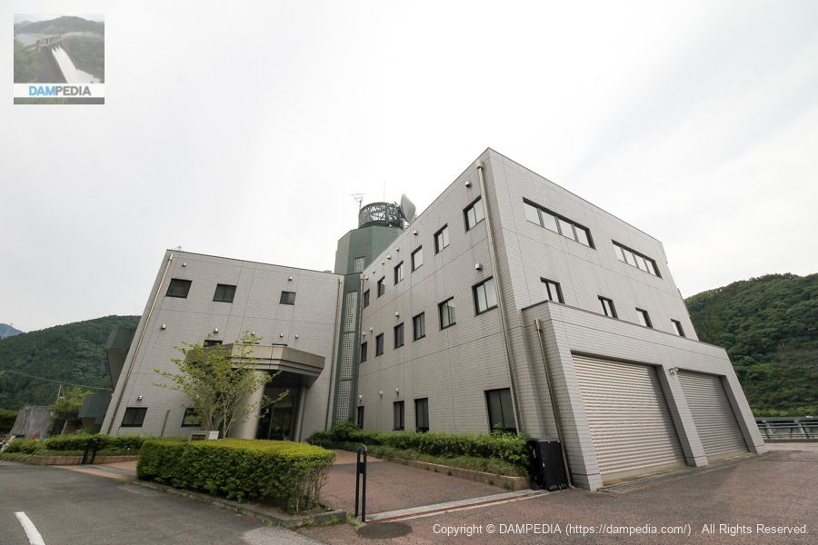
Urayama Dam management office on the right bank
The dam management office back to the right bank. It is a magnificent and clean management office.
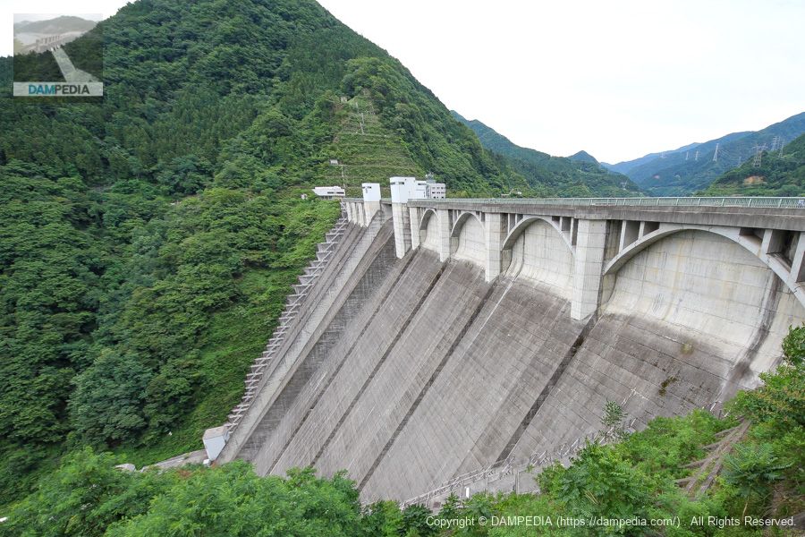
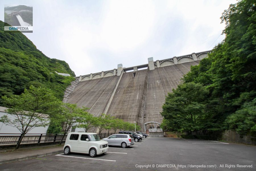
View of the downstream face of the levee from the parking lot downstream
We came to the downstream side. It's quite a high point to be able to look up at the embankment with a big bang. It is as if the Urayama Dam is saying, "Please look and see! It is as if the Urayama Dam is saying to us, "Please look!
irrigation and drainage system
Although water was not discharged on this day, this is a facility for discharging water taken in from the selective intake system. The thicker pipe on the right side of the jet flow gate is the main pipe that discharges 40 m3/s, and the thinner pipe on the left side is a branch pipe that discharges 2 m3/s.
Elevator and footing stairway entrance/exit
I would like to visit it properly someday, as I was not able to take a good look at it during this first visit, as well as during my second visit at a dam association event.
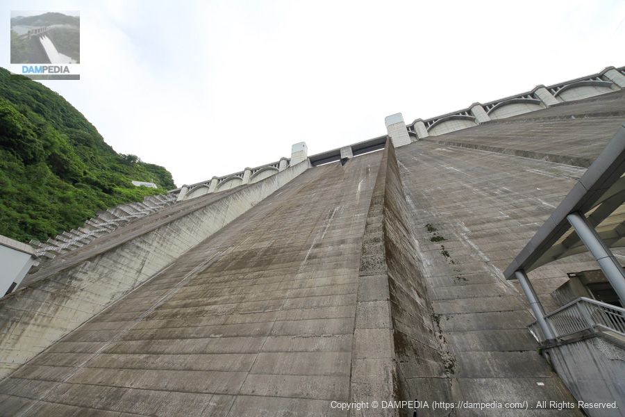
Urayama Dam looking up from directly below
This is the point where one can directly feel the enormity and grandeur of the Urayama Dam. Is it possible to come here even during the discharge of water?
Urayama Dam is also called the "156-meter group of flowers" because it has the same embankment height as the Miyagase Dam in Kanagawa Prefecture and the Onui Dam in Hiroshima Prefecture. The Urayama Dam, which can be viewed from various angles, has a maximum recommendation of 5.0, and is a must-see when visiting Chichibu.
Urayama Dam Specifications
| Location | Arakawa Kamitano, Chichibu-shi, Saitama |
| River Name | Urayama River, Arakawa River system |
| Objective | F (flood control, agricultural disaster prevention) N (unspecified water, water for river maintenance) W(Water for water supply) P(Power generation) |
| Model | G(gravity-fed concrete dam) |
| Bank height | 156m |
| Bank length | 372m |
| Dam volume | 1,750,000 m3 |
| Watershed Area | 51.6 km2 |
| Reservoir area | 120 ha |
| Total storage capacity | 58,000,000 m3 |
| Effective water storage capacity | 56,000,000 m3 |
| Dam operator | Kanto Jiken → Water Public Corporation One Construction |
| Main body constructor | Tobishima Corporation, Hazama Corporation, Takenaka Civil Engineering |
| Year of launch | 1972 |
| Year Completed | 1998 |
| Name of Dam Lake | official in charge of the administration of domains and general affairs of powerful noble families (from the middle of the Heian period)cherry blossomlake |
Other facilities/observations
| Parking lot | ○ |
| Toilet | ○ |
| Park | × |
| PR Exhibition Hall | ○ |
| Fishing | ○○ (excluding no-take zones) |

Comment