
Date of interview: Wednesday, 1/28/2015
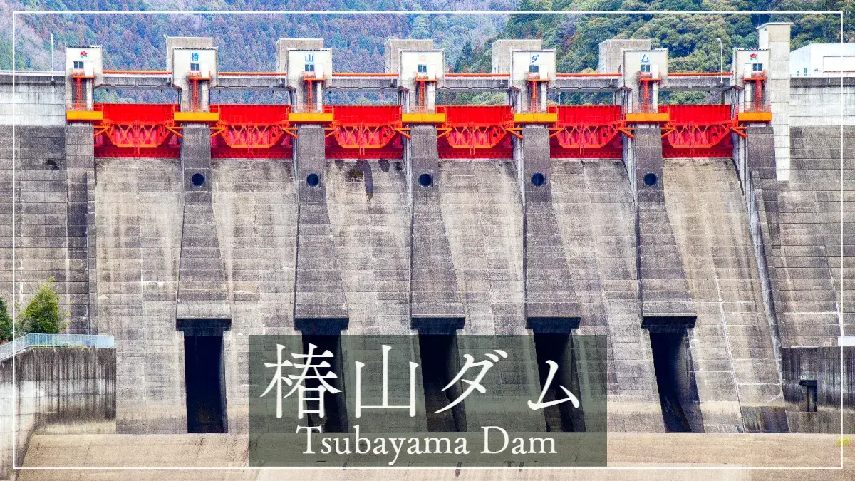
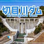
The second dam of the day was the Tsubayama Dam. This is one of the Wakayama dams that I would like to see once because it has prevented flooding many times. It is equipped with many facilities and looks like a dam owned by the Ministry of Land, Infrastructure, Transport and Tourism or the Japan Water Agency, but it was a dam of such a scale that I wondered if it was a prefectural dam! It looks like a dam operated by the Ministry of Land, Infrastructure, Transport and Tourism or the Water Resources Agency, but it is a prefectural dam!
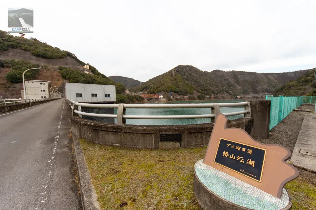
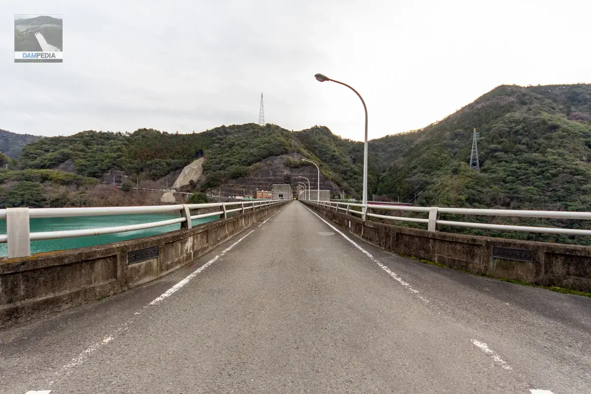
I will start from the left bank
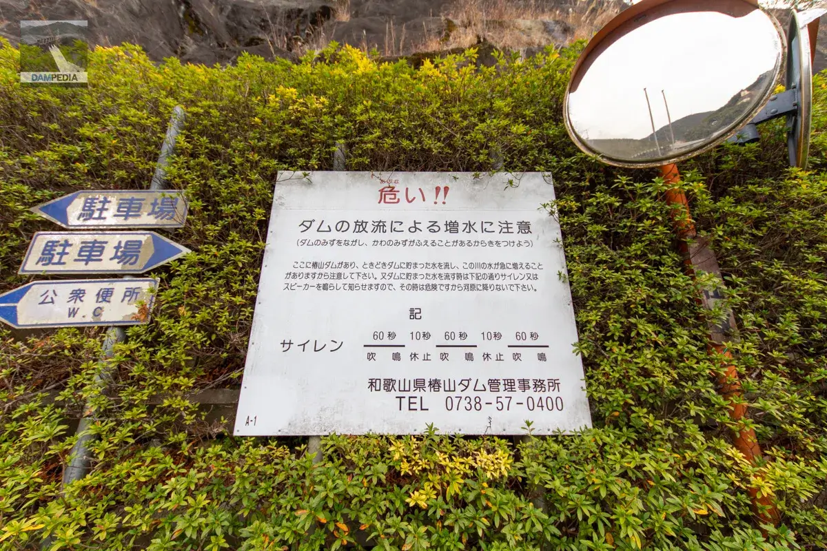
This discharge warning sign will be at the end of the road from R424 across the top edge.
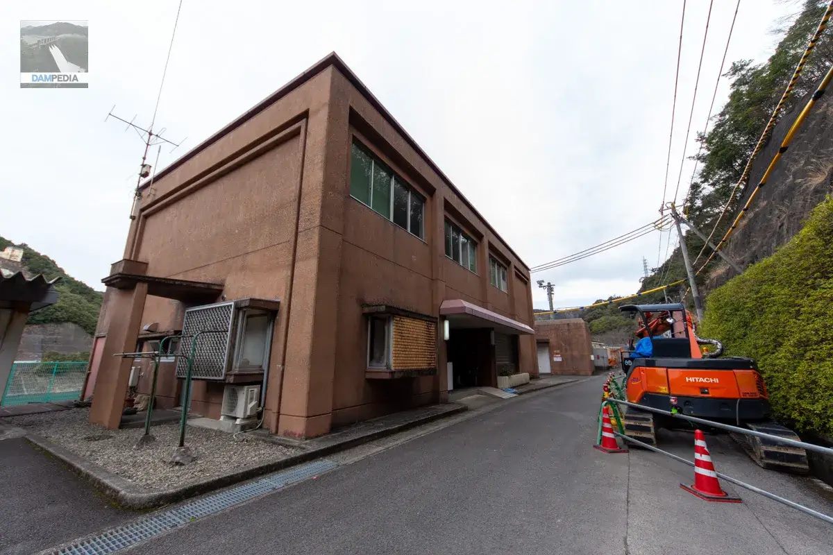
The dam management office is located on the upstream side of the left bank. The colors and design are very much in keeping with the era and the prefectural government, but the bay window is a bit stylish.
On the left bank, a water use sign, a fixed foundation, a monument in honor of the transferee, and the nameplate of the 100 best dam lakes are all in one place.
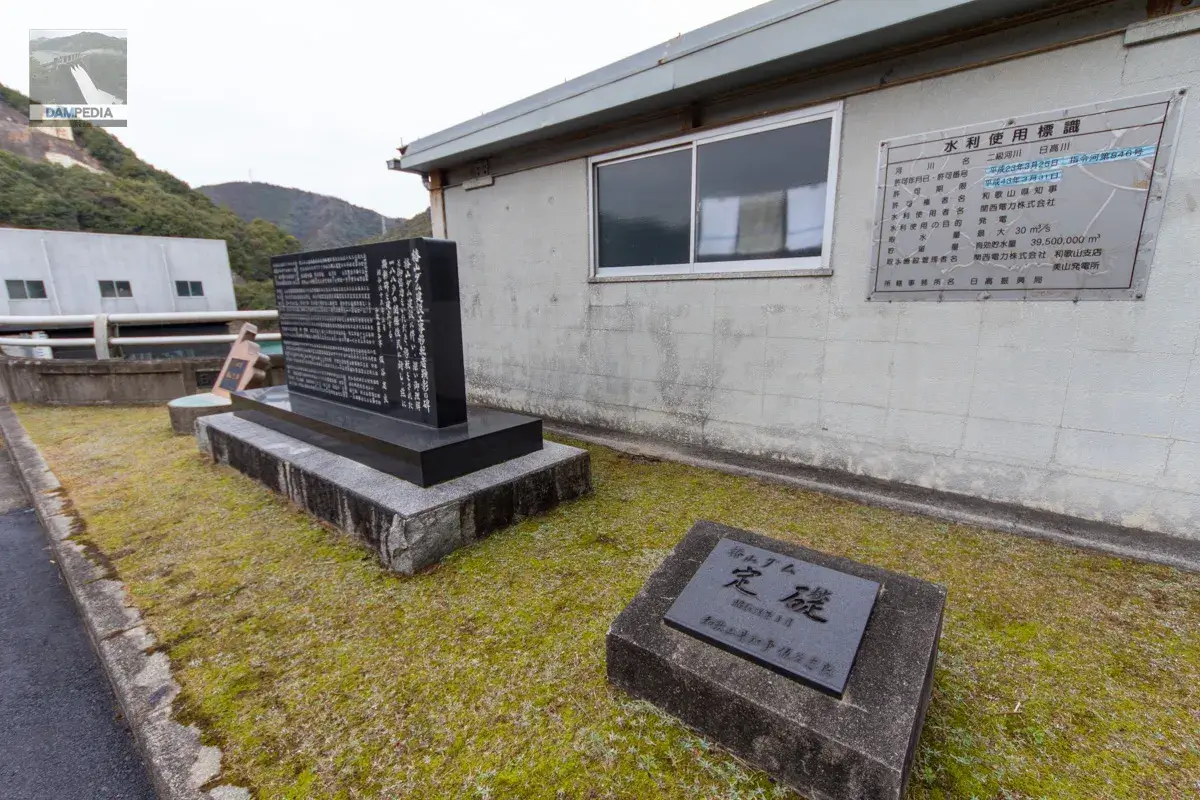
The nameplate of the 100 dam lakes must indeed be in a position where the dam lakes can be seen. The frame that this nameplate is housed in has a unique shape, but it seems to represent something...but I couldn't figure out what.(Also unconfirmed by the control center.)
(Added 3/18/2023) When we asked the management office about the shape of this frame, they said it was inspired by the shape of the river in the former Miyama Village area.
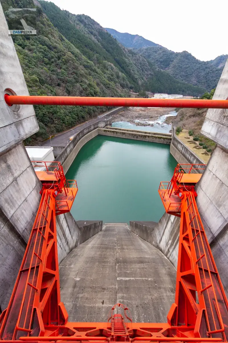
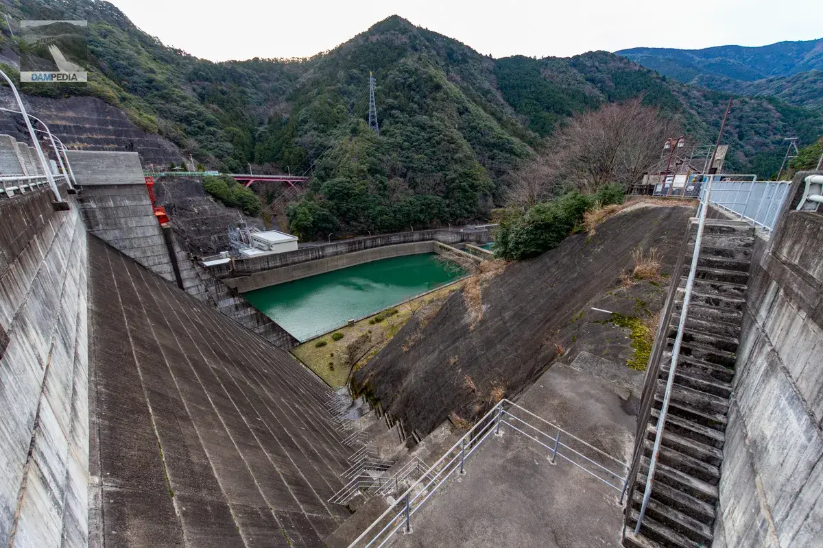
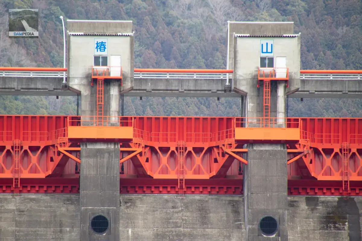
Tsubayama Dam has a selective intake facility on the left bank, and the crest has 6 radial gates and 5 conduit gates. Still, I'm curious about the observation deck on the right bank...
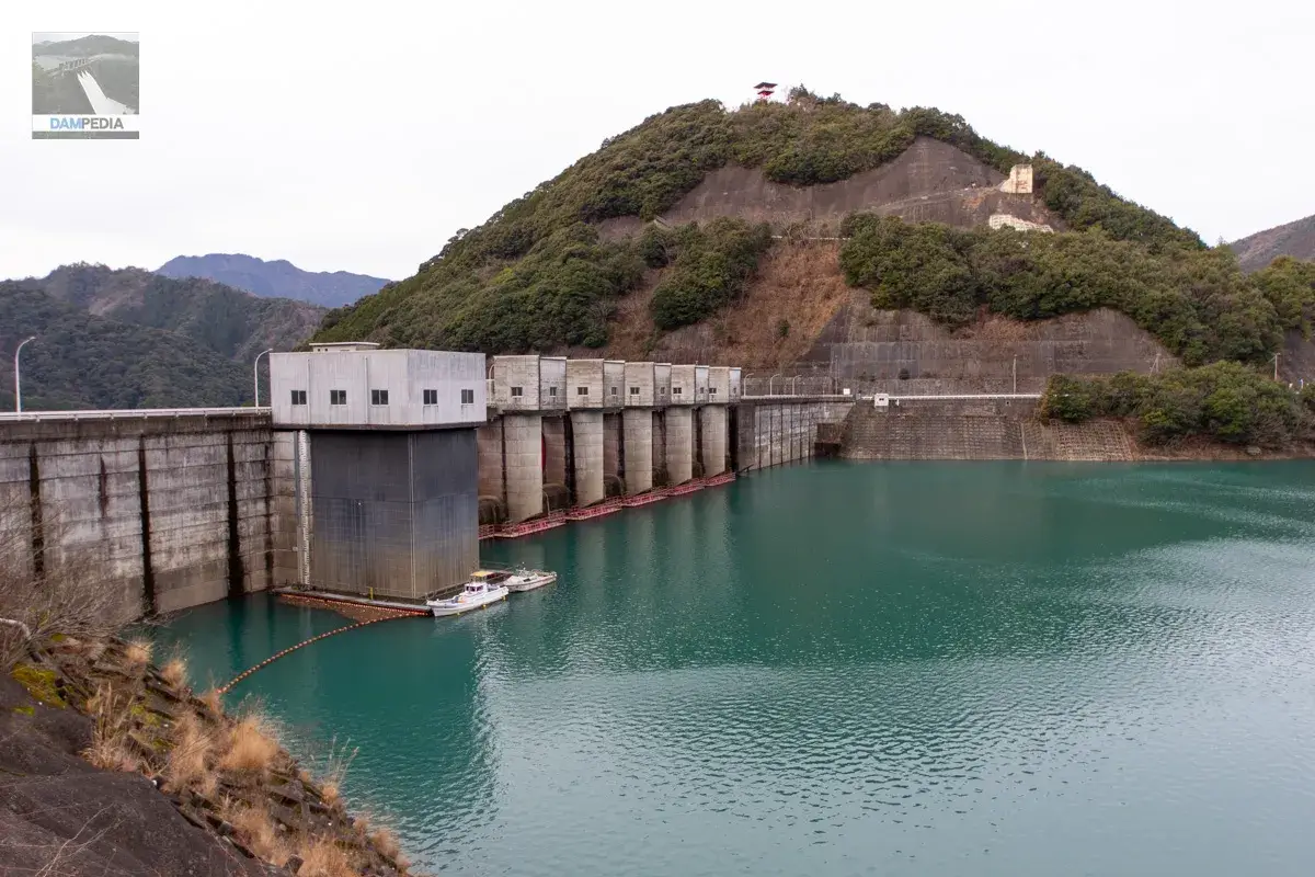
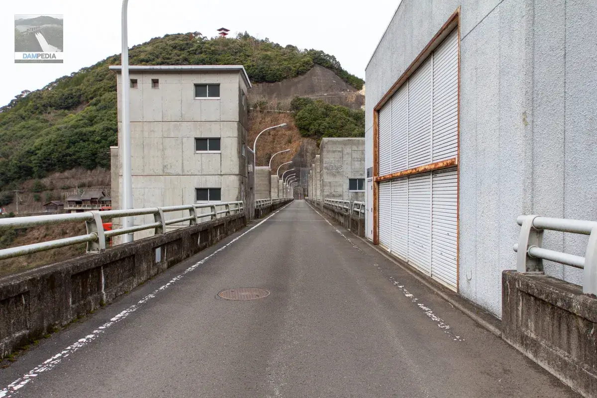
The top end is open to automobile traffic. The three-story building on the downstream side (left) houses elevators and other facilities, while the building with shutters on the upstream side (right) is the intake equipment operation room. Behind the building is a winding machine room for the crest gate on the downstream side and a winding machine room for the spare gate of the conduit gate on the upstream side.
The specifications of the selective intake facilities are as follows
| Model | Steel 5-step circular gate |
| the way (of proper conduct, etc.) | 3.5m to 4.7m |
| effective height | 30.0m |
| Opening and closing speed | 0.3m/min |
| door weight | 113t |
| number of gates | (one) gate |
| Date of manufacture | March 1988 |
| production | Sakai Ironworks Co. |
The specifications of the intake water control gate are as follows
| Model | Steel Slide Gate |
| straight-radius interval | 3.5mm |
| volume (e.g. drinking, spigotting, etc.) | 3.5m |
| Opening and closing speed | 0.3m/min |
| door weight | 14.4t |
| number of gates | (one) gate |
| Date of manufacture | March 1988 |
| production | Sakai Ironworks Co. |
Top (Crest)
クレストゲート上からダム湖を見ます。鉄塔がすごく歪んでいますがレンズのせいですので気にしないでください💦
Now I look at the other side. It is interesting to note that "Tsubayama" is planted on the right bank of the reduction work. Incidentally, the sidewall of the reduction work near the dam collapsed suddenly on December 17, 2021, and as of January 2023, it is still under restoration work, but the casting of the sidewall itself seems to have been completed. It is a relief to know that the dam itself and the land on the right bank were not affected. The cause of the collapse has not yet been announced as of January 2023, but I am a little concerned.
(Added 3/18/2023) When we asked the Tsubakiyama Dam Management Office about the cause of the collapse, they said that at this point, it is not due to rainfall, etc., but is presumed to be the result of a combination of various factors. The main cause is thought to be the repeated increase and decrease of water pressure and earth pressure on the retaining wall due to the rise and fall of the water level in the embankment behind the retaining wall over the years.
It is unusual to see a double sub-dam. It seems to be a double abatement.
(Added 3/18/2023) This double sub-dam was model tested and this structure was adopted as the shape that would properly reduce water discharge.
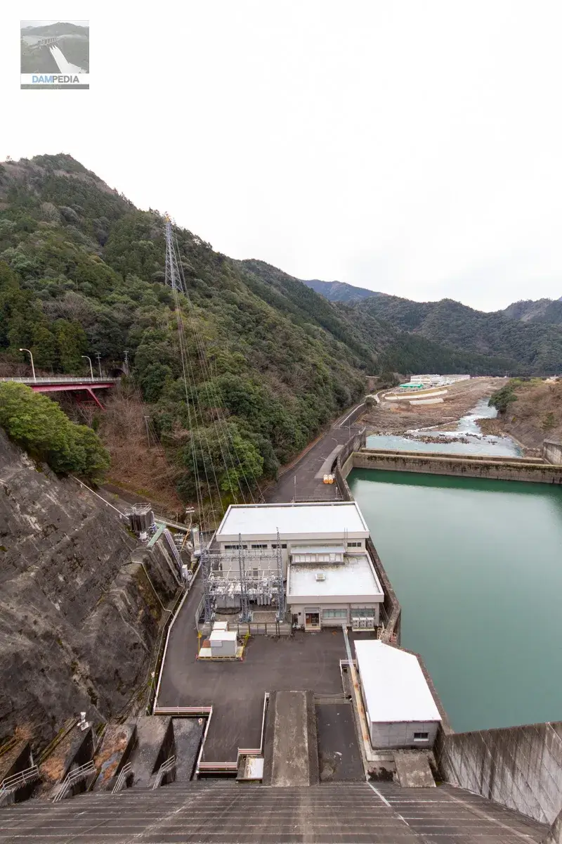
The white building in the photo below is the Miyama Power Station of Kansai Electric Power Co. The power plant is named after the former Miyama Village before it was merged into Hidakagawa Town. The maximum output is 11,400 kW.
Go to the right bank.
Anyway, I walked a lot that day.
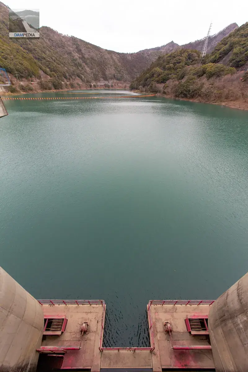
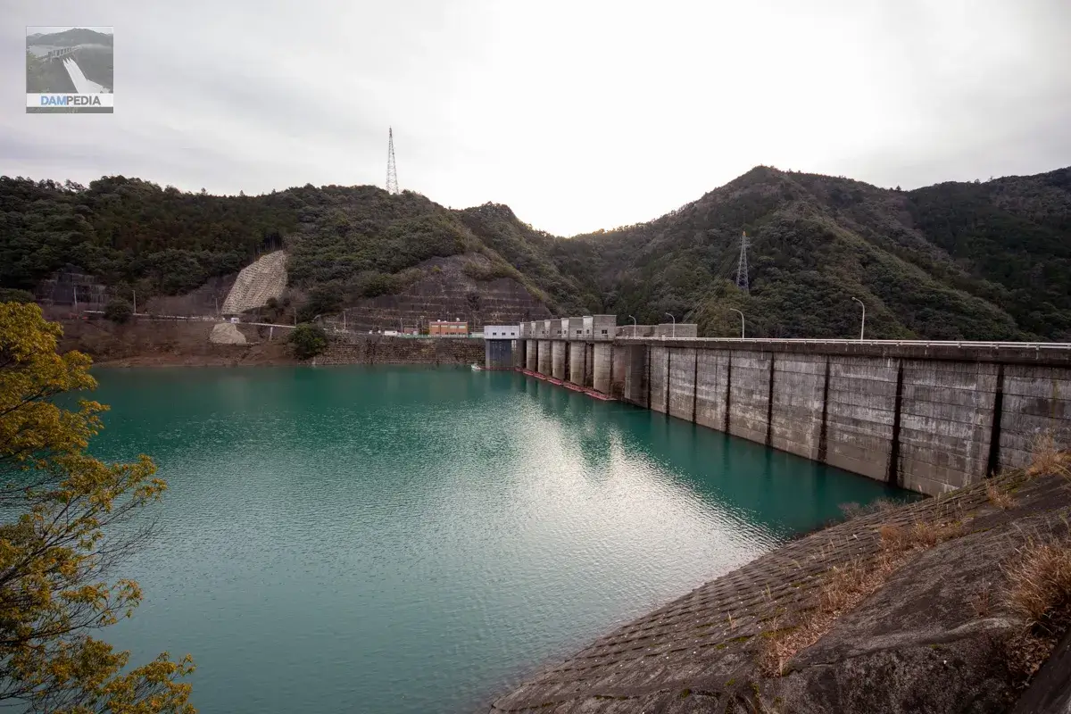
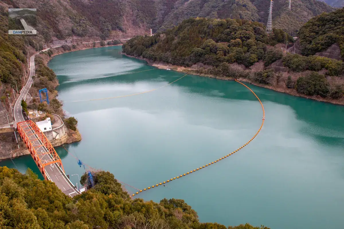
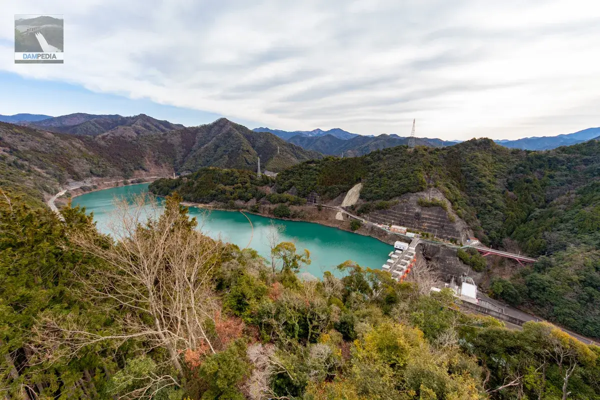
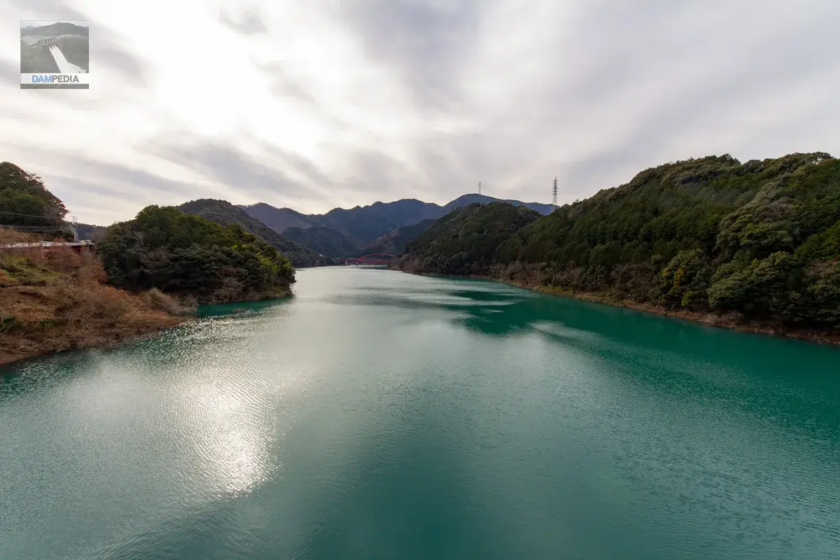
The reservoir has a unique green color. By the way, according to the nameplate, the name of the dam lake is "Tsubayama Dam Lake," which is a simple name for the 100 best dam lakes. Tsubayama Dam is also selected as one of the 100 best sunsets in Wakayama Prefecture.
The footings are not available for public use. However, seeing that it is well maintained, it is likely to be open for tours.
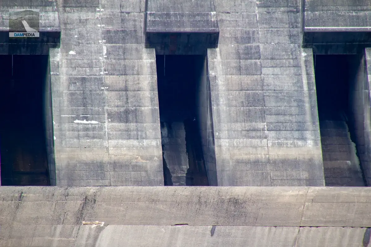
From here the downstream face is very straight and cool. The deflector on the conduit gate, or rather the structure to control the water discharge from the crest gate, is really cool. (You get the idea.)

Wanting to see a little more of the downstream face of the levee, we move by car to a position where we can see the downstream face. There is a large factory downstream, and we can reach the downstream face of the levee by passing by the factory.
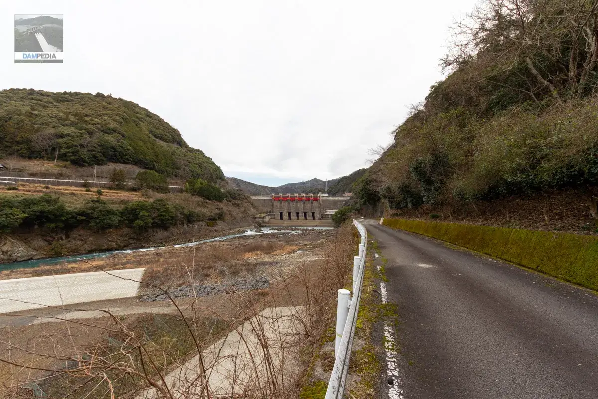
Oh, this is amazing. The height of the embankment is 56.5m, which is middle class, but the conduit gates are neatly arranged in the middle and lower part of the six crest gates, giving the appearance of functional beauty. The red crest gate also enhances the impression of the dam.
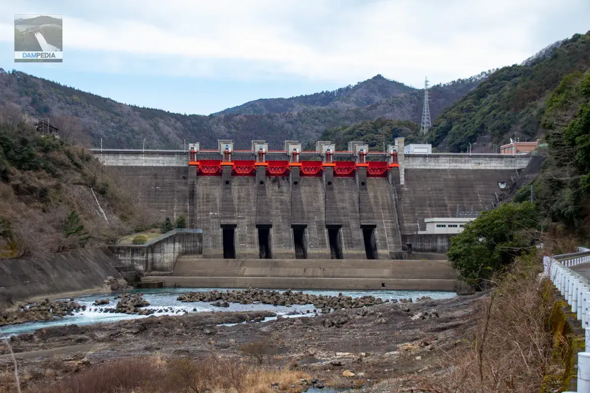
The specifications of the crest gates are as follows. It is interesting to note that the three gates on the left bank are manufactured by Ishikawajima Harima Heavy Industries, while the three gates on the right bank are manufactured by Marushima Sluice Gate Works.
| Model | Steel radial gate |
| straight-radius interval | 11.500m |
| door height | 7.391m |
| Opening and closing speed | Motor 0.3m/min Engine 0.1m/min |
| door weight | 56.463t |
| number of gates | 6 gates |
| Date of manufacture | March 1988 |
| production | Ishikawajima-Harima Heavy Industries Co. Marushima Sluice Gate Manufacturing Co. |
Similarly, conduit gates are manufactured by different companies on the left and right banks.
| conduit gate | 5.0mx5.6m 5 gates |
| discharge pipe | Drinking mouth 7.9mx9.318m 5 Article Termination 5.0mx5.6m |
| Date of manufacture | March 1988 |
| production | Kurimoto Iron Works Co. Kawasaki Heavy Industries, Ltd. |
What a surprise, the same was true for the spare gate at the conduit gate.
| Model | Steel roller gate |
| width of the mouthpiece | 7.900m |
| volume (e.g. drinking, spigotting, etc.) | 9.318m |
| Opening and closing speed | 0.3m/min (0.6m/min at flow shutoff) |
| door weight | 149.670t |
| number of gates | 5 gates |
| Date of manufacture | March 1988 |
| production | Hitachi Zosen Corporation (3 left bank gates) Mitsubishi Heavy Industries, Ltd. |
I wondered if the reason for the different manufacturing companies on the left and right shores was to show the world that we do not have a single public works contractor as a monopoly. I wondered if this was to show the world that they are not contracting public works projects exclusively to one company. However, there is only one selective intake system, so it seems that there is only one company.
(2023/3/18) When we asked the management office why each gate was manufactured by a different company, they told us that the reason was that the orders were divided among different companies in order to secure opportunities to receive orders for public works projects. Personally, I think that monopolizing one company would be more cost-effective, but there must have been a lot going on.
Crestgate and conduit gates are further expanded.
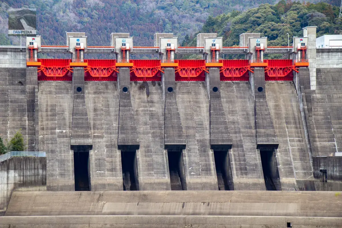
The gate itself is hidden in the back and cannot be seen, but this is the outlet part of the conduit gate. I feel like I am taking a hidden picture of an invisible part.
If you look closely, you can see "Tsubayama Dam" written on the gate winder chamber. The color of the gate is closer to vermilion than red.
Right bank observatory
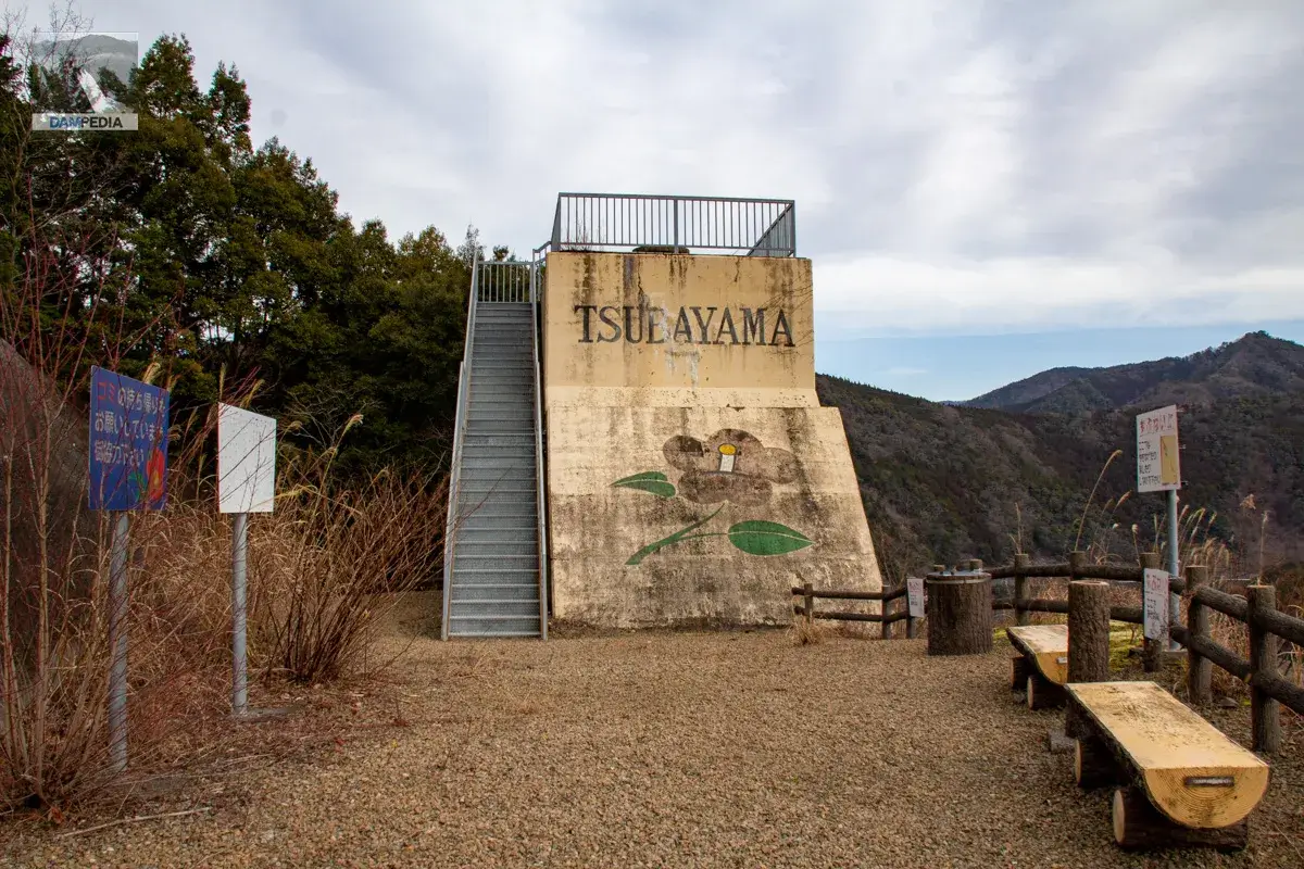
After enjoying the downstream, I came to the observation deck on the right bank. I could drive close to the observatory, so it was relatively easy to get there. There is a concrete structure with the word "TSUBAYAMA" written on it and an illustration of a camellia. It is thought that the remains of the foundation of a cable crane were converted into the observatory.
Now, this is what the embankment looks like from the observation deck at the Tsubayama Dam! It's a little disappointing that it's not the downstream face, but it's very nice to get a good sense of the dam dam holding back the water.

Looking toward the reservoir from the observation deck. The upstream end cannot be seen due to the large curve. The blue thing near the lower left edge is a cable crane, probably used to collect garbage from the reservoir.
Actually, there is another observation platform-like thing at Tsubayama Dam. I have to see it in person! I was so excited that I decided to head there.

The observatory you are aiming for is located in Miyama-no-sato Forest Park. There is a parking lot just north of the park entrance called "Michi no Hot Station Miyama no Sato," which is a facility that also serves as a souvenir shop and a plaza.
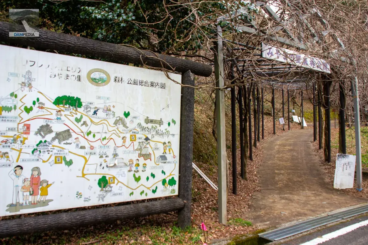
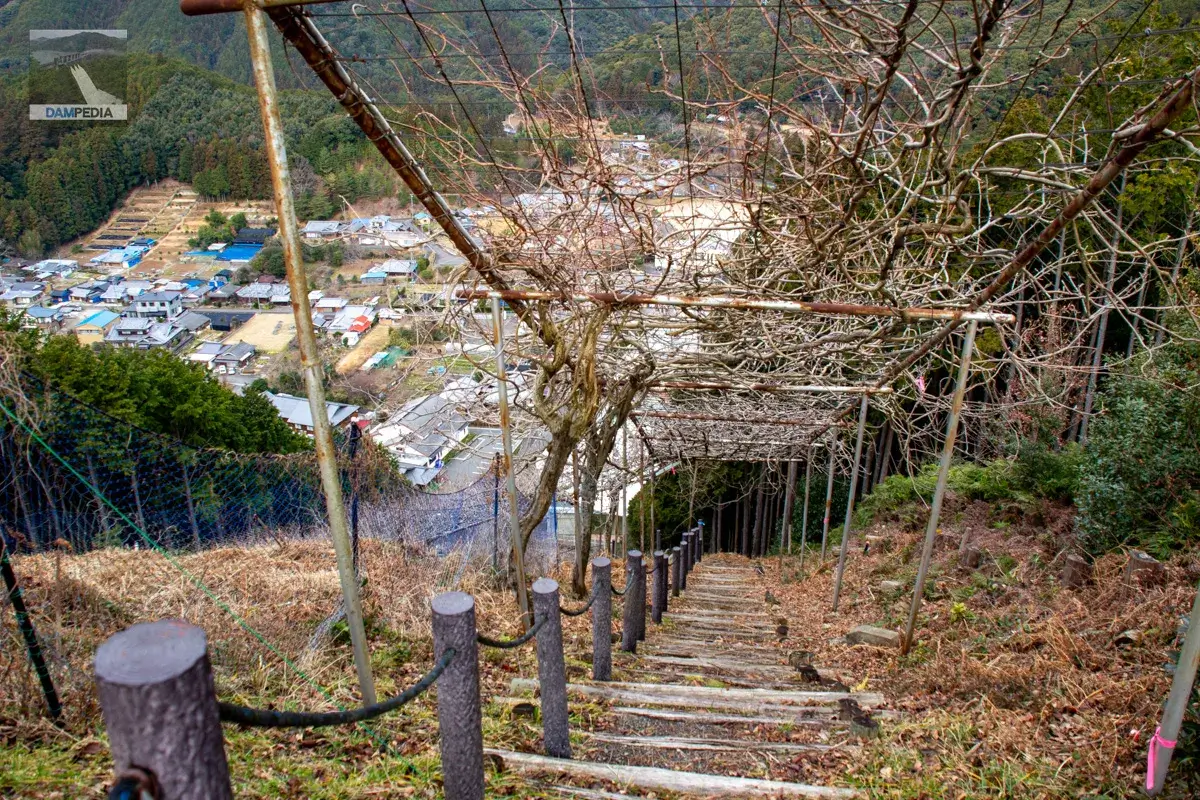
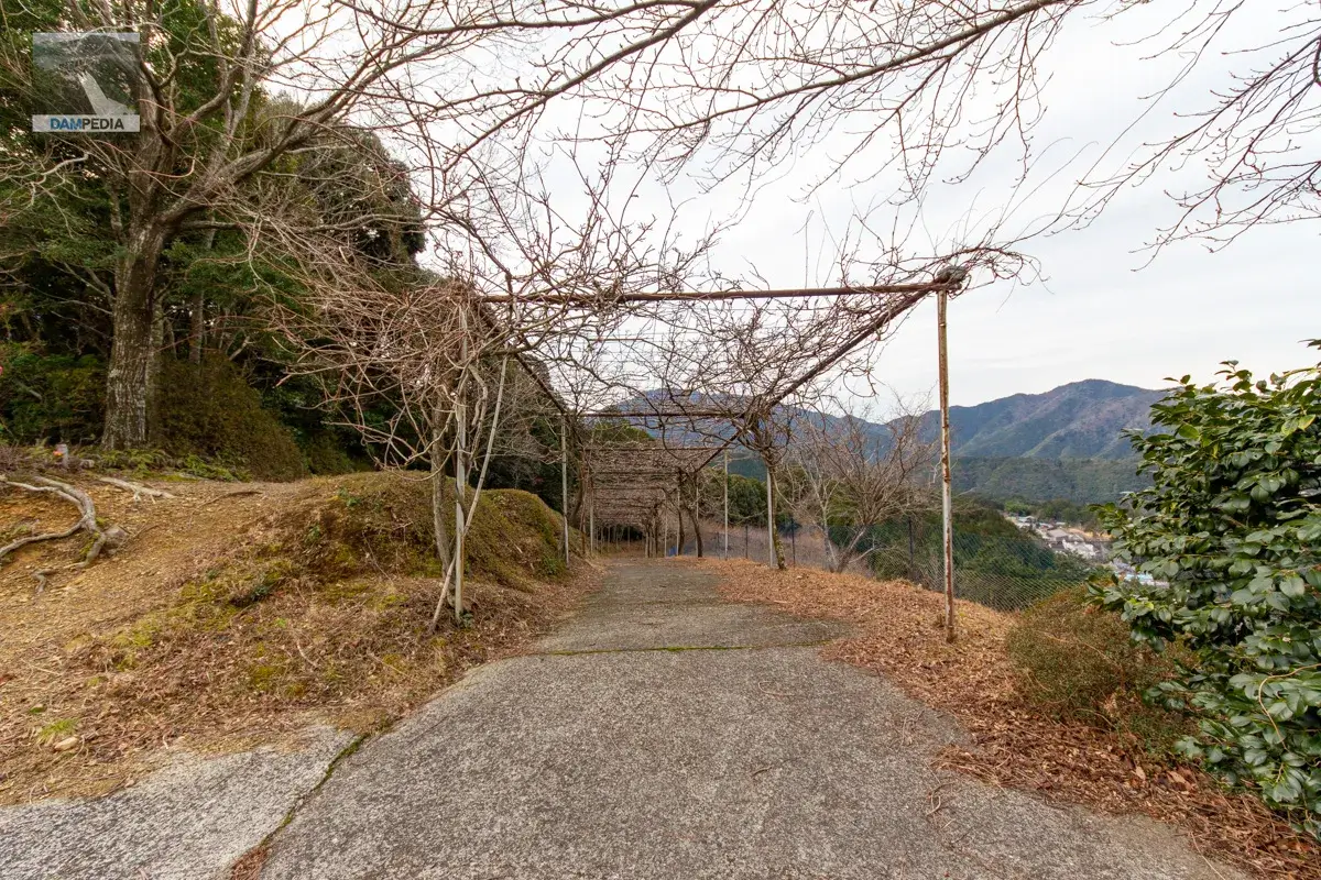
I climbed up the slope, out of breath. It is quite a steep slope. There is a row of wisteria trellises in Miyama-no-sato Forest Park, which is said to be the longest in Japan at 1,646 meters. However, since it was the middle of winter, this photo does not show the wisteria trellis at all.
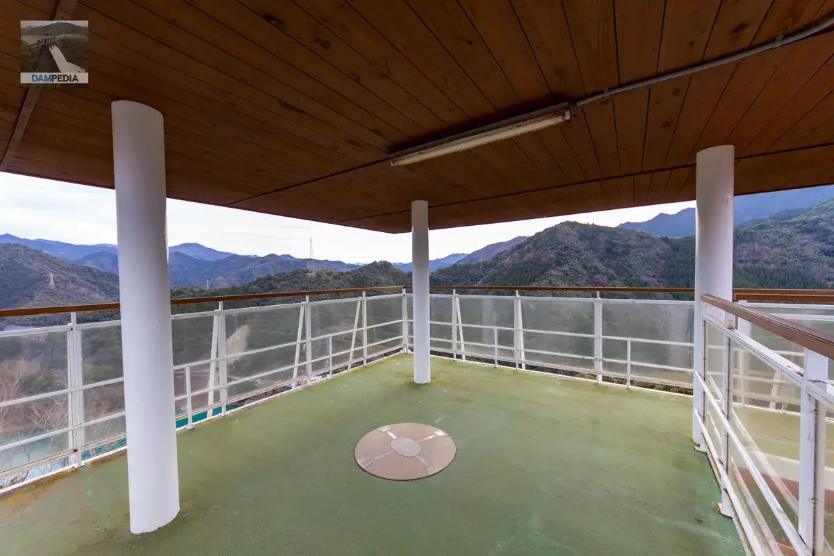
I reached the top. Then, there was this magnificent observation deck. This must be a great bird's eye view of the dam!
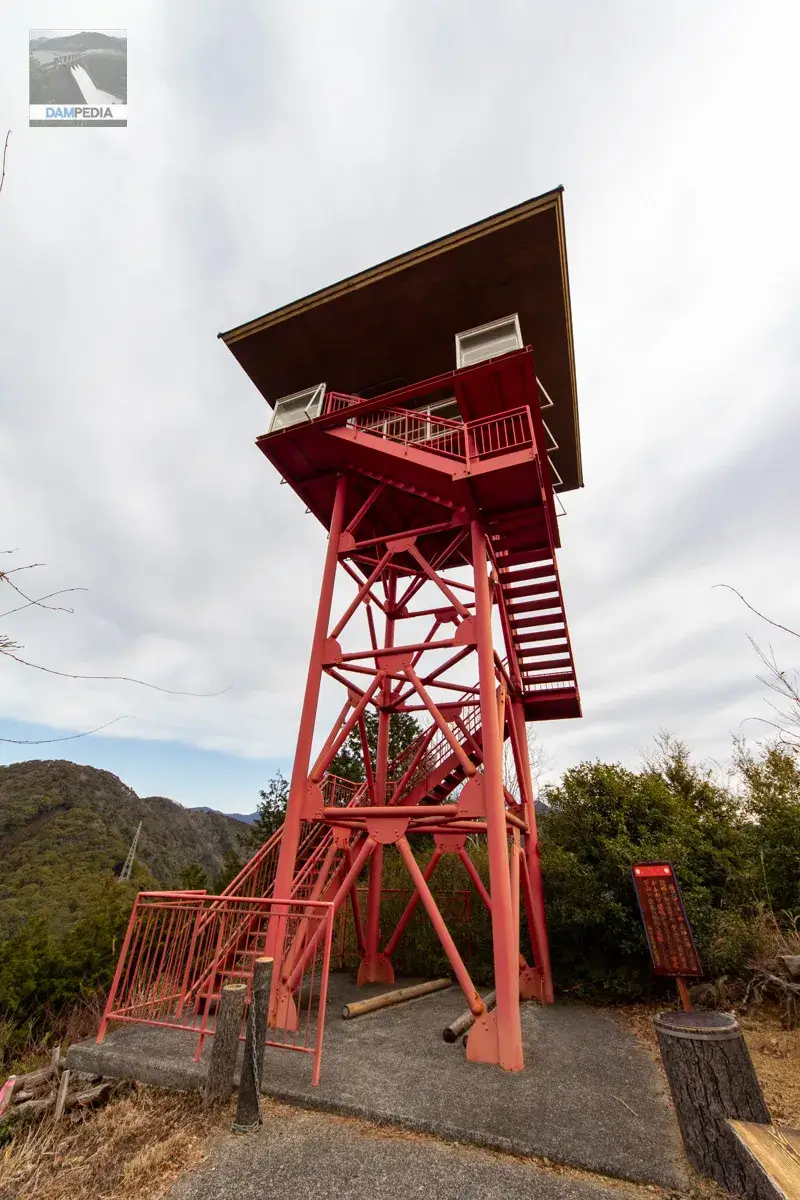
"Let me show you! Let's see what the view from the other observatory is like...!" I didn't say it out loud, but I am looking at the Tsubayama Dam from the observation deck...looking at it. Personally, it would be great if there was an observation deck a little further downstream so that I could see almost the entire levee...but yeah, well, it can't be helped. The view is nice.
It is a spacious observatory. It may be a good spot for the first sunrise. It is a little disappointing that the angle does not allow the dam to be included in the sunrise.
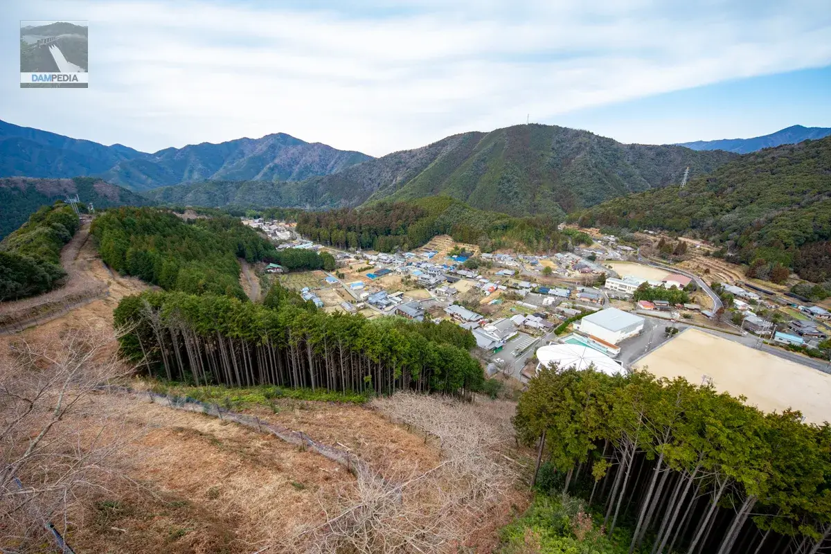
Looking in the opposite direction from the dam, you can see a panoramic view of the wisteria trellises along the ridge line and the villages at the foot of the mountain.
行きは激坂を息を切らせながら登りましたが、帰りは稜線沿いに作られた藤棚の下を歩いていきます。遠回りですがこっちの方が緩やかな勾配なので行きもこちらのルートを使った方が良かったのかもしれません💦
I descended from the observatory to the foot of the mountain. On the way down, there is this large cedar tree on the north side of the old people's home, with a sign erected that reads "Akaya no tani to hebisugi" (Akaya valley and snake cedar).
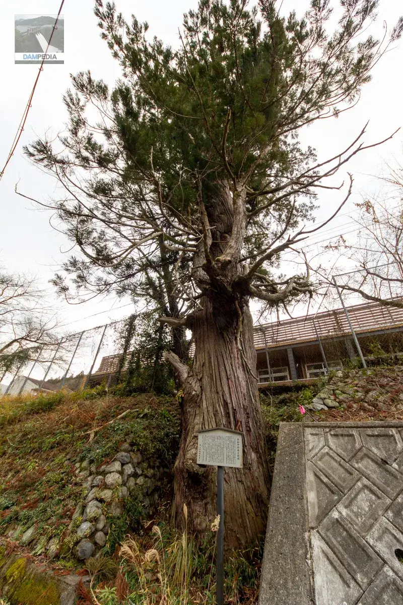
This cedar tree was home to a giant snake. The festival of the Kami-Adagi Shrine is a "walking" procession with a flute being played, and when it reached the road in front of this cedar tree, the sound of the flute angered the serpent and it appeared and attacked the villagers. The angry villagers consulted with each other and decided to exterminate the serpent.
The first thing to do was to cut down the giant cedar that inhabited this giant snake. When one of the brave men of the shrine tried to put his axe into the cedar, the serpent became enraged and attacked the man. In desperation, the man threw the axe at the serpent. The axe hit the serpent with such force that the area became a pool of blood. The serpent fled deep into the forest, wounded, and was never seen again. The blood spilled by the serpent flowed into a valley, which is still called "Akaya-no-tani. The valley flowing in front of us
During the festival, the street in front of this cedar tree is crossed without blowing a whistle.
This cedar is called "snake cedar" and is said to bleed when cut.
Miyama Village Board of Education
Signboard explaining "Akkaya Valley and Snake Cedars" (original in Japanese)
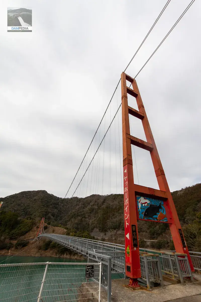
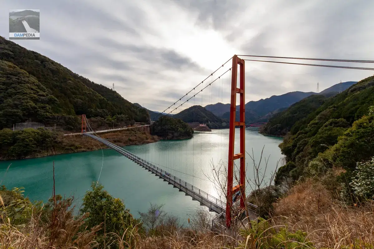
Tsubayama Lake Bridge and Yahoe Point
From Miyamanosato Forest Park, we came to the Tsubayama Lake Bridge, which is located upstream from the Tsubayama Dam. Tsubayama Lake Bridge is quite a magnificent suspension bridge.
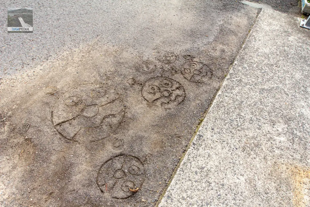
Found Baikinman graffitied on the ground at the entrance of the bridge. All of them are Baikinman.
The main tower is painted vermilion, the same color as the crest gate of the Tsubayama Dam, and is decorated with a relief that appears to be a carp.
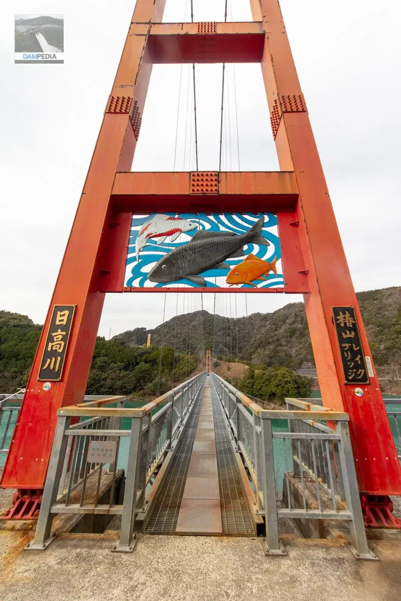
Unfortunately, you cannot see the Tsubayama Dam's embankment from the bridge, but why not try crossing the suspension bridge as an easy activity?
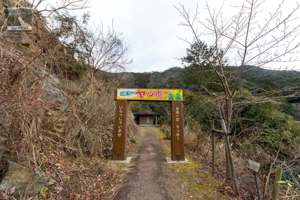
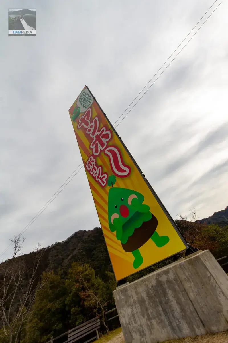
After crossing the Tsubayama Lake Bridge, you will see a gate marked "Japan's Best Yaho Point. Makoto Takase (Uncle Yoo-hoo), a yamabiko researcher living in Wakayama Prefecture, has visited 400 places in Wakayama Prefecture and found the point where the most beautiful yamabiko return to the lake. Since it was introduced on NHK's "Ohayo Nippon" (Good Morning Japan), it has been introduced on various TV programs and even appeared on "Itte Q to the Ends of the World".
The yahoo points are interesting, but the scenery can also be enjoyed to the fullest.
The actual yahoo point is located below this point, but a large sign is set up so that it can be seen from a distance. Incidentally, the characters are Yamahiko-kun at the bottom and Kodama-chan at the top.
Tsubayama Dam is also large in scale and has many attractions, and the surrounding area has been developed as a sightseeing spot, so why not visit as a dam sightseeing trip? We hope you enjoy your visit to Tsubayama Dam to the fullest.
Tsubayama Dam Specifications
| Location | Aza Hashimoto, Ubuyugawa, Hidakagawa-cho, Hidakagawa-gun, Wakayama |
| River Name | Hidaka River System Hidaka River |
| Objective | F (flood control, agricultural disaster prevention) N (unspecified water, water for river maintenance) P(Power generation) |
| Model | G(gravity-fed concrete dam) |
| Bank height | 56.5m |
| Bank length | 236m |
| Dam volume | 265,000 m3 |
| Watershed Area | 396.5 km2 |
| Reservoir area | 268 ha |
| Total storage capacity | 49,000,000 m3 |
| Effective water storage capacity | 39,500,000 m3 |
| Dam operator | Wakayama prefecture (Kinki area) |
| Main body constructor | Nishimatsu Construction, Fujita Corporation, Taiho Construction |
| Year of launch | 1966 |
| Year Completed | 1988 |
| Name of Dam Lake |
Other facilities/observations
| Parking lot | ○ |
| Toilet | ○ |
| Park | ○ |
| PR Exhibition Hall | × |
| Fishing | ○ |
| Viewing platform | ○ |
Map around Tsubayama Dam
Weather around Tsubayama Dam
Accommodations that may be close to Tsubayama Dam

Comment