

Location: Ariki, Onohara-cho, Kanonji City, Kagawa Prefecture
Date of interview: Wednesday, November 17, 2010
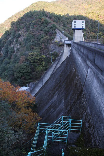
View of the top edge from the left bank

Gogo Dam is a gravity concrete dam constructed on the Maeda River in the Quaoda River system for flood control and irrigation. It is located very close to the Toyoten-ike Dam (3048 - Toyoten-ike Dam), and I actually visited there right after the Toyoten-ike Dam.
View of the levee downstream from the left bank
Unfortunately, I missed taking pictures from downstream. However, there is a chicken coop directly below, so there are not many viewpoints.
The impression of the Toyoten Pond Dam is so strong that even its features are not very acceptable.... Even the information signboard only mentions the specifications and tourist attractions near this dam (sweat).
Without mentioning this Gogo Dam, he mentions the Toyotoshi Pond Dam, and uses the subtle expression "Arimori Bridge spans the dam" (laughs).
To the west of the dam is Toyoten-ike Pond, famous for Japan's oldest stone masonry arch, and to the northeast is the Unbe-ji Ropeway, the largest ropeway in Japan. Upstream of the dam, the "Arimori Bridge," named after a Genpei legend, spans the dam, and further upstream is the Mandan Tunnel, a sightseeing route leading to Unbenji, the 66th temple of the Shikoku Sacred Sites.
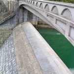
View from the left bank of the river, looking downstream
The downstream side is broken to the right, and the sub-dam can be seen at the point where it is broken. During this trip to Shikoku, I had the impression that the people of Shikoku are all friendly. I would say that they are friendly to tourists. So, perhaps the person who manages that chicken coop could have given us permission to enter.
View of the dam lake from the top
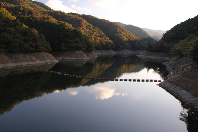
The volume of water in the dam lake is a little low. The surface of the lake is calm.
Emergency flood discharge gate pier
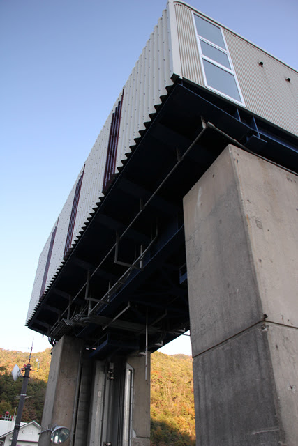
This is a beautiful gate pier for a building completed in 1964. It appears to have been renovated in recent years. It was designed by Crearia Corporation (INA at that time).
Emergency flood discharge roller gate

Type: Steel 2-stage roller gate
Number of gates: 1
Net diameter interval: 8.00 m
Door body height: 10.30m
Opening and closing method: 1M2D wire rope winding type
Opening/closing speed: 0.320 m/min when main electric motor is used
With spare motor 0.105m/min
Door weight: 43.5t
Date of production: March 2004 (A.D. 2004)
Production: Ishikawajima-Harima Heavy Industries Co.
Selective water intake facility building
The selective water intake system is also new. This appears to have been installed by Marushima Aqua System in 2007.
Stone monument at the right bank dam site
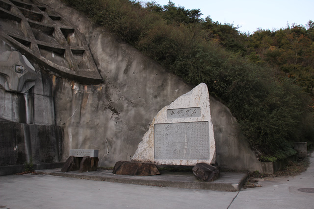
A stone monument is placed on the right bank. Most of these stone monuments are placed in a position where the dam lake and the embankment can be seen, but the Gogo Dam's stone monument was placed quietly.
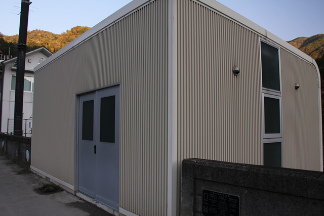
Gogo Dam Management Station
The Gogo Dam has a control center and appears to be permanently staffed.
View of the top edge from the right bank
The top end can be accessed by cars, but due to its narrow width, alternating traffic is not possible. Also, the area around the gate is cranked.
View of the levee downstream from the right bank

It was difficult to find a place where we could see the downstream bank from the right or left bank, so this was the best we could do.
Embankment surface
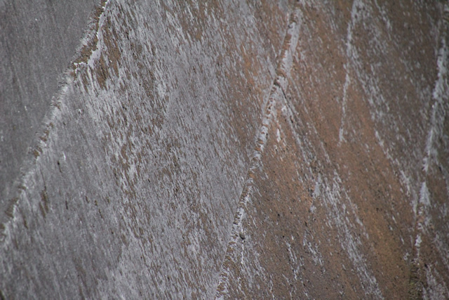
This is the concrete surface of Gogo Dam. It looks good with moss growing on it.
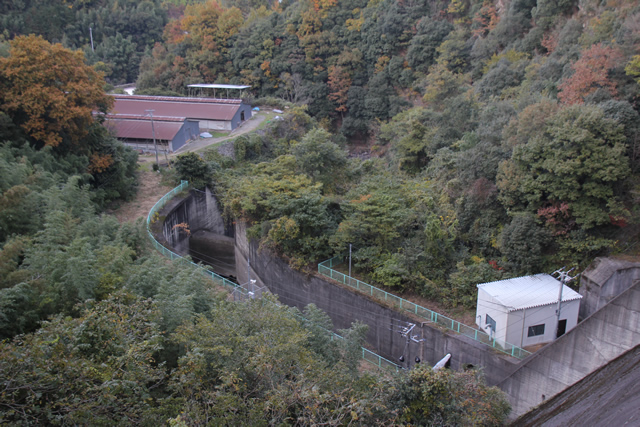
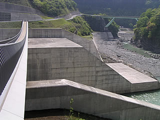
View of the flow-conducting section and force-reducing structure from the top edge

You can see a triangular structure on the left bank downstream. Although the scale is completely different, there is a similar structure at the Nagashima Dam (1178-Nagashima Dam), so it is probably a structure designed to protect the flow-conducting wall and reduce the force of the dam.
Here is a picture of the structure at its Nagashima Dam. However, that of the Nagashima Dam is integrated with the sub-dam.
View downstream from the top
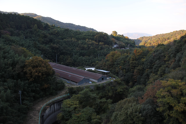
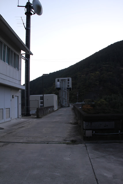
The shed downstream is a chicken coop. They say that depending on the direction of the wind, a great smell wafts through the air, lol.
Gogo Dam Specifications
| River Name | Maeda River (Quercus serrata) |
|---|---|
| Objective | Flood control, agricultural disaster prevention, unspecified water, river maintenance water |
| Model | gravity-fed concrete dam |
| Bank height | 50.5m |
| Bank length | 132m |
| Dam volume | 81,000m3 |
| Watershed Area | 12.4 km2 |
| Reservoir area | 16 ha |
| Total storage capacity | 2,500,000m3 |
| Effective water storage capacity | 2,250,000m3 |
| Dam operator | Kagawa prefecture (Shikoku) |
| Main body constructor | foundation |
| Year of launch | 1960. |
| Year Completed | 1964 |
Other facilities/observations
| Parking lot | ○ | Not a parking lot. There is a rather large space at the left bank dam site. You may park here. |
|---|---|---|
| Toilet | × | |
| Park | × | |
| PR Exhibition Hall | × | |
| Fishing | ? |

Comment