
Date of interview: Saturday, August 03, 2013
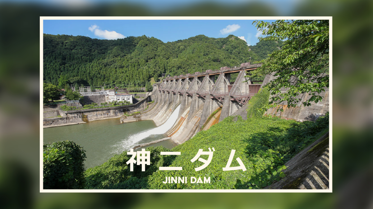
Moving on from the Kumanogawa Dam, we came to the Jinji Dam. The Jinji Dam is a power generation dam operated by Hokuriku Electric Power Company and produces up to 44,000 kW of electricity at the Jinzu River No. 2 Power Plant located directly below it. It is sometimes called the Jinzu River No. 2 Dam because of the name of the power station.
There are also three ways to read the Jinzu River, Jinzu-Ugawa, Jinzu-Ugawa, and Jinzu-Ugawa. Local people seem to be familiar with the reading "Jinzuugawa," but there does not seem to be a unified and accurate way to read the river.
Looking downstream from the left bank
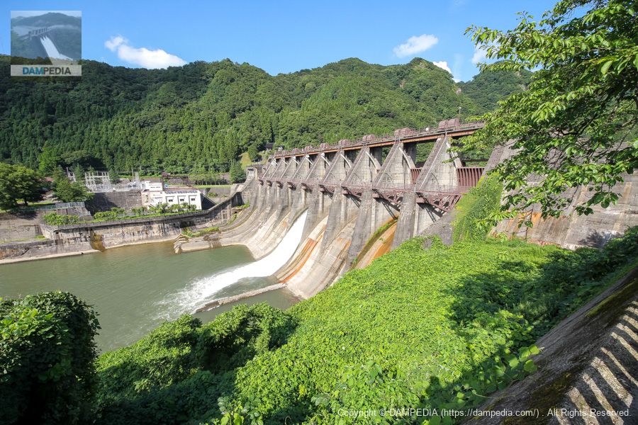
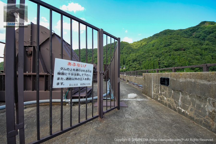
Driving along Route 41, you will find a large parking lot-like plaza open to the public, where you can park your car and walk around the dam. From the side of the parking lot, you can get a clear view of the downstream face as shown in the photo below.
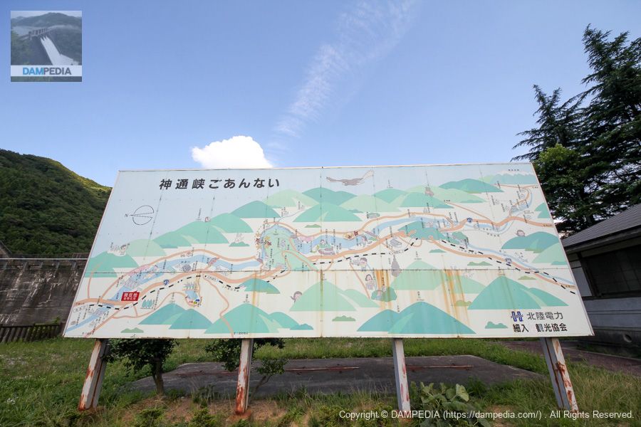
tourist information board
The Jinzu Gorge was created by the natural forces of the Jinzu River, forming a V-shaped canyon. Therefore, tourist attractions are depicted, but power plants and dams are also depicted on the information board. With a valley and a river with an abundance of water, it may be quite natural to focus on hydroelectric power generation.
Closer to the levee and looking at the downstream face
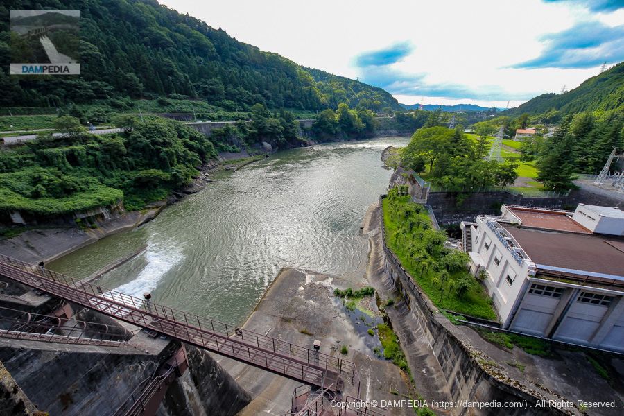
This dam was completed in 1953, and its austerity shines through. The white building on the right bank is the Jinzu River No. 2 Power Plant.

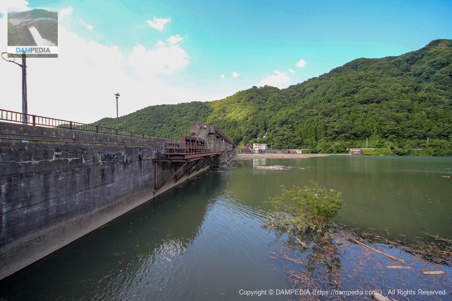
Looking upstream from the left bank
Is that the door body of the preliminary gate in the foreground?
View of the top edge from the left bank
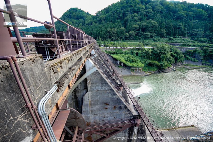
The top end of the Jinni Dam is open and accessible on foot. It is surely used as a bridge by the locals.

Further up the gated pier.
Further stairs lead to a passageway above the gate pier. In these cases, we would like to see the downstream side if possible, but unfortunately we cannot see downstream because of the gate winder.
gate nameplate
There are a total of nine radial gates at Shinji Dam, and Gate No. 9 on the far right bank has a 寫寫 board (欠瀉板・).flash board(寫寫板) attached to the reservoir. The detsuwai board is a small gate used to channel driftwood and other debris downstream from the reservoir. Since laws and the environment have changed and driftwood can no longer be discharged downstream, it is probably no longer in use.

View of the reservoir from the top
The number of driftwoods is amazing. Although the driftwood was not that large at this time, it can flow in large quantities during heavy rains and typhoons, so this photo shows that it can be an advantage for downstream users to have driftwood trapped by the levee.
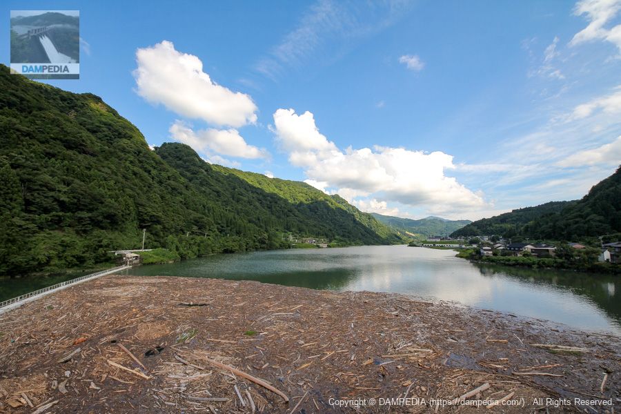
Incidentally, the reservoir is used as a rowing course, but it is stable with almost no flow due to the Jinni Dam except during floods. Also, because of the canyon, there is no crosswind, and the terrain seems to be less susceptible to rowing.
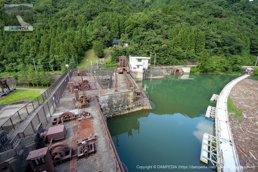
View of the water intake from the top
You can see that the driftwood fence on the right firmly traps the driftwood so that it does not affect the water intake. There is another small intake between the power generation intake and the driftwood fence, which is the intake for the "Osawano water" for agricultural use.
The Osawano Irrigation Canal was planned in 1819, started in 1865, and completed in 1868, but was damaged by a flood in 1870. After that, numerous repair works were carried out, and it was not until 1902 that the bridge was finally put to full-scale use.
Later, with the construction of the Jinji Dam, the water intake, which was originally located near the power plant, was moved upstream of the dam. Incidentally, the story of the Jinzu River and agricultural water inevitably leads to itai-itai disease, but since it is a long story, I will not go into it here.
Looking downstream from the top of the right bank
As usual, I left my family in the car, so I turned around here instead of going to the right bank road to return immediately, but the thought that I might have been able to see the embankment from the plaza visible downstream on the right bank makes me feel that I must go back to the Jinji Dam.
Downstream view of the levee from the top of the right bank
In addition, I wasn't paying attention to the kishaban at the time, so I didn't take a good picture of it. The photo below shows only a glimpse of the kishaban.
It was the Jinji Dam that I would like to revisit someday.
Jinji Dam Specifications
| Location | Iwaina, Toyama City, Toyama Prefecture |
| River Name | Jinzu River system Jinzu River |
| Objective | P(Power generation) |
| Model | G(gravity-fed concrete dam) |
| Bank height | 40m |
| Bank length | 336.8m |
| Dam volume | 107,000 m3 |
| Watershed Area | 2,060 km2 |
| Reservoir area | 67 ha |
| Total storage capacity | 8,663,000 m3 |
| Effective water storage capacity | 3,141,000 m3 |
| Dam operator | Hokuriku Electric Power Co. |
| Main body constructor | Maeda Corporation |
| Year of launch | 1952 |
| Year Completed | 1953. |
| Name of Dam Lake | - |
Other Equipment/Specifications
| Parking lot | ○ |
| Toilet | ○ |
| Park | × |
| PR Exhibition Hall | × |
| Fishing | ○ |
Comment