

Location: Yanbira-cho, Toyota City, Aichi Prefecture
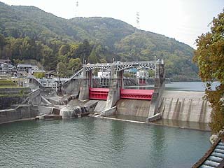
View of the levee from the downstream side of the left bank
I was checking to see if there might be something I forgot to disclose when I disclosed the Kiso Dam, and to my surprise, I realized that I had also forgotten to disclose this dam. However, it is not a dam in the narrow sense of the word, because the height of the embankment is not 15m.
To reach Momotsuki Dam, drive National Route 153 toward Asuke if you are coming from Toyota City, and go straight north on Prefectural Route 11 without crossing the Hirado Bridge. The photo was taken from Route 355 on the left bank of the river, not from Prefectural Route 11 on the right bank.
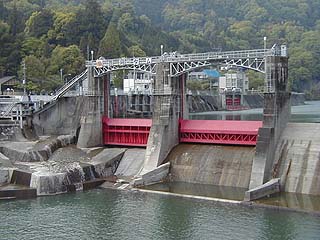
Zoom in on the flood discharge
Two roller gates. The red color is very impressive. At this height, it would have been completely submerged during the Tokai torrential rain.
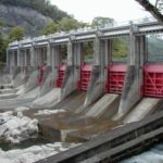
View of the fishway
It is a beautiful stepped fishway. However, I could not see the fish actually passing through.

Hyakutsuki Dam Specifications
| form (something takes) | gravity-fed concrete dam |
| Objective | generation (e.g. power) |
| Bank height | m |
| Bank length | m |
| Dam volume | m3 |
| Elevation of non-overflow area | E.L.m |
| catchment area | km2 |
| Reservoir area | km2 |
| Total storage capacity | m3 |
| Effective water storage capacity | m3 |
| River Name | Yahagigawa River System Yahagigawa River |
| Year Completed | counter for years (following a number in the hito-futa-mi counting system) |
Other facilities/observations
There is very little information on this dam, and I have no idea about the specs. I think Chuden could disclose a little more information.
| Parking lot | × |
| Toilet | × |
| Park | × |
| PR Exhibition Hall | × |
Comment