

Location: Sangamachi, Toyota City, Aichi Prefecture
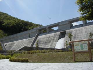
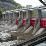
View of the levee from downstream
From Toyota City, take Route 419 to Fujioka Town. Continue north and turn left onto Prefectural Road No. 13. Continue straight on Prefectural Road No. 13 and you will find Kise Dam. You can come here without getting lost. The photo on the left was taken from the parking lot just off the prefectural road.
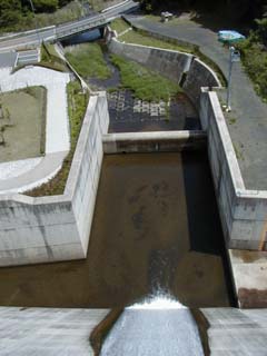
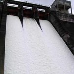
View of the flood discharge from the top of the embankment
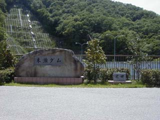
Monument from the park on the left bank
Further north on the prefectural road, there is a road to the left that leads to the top of the dam. The area around the dam is a small park, "open to the community," where many families were enjoying fishing and barbecuing on the sunny day of the photo shoot.
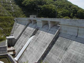
View of the embankment from the left bank
dam characteristics
| Model | gravity-fed concrete dam |
| Bank height | 33.0m |
| Bank length | 192.0m |
| Dam volume | 52,300m3 |
| Elevation of non-overflow area | E.L. 204.5m |
| catchment area | 8.9km2 |
| Reservoir area | 0.09km2 |
| Total storage capacity | 644,000m3 |
| Effective water storage capacity | 579,000m3 |
| ordinary flood discharge | Natural regulation by orifice Height 2.5m x Width 5.0m x 1 gate |
| emergency flood discharge | Crest Free Overflow Height 1.9m x Width 9.4m x 4 gates |
| water intake facility | Multi-hole selective water intake system Slide gatephi400mm x 4 gates |
| irrigation and drainage system | discharge pipephi600mm x 1 strip Jet Flow Gatephi350mm x 1 gate conduit for water supplyphi150mm x 1 strip |
| Year Completed | 1999 |
Other facilities/observations
It is a relatively new dam and has basic facilities as it is "open to the community". I personally did not expect much since it is a small dam, but it seems to be a good spot to enjoy barbecue parties and fishing.
| Parking lot | ○ |
| Toilet | ○ |
| Park | ○ |
| PR Exhibition Hall | × |
Comment