

Location: Gaoya, Seirenji, Nabari City, Mie Prefecture
Official website:.Kizugawa Dam General Management Office, Japan Water Agency
Date of interview: 2005/4/16
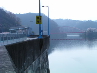
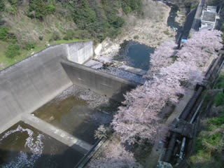
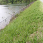
View of the dam lake from the left bank
Continuing with the Hinachi Dam, I will send you an impossible white balance setting (mystery).
So here we are at the Seirenji Dam.
Walking a dog on a lead in a turnip!
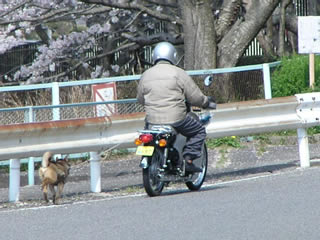
Amazing. What a speed-oriented dog walker. I wonder how the shutter caught up with him. I was running at a slow pace. So the dog is only jogging. I mean, don't do that because it's dangerous...uncle.
Downstream view of the levee from the left bank
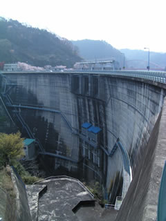
It somewhat resembles the slightly smaller Yahagi Dam or Amagase Dam.
View of the right bank of the dam lake from the top
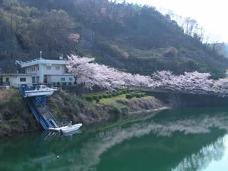
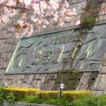
The cherry blossoms were blooming beautifully. I wish I could take more beautiful pictures...
View of the top edge from the right bank
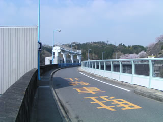
The top end is open to vehicular traffic. However, the top edge is a bit narrow, making it somewhat difficult to separate vehicles, but a shelter is provided at the top edge.
The problem is the polycarbonate fence installed downstream. It is quite high. Since Seirenji Dam has the negative aspect of being a "suicide spot," we assume that the height was taken into consideration for this reason.
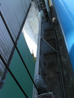
View downstream from the top
The height of the fence makes it extremely difficult to photograph downstream. However, I prepared my stepladder for such a situation. Stepladders are good. Convenient and useful. However, be careful not to accidentally fall off the stepladder while taking pictures or being distracted by the cherry blossoms. I was also taking pictures while I was in a fearful situation...lol...so I will not be responsible in case you fall down.
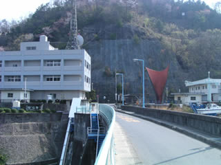
View of the right bank from the top
I wonder if they think there's a weirdo in that window.
View of the gate from the top
The gate is quite wide, so it was a bit difficult to fit it in the viewfinder. I wish I had a wicon lens for such a situation...
These are the Seirenji Dam.
Seirenji Dam Specifications
| River Name | Yodo River System Seirenji River |
|---|---|
| form (something takes) | arch |
| Objective | Flood control, agricultural disaster prevention, irrigation water, water supply, power generation |
| Bank height | 82m |
| Bank length | 275m |
| Dam volume | 175,000m3 |
| catchment area | 100km2 |
| Reservoir area | 104ha |
| Total storage capacity | 27,200,000m3 |
| Effective water storage capacity | 32,800,000m3 |
| Dam operator | Public corporation for water resources development, one construction |
| Main body constructor | Tobishima Construction |
| Name of Dam Lake | Magnolia Lake |
| Year of launch | 1964 |
| Year Completed | 1970 |
| Access | Take Meihan National Highway (Route 25) and get off at Ueno IC. Heading south on Route 368 Turn right at the intersection with Route 165 Go past Nabari City Hall and turn left at Natsume intersection before the bridge over the Nabari River. Let it run for a bit and turn right immediately. The rest will follow the road to get there. |
Other facilities/observations
| Parking lot | ○ | The left bank is a large parking lot where large buses can be parked. Toilets are on the right bank, on the lake side of the dam. Perhaps there was one on the left bank. There are also walking paths and observatories in the vicinity. It would be ideal for social visits, field trips, and picnics. |
|---|---|---|
| Toilet | ○ | |
| Park | ○ | |
| PR Exhibition Hall | × | |
| Fishing | ○ |
Comment