
Date of interview: Sunday, February 24, 2013
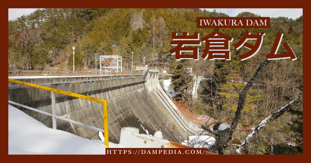
The day after the "1st Gathering with Dam Lovers in Agigawa Dam," I was going to visit the Shin-Toyone Dam, but I remembered that there was a dam near the Shin-Toyone Dam that I had not visited, so I decided to visit the Iwakura Dam in a hurry.
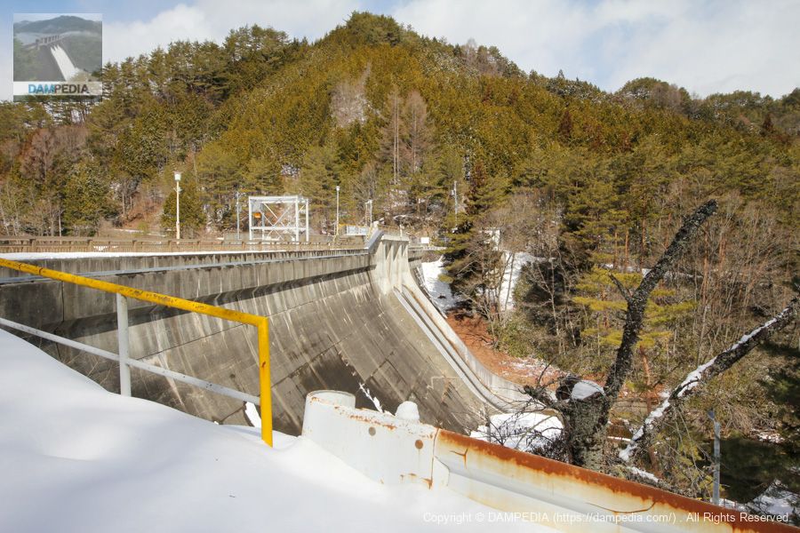
Downstream view of the levee from the right bank
I wanted to get as close as possible to the guardrail and fence, but the snow was so deep that this was the best I could do. Iwakura Dam is owned by Chubu Electric Power Co.
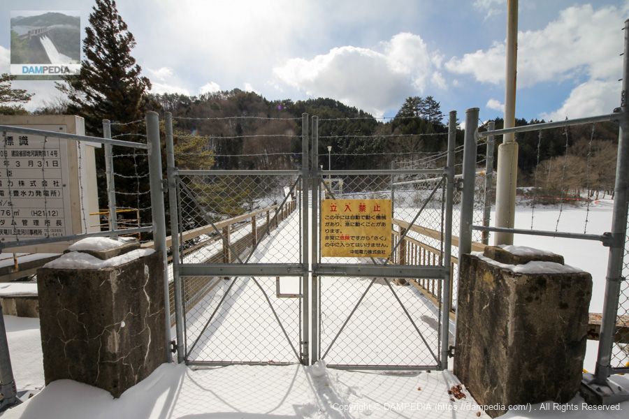
View of the top edge from the right bank
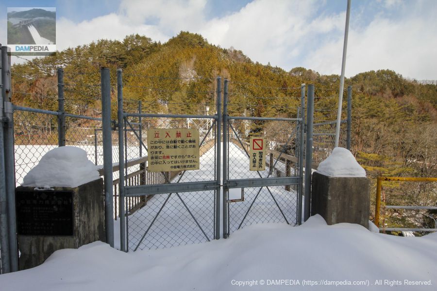
The top edge of the dam is off-limits, as is often the case with power dams.
View of the upstream face of the embankment from the right bank
The dam lake is frozen and covered with snow, giving it the appearance of a snowfield.
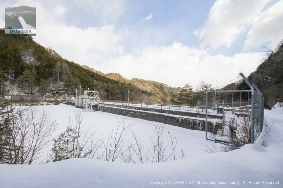
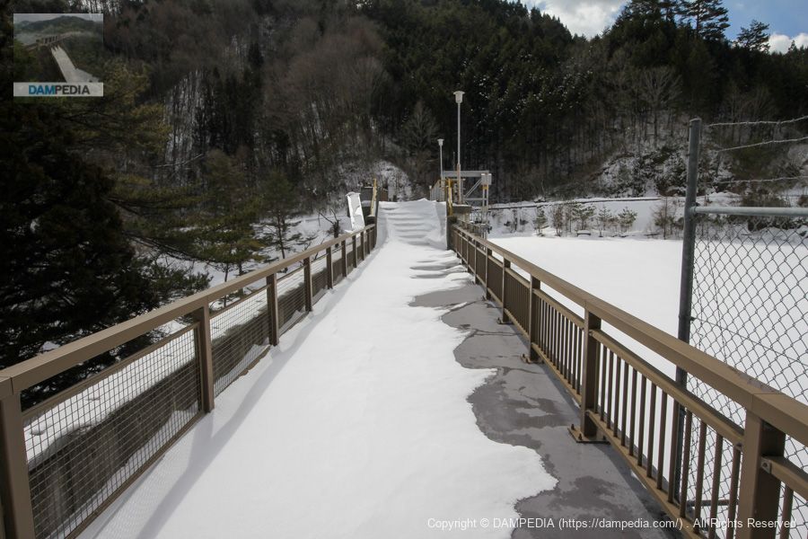
View of the top edge from the left bank
We moved to the left bank.
View of the top edge from the left bank through the fence
The left bank was not covered with snow, so we were able to peek at the top end through the fence. You can see that the top edge is higher at the gate.
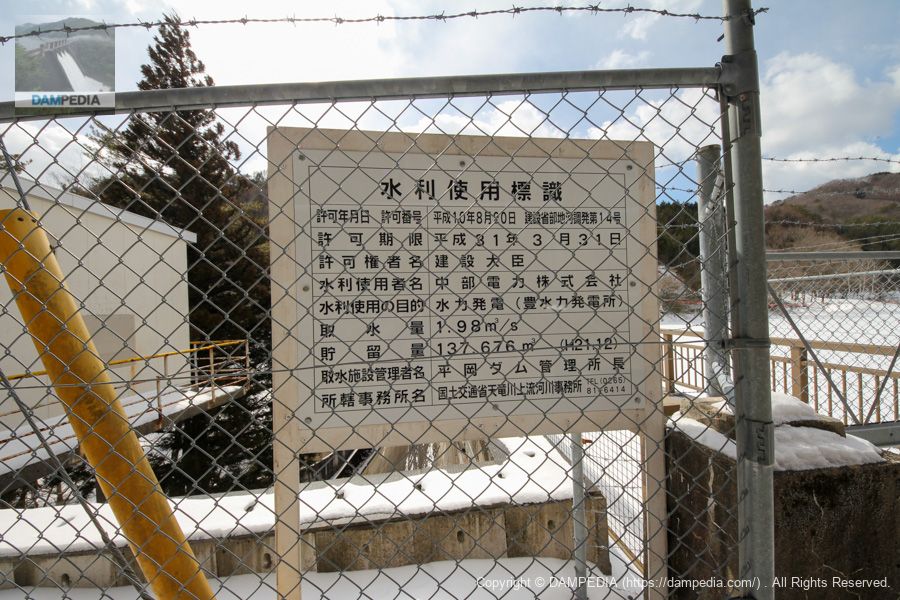
Water Use Signs
The water intake is 1.98 m3/s. The water is delivered to the Toyosuiryoku Power Station for power generation, but it is not directly connected to the power station by a conduit, etc. Instead, it is discharged into the Iwakura River, flows into the Sellaki River, is taken at the Maruhata weir, and is then carried through a dedicated channel to the Toyosuiryoku Power Station.
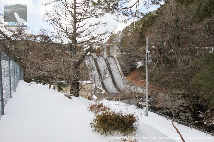
Downstream view of the levee from downstream on the right bank
We moved downstream on the right bank. We gave up on moving any closer because the snow was deep and the area directly below us seemed to be off-limits.
Incidentally, it is discharged from the Crest, but unfortunately it is gateless; it seems that they removed the Crest gate in 2000.
Iwakura Dam discharge animation
It is not a very good video, but I put it together.
Iwakura Dam Specifications
| Location | Sellaki Village, Shimoina-gun, Nagano Prefecture |
| River Name | Tenryu River System Iwakura River |
| Objective | P(Power generation) |
| Model | G(gravity-fed concrete dam) |
| Bank height | 25m |
| Bank length | 100.6m |
| Dam volume | 19,000m3 |
| Watershed Area | 8.8km2 |
| Reservoir area | 6 ha |
| Total storage capacity | 435,000m3 |
| Effective water storage capacity | 408,000m3 |
| Dam operator | Chubu Electric Power Co. |
| Main body constructor | Shimizu Corporation |
| Year of launch | 1935. |
| Year Completed | 1936. |
| Name of Dam Lake | Iwakura Reservoir |
Other facilities/observations
The Iwakura Dam Campground is located on the backwater and seems to be releasing amago. A daily fishing ticket is required for fishing.Shimoina Fishery Associationfor more information.
| Parking lot | × |
| Toilet | × |
| Park | × |
| PR Exhibition Hall | × |
| Fishing | ○ |
Comment