

Location: Omachi-city, Nagano, Japan
Official Web site:.http://www.hrr.mlit.go.jp/omachi/
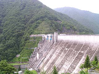
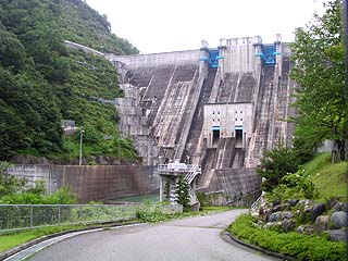
View of the levee (downstream side) from the left bank
To get to Omachi Dam, get off at the Toyoshina IC of the Chuo Expressway and take the Alps Panorama Road. However, this time we stopped by after covering the Kurobe Dam, so we are not sure if this is the actual approach or not. A short distance from the dam site, there is the Takasegawa Tepco Museum, but due to time constraints, we did not cover that site this time.
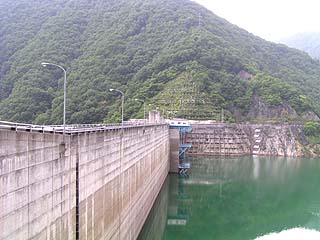
View of the embankment (lake side) from the left bank
There were many monkeys in a nearby park. There are so many monkeys that it is really unbelievable. Please do not feed them, even if they are cute. It will be the same as Nikko.
After the Kurobe Dam coverage, my senses were off and I couldn't really feel how big it was. It looks like it's going to rain too...
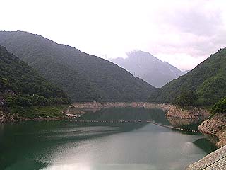
View of the dam lake from the embankment
The water in the dams in this area is very clean. Unlike the dams in Okumikawa, there is no garbage floating in the water at all.
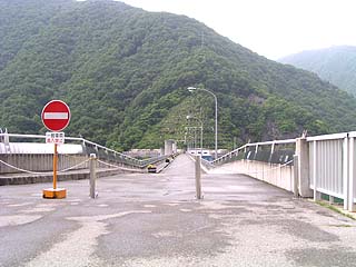
View of the embankment from the left bank
The bank is wet. It seemed to have been raining earlier. It had stopped raining at the time of the interview, so we took advantage of this opportunity to cover the event! The road for automobiles is prohibited at the top of the embankment.
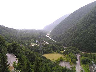
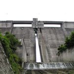
View downstream from the levee
The river in the middle is the Takase River. This river continues southward and joins the Saikawa River near Hotaka and Akeina towns. If the weather is clear, you can see the outside of Omachi City. It is said that night views can also be seen.
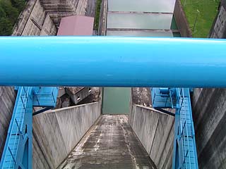
Downstream view from the crest gate
Ugh, I couldn't get a good shot because the bar at the crest gate was in the way....
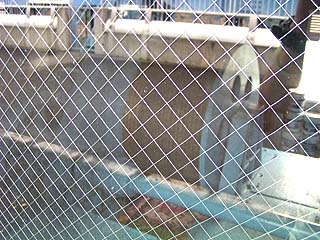
Crestgate hoisting room
There was a window in the hoisting room, so we could look inside. But it is hard to see because of the reflection...
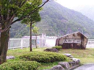
View of the monument and embankment from the left bank
View of the levee from the left bank (downstream)
The upper part isemergency flood discharge(in Japanese history)crest gateThe lower part is a permanent flood discharge (conduit gateThe dam is two gates with two gates. For some reason, I find wet dams scary, but that's just my imagination, right?
dam characteristics
| Model | gravity-fed concrete dam |
| Objective | Flood control, agricultural disaster prevention, unspecified water Water for river maintenance, water supply, power generation |
| Bank height | 107m |
| Bank length | 338m |
| Dam volume | 765,000m3 |
| Watershed Area | 193km2 |
| Reservoir area | 110 ha |
| Total storage capacity | 33,900,000m3 |
| Effective water storage capacity | 28,900,000m3 |
| Name of Dam Lake | Lake Ryujin |
| River Name | Shinano River System Takase River |
| Year of launch | 1972 |
| Year Completed | 1985 |
Other facilities/observations
This area has become a tourist destination, and there are many things to see and do. Omachi Dam is also a "show" dam, but the number of visitors is relatively small, perhaps due to the rain.
| Parking lot | ○ |
| Toilet | ○ |
| Park | ○ |
| PR Exhibition Hall | ○ |
Comment
黒部ダム 工事…
Please let me know if you have a website that describes the construction of the Kurobe Dam in detail.
黒部ダムの建造について詳しくかかれているサイトがありましたら教えてください。何気なく見たサ…