
The dam is located at the headwaters of the Kiso River.
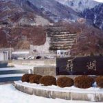
Location: Ogiso, Kiso Village, Kiso-gun, Nagano Prefecture
Official Web site:.http://www.water.go.jp/chubu/misogawa/index.html
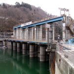
Downstream view of the levee from the right bank
Sudden New Year's Day 2003dam tourThe sixth installment in the "Misogawa Dam" series is the Misogawa Dam. This is the end of this series. To get to the Misogawa Dam, go north on Prefectural Road No. 26 from the Yabuhara intersection on National Road No. 19 and follow the signs you see for a while, or take the road leading north just after the Torii Tunnel exit on the Kiso Village side of National Road No. 19.

View of the emergency flood discharge from the top
The name of the river "Misogawa" is not written on the map at hand, and it is supposed to be the Kiso River, but why is it there? I checked and found that the Kiso River upstream from this dam is indeed called Misogawa, and since it is upstream of the Kiso River, it was named Misogawa because it "has not yet become Soso," or Kiso River.
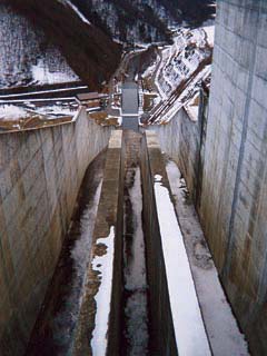
The photo above shows the emergency flood discharge, which has a beautiful slit shape. It looks somewhat similar to the flood discharge of the Agigawa Dam in Gifu Prefecture. It looks like a narrower and higher flood discharge than that of the Agigawa Dam. If it is the same as that of the Agigawa River, the orifice is in the middle and the crests are on the left and right sides.
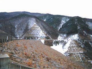
View of the lake side of the embankment dam from the right bank
In the top dike photo, there was no snow on the riprap, but there was on the dam lake side. Perhaps the snow was blowing from the direction of the dam lake side, i.e., from the north.
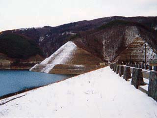
Incidentally, the top edge is open to automobile traffic.
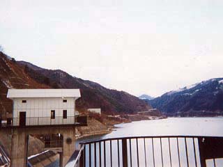
View of the dam lake from the top
The headwaters of the Kiso River lie beyond this point, and the Kiso River beyond this point changes its name to the Miso River.
dam characteristics
| Model | Central impermeable rockfill dam |
| Objective | Flood control, agricultural disaster prevention, unspecified water, river maintenance water, water for waterworks, industrial water, power generation |
| Bank height | 140m |
| Bank length | 447m |
| Dam volume | 8,900,000m3 |
| Watershed Area | 55.1 km2 |
| Reservoir area | 135 ha |
| Total storage capacity | 61,000,000m3 |
| Effective water storage capacity | 55,000,000m3 |
| Name of Dam Lake | Okugiso Lake |
| River Name | Kiso River System Kiso River |
| Year of launch | 1973 |
| Year Completed | 1996 |
Other facilities/observations
The exhibition hall was supposed to be closed during the winter season. However, it stated, "We will do our best to accommodate requests for tours even on days when the museum is closed, so please do not hesitate to contact us. They are very generous.
| Parking lot | ○ |
| Toilet | ○ |
| Park | ○ |
| PR Exhibition Hall | ○ |
Comment