
Date of interview: Saturday, May 25, 2013
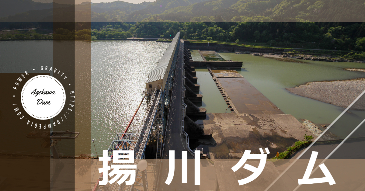
After the Shimojogawa Dam and Hayadegawa Dam, we visited the Agegawa Dam. Located on the Agano River (called the Aga River in Fukushima Prefecture), which has its headwaters in the Arakai Mountains on the border between Tochigi and Fukushima Prefectures, it is the lowest dam on the river and is owned by Tohoku Electric Power Company and dedicated to power generation.
By the way, I always thought it was "Agegawa", but it seems "Agekawa" was correct.
Downstream view of the levee from the right bank
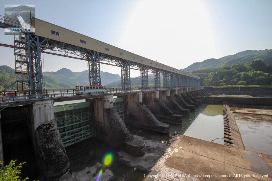
From the Hayadegawa Dam, we first came to the right bank via Prefectural Road No. 17. A Niigata Kotsu bus was just passing by the top end of the dam, and you can clearly see the size of the embankment and gate.
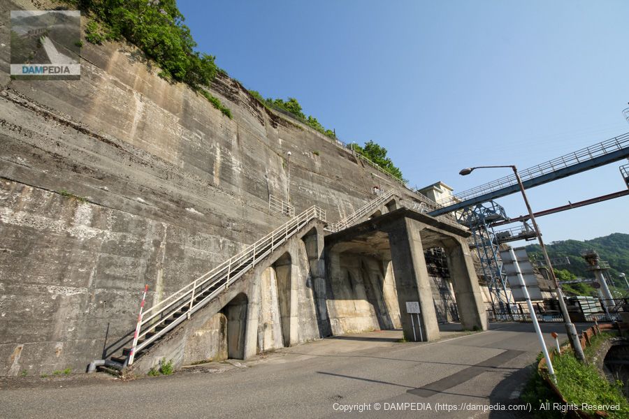
Ruins of batcher plant on the right bank
On the right bank, the remains of the batcher plant, such as this one, can be found at the time of construction. The hole in the roof has been sealed, and it looks like a covered parking lot.
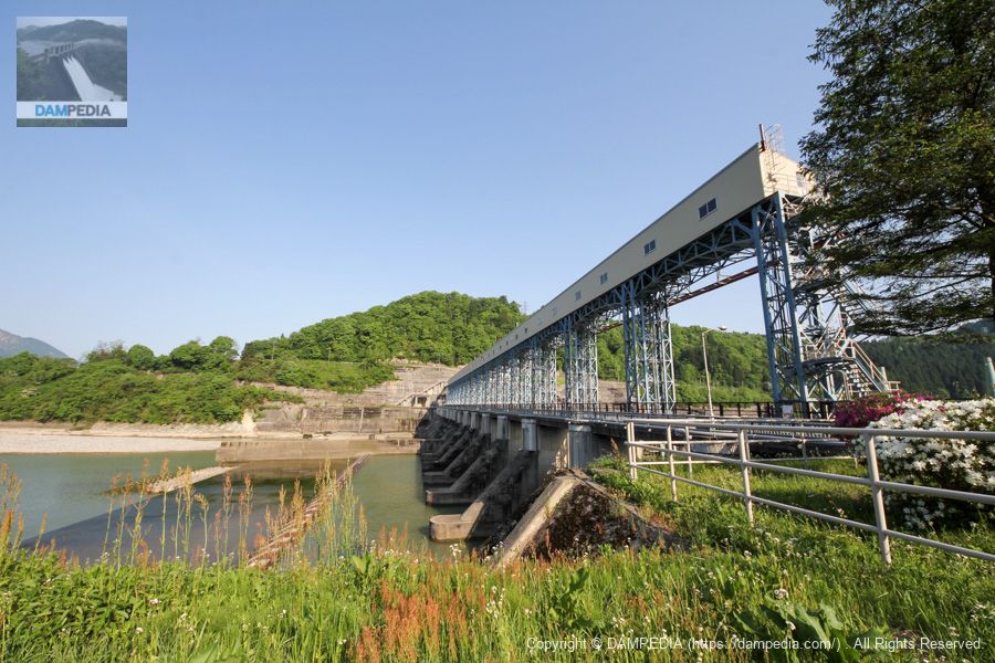
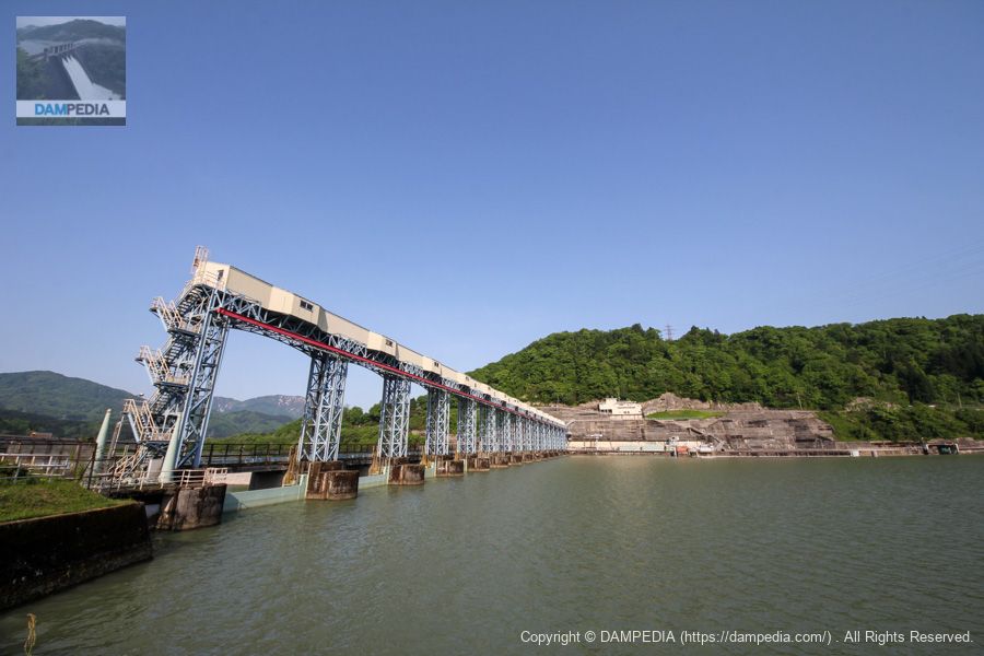
View of the top edge from the right bank
The atmosphere of the steel-framed gate piers is similar to that of the Ikeda Dam in Tokushima Prefecture.
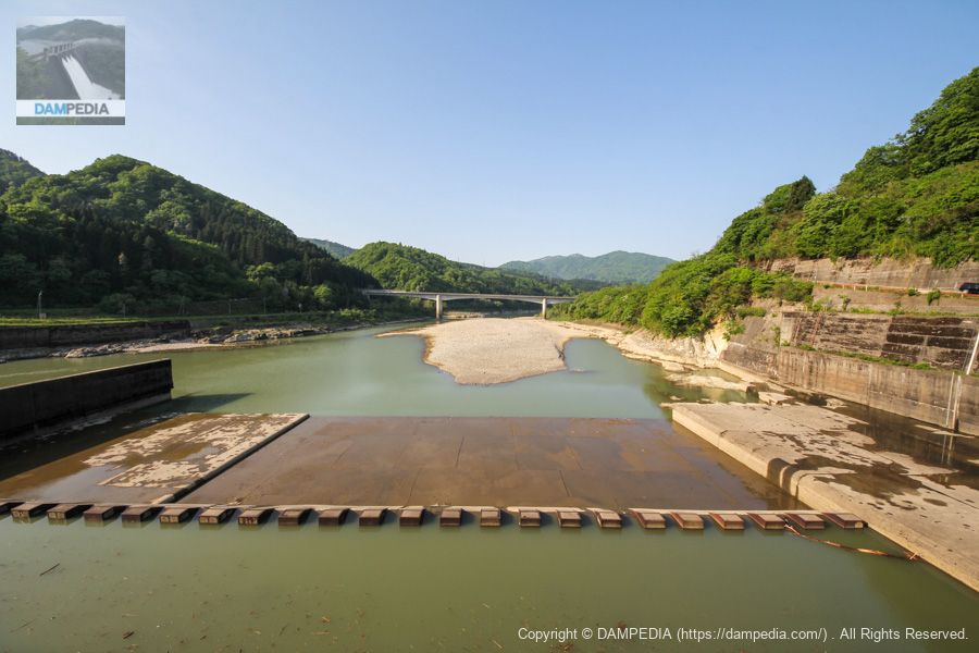
View of the reduction work from the top edge near the right bank
The Agano River is very wide. Baffle piers are neatly lined up at the reduction works, and beyond them are revetment works. The rightmost bank has a sediment discharge gate (unconfirmed), so the embankment seems to extend beyond the embankment. Another feature of the embankment is that the flow guide wall extends downstream from the center of the embankment.
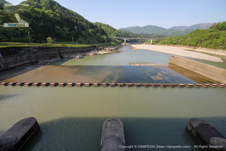
View from the top of the reduction work near the left bank
On the left bank side, the angle was taken slightly downward. The white bridge downstream is the Joban Expressway. The Agano River makes a U-turn at this point.
View of the top edge from the left bank
The upstream side is well guarded by a fence. The downstream side is terraced with concrete gate piers each.

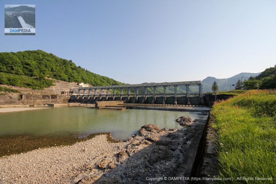
Downstream view of the levee from the left bank
The structures lined up in a row are unbearable.
Downstream view of the levee from the downstream left bank
The height of the embankment is not so high (19m), but the 316.2m length of the embankment top gives the impression of being large in scale.
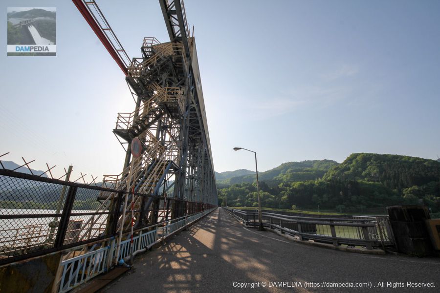
Encountering a bus on the way to the skyline
Here, too, we encountered a Niigata Kotsu bus.

View of the upstream face of the embankment from the left bank
The rugged construction of the abutment on the right bank also gives it a cool look. Also, although it is hard to see in the photo, there is an intake to the power plant on the right side of the photo.
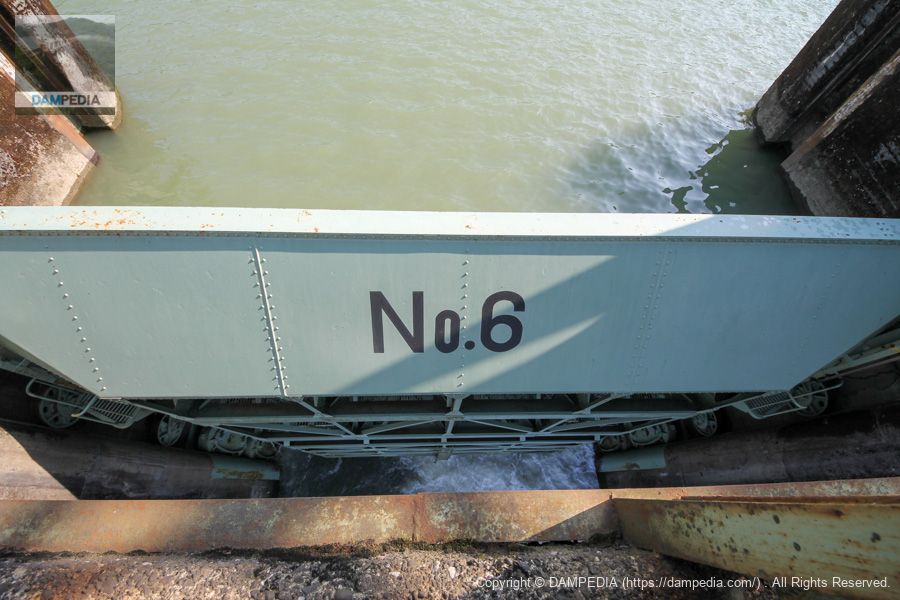
View of the roller gate from the top
After a quick tour of the left bank, we returned to the right bank, and on our way back we peeked through a gap in the fence at a roller gate. A small amount of water was discharged through this gate No. 6.
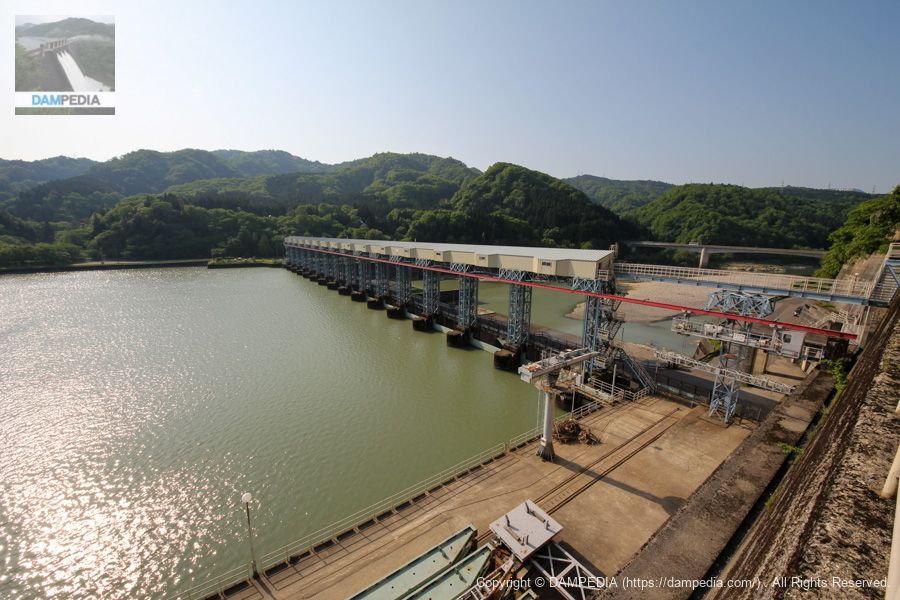
View of the upstream face of the embankment from the right bank abutment
The right bank abutment of the Yangtze River Dam is freely accessible and provides a bird's eye view of the dam. This is the best of both worlds. (Of course, I think this is more as a passage for locals than for enthusiasts.)
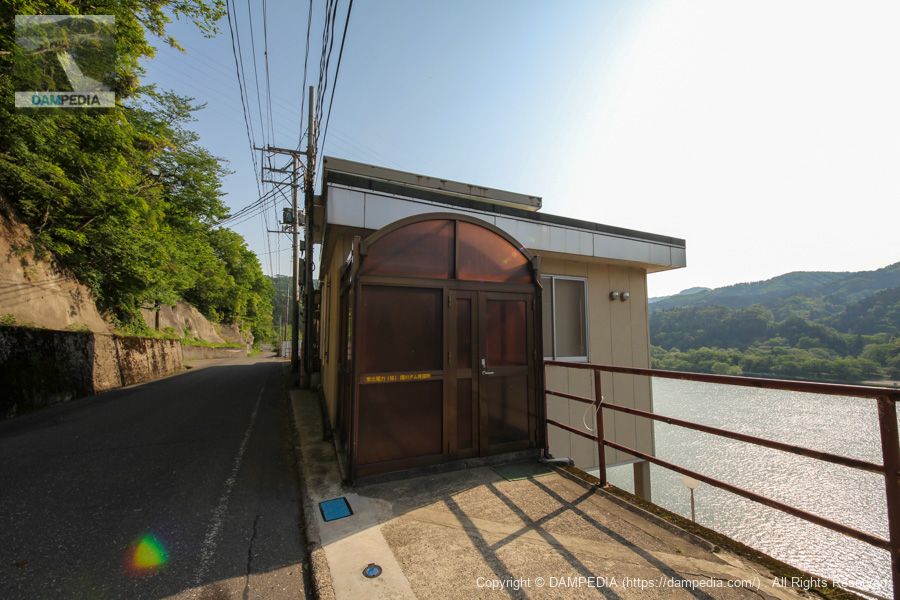
Yanggawa Dam Watchtower, Tohoku Electric Power Co.
A guard station, not a control station, is erected at the top of the abutment.
View of the dike from the top of the abutment
I left my car at the top level and walked back up, but the photo was taken on the way up. Angles like this are hard to find.

Water conduit and sluice gate of the Yangtze River Power Plant
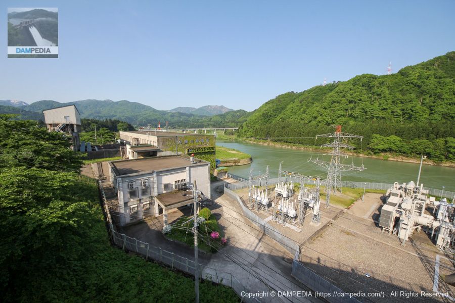
The Agano River, which flows southward, makes a U-shape and turns northward at the Yanggawa Dam, and the water taken from the dam is channeled through a conduit tunnel to a power plant at the point where the Agano River turns northward and is used for power generation. The photo below shows the exit of the conduit tunnel and the sluice gate.

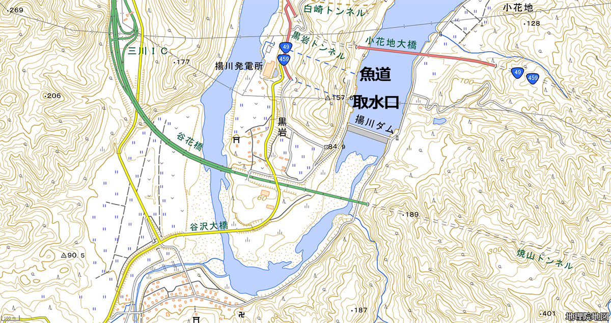
It is difficult to understand the relationship between the locations in text, so we have prepared a map. You can see that a fish passage is also installed in the form of a tunnel on the north side of the conduit tunnel to the power plant.
Upstream power plant building and spillway
The power plant building is located at the end of the sluice gate, and the water flows through the spillway to the Agano River. The back of the photo is upstream and the right hand side is downstream. The Yogawa Power Plant generates a maximum of 53,600 kW of electricity. Its maximum water consumption is 460.00 m3/s, which is said to be the highest in Japan for general hydraulic power.
The Yangtze River Dam was a very interesting power plant that utilizes the plodding flow path of the Agano River.
Yangtze River Dam Specifications
| Location | Shinse, Tanizawa, Aga-machi, Higashikanbara-gun, Niigata |
| River Name | Agano River System Agano River |
| Objective | P(Power generation) |
| Model | G(gravity-fed concrete dam) |
| Bank height | 19m |
| Bank length | 316.2m |
| Dam volume | 90,000 m3 |
| Watershed Area | 6,728km2 |
| Reservoir area | 207ha |
| Total storage capacity | 13,748,000 m3 |
| Effective water storage capacity | 5,039,000 m3 |
| Dam operator | Tohoku Electric Power Co. |
| Main body constructor | Maeda Corporation |
| Year of launch | 1961 |
| Year Completed | 1963. |
| Name of Dam Lake | - |
Other facilities/observations
The parking lot is not a parking lot with separated parking spaces, but there are large spaces on both the left and right banks of the top level, so you can park freely. The left bank is like a park, but I am not sure if it can be called a park.
| Parking lot | ○ |
| Toilet | × |
| Park | ○ |
| PR Exhibition Hall | × |
| Fishing | ? |
Map of the area around the Yanggawa Dam
Weather around the Agegawa Dam
Accommodations that may be close to the Yanggawa Dam


Comment