
Date of interview: Sunday, May 26, 2013
After visiting the Tainai No. 2 Dam, we next visited the Oishi Dam. At the time, Prefectural Route 272 was closed to traffic, so we had no choice but to use National Routes 290 and 113 as a detour, but it turned out to be quite a detour.
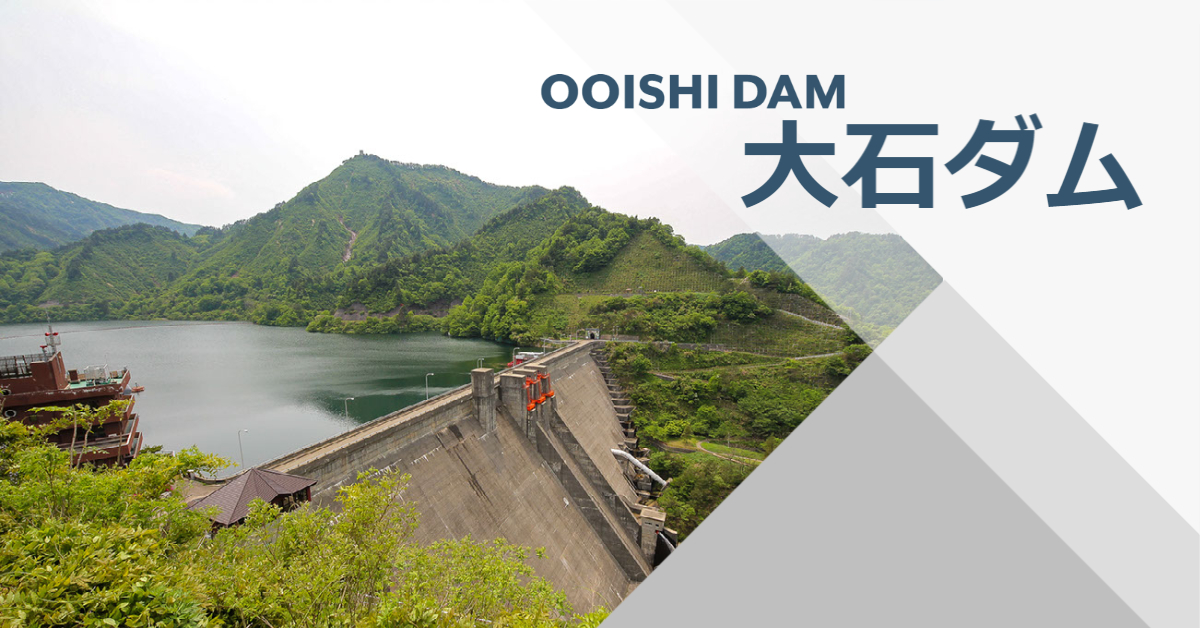
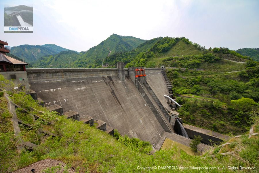
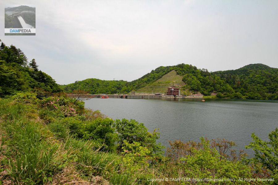
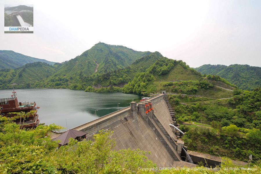
The Oishi Dam is a gravity concrete dam under the direct control of the Ministry of Land, Infrastructure, Transport and Tourism, and is responsible for flood control and power generation. Incidentally, it was the first dam built under the jurisdiction of the Hokuriku Regional Construction Bureau (now the Hokuriku Regional Development Bureau).
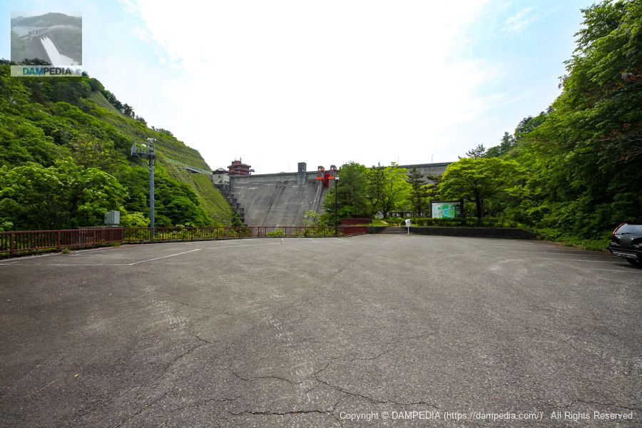
View of the levee from the parking lot on the left bank downstream
Because it is a dam under direct control, the parking lot is spacious and well maintained.
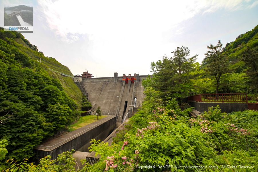
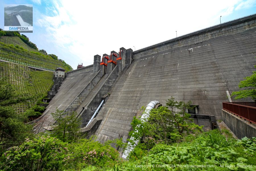
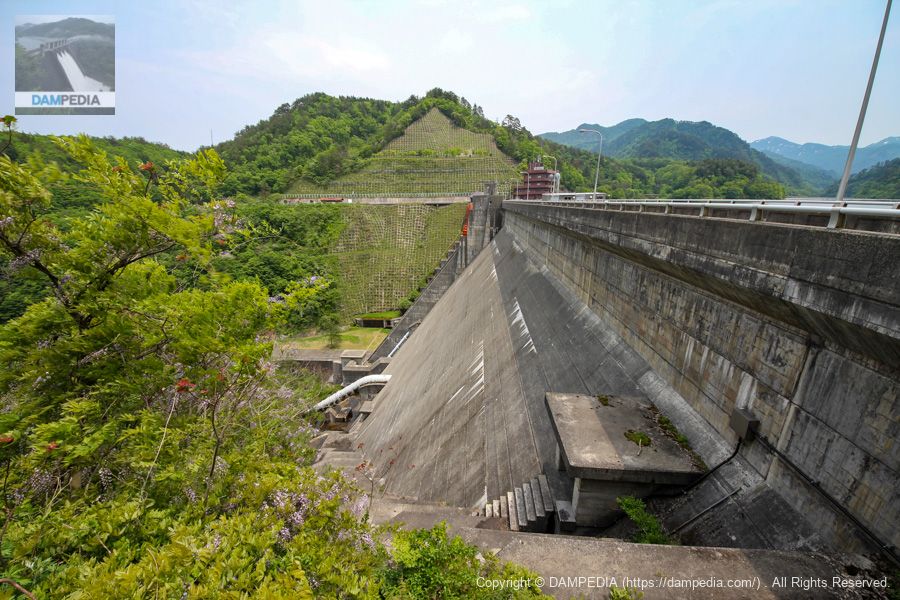
View of the levee from the edge of the parking lot on the downstream left bank
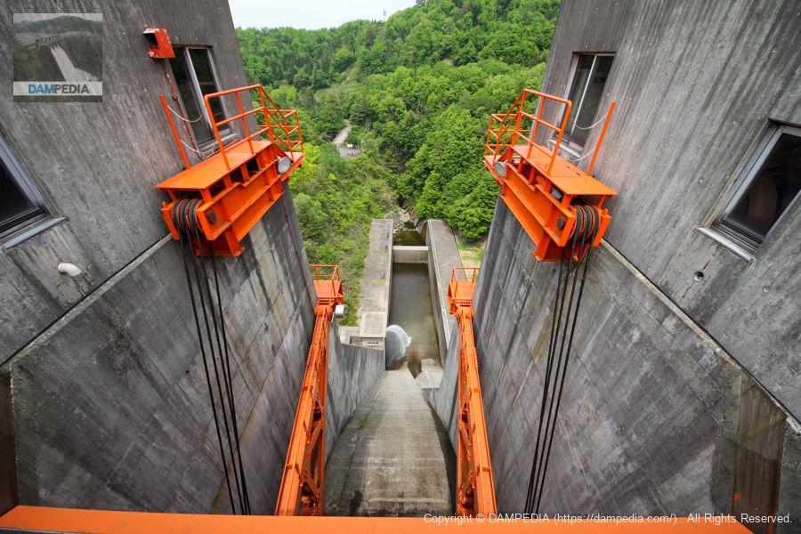
It is a little regrettable that the left bank side is hidden by trees, but it is possible to get even closer to the dike from here. The discharge facility consists of a crest gate and two red radial gates (7.0 m wide by 10.6 m high),conduit gate(3.7m wide by 4.6m high) and one "hollow jet valve (Φ600mm)".
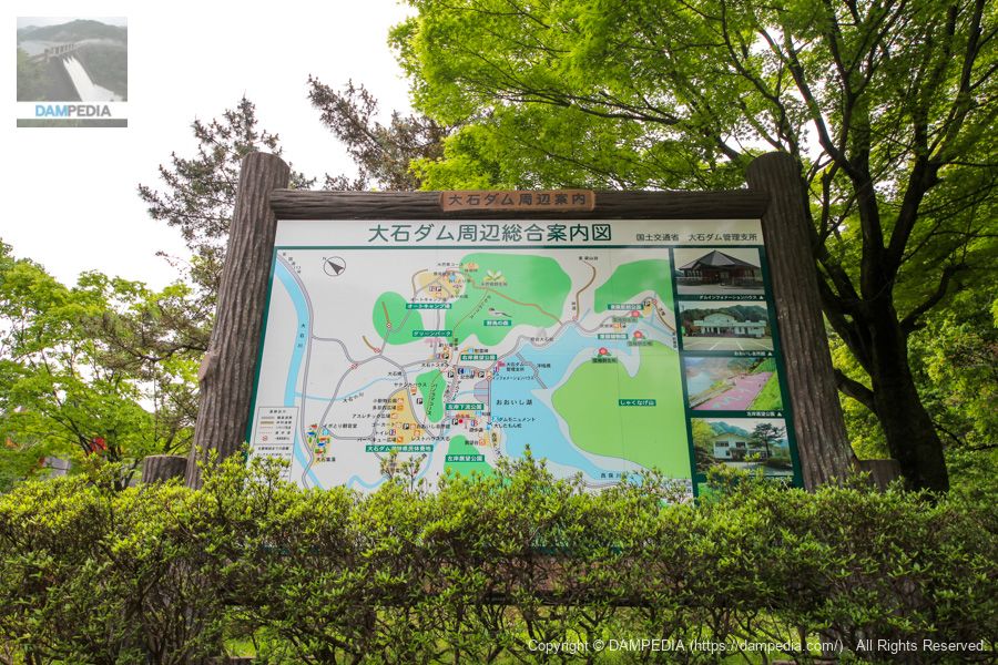
General information map of the Oishi Dam area
In addition to the parking lot, the area around the Oishi Dam is quite well maintained, with parks and campgrounds. What I personally noticed is that there are observatories on both the left and right banks, although it may be a little difficult to see in this picture.
It is rare for a dam to even have an observation deck, and even if it does, it is only on one side of the dam, on either side of the dam. The real value of an observation deck depends on how good the view is, so we decided to go there later.
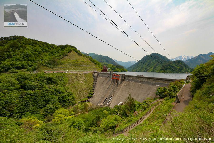
View of the levee from the park downstream on the left bank
It is also a good point to be able to get quite close to the levee downstream. It would be better if we could get a little closer to the embankment, but I guess this was the limit due to the safety design.
The white pipe in the lower part of the photo, slightly to the right of the center, is a hydraulic iron pipe for power generation, which is fed to the Arakawa Hydroelectric Power Station (Oishi Power Station) located 1 km downstream from the dam.
Phrase monument of appreciation from Sekikawa Village
Maeyama's cool shadow on the water"---The Hetsu torrential rainstorm of 1967 was a disaster that caused tremendous loss of life. The Oishi Dam was constructed in response to this, but it was a long-cherished wish of the Sekikawa villagers, and this haiku monument conveys their gratitude to those involved in its construction.
The poet of the haiku, Tomoji Ishizuka, is an honorary member of the Haiku Poets' Association of Niigata Prefecture.
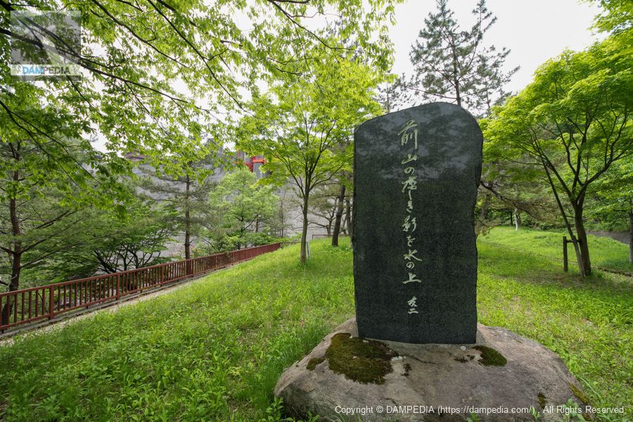
On the back of this monument is inscribed the history of the construction of the Oishi Dam and the building of this haiku monument.
The Arakawa River, a clear stream originating in the Iide-Asahi mountain range, has occasionally overflowed, causing distress to local residents. In particular, the Hetsu torrential rainstorm of August 28, 1967, which claimed 34 lives and devastated public and private facilities, causing damage totaling 20 billion yen, prompted a major revision of the national flood control plan, which included the use of dams for flood control.
Construction of the Oishi Dam, the first of its kind, began in 1972. It was completed at a cost of 15.9 billion yen. It is a great pleasure to see that the safety of the basin and the promotion of industry will be ensured in the future.
We would like to express our deepest respect to the Ministry of Construction officials and contractors who worked so hard on this project, and we would also like to express our sincere gratitude to the Oishi Tribe and other local residents who provided the land and all other aspects of the project.
This monument is erected to commemorate the completion of the Oishi Dam and to remember the names of those who were involved in its construction, as well as to wish for the unlimited development of Sekikawa Village.July 1978 Sekikawa Village
Local stone monument (original text partially modified for readability on this site)
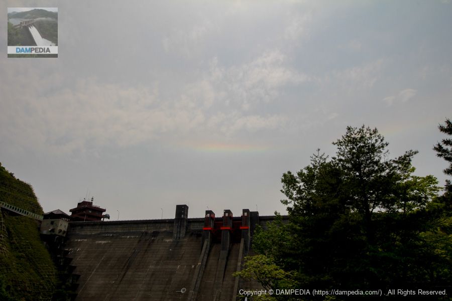
Ring-shaped horizontal arc over the dike
When I was returning to my car to go from the park downstream to the top level, I suddenly looked at the levee and saw what looked like a rainbow overhead. I wondered if the rainbow was caused by a fountain in the dam lake. But when I looked closer, I found that the direction of the arch was the opposite, and later I found out that it was a horizontal arc. (The photo has been modified to make it easier to see the horizontal arc.)
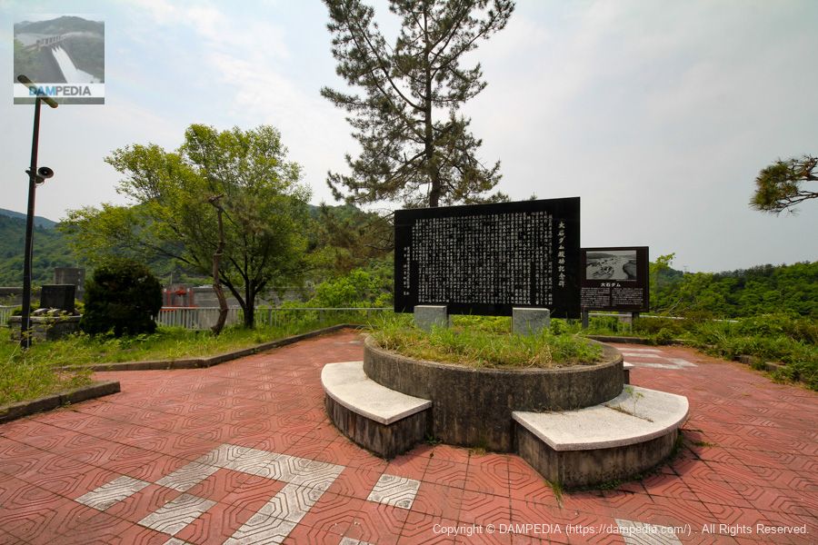
Stone monument at the top level of the right bank
We drove from downstream to the top level by car. A monument commemorating the completion of the Oishi Dam has been erected here. Behind the monument, there is a signboard that describes the history of the construction of the Oishi Dam along with the Hagetsu torrential rains.
The Arakawa River, which originates in the Iide-Asahi mountain range, cuts through Sekikawa Village, Arakawa Town, and Kanbayashi Village, and flows into the Sea of Japan. As its name suggests, the Arakawa River is extremely rough and has caused repeated disasters since the beginning of history, and has been a source of concern for coastal residents and local administrators alike.
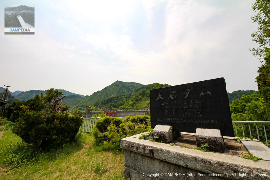
From the local stone monument, "Oishi Dam Completion Monument
In particular, the August 1967 Hagoe flood was a disaster of unprecedented scale, taking away 77 precious human names and causing unspeakable damage totaling more than 100 billion yen. The Arakawa-go Integrated Development Promotion Council petitioned the government survey team, the Disaster Countermeasures Headquarters survey team of both houses of the Diet, the Liberal Democratic Party survey team, and other survey teams that visited the area as fast as they could to request a drastic overhaul of the Arakawa River so that the disaster would never be repeated. On October 1 of the same year, the Ministry of Construction's Hetsu Construction Office was newly established in Arakawa-cho, and work began on improving and restoring the Arakawa River and National Route 113. Since then, in response to the requests of local residents, a drastic overhaul of the Arakawa River and National Route 113 was carried out at an early date, and the construction of the new Arakawa River intake weir was completed with the best of modern technology, resulting in a magnificent facility that can withstand even greater floods than ever before. Meanwhile, National Route 113 has been steadily improved, and the Sekigawa River Bypass has become a sight to behold. The construction of erosion control dams on many tributaries, including those in Yamagata Prefecture upstream, and the construction of the Oishi Dam was started in May 1972 by the Ministry of Construction at the request of the Tou Council to protect Arakawa Township from flood damage. Construction of the Oishi Dam was completed in August 1978, after 11 years and 15.9 billion yen had been spent. In addition, a study is underway this year for a flood control dam to be constructed in Oguni Town, Yamagata Prefecture. Once these dams are completed, coastal residents will never have to worry about being plagued by disasters again, and their completion is eagerly awaited. In commemoration of the 20th anniversary of the Hagoe flood, we recognize the importance of flood control projects, and as part of the commemorative project, we have erected a monument here to pray for the victims of the disaster and to pass on to future generations the achievements of all those involved in the restoration of Arakawa Township.
August Good Day, 1987
Arakawa-go Comprehensive Development Promotion Council Selected
Calligraphy by Yoshiyoshi Kaneko
The "flood control dam to be constructed in Oguni Town, Yamagata Prefecture" refers to the Yokogawa Dam, right? The stone monument, as well as the monument downstream, clearly shows how much the Oishi Dam was a long-cherished wish of the local people.
Oishi Dam Stone Monument
Yet another monument has been erected.
Downstream view of the levee from the right bank
It would be nice if we could go downstream more easily, but it seems that it is possible to enter during the "Friendship with Forests and Lakes" event, so I would like to participate if there is an opportunity. The water is being discharged from the water discharge pipe (Hollow Jet Valve).
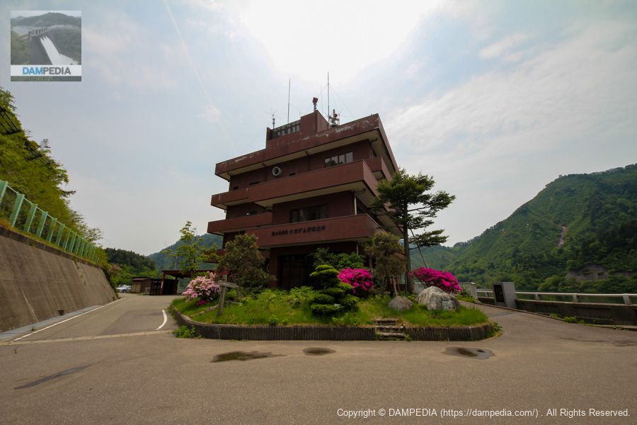
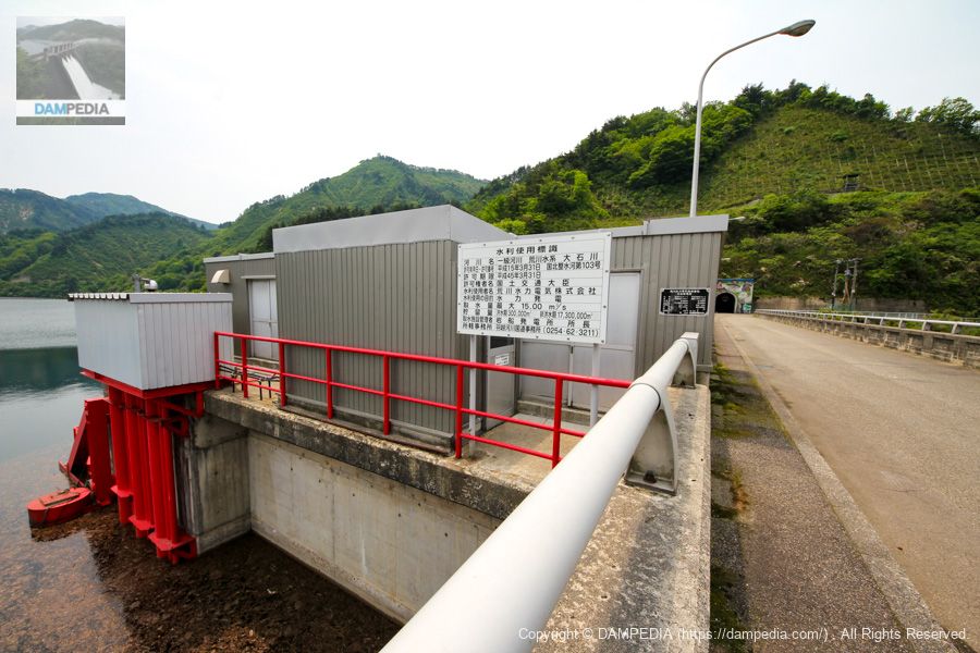
Oishi Dam Management Branch Office
It is a large management station, as it is the only dam under direct control.
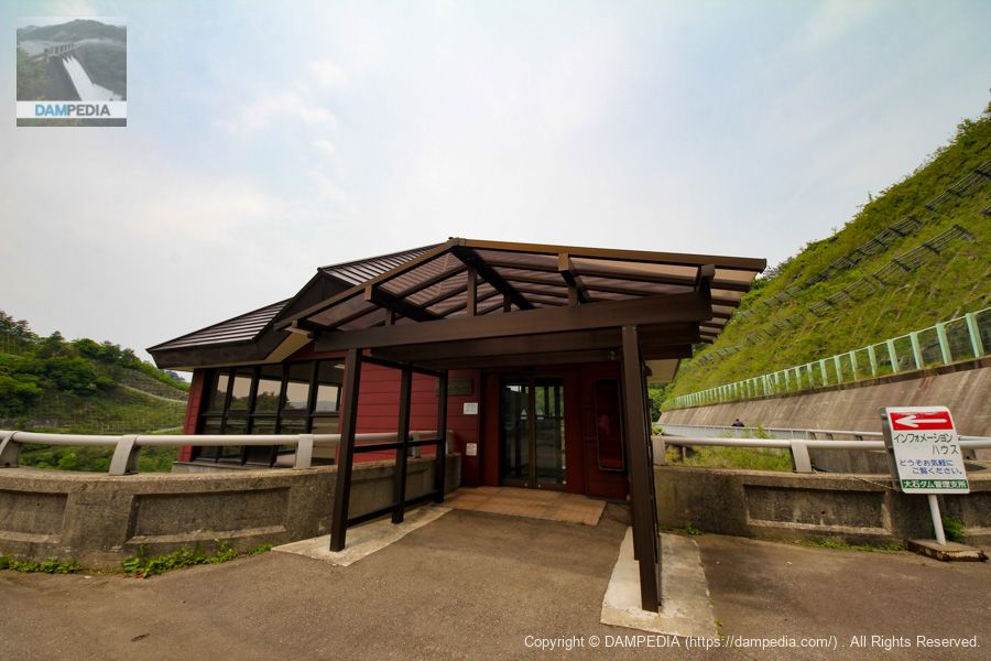
information house
The Information House is attached to the right bank as a PR exhibition hall.
Hanegoshi Flood Damage Panel Exhibition
I think it is a permanent installation, but there were panels on display about the Hanegoshi flood.

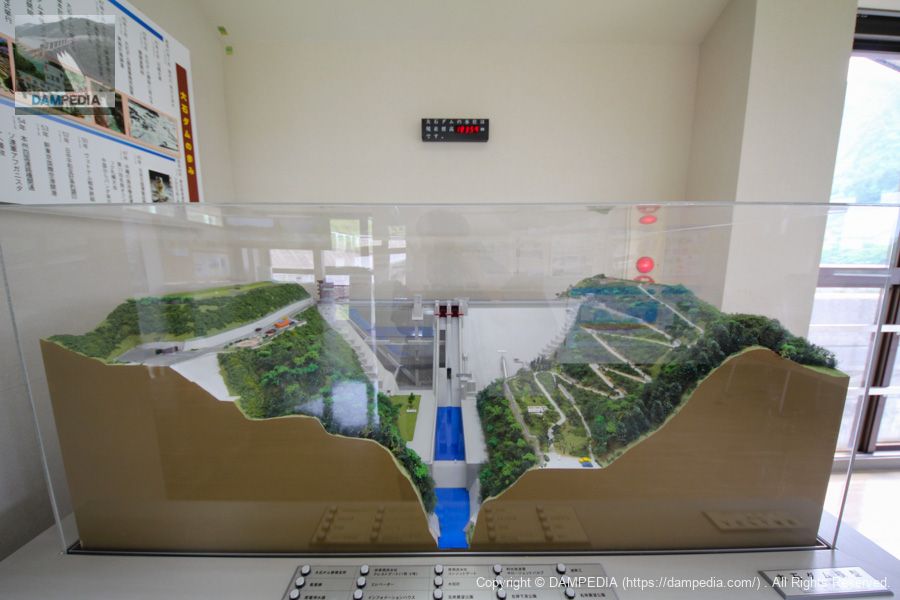
Model of Oishi Dam
Half of the dike is skeletonized to make it easier to understand the interior. The model is quite elaborate. Incidentally, the black object on the wall at the back of the model shows the current water level in elevation, which was 183.59 meters at this time.
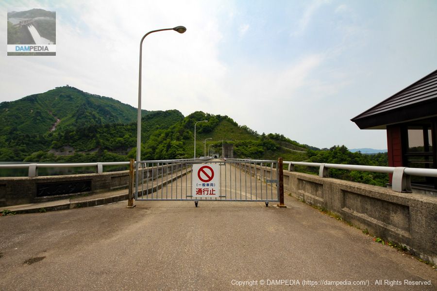
View of the top edge from the right bank
The top edge is closed to general vehicular traffic.
View of the upstream face of the embankment and dam lake from the right bank
The water level was quite high that day. If the timing had been right, we might have had a snow-melting discharge. The water level at this time was EL.183.59m as mentioned above, but it was almost there because the water level was always full at 184.0m.

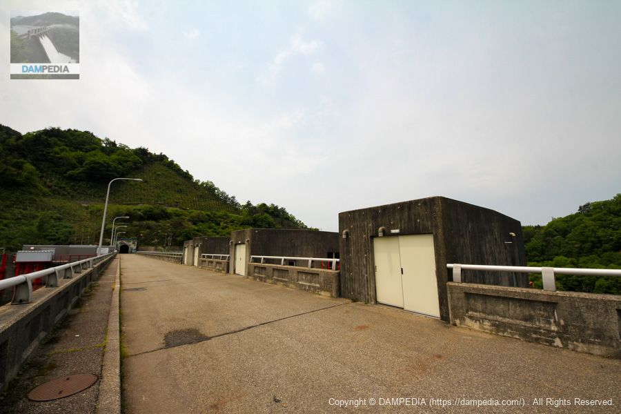
Gate winder chamber at top end
Compact gate winder room.
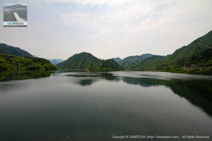
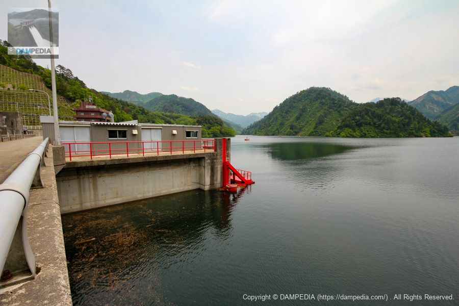
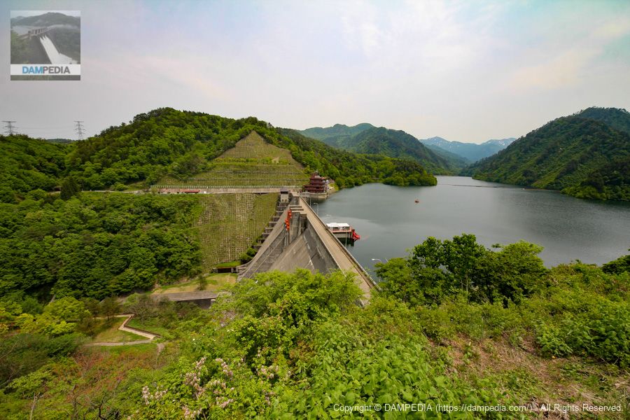
View of the dam lake from the top
The Oishi Dam is flooded from June 16 to September 30, and during this period, the water level is lowered to EL.155 m, which is the flood limit. This is a rare sight that can be seen from July to September, so it would be nice to visit again at that time.
View downstream from the top through the crest gate
The crest gate looks more like vermilion than red up close. Also, in this way, the width of the abatement works seems much narrower.
Arakawa Hydroelectric Company Oishi Power Station Intake
Arakawa Hydroelectric Corporation is a member of the Tohoku Electric Power Group, but it was established as a joint venture between Tohoku Electric Power Co. and Nippon Light Metal Co. and owns only two hydroelectric power plants: this Oishi Power Station and the Iwafune Power Station at the Iwafune Dam.
Water intake from another angle
This photo is taken by going around to the opposite side from the photo above. It looks redder than the vermilion color of the crest gate.
The specifications of the intake gate are as follows
| name | Surface water intake gate | Water intake control gate |
| Model | 4-stage steel roller gate | Steel roller gate with bypass valve |
| straight-radius interval | 3.600m | 2.700m |
| Inlet Height | Gate height 32.000m | 3.200m |
| Opening and closing speed | 0.3m/min | 0.3m/min |
| lifting height (of a pump, etc.) | 25.400m | 38.000m |
| number of gates | (one) gate | (one) gate |
Date of production: December 1997
Production: Marushima Water Gate Manufacturing Co.
View of the hydraulic pipe from the top
Looking at the location of the power plant, it appears that the hydraulic iron pipe extending from the dike is straight but immediately turns to the left (west).

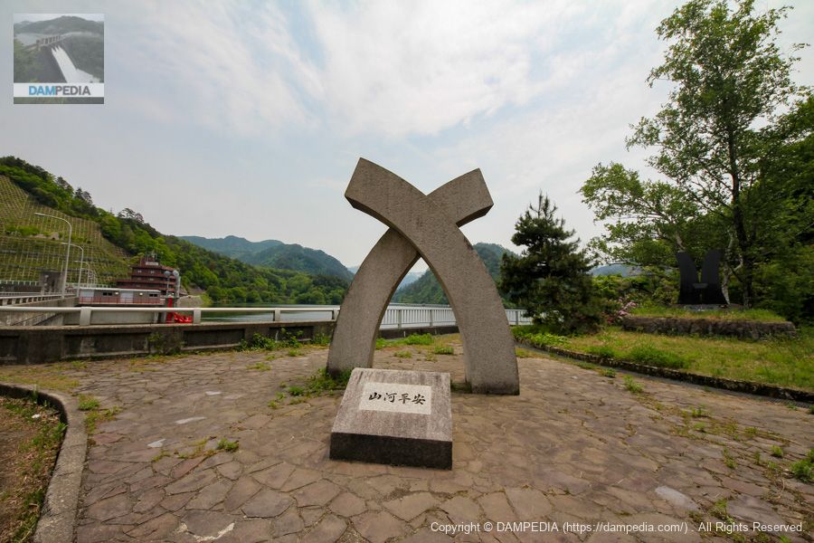
Monument on the left bank
In front of the monument is a monument that reads "Mountains and Rivers at Peace. It is best for both mountains and rivers to be at peace. There is another monument on the far right, but I have not confirmed what it is for.
View of the top edge from the left bank
The upper part of the abutment on the right bank is a viewing platform, but it appears to be using the site of a former batcher plant. (Unconfirmed)

Downstream view of the levee from the left bank
Looking at it this way, the construction of the slope on the right bank is amazing. There is a sense that it has been solidified. The absence of large trees, although grass is growing, is a great advantage to protect the view from the observation deck.
A view of the downstream side of the dike from a little downstream on the left bank
We moved a little downstream from the top end. It is a good point to see the levee from various angles.

View of the downstream face of the levee on the way to the left bank observation platform
As you gradually gain elevation, you start to catch your breath (lack of exercise), but the scenery is nice and gets you excited.
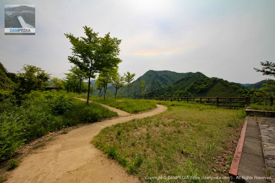
left bank (of a river) viewing platform
We finally arrived at the left bank lookout. It is a fairly well maintained observation deck with a pavilion. The sign on the left is a legend of Sekigawa Village.Daisato PassThe story of the giant serpent of the "Mere Old Man" is published in dialect.

View of the levee from the left bank observation platform
It would be nice if there were a few more trees in the foreground, but it is still a good vantage point where most of the levee can be seen clearly. It also gives a good sense of the water storage. This is definitely a viewpoint that should be climbed.
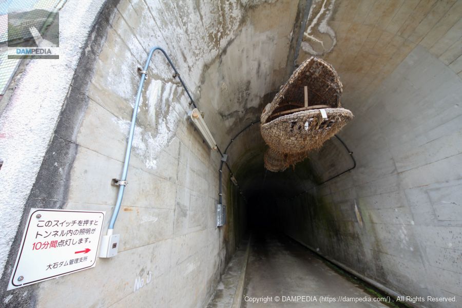
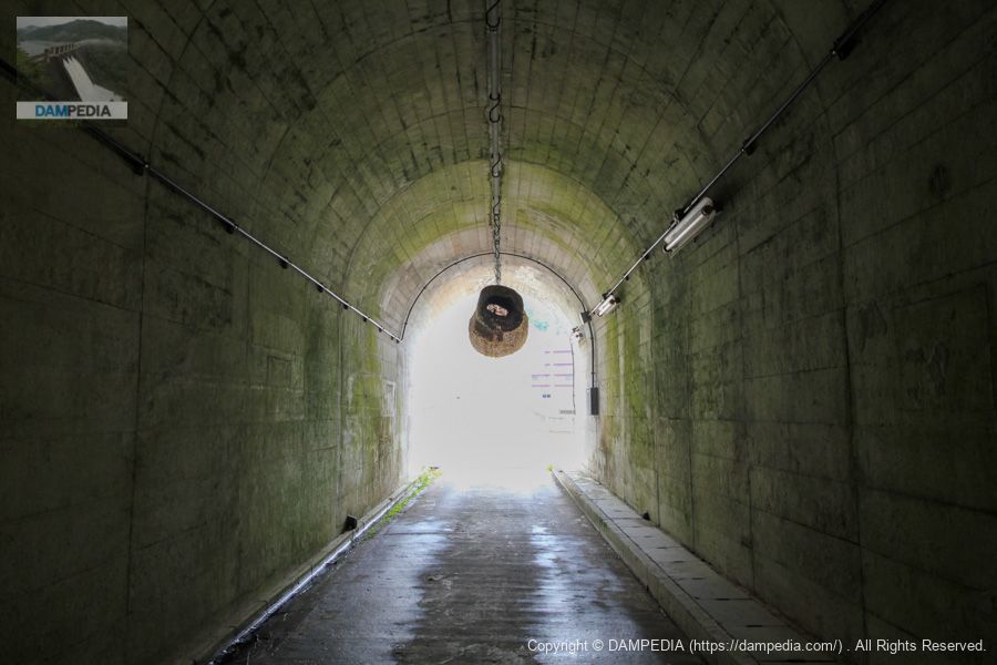
Nishimata Tunnel Portal
Nishimata Tunnel is a tunnel that leads out to the lake road on the left bank. It connects directly to this tunnel from the top end, but perhaps it also serves as a rim tunnel?
The portal is illustrated with the legend of the giant snake that was also in the aforementioned park. And inside the tunnel is a...
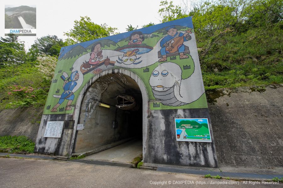
boa constrictor (Nephila pilipes)
The Oishi Dam pamphlet describes it as a "Great Monster Snake Monument," but it is a giant snake made of straw and bamboo. In Sekikawa Village, the "Echigo Sekikawa Great Monster Snake Festival" is held once a year, and the festival is based on the legend of the Osato Pass.
The serpent is 82.8 m long, 1.2 m thick, and weighs 2 tons, and was recognized by Guinness World Records in 2001 as the world's longest snake made of straw and bamboo. Only its head is enshrined in this tunnel. The head of the snake is enshrined in this tunnel. Other photos in the tunnel show that the body seems to be longer, but perhaps it has deteriorated and become shorter.
そしてトンネル内が真っ暗ですが、入口にスイッチがありそれを押すと10分間点灯するそうです。しかし先が見えないので10分過ぎたらどうしよう…という不安な気持ちに😓
Inside Nishimata Tunnel
一人寂しくとぼとぼとトンネルを進みます。で、出口が見えない💦大蛇のお腹の中にいるのかもしれません。

Valley near the exit
When we finally passed through the tunnel, we found a small valley on our right, where snow had accumulated.

View of the upstream face of the levee from the lakeshore road on the left bank
It seems to have moved away from the levee more than I expected. However, I think this photo clearly shows that it is full of water.
Buckshot of a great snake
来た道を引き返してトンネルの入口に戻ってきました。大蛇の後ろ姿…ちょっと寂しい感じもしますね😓
Right bank observatory
Finally, we came to a lookout on the right bank. Like the observatory on the left bank, this observatory is well maintained with a pavilion and other facilities. The cenotaph for those who died during the construction is on the right side of the photo. Here, too, you can see the Kankuihirak.
Traces of batcher plant?
At the south end of the right bank observation deck, there are concrete remains such as these. It may be the remains of a batcher plant.

View of the levee from the right bank observatory
And finally, the Oishi Dam viewed from the right bank observation deck! This view! I can only say that it is wonderful.
It is unusual just to have observation decks on both the left and right banks, but both are well maintained, and the views are good enough to see the levee downstream, giving a perfect sense of the water being stored. There is so much to see at this dam that we recommend that you allow plenty of time for your visit! (For reference, the tour took about 1 hour and 30 minutes at this time)
Oishi Dam Specifications
| Location | Sekikawa-mura, Iwafune-gun, Niigata Prefecture |
| River Name | Arakawa River system Oishi River |
| Objective | F (flood control, agricultural disaster prevention) P(Power generation) |
| Model | G(gravity-fed concrete dam) |
| Bank height | 87m |
| Bank length | 243.5m |
| Dam volume | 400,000 m3 |
| Watershed Area | 69.8km2 |
| Reservoir area | 110 ha |
| Total storage capacity | 22,800,000 m3 |
| Effective water storage capacity | 17,800,000 m3 |
| Dam operator | Hokuriku Regional Construction Bureau |
| Main body constructor | Maeda Corporation, Sato Kogyo Co. |
| Year of launch | 1970 |
| Year Completed | 1978 |
| Name of Dam Lake | Lake Ohishi |
Other facilities/observations
| Parking lot | ○ |
| Toilet | ○ |
| Park | ○ |
| PR Exhibition Hall | ○ |
| Fishing | ○○ (excluding no-take zones) |
Map around Oishi Dam
Weather around Oishi Dam
Actual accommodations
*It was "Tsukioka New Hotel Kangetsu", but in April 2018 it joined the Hotel Area One Group and changed its name.
Comment