
Date of interview: Saturday, September 15, 2012
However, since the Ishibuchi Dam is now a phantom dam, we hope that this release of information will be considered a memorial to the dam.
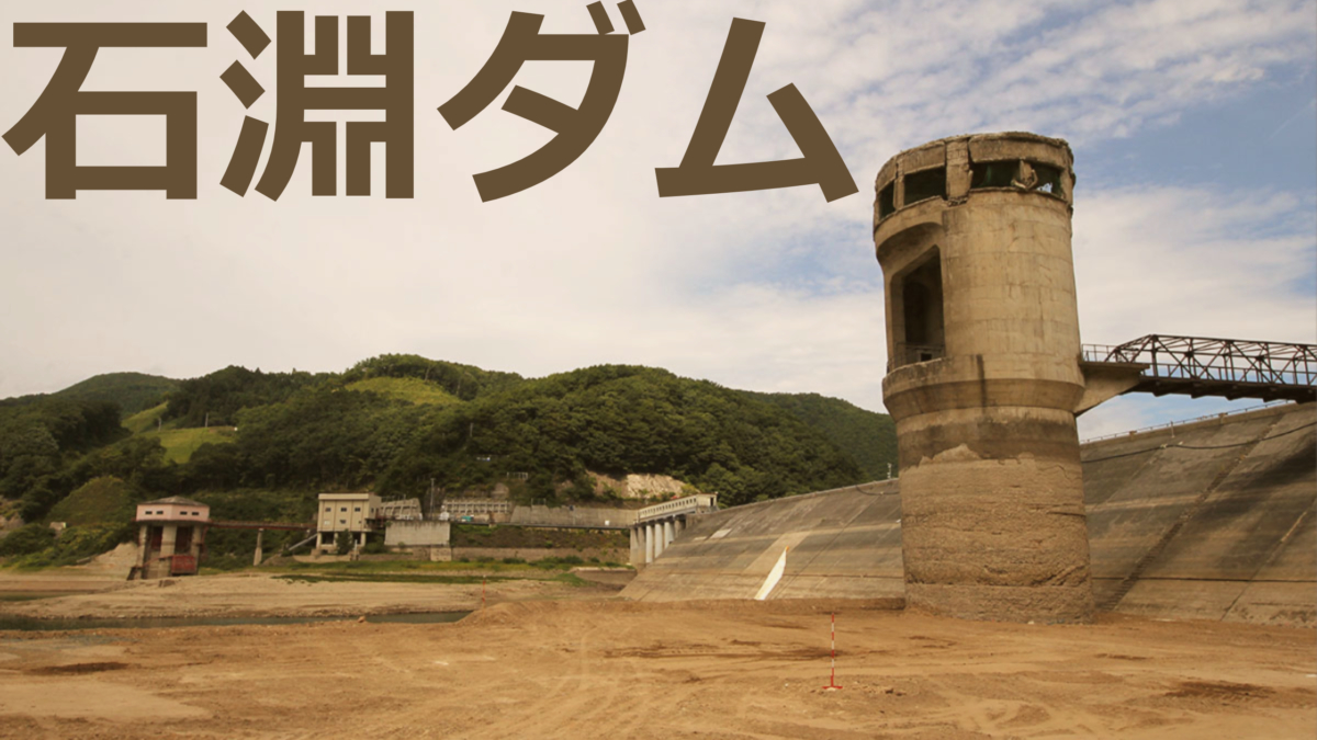
This article is about my visit to the Isawa Dam and Ishibuchi Dam organized by the Japan Dam Association. The following month, the Ishibuchi Dam was succeeded by the Isawa Dam, ending its role as a dam, and this was my first and last visit to this dam. It was also the first dam I visited in the Tohoku region.
Isawa Dam Museum
Excited to be in Tohoku for the first time, I met up with two dam enthusiasts from Kyoto at my home and left Aichi around 23:00 midnight. We arrived at around 10:40 am, caught in traffic on the Tohoku highway. I think the meeting time was 10:00, but we were splendidly late... I knew that Tohoku was a long way. Still, the three of us took turns driving, so it was good that we were able to reduce fatigue.

Incidentally, the Isawa Dam Museum has now been reborn as the Oshu Lake Exchange Center.
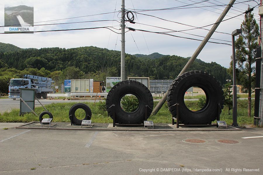
Tire located on the grounds of the Isawa Dam Museum
Those who gathered on time were at Ishibuchi Dam ahead of us, but a microbus was to return to pick us up. Since we have some time before returning, we will visit the Isawa Dam Museum.
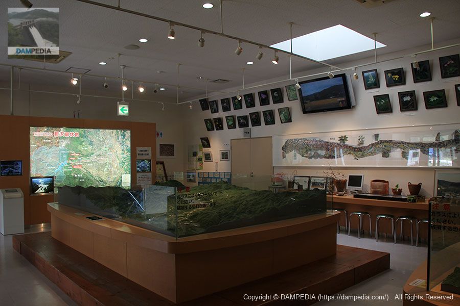
Inside the Isawa Dam Museum
It probably looks completely different now, but inside there was a large diorama and other equipment to help visitors learn about the Isawa Dam. Then the bus arrived and we headed for Ishibuchi Dam.
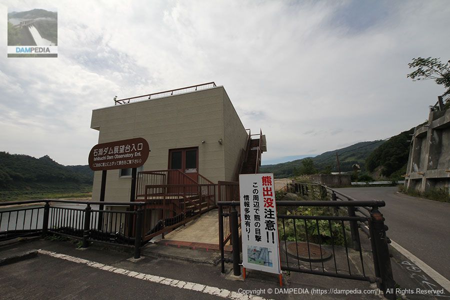
Ishibuchi Dam Management Branch Office
The Ishibuchi Dam, with the Isawa Dam on the side. I wonder what happened to the nameplate of the control station.

View of the gate operation room from the temporary bridge downstream
Hmm? Someone is making a peace sign.

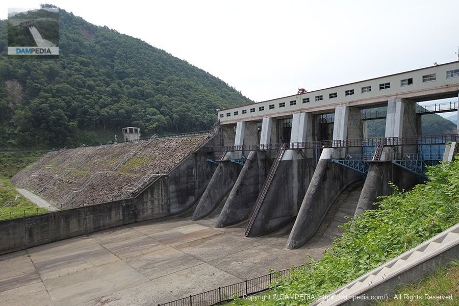
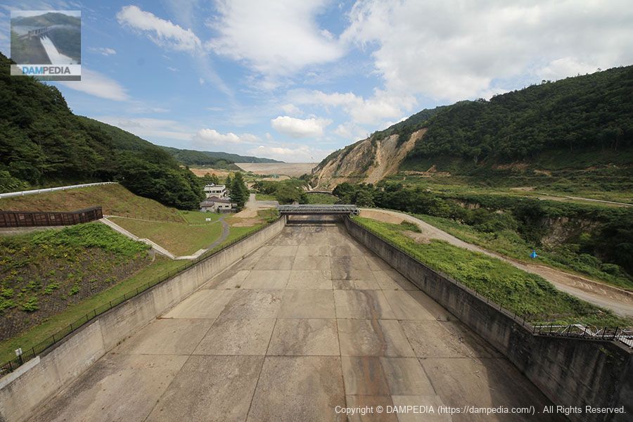
View of the flood discharge from the temporary bridge
It has perfect symmetry, with two roller-gate permanent flood discharges in the center and two radial-gate emergency flood discharges on each side.

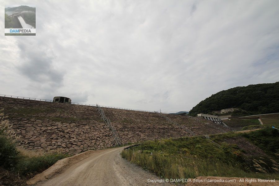
View of the embankment from the temporary bridge
It is a rough embankment. Ishibuchi Dam was the first of the five dams built under the Kitakamigawa River Upstream Five Dam Project, which was also known as Japan's TVA.
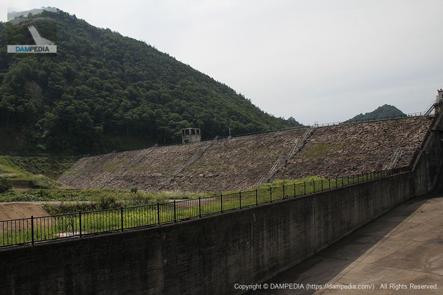
The embankment was built using a method that would be unthinkable today: a steel bridge and rails were built over the embankment, and rock materials were thrown down from trolleys. The bridge piers were buried in the embankment as they were.
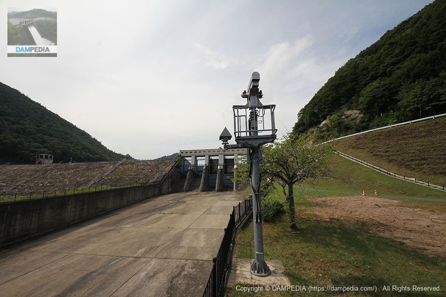
CCTV kept an eye on it until the end.
I believe these were removed before they were submerged, but it is very moving to think that this is the last time we will have a bit of equipment.
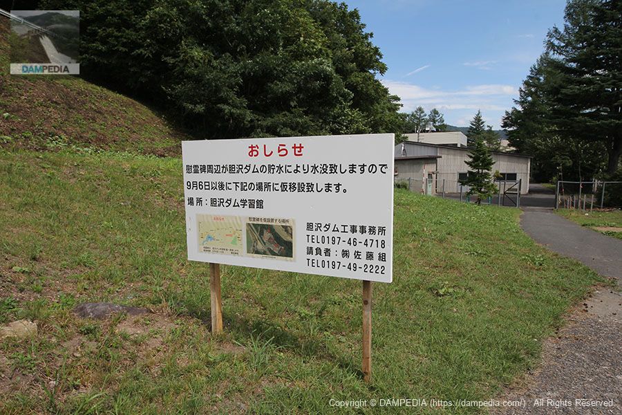
Signs indicating relocation
It seems that there was a cenotaph for those who died in the construction of Ishibuchi Dam in this area, but it was temporarily relocated to the Isawa Dam Learning Center. It has now been relocated to the Ishibuchi Dam Plaza along with one radial gate.
View of the levee downstream from the left bank
The Ishibuchi Dam, which has moistened the fields of the postwar Isawa Fan, protected people from flooding, and provided electricity, is soon to be completed.
View of old Route 397 from the left bank, looking upstream
This old national road would also be submerged.
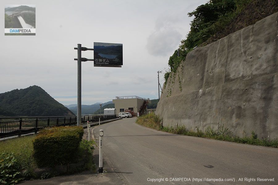
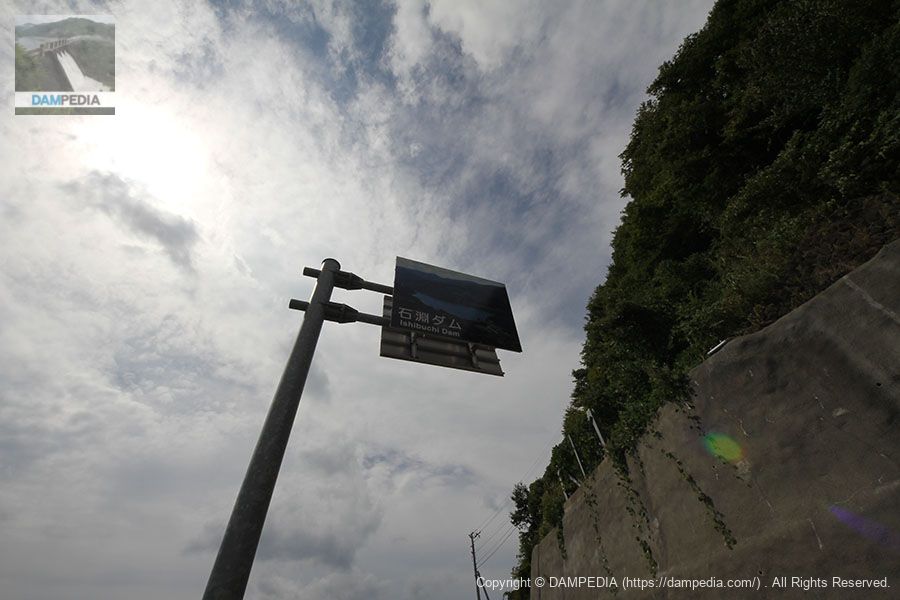
Signboard of Ishibuchi Dam
This sign, which has continued to guide people touring and driving around the dam, is also ending its role.
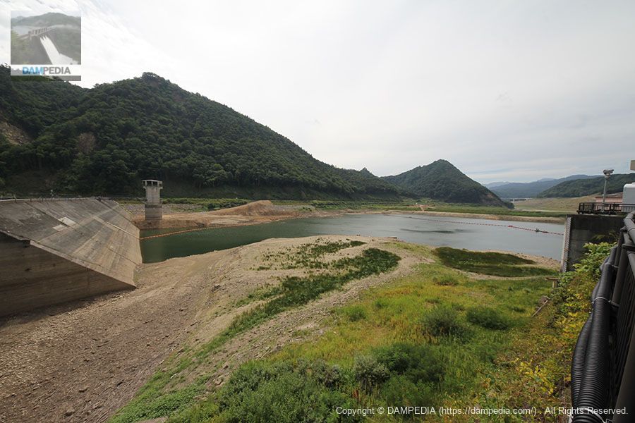
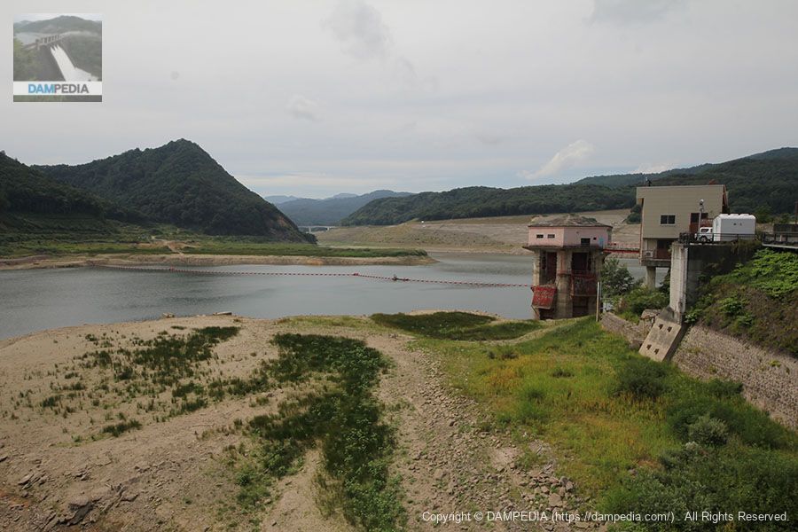
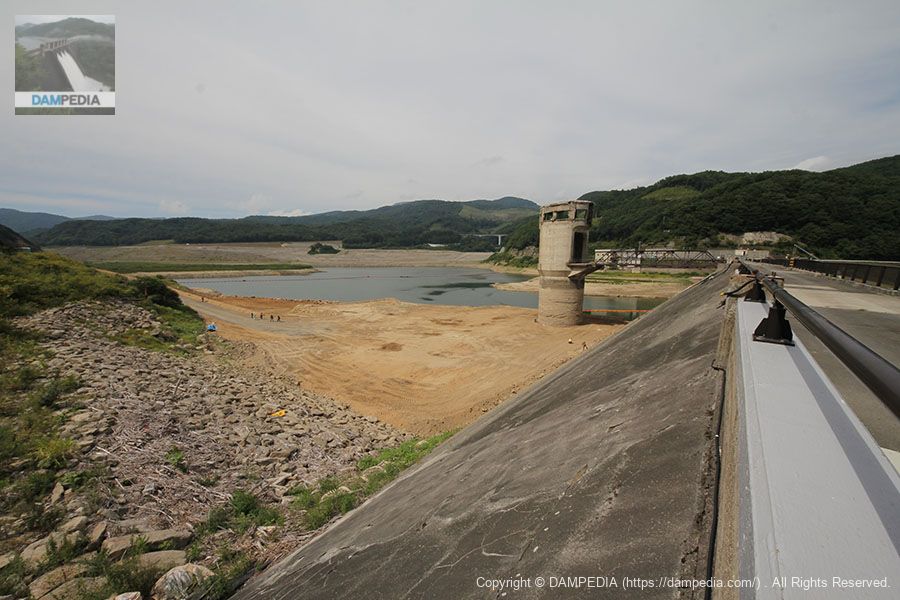
View of the dam lake from the left bank
The water level is falling because water is flowing directly from the intake tower. When the test flooding of the Isawa Dam begins, not only Ishibuchi Lake but also the embankment will be submerged...
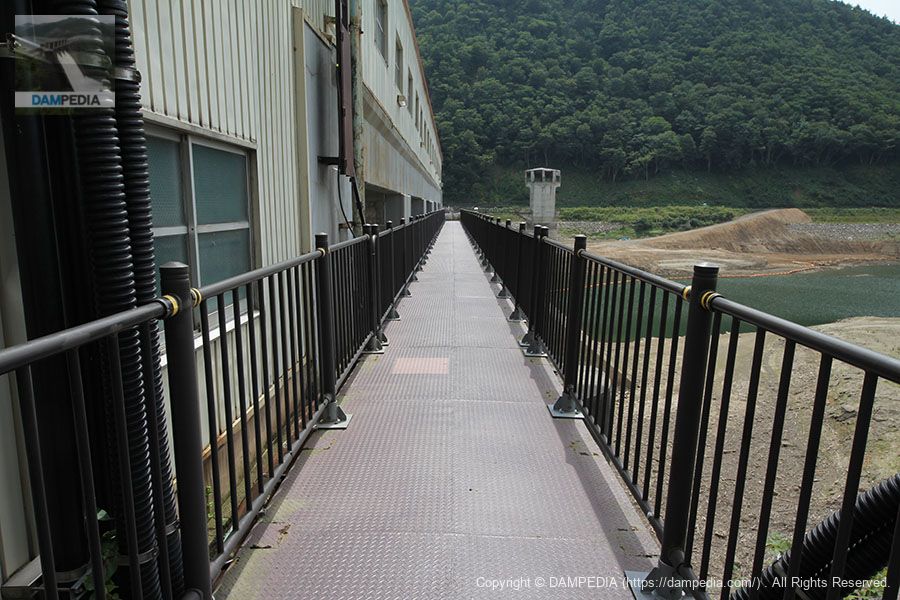
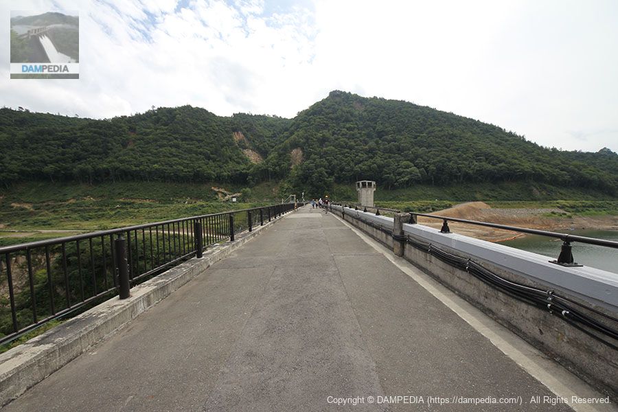
View of the gate passage from the left bank
I don't know if we can call this a top end, but it is a retrofit-like passageway.
View downstream from the gate passage
How many times have I spit out water from here?
View of the dam lake from the gate passage
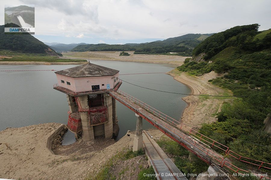
The light pink building on the right is the water intake tower. Further to the right is a boatyard with a rooftop observation deck.
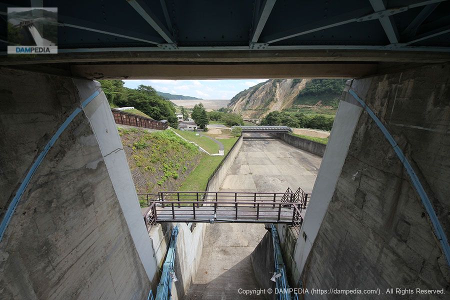
View of the top edge from the entrance of the gate operation room
The top edge looks somewhat distorted.

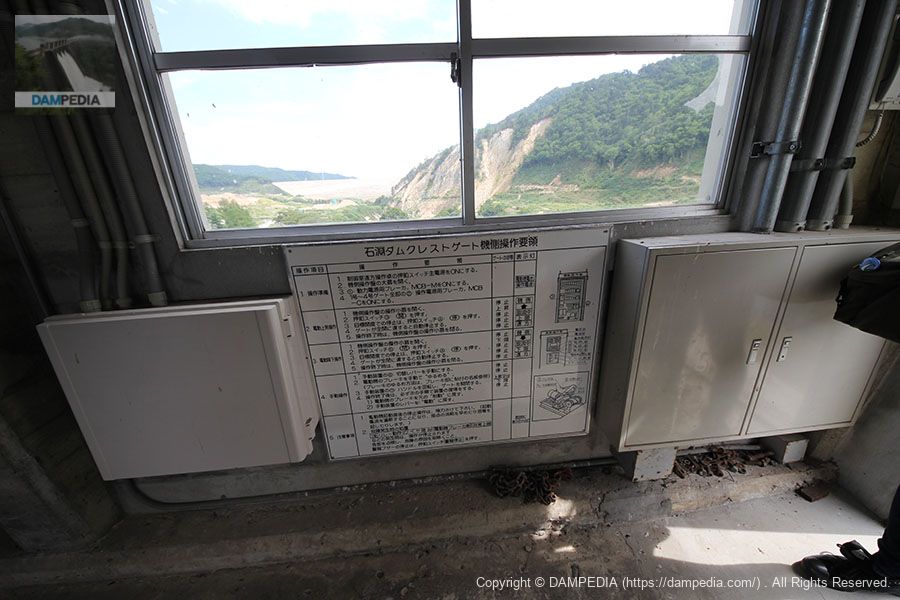
Inside the gate operation room
The windlass and equipment that have moved the gate many times. If time allowed, I would like to watch them all the time.

Operation Procedure for Ishibuchi Dam Aircraft Side
When you couldn't operate it from the control center, did you operate it while watching this here?
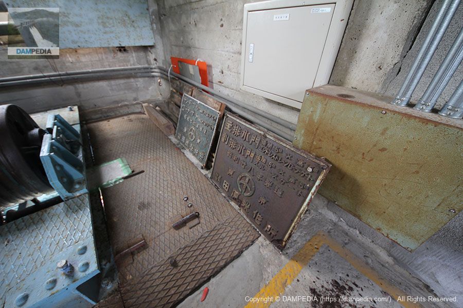
Old gate nameplate
An old gate nameplate stored deep in the gate operation room. I took this picture while thinking, "I want to have this.
View downstream from the window of the gate operation room
Everything is new to me, and when I think that I will never see this scenery again, I can only regret that I should have visited more than once. I regret that I should have visited this place more than once. The white structure at the far end is the embankment of the Isawa Dam.
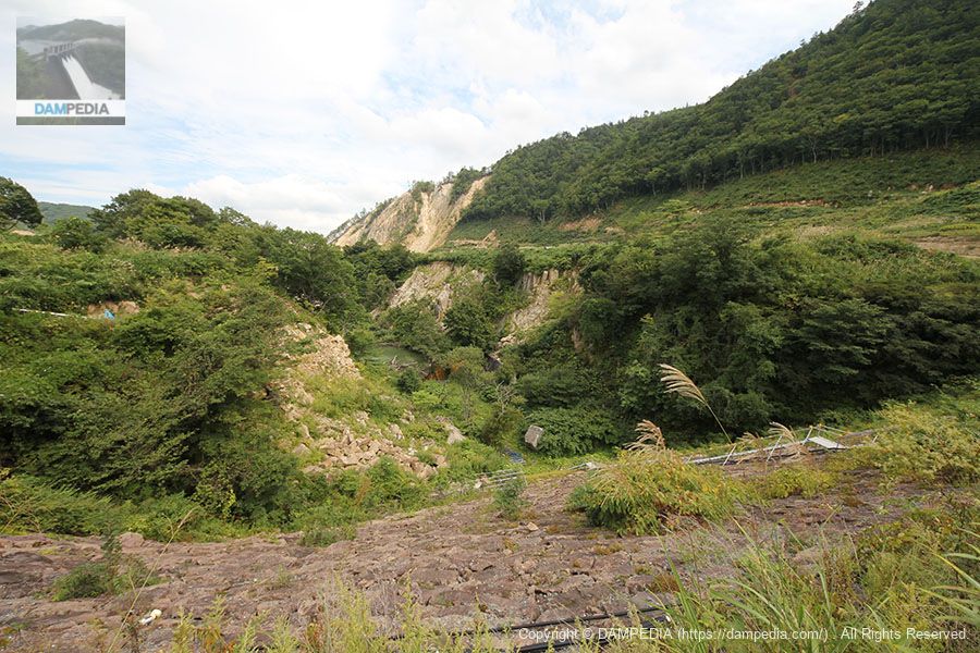
The collapsed mountain in the foreground is the scar from the Iwate-Miyagi Nairiku Earthquake of 2008.
View of the top edge toward the right bank
It is hard to see in this photo, but that earthquake deformed the top edge so that it was rippling. You can see that the area around the abutment on the right bank has also collapsed, partially exposing the mountainside.
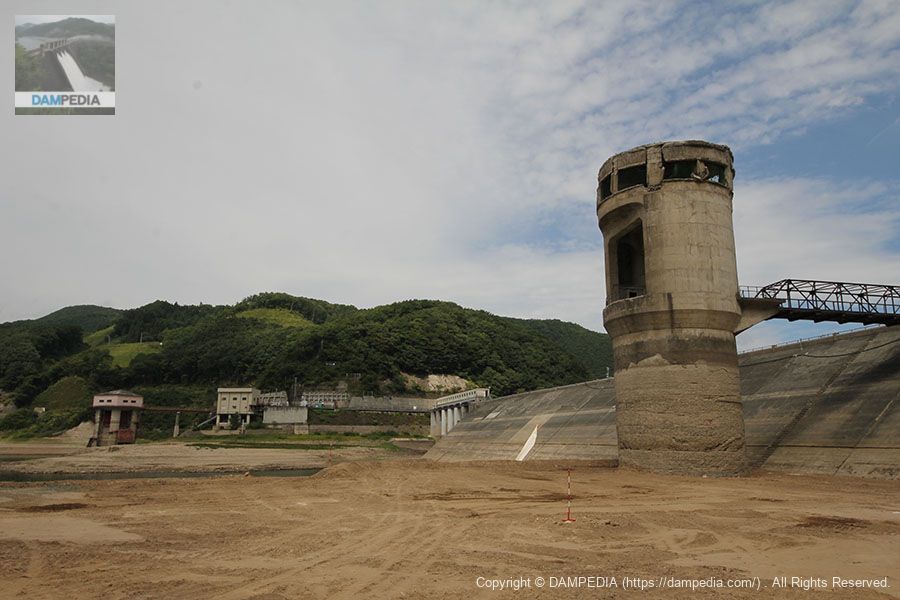
Drainage tower and truss bridge
What was unusual about the Ishibuchi Dam was this drainage tower. Unlike the intake tower, this tower was designed to drain water during construction. It seems that it had the role of draining water after construction, but was rarely used.
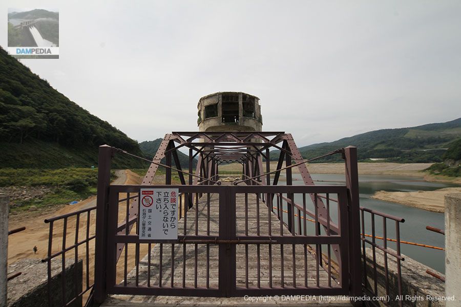
Drainage tower and truss bridge
However, this drainage tower is also damaged by earthquakes.
Looking downstream from the right bank
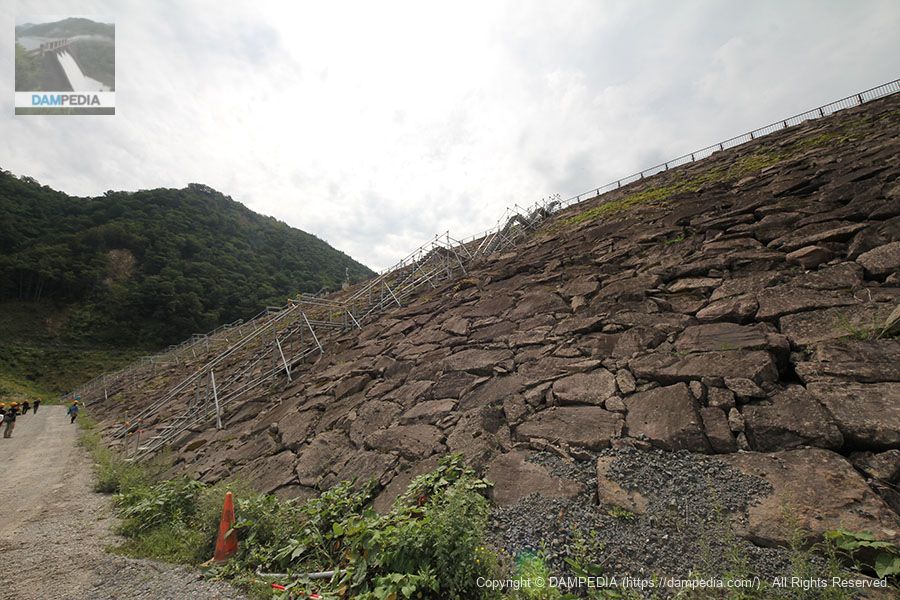
The embankment also has a riprap that has been rippled. However, being a rockfill dam, the shaking actually caused it to settle and tighten more.
View of the dam lake side from the right bank
The Ishibuchi Dam is also a "concrete surface barrier type rockfill dam (concrete barrier dam)," which is a rockfill dam with a concrete reservoir side.CFRD) form, but the impervious wall was not damaged, and the water was well intercepted.
The seismograph installed at Ishibuchi Dam indicated an intensity of 7, partly because of its proximity to the epicenter, and recorded maximum accelerations of 1,461 gal in the upstream direction, 934 gal in the axial direction, and 2,070 gal in the vertical direction at the dam's top edge, and 1,382 gal in the upstream direction, 2,097 gal in the axial direction, and 1,748 gal in the vertical direction on the downstream dam terrace surface. (The seismograph at the top end of the dam is a lock. (The seismograph at the top end of the dam is likely to have an error due to the misalignment of the locking material.)
View of the top edge from the right bank
This area was probably damaged, but the pavement is clean and the guardrails look new.

View of the embankment on the lake side from the right bank
It is an amazing feat of Japanese dam technology that the dam did not lose its function despite all this damage. Moreover, the year before we visited the dam, it had been hit by the Great East Japan Earthquake.

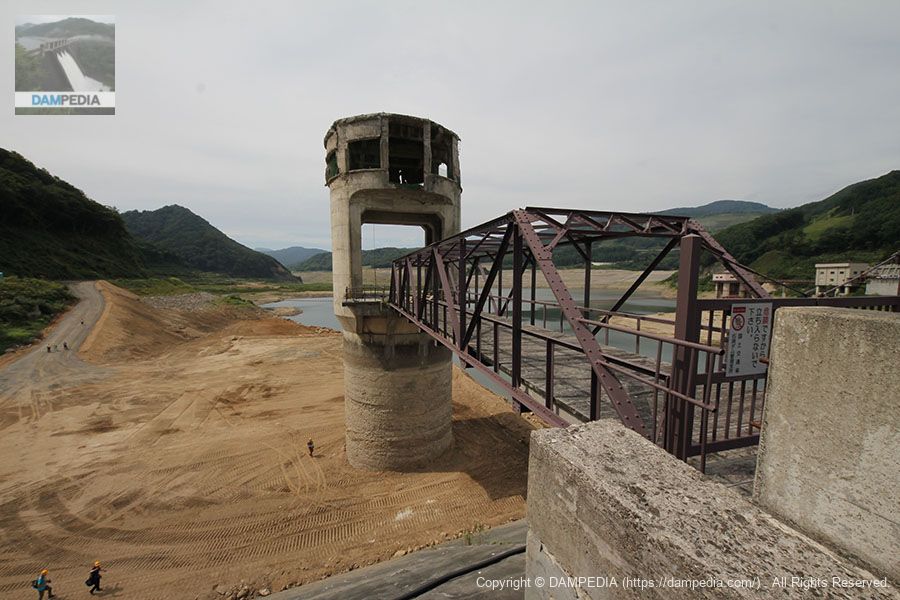
View of the dam lake and embankment from the right bank
We were allowed to enter the dammed lake where the water level had dropped. It is a world we will never see again.

drainage tower
My vocabulary is so limited that the only words I can come up with are "oh" and "wow".
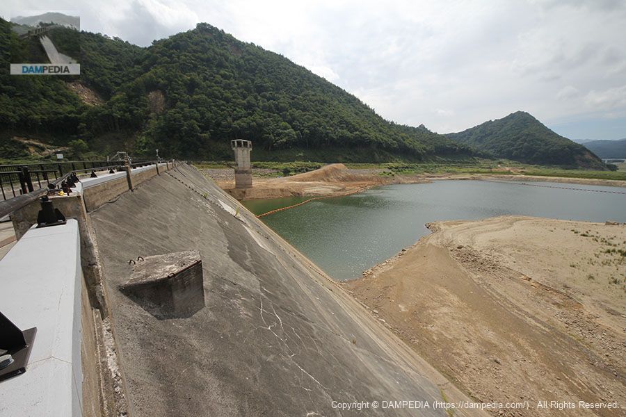
View of the embankment and dam lake from the flood discharge area
We are back to the left bank again. This shows that the barrier wall was not damaged.
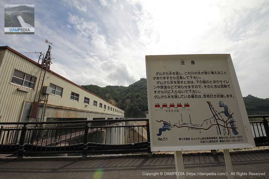
Discharge warning sign
Discharge warning signs that will soon no longer need to be posted.
Ishibuchi Dam Observation Deck
Climb to the boatyard and observation deck.
View of the water intake tower from the observatory
This intake tower was used to supply water to the former Isawa No. 1 Power Station, which was the first hydroelectric power station built by the Power Development Corporation. However, with the construction of the Isawa Dam, the tower and the intake tower were no longer used for power generation, and were handed over to the newly built Isawa No. 1 Power Station.
View of the embankment on the lake side of the dam from the observation deck
The hard part is that I can't see it anymore, even though it's all new to me. But...When the water level drops, it comes out in a heap.The first is the

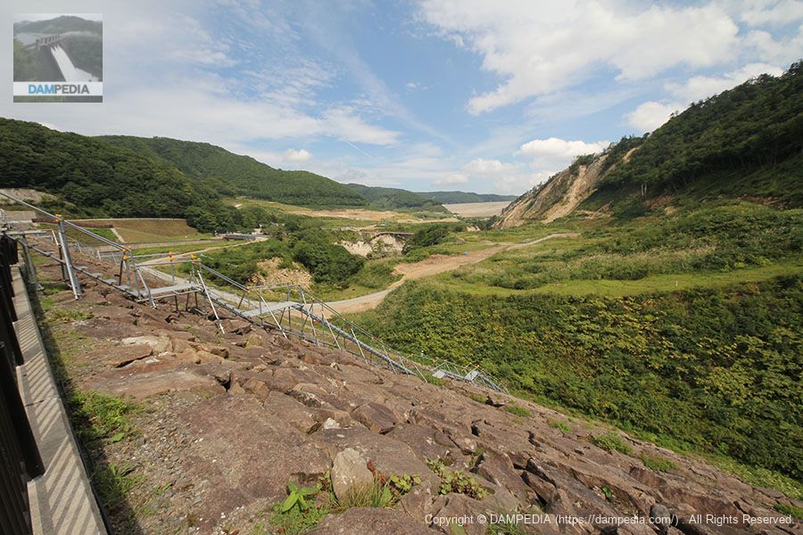
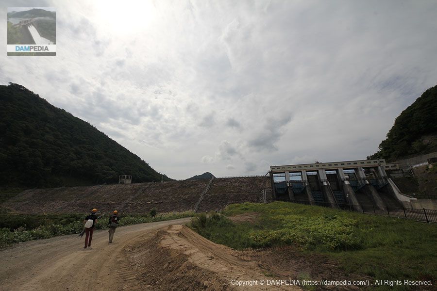
View of the levee from downstream
Move downstream.
lip wrap
Riprap that has been hit by waves due to the earthquake. It was rough or painful...but it still served the role of a dam to the very end.
Looking downstream from the downstream face of the dike
There is a spot in the middle where water is stored, and it appears that the tunnel from the drainage tower was connected to this spot. Since the drainage tower is not functioning, rainwater may simply be stored or water flowing back from the Isawa River may be stagnant.
View of the embankment from downstream on the right bank
We will keep this scenery firmly in our eyes until the very end.
Entrance to the dam site downstream
The group then leaves the Ishibuchi Dam.
The Ishibuchi Dam will later perform its final flood control due to Typhoon No. 17, which hit the area between September 30 and October 1. The Ishibuchi Dam was originally scheduled to finish its role on September 30 and be taken over by the Isawa Dam on October 1, but the typhoon forced the postponement of the handover.

On October 4, the handover ceremony to the Isawa Dam will be held, and the Ishibuchi Dam will finish its 60-year work of flood control, irrigation water, and power generation, but will actually continue to work as a sand storage dam for the Isawa Dam even after it sinks.
Nowadays, only a part of the embankment and gate pier of the Ishibuchi Dam can be seen when the water level of the Isawa Dam drops, but we hope that you will take note of the fact that the old dam, which continued to support the Isawa Fan Land after the war, is still active as a part of the Isawa Dam.
Ishibuchi Dam Specifications
| Location | Wakayanagi, Isawa-ku, Oshu-shi, Iwate |
| River Name | Kitakami River System Isawa River |
| Objective | F (flood control, agricultural disaster prevention) A (irrigation water) P(Power generation) |
| Model | R (Rock-fill dam) |
| Bank height | 53m |
| Bank length | 345m |
| Dam volume | 443,000m3 |
| Watershed Area | 154km2 |
| Reservoir area | 108 ha |
| Total storage capacity | 16,150,000m3 |
| Effective water storage capacity | 11,960,000m3 |
| Dam operator | Tohoku Regional Construction Bureau |
| Main body constructor | Nishimatsu Construction |
| Year of launch | 1945. |
| Year Completed | 1953. |
| Name of Dam Lake | Lake Ishibuchi |
Other facilities/observations
The following is described as Ishibuchi Dam Plaza and Ishibuchi Weir Archives. The Ishibuchi Weir Archives is located on the first floor of the Isawa Dam Management Branch Office.
| Parking lot | ○ |
| Toilet | △ (using Isawa Dam) |
| Park | ○ |
| PR Exhibition Hall | ○ |
| Fishing | ? |
Map around Ishibuchi Dam
It is marked as Ishibuchi Dam Plaza.
Accommodations that may be close to Ishibuchi Dam
References
- Farewell Ishibuchi Dam(Hagiwara's article in Daily Portal Z)
- Damage survey report on dams damaged by the Iwate-Miyagi Nairiku Earthquake in 2008(Japan Society of Dam Engineering)
- Dam survey in the Iwate-Miyagi Nairiku Earthquake of 2008(PDF/Public Works Research Institute)
- Damage to dams caused by the Iwate-Miyagi Nairiku Earthquake of 2008 (preliminary report)(PDF/J-STAGE)

Comment