
Date of interview: 9/17/2012 (Monday)
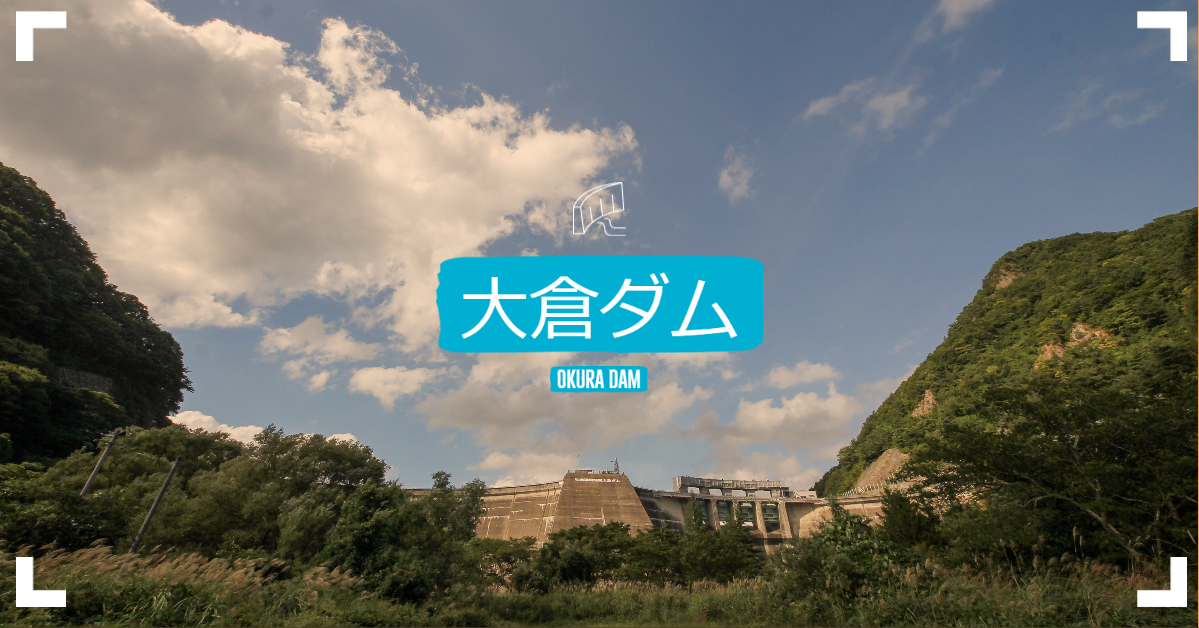
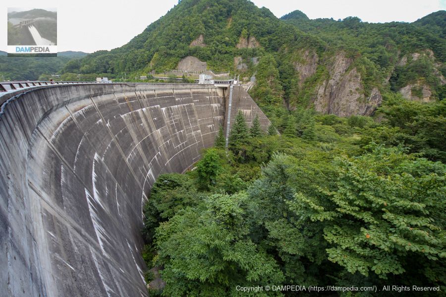
After leaving the Naruko Dam, we came to the Okura Dam, one of only two multiple arch dams in Japan. The other multiple arch dam, Toyotoshi Pond Dam in Kagawa Prefecture, completes the list of dams of this type.
The Okura Dam was under the direct control of the then Ministry of Construction at the time of construction, but was transferred to Miyagi Prefecture after completion.
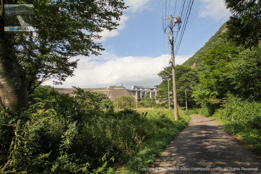
View of the levee from downstream
The season was supposed to be autumn, but it was still hot like midsummer. Moreover, the grass was thriving.
View of the levee on the left bank from the plaza downstream
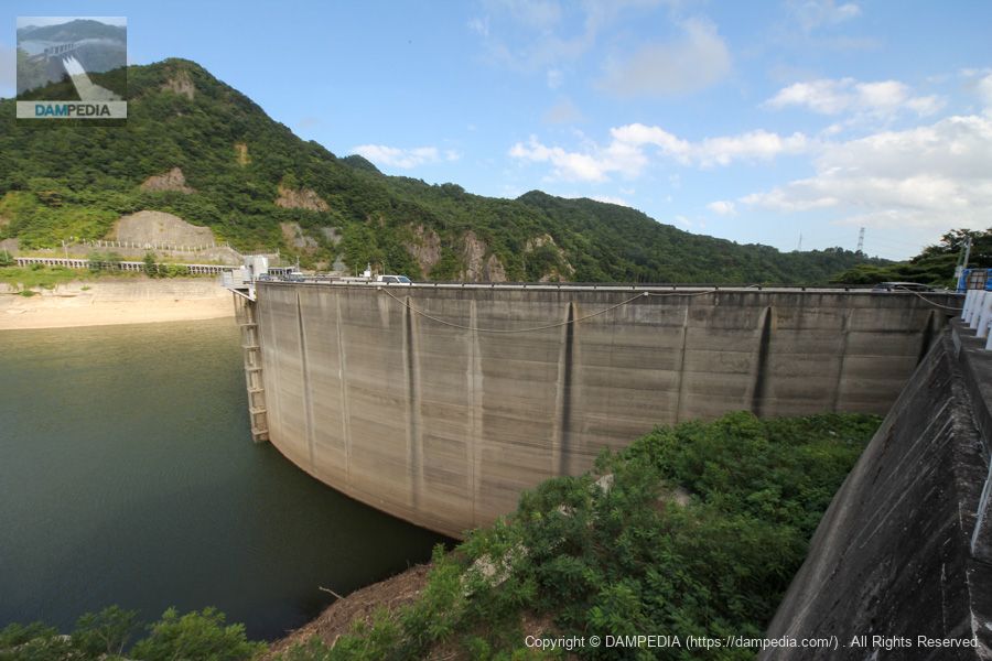
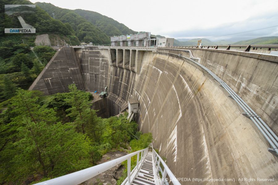
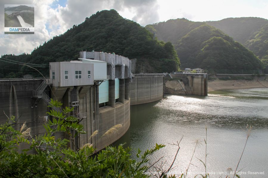
The Okura Dam is a double multiple-arch dam. The photo shows the left bank side of the embankment. The photo shows the left bank side of the embankment, where a gate for releasing water is installed. Even when we got closer, we could not see the entire dam because of the huge amount of grass.

View of central abutment from downstream plaza
I'm sorry that the photo is too grassy to be clear, but this is the central part of the double arch, the part called the abutment or thrust block.
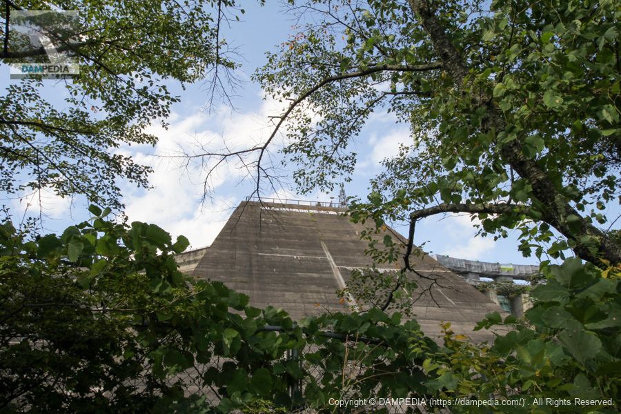
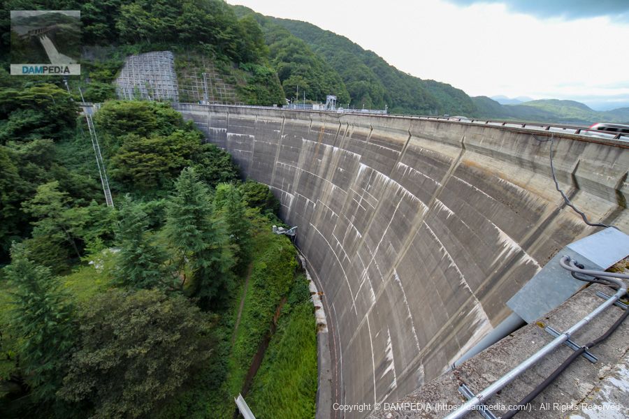
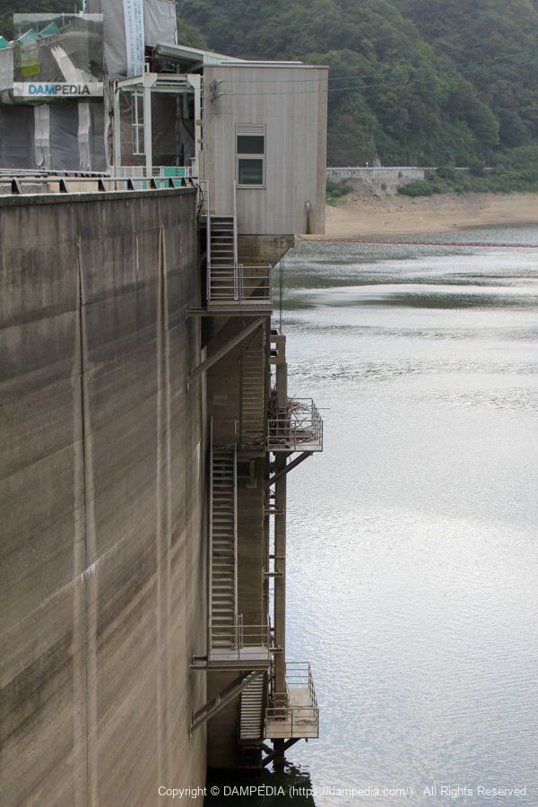
View of the downstream face of the levee from the downstream plaza
I was supposed to look downstream and exclaim, "Oh! I was supposed to exclaim, "I can't see! but I just kept shouting, "I can't see it!

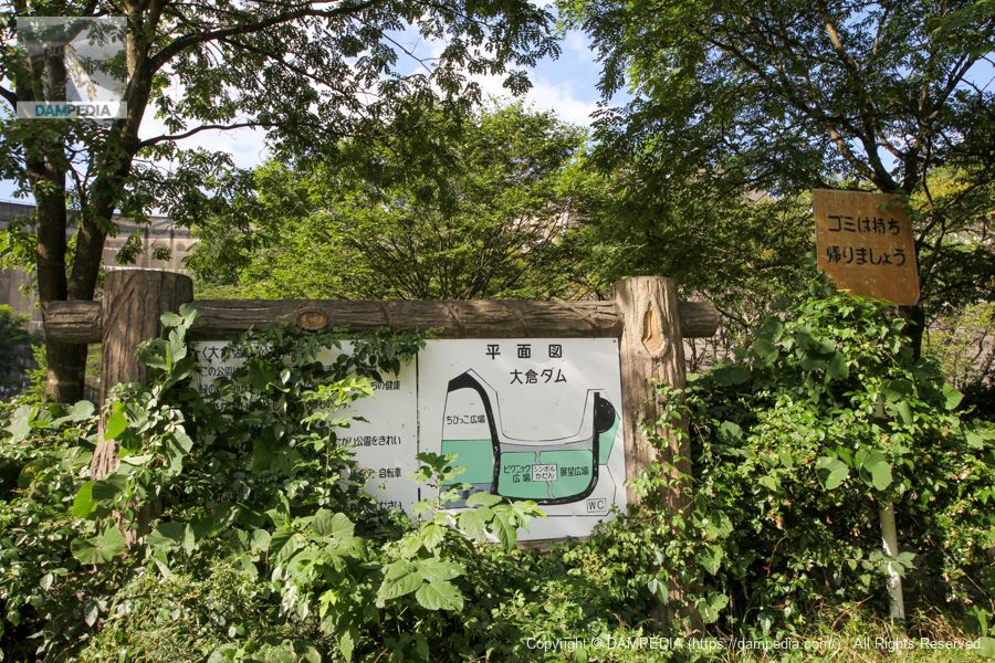
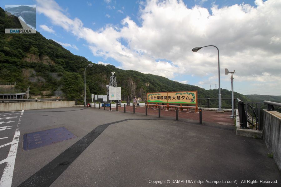
Sign in the plaza downstream.
It's as if...Dr.STONEGood Morning World! Good Morning World!

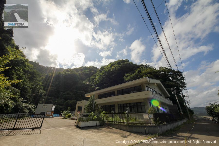
View of the administration office
Moved to the top edge level. Completely backlit. We got an unofficial dam card at the management office on the right bank.
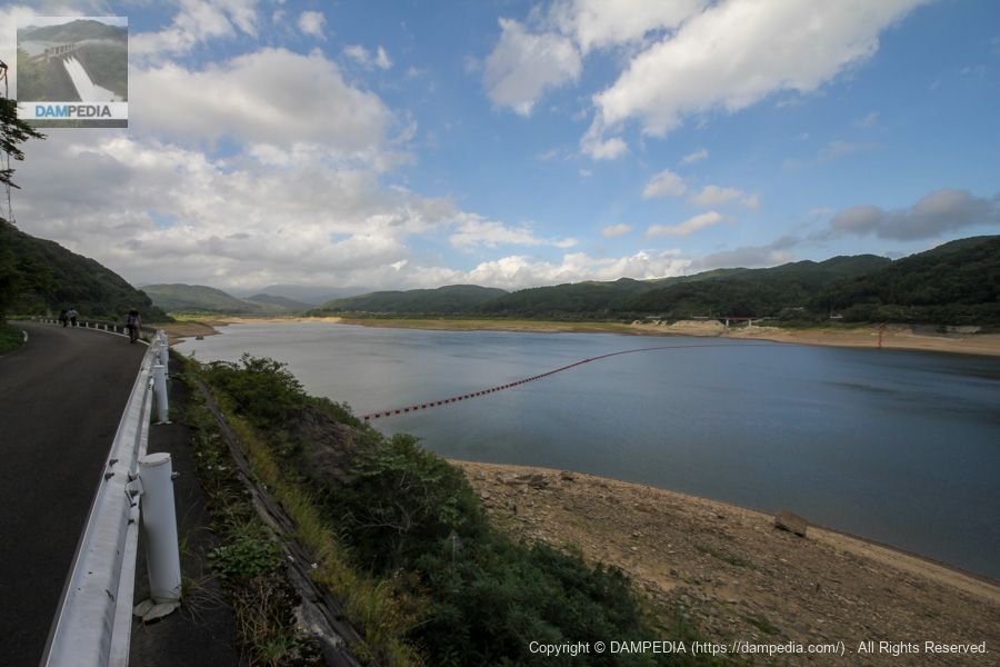
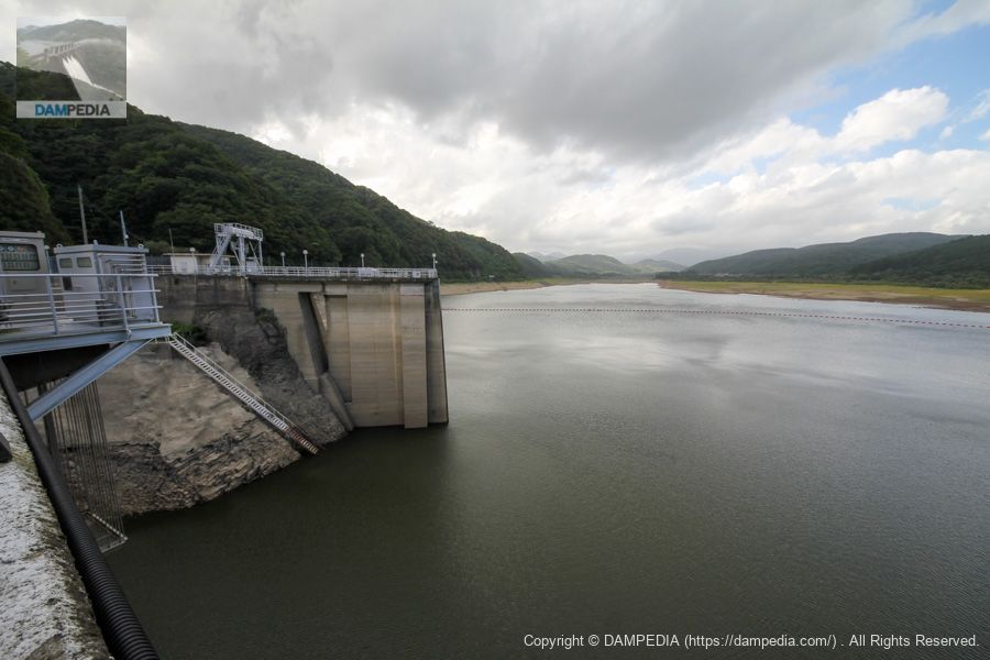
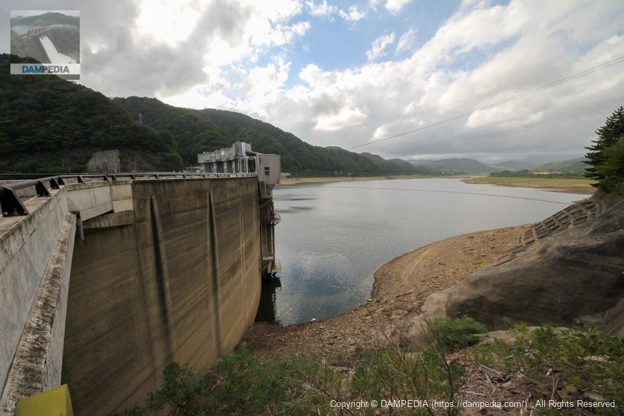
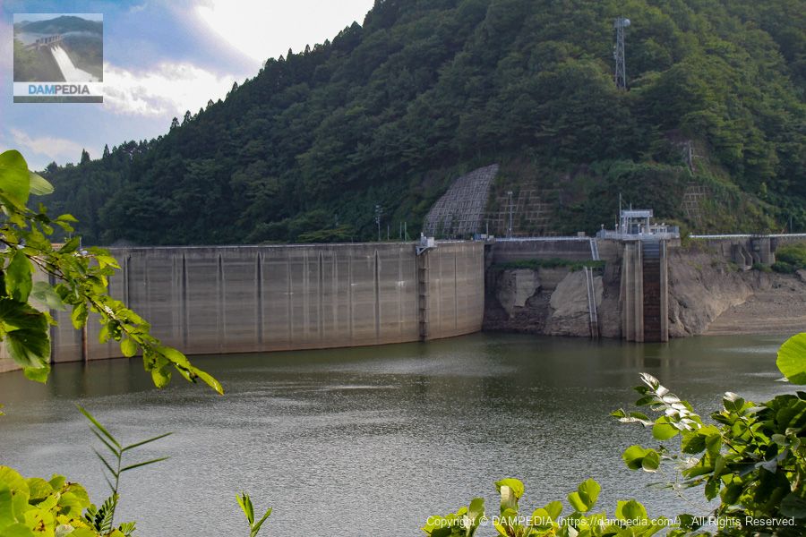
View of the dam lake from the right bank
The dam lake is called Lake Okura. Upstream of the Okura River isdefinitional如如如(word puzzle)The temple is also called Saifo-ji Temple, where the famous "Sankaku Aburage" (triangular deep-fried tofu) is sold in the town in front of the temple's gate. It is intriguing, but on this day, we will proceed with the dam first. (It was already around 2:00 p.m. at this time, and if we stopped by, we would have a terrible time returning home...)
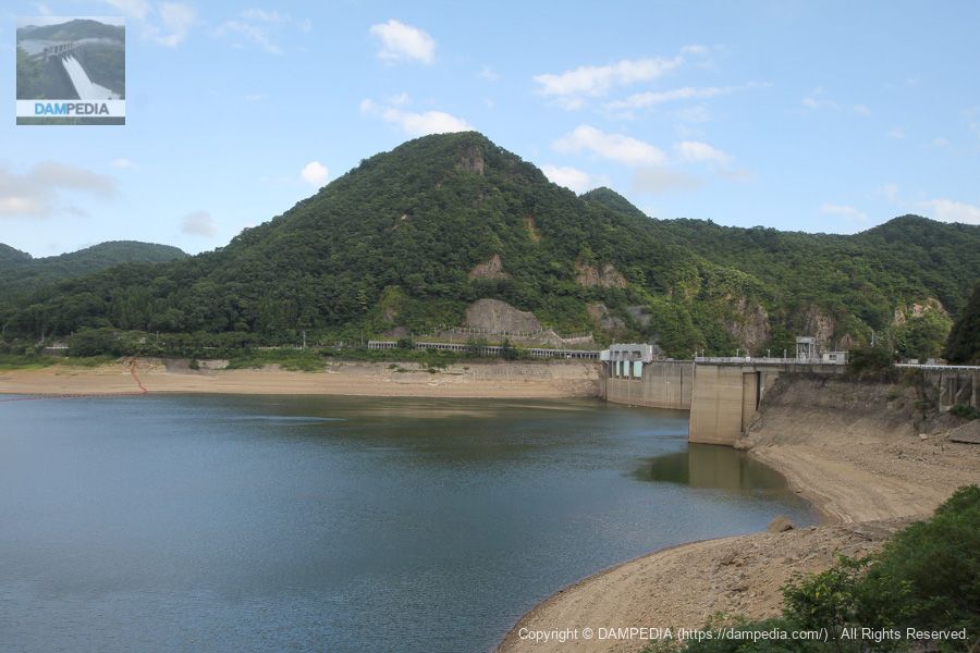
View of the upstream face of the embankment from the right bank
The water level seems to be quite low.
View of the upstream face of the embankment from the right bank
This is the upstream face of the arch section on the right bank side.
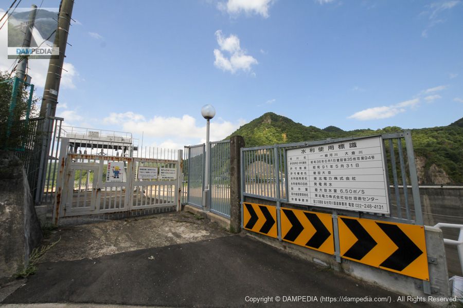
Tohoku Electric Power Company's water intake installed on the right bank
This is a water intake for Tohoku Electric Power Company. The maximum water intake is 6.50 m3/s.
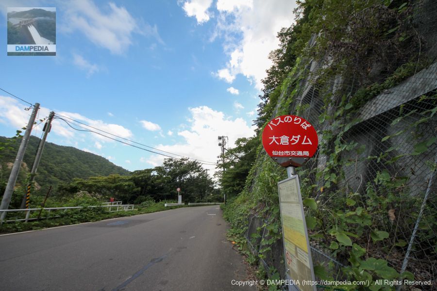
Bus stop "Okura Dam" on the right bank
the so-calleddam stop....... I think the bus stop will be used by the aforementioned visitors to the definition, but I hope it will remain there forever.
View of the top edge from the right bank
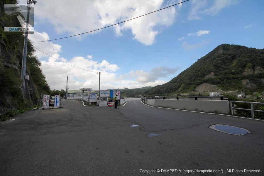
On the right.Top (Crest)On the left is the right bank road leading to the management office. A security guard is standing guard because of the construction. The top end of the road was constantly crowded with private cars as well as buses, probably for visitors to the shrine.
View of the top edge from the right bank
The top edge is narrow, making it difficult for vehicles to separate.

Downstream view of the right bank side of the embankment from the right bank
From here, you can see that the downstream area is thickly overgrown with vegetation. Still, looking only at this point, it looks like an ordinary arch dam without an overflow section.
View of the dam lake and water intake from the top of the arch on the right bank
The structure of the water intake is a bit complicated.
View of the downstream face of the arch on the right bank from the abutment
We walked along the top edge and came to the abutment.
Abutment top edge
Although the most distinctive feature of the Okura Dam is that it is a multiple-arch dam, it is also a dam that actually has another different name. Miyagi Prefecture sells several dam names as naming rights, and through this, a company called "Sendai Kankyo Kaihatsu" purchased the dam and also named it "Sendai Kankyo Kaihatsu Okura Dam.
By the way, there is an illustration of a bear on this sign that says "©BANDAI," but is it a Bandai character?
View downstream from the center of the top edge of the abutment
A plaque on the abutment wall also reads "Sendai Environmental Development Okura Dam.
View of the downstream face of the left bank arch from the abutment
The flood discharge is installed here at the arch on the left bank side.

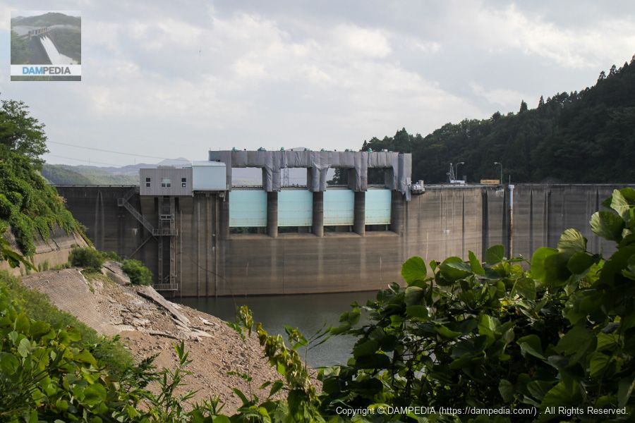
View of Gate Pier
The Crestgate was being renovated at the time and the peers were covered with a sheet.
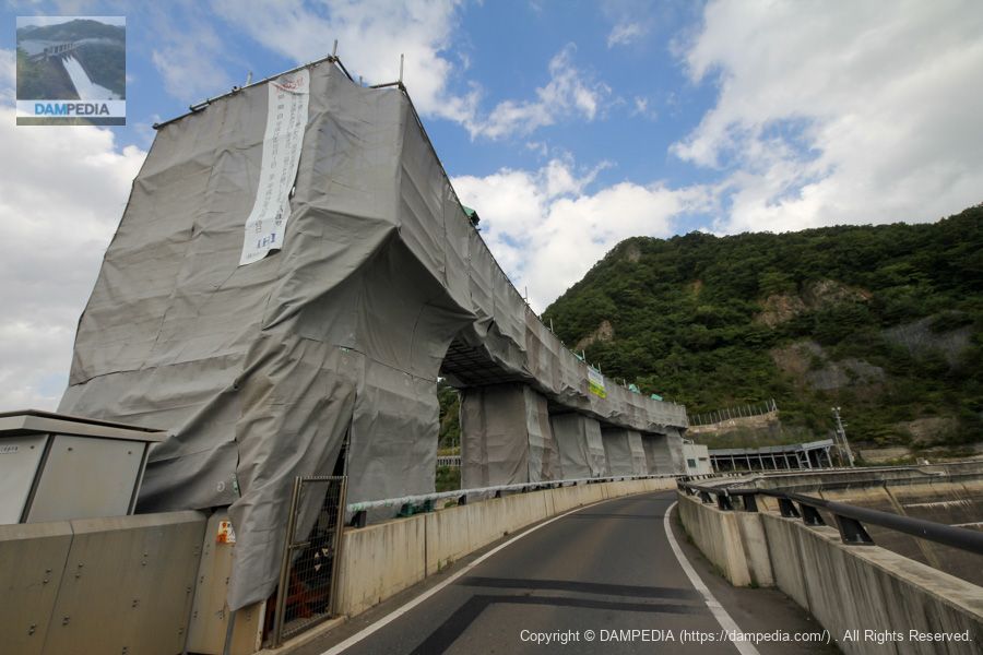
Gate 1
The crest is equipped with four large roller gates, 7.55 m high and 8.86 m wide.

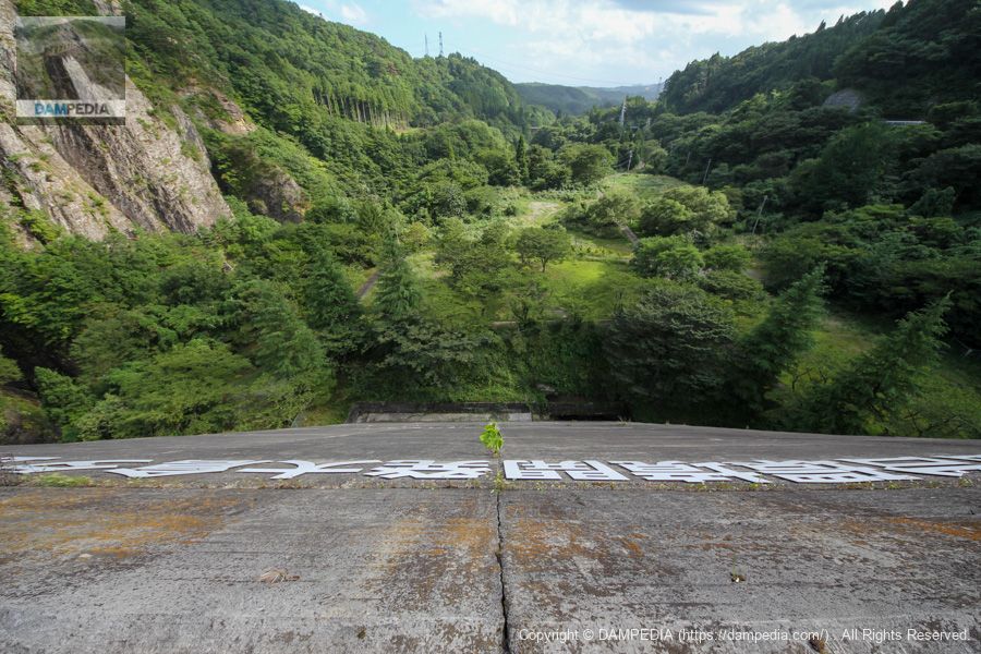
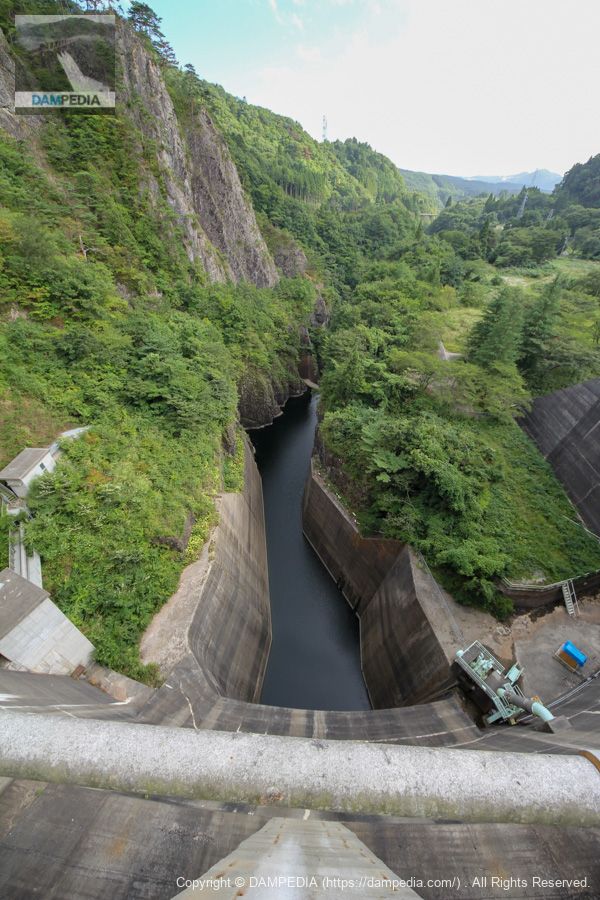
View downstream from Crest
The downstream side forms a little canyon.
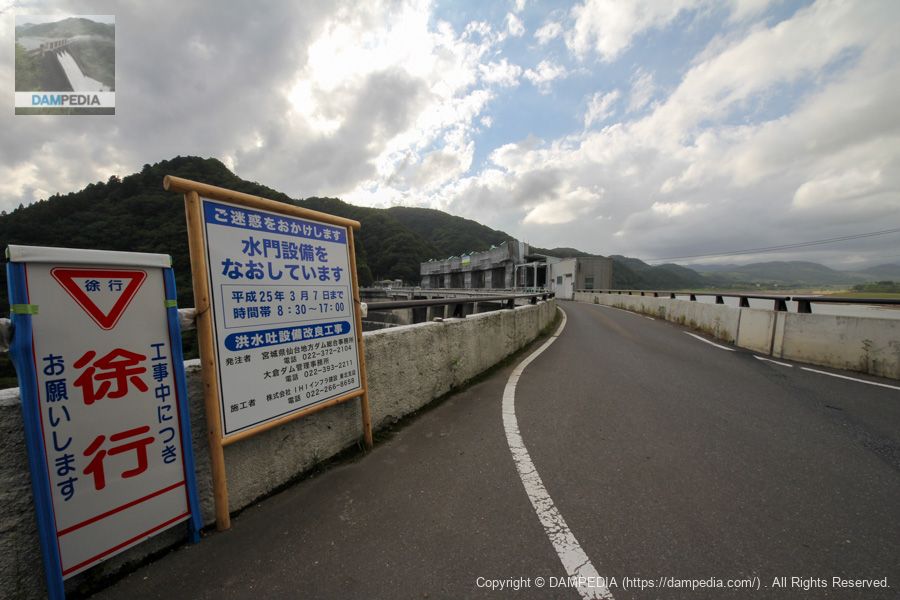
View of the top edge from the left bank
Top edge and construction sign.
View of the embankment and dam lake from the upstream side of the left bank
From here, it does not look like a double arch.
View of the downstream bank of the left bank arch from the left bank
The structure on the left bank at the bottom of the embankment is a valve for agricultural water, and the structure on the right bank is an emergency discharge valve. The valves for agricultural water are also located on the right bank, but the valves on the left bank supply agricultural lands along the Okura and Hirose Rivers.
Rock shed (snow shed?) on left bank
This is a prefectural road on the left bank. The rock shed (snow shed?) continues all the way to the back.

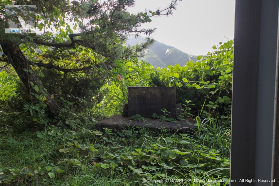
stone monument
A stone monument is set up on the side of the road. The words "Okura Dam" can be seen, but it is unclear whether it is a memorial or a cenotaph due to heavy cobwebs.
View of the power plant intake from the left bank
This is the water intake of the power plant. The screen looks very large.

View of the power plant intake from the left bank and the upstream arch on the right bank
The structure attached to the embankment on the right bank is a valve for agricultural water, which is supplied to farmland in the Shimokura area, located immediately downstream from the Okura Dam.
View of the left bank and upstream arch from the left bank
You can see the gate is open. Probably the gate is under renovation and cannot be moved, so it is open in case of emergency.
Left bank agricultural intake tower
The maximum water intake is 1.3 m3/s.
View of the upstream bank from the left bank
Finally, it was time to say goodbye. It was already around 15:00 at this time.
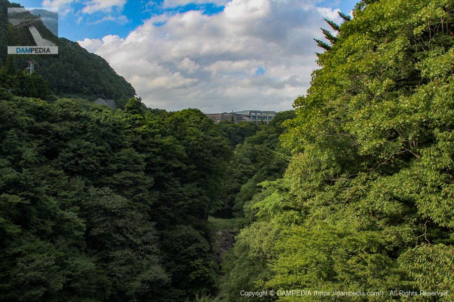
View of the levee from the bridge downstream
The bridge is located quite far downstream. Moreover, it is so overgrown with trees that it is difficult to grasp the full extent of the embankment.
This was the end of my tour of dams in Tohoku at that time. In the end, I was not able to visit Tohoku, and almost 8 years have passed since this time. I would like to go back to Tohoku someday. I would also like to go back to eat fried bean curd.
bonus
The group somehow feels a sense of home in Tokyo, even though it is still four hours to Aichi.
Okura Dam Specifications
| Location | Takatana, Okura, Aoba-ku, Sendai City, Miyagi Prefecture |
| River Name | Natori River System Okura River |
| Objective | F (flood control, agricultural disaster prevention) N (unspecified water, water for river maintenance) A (irrigation water) W(Water for water supply) I (industrial water) P(Power generation) |
| Model | MA (multiple)arch dam) |
| Bank height | 82m |
| Bank length | 323m |
| Dam volume | 226,000m3 |
| Watershed Area | 88.5 km2 |
| Reservoir area | 160 ha |
| Total storage capacity | 28,000,000m3 |
| Effective water storage capacity | 25,000,000m3 |
| Dam operator | Tohoku Regional Construction Bureau |
| Main body constructor | Maeda Corporation |
| Year of launch | 1956 |
| Year Completed | 1961 |
| Name of Dam Lake | Okura Lake |
Other facilities/observations
| Parking lot | ○ |
| Toilet | ○ |
| Park | ○ |
| PR Exhibition Hall | × |
| Fishing | ○? |
Comment