
Location: Nishihatamadu-cho, Nishio City, Aichi Prefecture
Date of interview:2011/05/22 (Sun.)
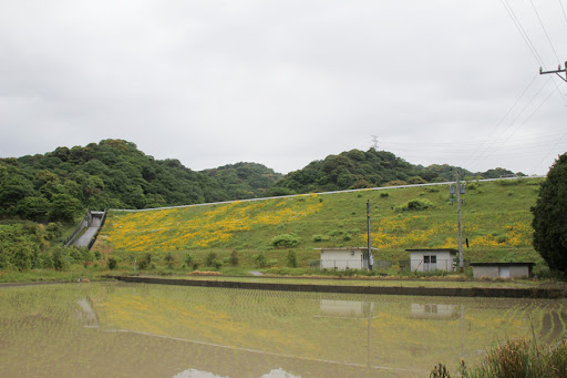
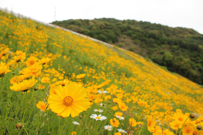
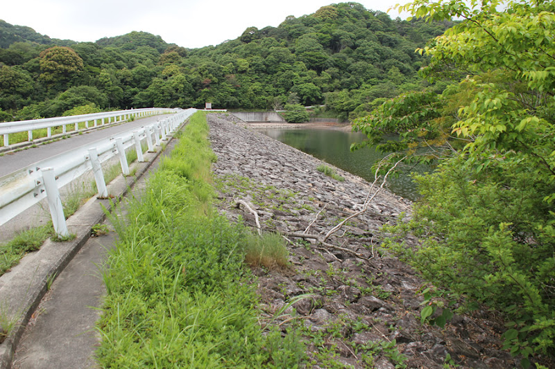
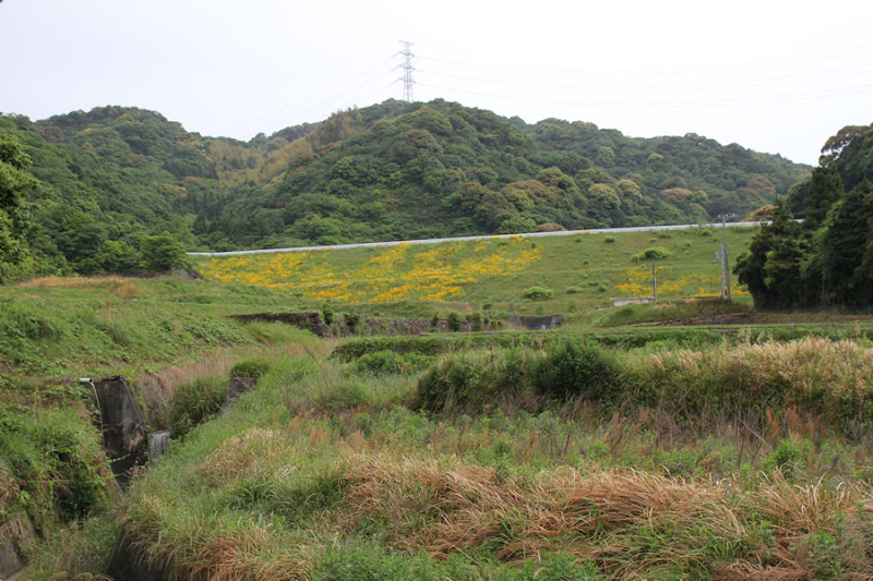
View of the levee downstream from the right bank
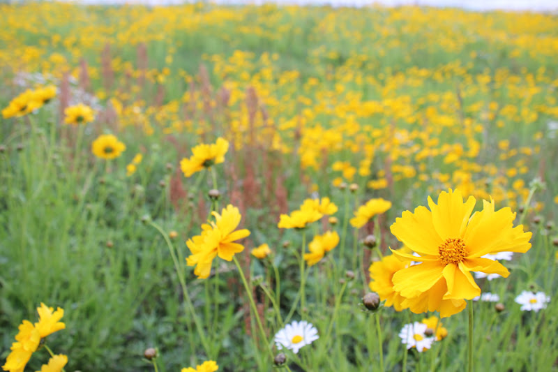
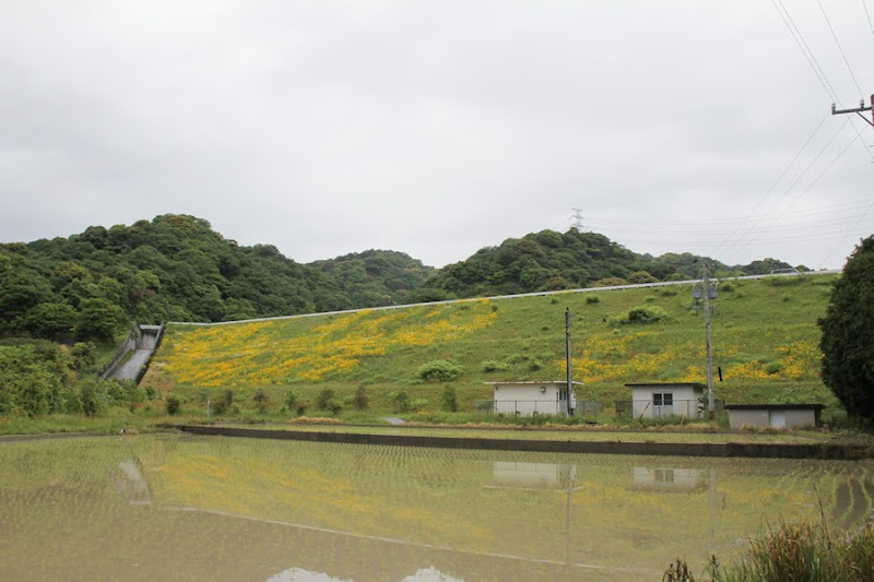
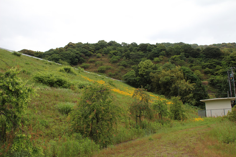
At a quick glance, it looks like an earth dam, but it is a rock-fill dam. Yellow flowers blooming all over the riprap is a sight not often seen in other rockfill dams. I am not sure what kind of flowers they are... Margaret?
*We received information on Twitter that it may be an exotic Specified Species, "Giant Cordyceps sinensis". (Added 11/26/2014)
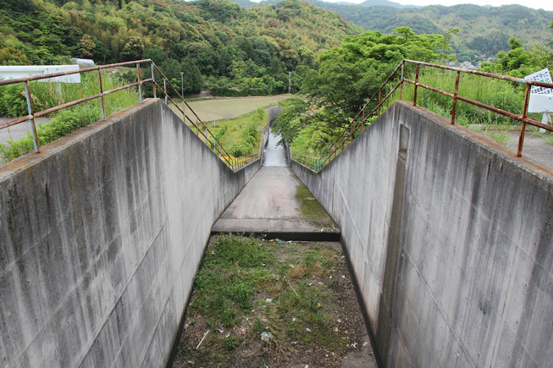
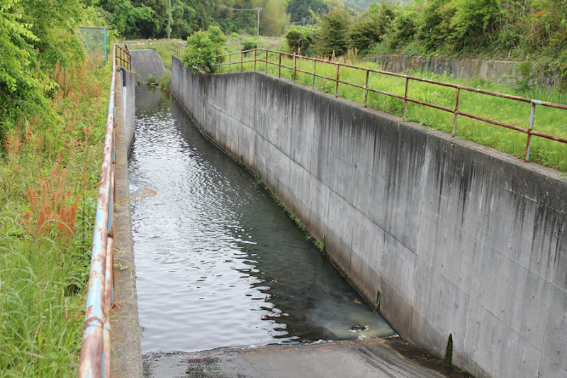
View of the conduit
It is a very ordinary conduction section with no special features.
The Yawata Regulating Pond is used to supply water to Koda Town, former Kira Town, and former Hazu Town, which had no water source of their own, through a shared waterway and the Nanbu-Kira trunk waterway, which enabled water to be taken from the Yahagigawa River as part of the state-run Yahagigawa River General Project, and water is stored as a valuable source of agricultural water for the former Hazu Town.
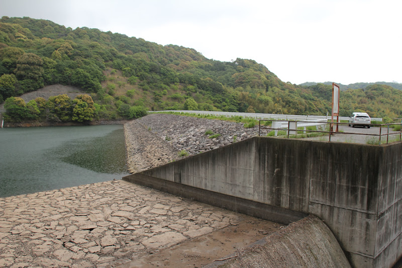
View of flood discharge
This side is also a common type of flood discharge.
The design flood volume is 31.0 m3/s, the overflow depth is 0.80 m, the overflow weir length is 21.0 m, and the total length of the flood discharge is 181.2 m. (From a signboard at the site)
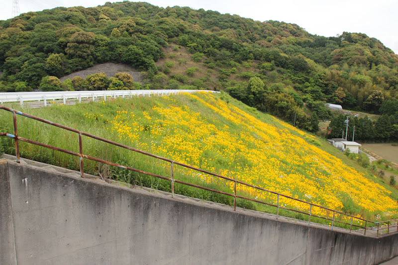
View of the levee downstream from the right bank
Have you ever seen so many flowers blooming on the riprap of a rockfill dam before?

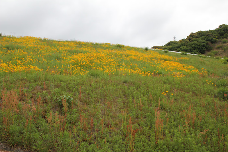
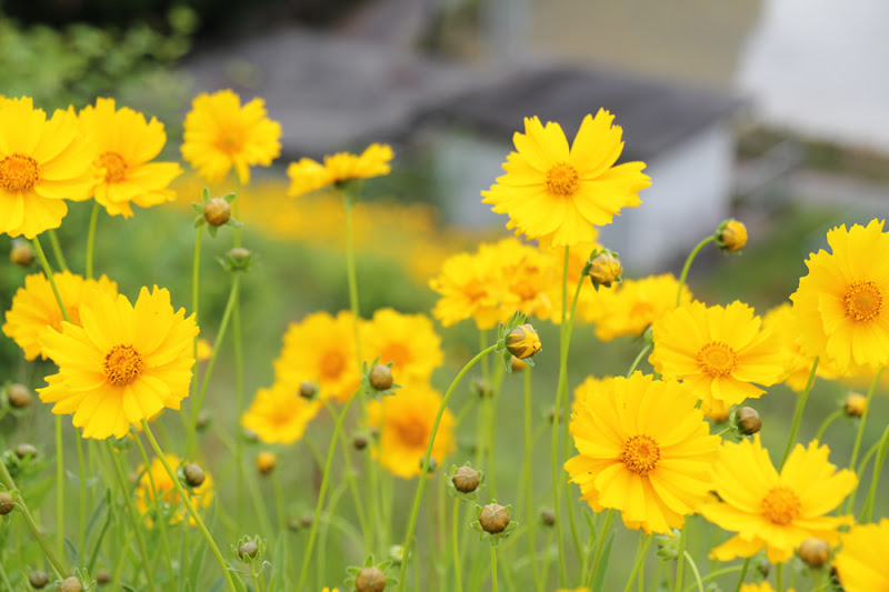
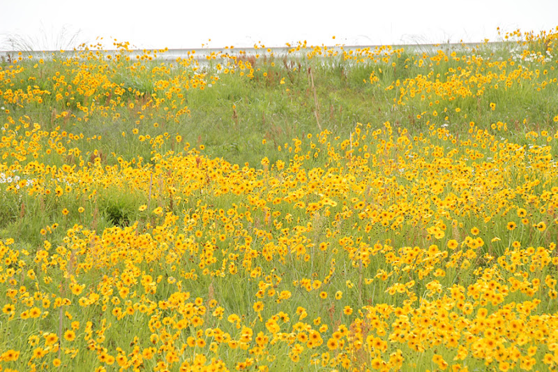
Flowers on the levee
It is like a flower garden already.
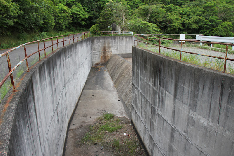
View of the abatement pond
There was a staircase along the conduit wall that led down to the bottom.
View of the conduit from downstream
I wonder if I am allowed to be seen in such a casual way? I feel like it is.
View of the levee from downstream
Upon closer inspection, it appears that the flowers are not the entire riprap, but only the upper half of the bank on the right bank side.
Flowers on the levee
Sometimes it is nice to love flowers instead of dams. No, I visited here to love the dam.
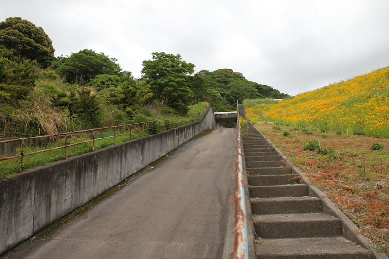
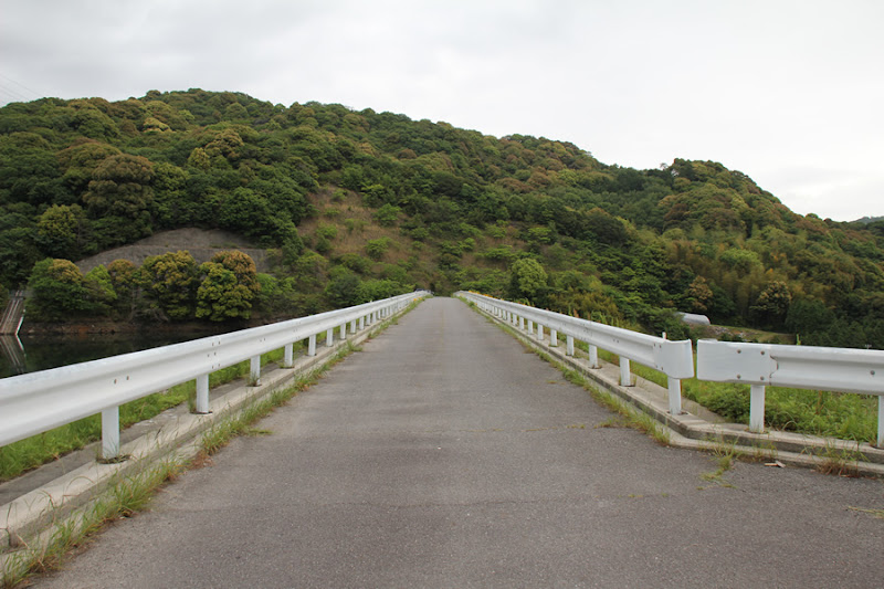
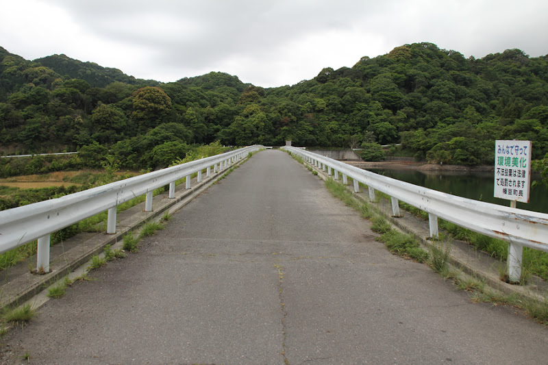
View of the top edge from the right bank
The top end is open to automobile traffic and can be reached to the backwater side.
View of the flood discharge (on the right is the site of the original stone pile)
Looking only here, it looks like a rockfill dam.

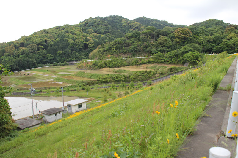
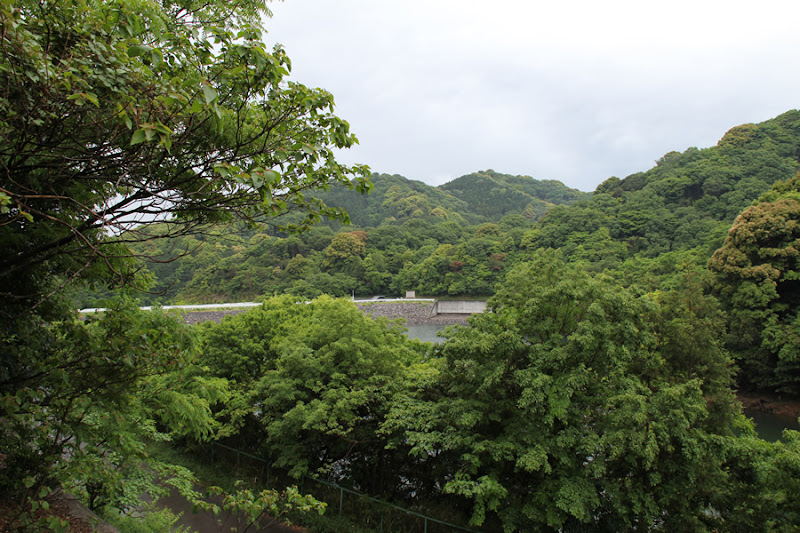
View of the backwater from the top
You can clearly see the water flowing in from here.

View of the slant-flume intake system
The maximum water intake is 0.23 m3/s, the diameter of the intake is 300-100 mm, and the diameter of the conduit is 1200 mm, which was also used as a temporary drainage channel. (From a signboard at the site)

Looking downstream from the left bank
Downstream is a peaceful rural landscape.
View of the top edge from the left bank
As usual, the sky is gloomy.
View of the embankment on the lake side from the left bank
The lake side of the dam looks like a fine rock-fill dam in contrast to the downstream side.
Flowers on the levee
The flowers are bright and beautiful. Although the name of the flower is still not clear to me.
View of the embankment on the lake side from the right bank
I drove back to the right bank where I left my car to see what the back of the left bank looks like. From this side, it is a complete rockfill dam.
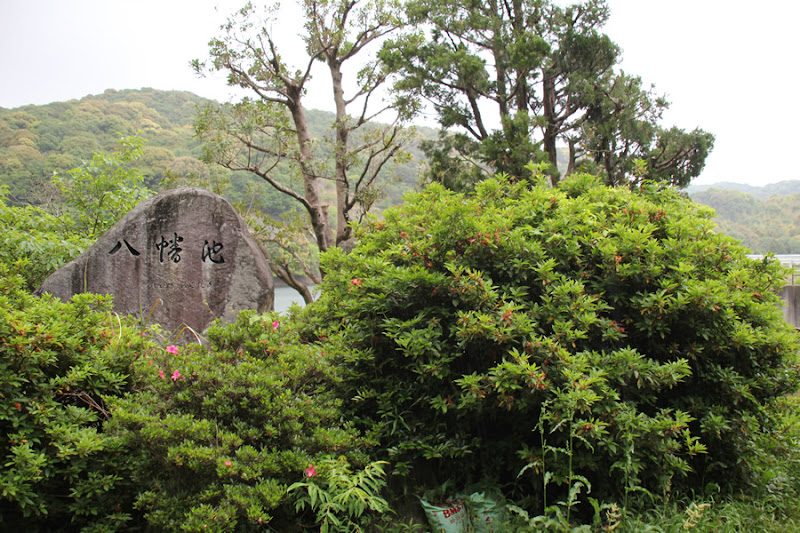
View of the stone monument at Hachiman Pond
The monument was quietly erected. It looked as if it would be missed with all its might.
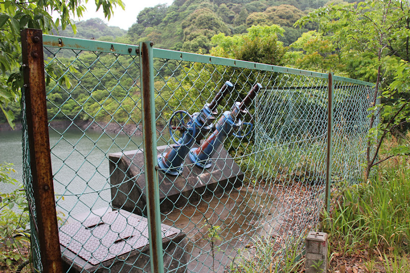
View of the valves of the slant-flume water intake system
It has been raining. Well, it happens often, so there is nothing we can do about it.
I climbed up the slope on the left bank.
There were stairs on the left bank and no restrictions, so I climbed them. A nostalgic CR-V.
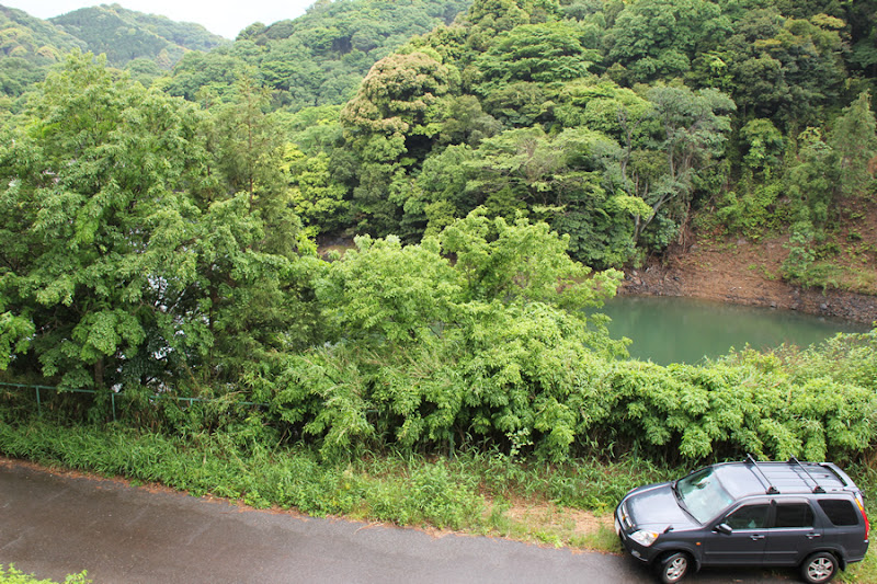
View of the dam lake from the slope on the left bank
I expected to be able to see the entire dammed lake, but unfortunately I could see very little.
View of the levee from downstream
Then move downstream. It is an earth dam by all appearances.
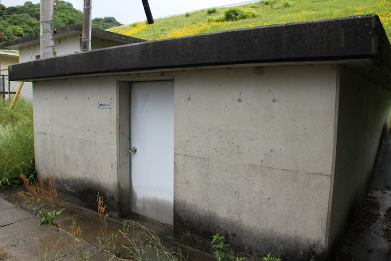
Yawata Regulating Pond (Intake Works Valve Room)
Water intake valve room.
Yawata Regulating Pond Station Building
Is it like a management office? It looks like it might have equipment, etc....but come on.
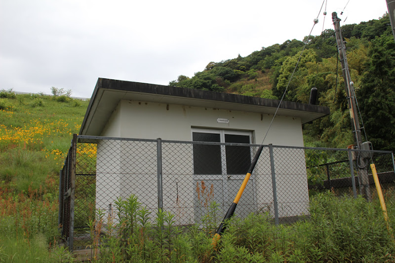
Yawata Regulating Pond Pumping Station
It appears to pump up water to a regulating pond.

View of the levee from just below the levee
Although it looks somewhat cluttered now, it appears to have been maintained as a plaza by the way the trees are evenly lined up.

View of the levee from just below the levee
Up close, it looks like an earth dam.
Flowers blooming on the levee
It is raining, but only here they are blooming spectacularly as if the weather is fine.
View of the levee from downstream
It is an important agricultural dam in the Hazu area, but it was a bit unusual, with beautiful flowers in bloom and a rock-fill dam that looked like an earth dam.
Yawata Regulating Pond Specifications
| River Name | Hachiman River |
| Objective | irrigation water |
| Model | Central barrier-type rockfill dam |
| Bank height | 22.7m |
| Bank length | 158m |
| Dam volume | 91,000m3 |
| Watershed Area | 0.7km2 |
| Reservoir area | 2 ha |
| Total storage capacity | 66,000m3 |
| Effective water storage capacity | 55,000m3 |
| Dam operator | Tokai Agricultural Administration Bureau |
| Main body constructor | Okumura Corporation, Tokyu Corporation |
| Year of launch | 1969. |
| Year Completed | 1986 |
| Name of Dam Lake | Hachiman Pond |
Other facilities/observations
The right bank dam site is wider, so you can park there.
| Parking lot | ○ |
| Toilet | × |
| Park | × |
| PR Exhibition Hall | × |
| Fishing | ○? |

Comment
@dampedia It's a giant aster.
Keizo Imai liked this on Facebook.
Hironao Numata liked this on Facebook.
Makoto Mariko Sakiyama liked this on Facebook.
Aki Shimizu liked this on Facebook.
Douken Norihiro liked this on Facebook.
Oota Toshiaki Syunmyou liked this on Facebook.
Ryota Mochizuki liked this on Facebook.
Marubashi Satoru liked this on Facebook.