

Location: Nishi-Akazawa-cho, Toyohashi-shi, Aichi, Japan
Date of interview: 2005/07/18
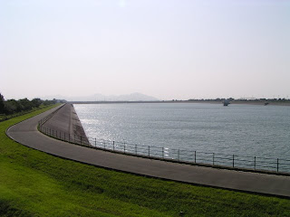
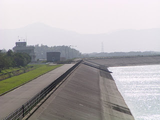
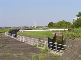
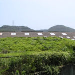
View of the embankment and dam lake from the observation deck
It is an unusual dam with a rectangular shape. So I don't know where to take pictures.... I am looking at the photos I took 4 years ago and remember that I took them from left to right, which means I may have tried to take a panorama. I'm taking my own pictures, but I've forgotten all about it...
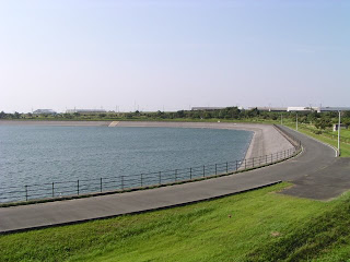
It didn't look like a dam at all.Not dumb" on Twitter.but it does not look like a dam to the extent that one might mistake it for one. However, it is said to be a magnificent dam with a height of 28.6 meters.
This dam is an asphalt-facing dam, which is a little unusual in that the barrier wall is covered with asphalt. Fuji in Shizuoka, Japan. It is the same type of dam and looks a little like the Higashi-Fuji Dam. However, comparing the Manba Regulating Pond and the Higashi Fuji Dam, the former has a crest length of 370 m, while the latter has a crest length of 1597.5 m. I think the Manba Regulating Pond was much longer. I think the Manba regulating reservoir was longer. The Manba Adjustment Pond is at the highest point of the embankment near the control center, and the Higashi Fuji Dam is probably measured around the dam lake. I am not sure if this is true or not, but I apologize if I am wrong.
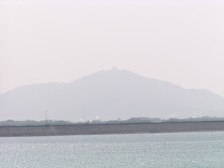
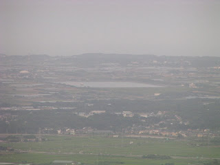
View of Mt. Zao from the observatory
It is hazy, but this is Mt. Zao, a famous mountain in Tahara Town. There is an observatory at the top of the mountain and the view is very good. There is also a huge windmill for wind power generation. The night view is also beautiful, making it a popular date spot.
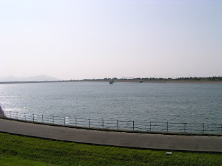
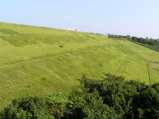
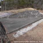
View of the levee
Incidentally, you are not allowed to enter the levee, but there is an observatory in a nearby park from which you can view the entire levee. There is also a promenade around the park where you can go for a walk or a jog.
Intake tower at the Toyohashi Nanbu Water Treatment Plant
Water taken here is sent to a water purification plant and further to the southern part of Toyohashi City.
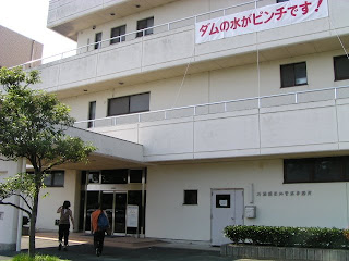
Management Office (Toyohashi Water Exhibition Hall)
Unfortunately, the Toyohashi Water Exhibition Hall is now closed.
The first floor of the management office is a PR exhibition hall, the Toyohashi Water Exhibition Hall, where you can get all the information about the Toyokawa water supply and related dams and reservoirs.
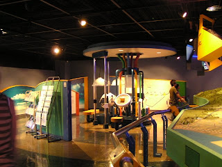
Model in the Toyohashi Water Exhibition Hall
Gah. The picture is skewed. It is a huge model of the Toyokawa water supply and very easy to understand.
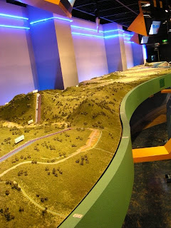
Uren Dam and Oshima Dam (model)
It is best to visit the site, but it is also very easy to understand the location of Uren Dam and Oshima Dam in this way.
Interior view of the Toyohashi Water Exhibition Hall
There are various other exhibits that can be enjoyed by adults and children alike.
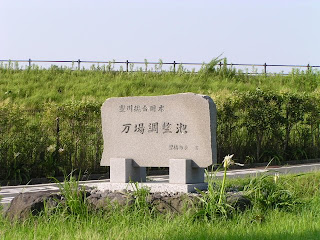
Manba Regulating Pond Stone Monument
The monument is located in a rather inconspicuous place. I would like to take a picture of it together with the embankment and the dam lake, but it is not easy.
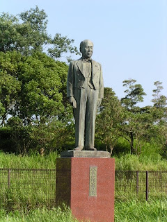
Bronze statue of Old Man Ichiro Yagi
I am sorry. I think this is a bronze statue of a local prominent person who deeply contributed to the construction of the Toyokawa water supply, but I have not checked the site and there is no information on the Internet, so I do not know the details. Well, since it is a bronze statue like this, it probably is.
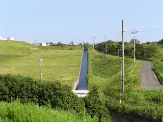
irrigation water
conduit
This is a gently sloping conduit.
View of the levee
Perhaps the aforementioned levee crest length is referring to the length here.
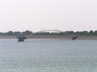
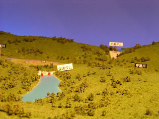
View of Manba Adjustment Pond from Mt.
You can see Manba Adjustment Pond from the aforementioned Mt. The distance is quite long, so it cannot be called an "aerial shot".... It is also quite hazy...
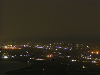
View of Manba Adjustment Pond from Mt. Zao Observatory (night view)
And furthermore, the night view from Mt. Can you see where is Manba Adjustment Pond?
dam characteristics
| River Name | Toyokawa River system Toyokawa |
| Objective | Irrigation water, water supply water, industrial water |
| Model | Asphalt-facing fill dam |
| Bank height | 28.6m |
| Bank length | 370m |
| Dam volume | 825,000m3 |
| Watershed Area | 0.4km2 |
| Reservoir area | 34 ha |
| Total storage capacity | 5,390,000m3 |
| Effective water storage capacity | 5,000,000m3 |
| Dam operator | Tokai Agricultural Administration Bureau |
| Main body constructor | Kashima, Katsumura, Toda |
| Year of launch | 1977 |
| Year Completed | 1994 |
Other facilities/observations
Although it is not possible to approach the dam, it is quite an interesting property. You should also visit the Water Exhibition Hall and Mt.
| Parking lot | ○ |
| Toilet | ○ |
| Park | ○ |
| PR Exhibition Hall | ○ |
| Fishing | × |
Comment