
Location: Tono, Kunifu-cho, Tottori City, Tottori Prefecture
Date of interview: 2011/04/04 (Monday)
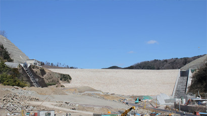
View of the levee downstream from the right bank road

I heard that a dam under the direct control of Tottori Prefecture will soon conduct a test discharge, so I drove six hours to get there. By the way, many dams in the Chugoku region have unique flood spouts, which is good. The most distinctive feature of the Tono Dam is its cascading flood discharge, which is a staircase-like structure.
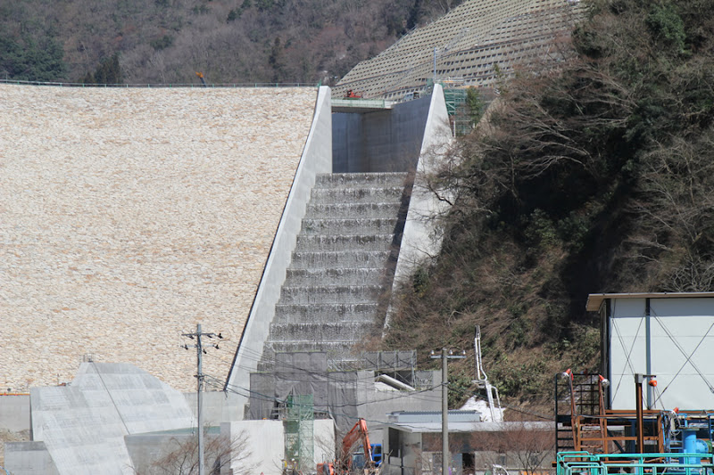
View of the cascading flood discharge from the right bank road

It is a staircase like this. The water is being discharged! It is hard to tell from here what is happening at the overflow section, but it seems that the discharge of water has already begun. Unfortunately, although the embankment has already been erected, the construction work around it has not yet been completed, so access to the area around the top edge was prohibited.
View of discharge gate room
Water was flowing dabblingly from the gate for irrigation water discharge. After a while, the water stopped flowing, so it is assumed that the water was probably flowing on a trial basis.
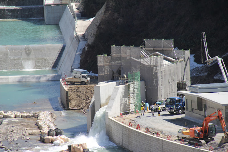
View of the reduction works and sub-dam

The reduction basin is full and overflows from the sub-dam. Still, the flow-conducting wall is cool.
Close-up of cascading flood discharge
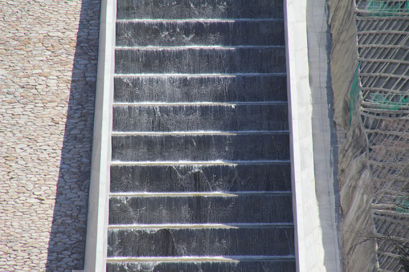
The advantage of using a cascade system is that the cascade section can be responsible for force reduction without the need for extensive force reduction work.
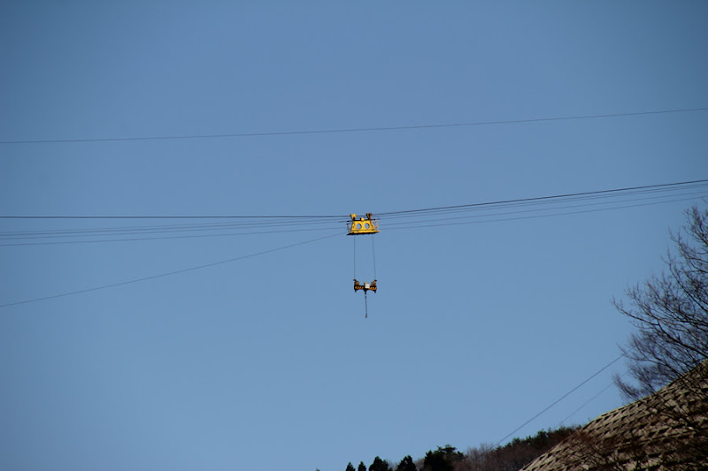
View of the incline installed on the right bank

There is a brand new control station and an incline on the right bank. I wonder if this incline is only moved during inspections.
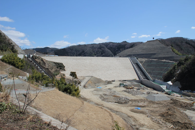
Move the right bank road a little to the lake side of the dam and view the levee on the downstream side.
Move a little upstream. From here, you can clearly see the shape of the conduit wall. The downstream side is still under construction.
View of discharge gate chamber and temporary drainage tunnel exit

The temporary drainage tunnel, which was not visible downstream due to a blind spot, becomes visible in this area. It appears that the temporary drainage tunnel is being reused for water utilization.
Tono Dam Information Room
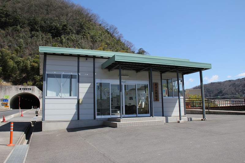
This information room, which for a long time served as part of the information dissemination for the construction of the Tono Dam, seems to have been dismantled now that the construction is completed. It seems to have been moved to an exhibition space in the administration branch office.
Viewing platform
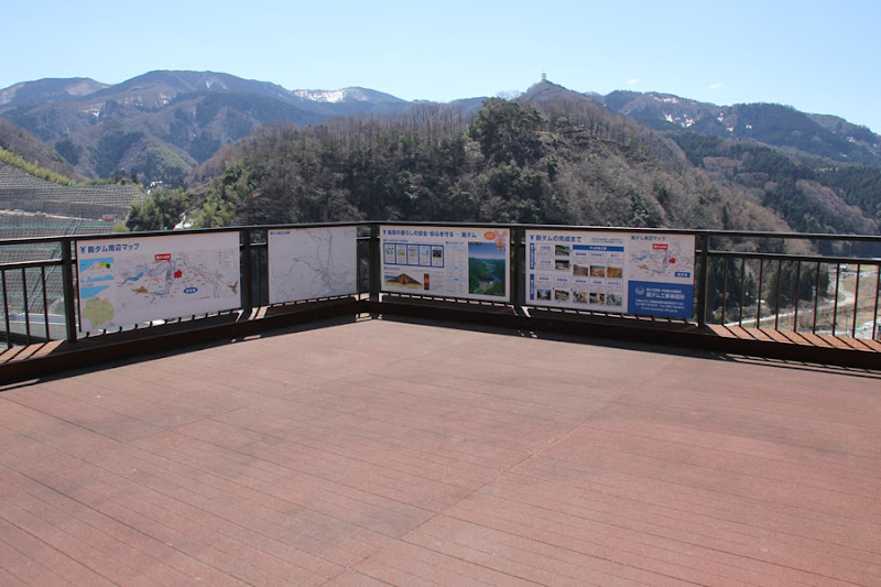
It is a spacious observatory. You can watch the show in a relaxed and calm manner.
View of the cascade flood discharge and force reduction works

The flow-conducting wall seen from this observation deck is just cool. I think the cascade is thinning the conduit wall, perhaps because the cascade reduces the flow sufficiently, and the design has been improved because of this.
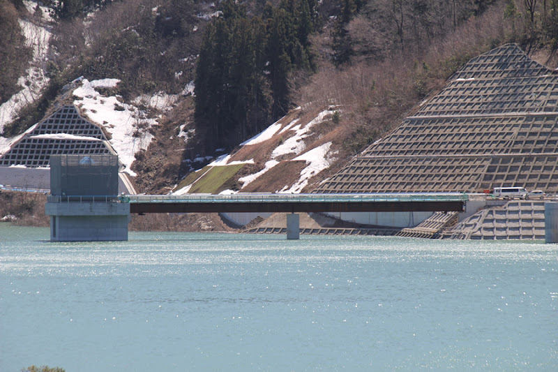
Jingo Bridge and the entrance to the skyline
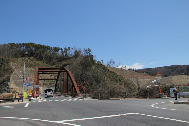
We moved to the dam lake side and aimed at the front of the dike. I also came to scout whether I could somehow get into the top end, but the entrance to the top end was firmly guarded by a guard. I asked him, "Can't I get in?" I asked the guard, but he would not be able to help me, and I would rather disturb his work.
View of the flood discharge and intake tower from Jingo Bridge
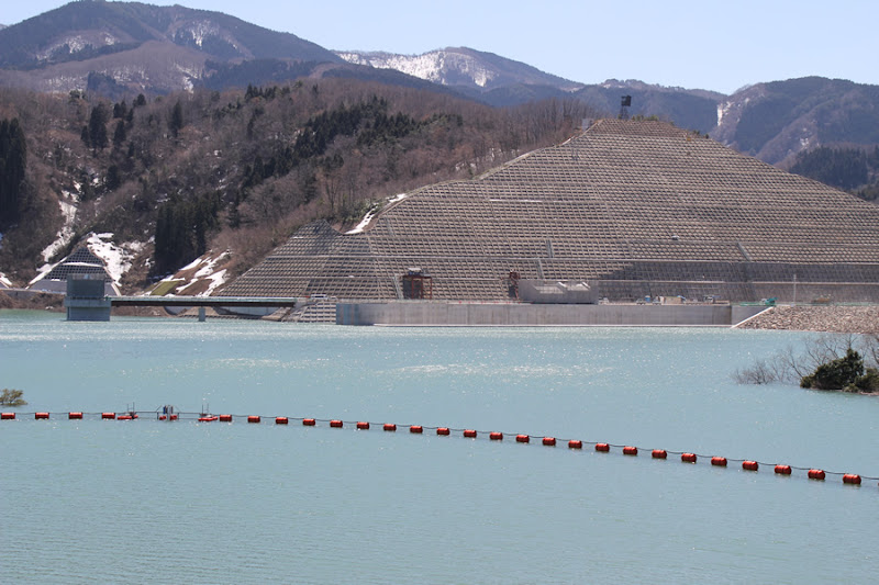
The flood discharge on the lake side of the dam is visible, although it is quite far away. You can also see the intake tower. I would like to see it closer, but...
View of flood discharge

This is the limit even at maximum telephoto. You can see that the water level is very close to the edge. It also seems that the water was flowing from the cascade type flow reducer because there was a slit in the flood discharge on the left side of the photo.
View of the intake tower (airlock-type continuous siphon intake system)
Even though it is a siphon-type water intake facility, it looks like an ordinary intake tower from a distance.
(a person) being well-versed in the ways of the world
If it is written in hiragana, I am likely to read it wrong.
View of the dam lake
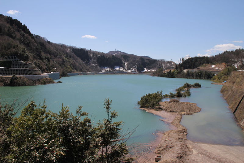
I moved a little further upstream.
View of the left bank slope

Unfortunately, the netting makes the slope look like a waffle.
View of downstream riprap

The lip wrap is beautifully laid out. It looks like craftsmanship. Hopefully, no vegetation will grow, or if it does, it will be cut back.
View of crane
A bare-bones crane without buckets was standing there. This crane reminds us that it will be completed soon.
View of the cascading flood discharge
It is as if you are trying to add your finger to it because you cannot see it at close range, but once again, you are hoping to see a cascading flood discharge.
More cascading flood discharges

The water flowing through the cascade glistens and reflects in the sunlight.
View of the levee on the downstream side
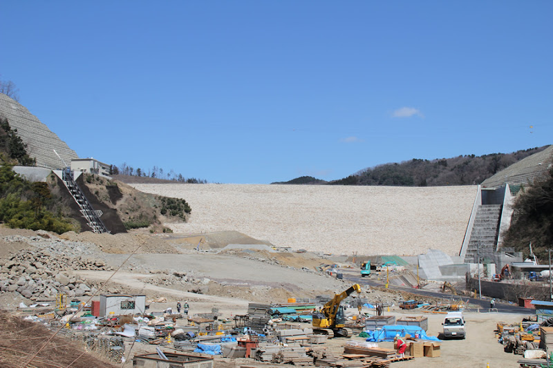
It was still undergoing maintenance, but now that it is complete, we wanted to revisit the Tono Dam again.
Tono Dam Specifications
| River Name | Chiyogawa River system Fukuro River |
|---|---|
| Objective | Flood control and agricultural disaster prevention, unspecified water and river maintenance water, water for waterworks, industrial water, power generation |
| Model | rockfill dam |
| Bank height | 75m |
| Bank length | 294m |
| Dam volume | 2,110,000m3 |
| Watershed Area | 38.1 km2 ( Direct: 38.1 km2 ) |
| Reservoir area | 64ha |
| Total storage capacity | 12,400,000m3 |
| Effective water storage capacity | 11,200,000m3 |
| Dam operator | Chugoku Regional Development Bureau |
| Main body constructor | Kajima Construction |
| Year of launch | 1985 |
| Year Completed | 2011 |
| Name of Dam Lake | Lake Manyo, Inaba |
Other facilities/observations
| Parking lot | ○ | It is a large scale direct-controlled dam, so it is maintained in various ways. |
|---|---|---|
| Toilet | ○ | |
| Park | × | |
| PR Exhibition Hall | ○ | |
| Fishing | ○? |


Comment
Haruka Oshida liked this on Facebook.
Yusuke Kai liked this on Facebook.
Atsushi Sasaki liked this on Facebook.
Douken Norihiro liked this on Facebook.
Japanese yellow loosestrife (Lysimachia japonica) liked this on Facebook.